

Photo: Wikipedia
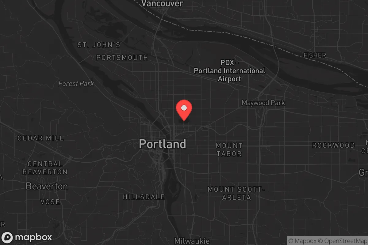
Strategic Assessment of Portland, OR
High tactical risk. This location is likely close to major population centers, strategic targets, or sits in a high-disaster corridor. A retreat property and careful exit planning is required.
What does the Strategic Assessment tell us?
Our Strategic Assessment grades tactical survivability of an area. Major population centers, military targets, fallout zones, natural disasters, and border exposure all drive risk — lower exposure means a more defensible position in a crisis.
This is heavily inspired by Joel Skousen's Strategic Relocation book. Highly recommended you checkout the book ($)What does this tell us?
Our Strategic Assessment grades tactical survivability of an area. Major population centers, military targets, fallout zones, natural disasters, and border exposure all drive risk — lower exposure means a more defensible position in a crisis.
This is heavily inspired by Joel Skousen's Strategic Relocation book. Highly recommended you checkout the book ($)Strategic Pillars

Key Distances
Regional Safe Places
Below is our recommended "safe zones" in Oregon and the surrounding area based on our strategic heuristics. For most people, it's unrealistic to live in a “safe zone” full-time due to work, family or other personal reasons. They tend to be more rural. However, many of these areas are perfect for second homes and retreat properties that double as a vacation home or even a short-term rental.


Important Note: For informational purposes only. This does not mean nothing bad ever happens in the green zones. Please use common sense. This is based on public data and modeled with AI. We tried to take a conservative approach but mistakes happen. We update this regularly as new information becomes available.
Solar Generator Recommendations
Backup power matters more here than in safer locations. We've picked three solar generators across budgets and capacity tiers — start with the budget unit if you only need a few essentials, or step up if you want to run a fridge and HVAC for days at a time.

Jackery Portable Power Station Explorer 300
Budget OptionPower on the Go: Weighing only 11 lbs, it's convenient to set up and store with book-sized foldable solar panels

BLUETTI Portable Power Station AC180
Designed for both indoor and outdoor scenarios, AC180 is highly capable as it has a robost capacity and continuous output power.

EF ECOFLOW DELTA Pro Ultra Power Station
Upgraded PickEcoFlow DELTA Pro Ultra is a whole-home energy system designed to grow with your family. Integrated with the Smart Home Panel 2, it scales to meet your evolving energy needs — keeping your home powered, intelligent, and secure through every stage of life.
We earn a commission, at no additional cost to you.
Strategic Assessment Analysis
Portland, Oregon, presents a deeply contradictory picture for the conservative prepper or strategic relocator. On one hand, its geographic position in the Pacific Northwest offers genuine natural advantages—abundant water, fertile soil, and a temperate climate that supports year-round food production. On the other hand, the city itself is a high-risk concentration of the very vulnerabilities you're trying to escape: dense population, ideological monoculture, and critical infrastructure that is both fragile and a target. For a single individual or family prioritizing resilience, Portland is not a destination to settle in, but a place to understand as a potential hazard zone you may need to avoid or navigate around. The real strategic value lies not in the city proper, but in the surrounding region—if you can secure a position far enough from its fallout.
Geographic position and natural advantages for long-term survival
Portland sits in the Willamette Valley, a corridor that is arguably one of the most agriculturally productive regions in North America. The soil is volcanic loam, rainfall is reliable at roughly 36 inches per year, and the growing season stretches from March to October. For anyone thinking about food security, this is a major plus. The city is also flanked by the Columbia and Willamette Rivers, providing surface water that, with proper filtration, is a sustainable resource. The Cascade Range to the east and the Coast Range to the west create natural barriers that could slow movement in a crisis, but they also limit egress routes. The Columbia River Gorge is a strategic chokepoint—whoever controls it controls access to the interior. For a relocator, the key takeaway is that the Willamette Valley's natural bounty is real, but it's also heavily contested. You're not moving to untouched wilderness; you're moving to a region where every acre of arable land within 50 miles of Portland is already spoken for, often by people who share none of your values.
Risks, exposures, and proximity to high-value targets and fallout zones
This is where Portland's strategic assessment turns sharply negative. The city is home to a major port, multiple bridges (including the I-5 and I-205 corridors), and critical infrastructure like the Portland International Airport and the Port of Portland's marine terminals. In a mass casualty event or wartime scenario, these are tier-one targets. The nearby Boeing facilities in Seattle and the naval base at Kitsap (Bangor) are roughly 150 miles north—close enough that a nuclear or EMP event affecting Puget Sound would have cascading effects on Portland's grid and supply chains. Portland itself is a likely secondary target due to its role as a logistics hub for the Pacific Northwest. Additionally, the city's political climate—consistently one of the most progressive in the nation—means that in a period of civic unrest, Portland would be a flashpoint. The 2020 protests and the subsequent rise in homicides (a 78% increase from 2019 to 2021) are not anomalies; they're a preview. For a conservative-leaning individual or family, the social environment is actively hostile, and the risk of being caught in a riot, arson, or targeted violence is higher here than in almost any other comparably sized American city. The density of the urban core also means that any biological or chemical event would spread rapidly.
Practical resilience for a relocator: food, water, energy, and defensibility
If you're considering a property within Portland's city limits, the practical resilience picture is poor. The municipal water system relies on the Bull Run Watershed, which is vulnerable to seismic activity—the Cascadia Subduction Zone is expected to produce a magnitude 9.0 earthquake within the next 50 years, and Portland's water infrastructure is not built to withstand it. After such an event, water service could be out for months. The power grid is equally fragile, with overhead lines and substations that are easy to disrupt. For a prepper, you would need to assume total independence from city utilities within 72 hours of any major event. That means a well, solar or generator backup, and a minimum of 90 days of stored food and medicine. Defensibility is another issue: Portland's layout is a mix of dense neighborhoods and sprawling suburbs with few natural chokepoints. A rural property in the Coast Range or the eastern Cascades offers far better defensibility, but then you're trading proximity to the city's resources for security. The best bet for a relocator is to look at areas like Hood River County or Wasco County, east of the Cascades, where the population is thinner, the political lean is more mixed, and the land is cheaper. But even there, you're within a two-hour drive of Portland's chaos, which means you're still in the blast radius of its social and economic collapse.
The overall strategic picture for Portland is one of high risk for low reward. The natural advantages of the region are real, but they are overshadowed by the city's vulnerability to natural disasters, its status as a likely target in any conflict, and its deeply unstable social fabric. For a conservative individual or family serious about preparedness, the smart play is not to relocate to Portland but to use it as a reference point—a place to avoid, a place to monitor, and a place whose resources (like medical centers and supply chains) you might need to access only in the calm before the storm. If you are already in the Pacific Northwest, your best move is to secure a position at least 100 miles from the urban core, preferably east of the Cascades, where the terrain offers more defensibility and the population is less dense. Portland is not a survival destination; it's a survival liability. Treat it as such, and plan accordingly.
* Values derived from national, state, county, city and local statistics and may differ in a specific area. Last updated: 2026-05-04T23:09:15.000Z
Narrative content on this page is AI-generated and may contain mistakes. Verify any details that matter before acting on them.
ReloMaps may earn a commission from affiliate links at no extra cost to you.