Photo: Wikipedia
Strategic Assessment of Poultney, VT
Meaningful friction. Expect exposure to either population pressure, blast zones, or natural disaster risk. Consider buying a retreat property.
What does the Strategic Assessment tell us?
Our Strategic Assessment grades tactical survivability of an area. Major population centers, military targets, fallout zones, natural disasters, and border exposure all drive risk — lower exposure means a more defensible position in a crisis.
This is heavily inspired by Joel Skousen's Strategic Relocation book. Highly recommended you checkout the book ($)What does this tell us?
Our Strategic Assessment grades tactical survivability of an area. Major population centers, military targets, fallout zones, natural disasters, and border exposure all drive risk — lower exposure means a more defensible position in a crisis.
This is heavily inspired by Joel Skousen's Strategic Relocation book. Highly recommended you checkout the book ($)Strategic Pillars

Key Distances
Regional Safe Places
Below is our recommended "safe zones" in Vermont and the surrounding area based on our strategic heuristics. For most people, it's unrealistic to live in a “safe zone” full-time due to work, family or other personal reasons. They tend to be more rural. However, many of these areas are perfect for second homes and retreat properties that double as a vacation home or even a short-term rental.


Important Note: For informational purposes only. This does not mean nothing bad ever happens in the green zones. Please use common sense. This is based on public data and modeled with AI. We tried to take a conservative approach but mistakes happen. We update this regularly as new information becomes available.
Solar Generator Recommendations
Backup power matters more here than in safer locations. We've picked three solar generators across budgets and capacity tiers — start with the budget unit if you only need a few essentials, or step up if you want to run a fridge and HVAC for days at a time.

Jackery Portable Power Station Explorer 300
Budget OptionPower on the Go: Weighing only 11 lbs, it's convenient to set up and store with book-sized foldable solar panels

BLUETTI Portable Power Station AC180
Designed for both indoor and outdoor scenarios, AC180 is highly capable as it has a robost capacity and continuous output power.

EF ECOFLOW DELTA Pro Ultra Power Station
Upgraded PickEcoFlow DELTA Pro Ultra is a whole-home energy system designed to grow with your family. Integrated with the Smart Home Panel 2, it scales to meet your evolving energy needs — keeping your home powered, intelligent, and secure through every stage of life.
We earn a commission, at no additional cost to you.
Strategic Assessment Analysis
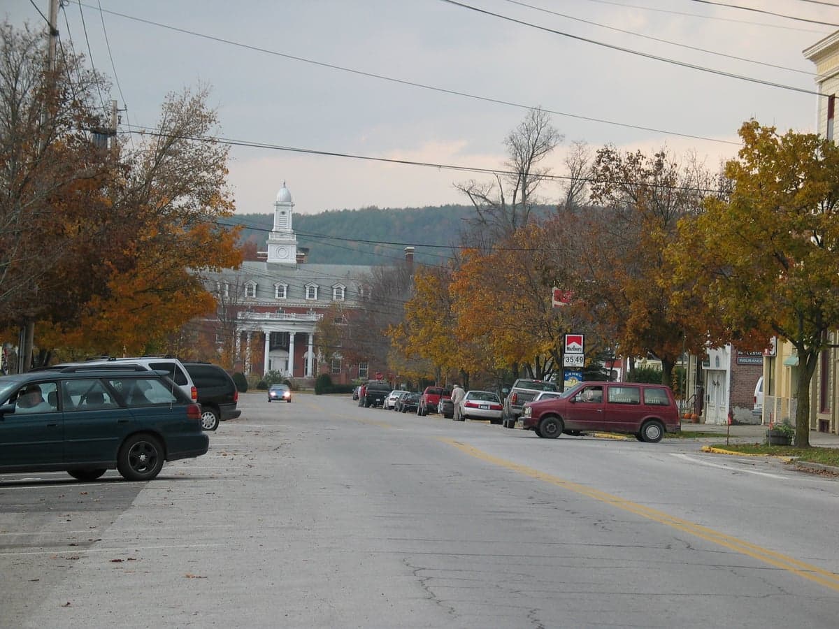
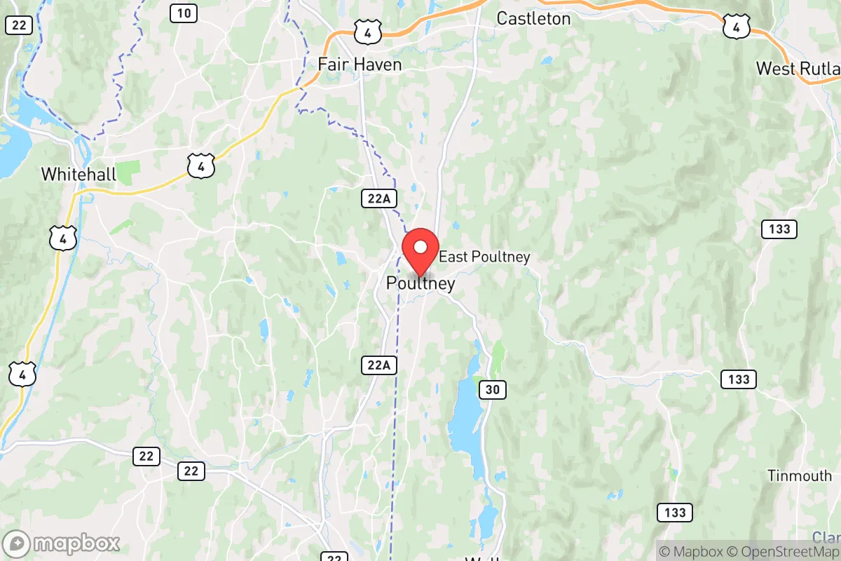
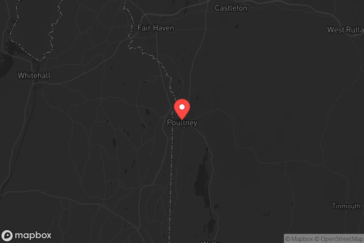
Poultney, Vermont, sits in a sweet spot that few people outside of strategic relocation circles have fully clocked: it’s far enough from the major Northeast corridors to avoid the worst of any cascading collapse, yet close enough to functional supply lines that you’re not completely cut off. This small town in Rutland County, hugging the New York border, offers a blend of rural self-sufficiency potential and low-key community infrastructure that makes it a serious contender for anyone thinking long-term about resilience. The key advantage here isn’t flashy—it’s the quiet reality that Poultney is off the beaten path of every major interstate, rail line, and population center that would become a liability in a crisis.
Geographic position and natural advantages for long-term stability
Poultney sits in the Taconic Mountains region, with the Poultney River running through town and the Green Mountain National Forest about 20 miles east. The terrain is rolling hills and valleys, not alpine—meaning you get decent drainage, workable soil, and plenty of tree cover for both privacy and resources. The town itself is roughly 30 miles from Rutland (population ~15,000) and 25 miles from Glens Falls, New York, but those are small enough that they won’t become refugee magnets in a major event. The real strategic value is that Poultney is over 60 miles from Albany, 100 miles from Burlington, and 150 miles from Boston—far enough that any urban evacuation or fallout from a major incident will likely dissipate before reaching you. The area sits at roughly 500–700 feet elevation, which means you’re above the valley fog and flood zones but not so high that winter becomes a survival nightmare. The Poultney River and its tributaries provide a reliable water source, and the surrounding forests offer hardwood for fuel, construction, and foraging. The town’s location on the Vermont–New York border also gives you a legal and logistical buffer: if one state’s governance becomes problematic, you have a short move to the other.
Risks, exposures, and proximity to fallout-relevant landmarks
No location is perfect, and Poultney has its share of vulnerabilities that a prepper needs to account for. The most obvious is the Vermont Yankee nuclear plant—though it ceased operations in 2014, the spent fuel is still stored on-site in Vernon, about 50 miles south. That’s within the 50-mile emergency planning zone, meaning a major release could affect Poultney depending on wind patterns. More immediately concerning is the rail line that runs through town—the Vermont Railway’s main line carries freight, including hazardous materials, between Rutland and points south. A derailment or chemical spill is a real, if low-probability, risk. On the human threat side, Poultney’s population is just over 1,700, and the town is small enough that you’ll know your neighbors—but that also means any outside disruption will be noticed quickly. The nearest major highway is US Route 4, about 10 miles north, which connects to Rutland and eventually I-89. In a crisis, that road could become a chokepoint for both evacuees and looters. The town itself has no major police presence beyond a small local department and the Rutland County Sheriff’s office, so defensibility relies heavily on community cohesion and personal preparedness. There are no military bases, no major government facilities, and no high-value infrastructure within 30 miles that would draw deliberate attack—which is actually a plus in this analysis.
Practical resilience for a relocator: food, water, energy, and defensibility
For someone serious about self-sufficiency, Poultney offers a workable baseline. The growing season runs roughly May through September, with Zone 4b/5a hardiness—meaning you can raise apples, pears, berries, and cold-hardy vegetables like kale, potatoes, and carrots. The soil is generally loamy with some clay, but raised beds or amended plots will produce reliably. The Poultney River and nearby Lake St. Catherine (just north in Wells) provide year-round water, though you’ll want a filtration system—surface water in Vermont carries giardia and other pathogens. Groundwater is accessible via well, and most rural properties already have one. For energy, the area gets about 160 sunny days per year, which is marginal for solar but workable with a properly sized battery bank and panels tilted for winter sun. Wood heat is the dominant backup here—most homes have wood stoves or boilers, and firewood is abundant if you have land or a chainsaw and a permit. The town’s electric grid is served by Green Mountain Power, which has a decent reliability record, but ice storms and nor’easters can knock out power for days. Defensibility is moderate: the terrain offers natural chokepoints (narrow valleys, river crossings), but the town itself is spread out along VT Route 30 and 31, making it hard to secure a perimeter. The best approach is to buy property with a single access road, good sightlines, and a reliable water source—many of the older farmsteads on the outskirts fit this description. The local community is a mix of longtime Vermont families, second-home owners from New York, and a small but growing number of remote workers and retirees. Politically, Rutland County leans slightly conservative by Vermont standards (Trump got about 45% in 2020), but Poultney itself is more moderate—you’ll find a mix of libertarian-leaning farmers, old-school Democrats, and a few off-grid types. The key is that people here generally keep to themselves and respect property rights, which is a solid foundation for a resilient community.
The overall strategic picture for Poultney is one of cautious optimism for a relocator with a prepper mindset. It’s not a bunker location—you’ll need to invest in your own water, energy, and food systems, and you’ll want to build relationships with neighbors before any crisis hits. But the combination of low population density, distance from major targets, reliable natural resources, and a functional small-town economy makes it a viable base for weathering the kind of slow-burn societal instability that many are concerned about. The biggest trade-off is access: you’re 45 minutes from a real hospital (Rutland Regional Medical Center), and the nearest Costco or Home Depot is an hour away in Queensbury, NY. That means you need to stock up and plan ahead, but that’s exactly the discipline that separates those who are prepared from those who are just hoping. If you’re looking for a place that’s off the radar but not off the map, Poultney deserves a serious look.
* Values derived from national, state, county, city and local statistics and may differ in a specific area. Last updated: 2026-04-30T05:04:35.000Z
Narrative content on this page is AI-generated and may contain mistakes. Verify any details that matter before acting on them.
ReloMaps may earn a commission from affiliate links at no extra cost to you.