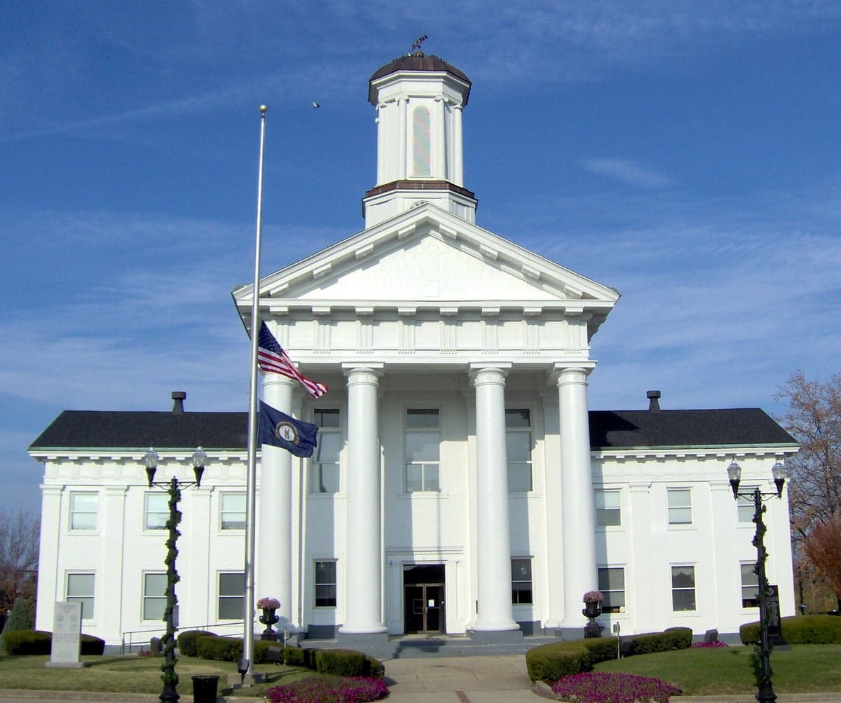

Photo: Wikipedia
Strategic Assessment of Richmond, KY
Meaningful friction. Expect exposure to either population pressure, blast zones, or natural disaster risk. Consider buying a retreat property.
What does the Strategic Assessment tell us?
Our Strategic Assessment grades tactical survivability of an area. Major population centers, military targets, fallout zones, natural disasters, and border exposure all drive risk — lower exposure means a more defensible position in a crisis.
This is heavily inspired by Joel Skousen's Strategic Relocation book. Highly recommended you checkout the book ($)What does this tell us?
Our Strategic Assessment grades tactical survivability of an area. Major population centers, military targets, fallout zones, natural disasters, and border exposure all drive risk — lower exposure means a more defensible position in a crisis.
This is heavily inspired by Joel Skousen's Strategic Relocation book. Highly recommended you checkout the book ($)Strategic Pillars

Key Distances
Regional Safe Places
Below is our recommended "safe zones" in Kentucky and the surrounding area based on our strategic heuristics. For most people, it's unrealistic to live in a “safe zone” full-time due to work, family or other personal reasons. They tend to be more rural. However, many of these areas are perfect for second homes and retreat properties that double as a vacation home or even a short-term rental.


Important Note: For informational purposes only. This does not mean nothing bad ever happens in the green zones. Please use common sense. This is based on public data and modeled with AI. We tried to take a conservative approach but mistakes happen. We update this regularly as new information becomes available.
Solar Generator Recommendations
Backup power matters more here than in safer locations. We've picked three solar generators across budgets and capacity tiers — start with the budget unit if you only need a few essentials, or step up if you want to run a fridge and HVAC for days at a time.

Jackery Portable Power Station Explorer 300
Budget OptionPower on the Go: Weighing only 11 lbs, it's convenient to set up and store with book-sized foldable solar panels

BLUETTI Portable Power Station AC180
Designed for both indoor and outdoor scenarios, AC180 is highly capable as it has a robost capacity and continuous output power.

EF ECOFLOW DELTA Pro Ultra Power Station
Upgraded PickEcoFlow DELTA Pro Ultra is a whole-home energy system designed to grow with your family. Integrated with the Smart Home Panel 2, it scales to meet your evolving energy needs — keeping your home powered, intelligent, and secure through every stage of life.
We earn a commission, at no additional cost to you.
Strategic Assessment Analysis
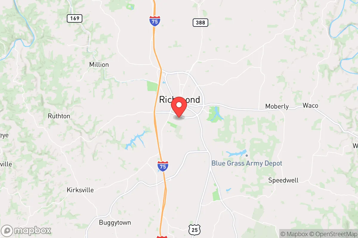
Richmond, Kentucky, sits in a sweet spot that few relocation analysts fully appreciate: close enough to Lexington to access its resources, yet far enough to avoid being swept up in the chaos of a major urban collapse. This Madison County seat offers a blend of Appalachian foothill defensibility, Bluegrass region agricultural richness, and a population density low enough to avoid the worst of civil unrest while still maintaining a functional local economy. For a conservative-leaning individual or family thinking about long-term preparedness, Richmond presents a credible option—but only if you understand both its natural advantages and its real vulnerabilities.
Geographic position and natural advantages for long-term stability
Richmond’s location at the junction of I-75 and the Kentucky River valley gives it a dual advantage: it’s a transportation corridor for commerce, but the surrounding terrain provides natural chokepoints. The area sits on the edge of the Cumberland Plateau, meaning you get rolling hills and forested ridges that break up sightlines and create defensible pockets—especially east of town toward Berea and the Daniel Boone National Forest. The Kentucky River runs just north of the city, offering a reliable water source that isn’t dependent on municipal infrastructure. The local geology includes limestone aquifers, which means well water is viable for those who drill deep enough. The climate is temperate, with four distinct seasons and no extreme drought or flood risk compared to coastal or plains states. Annual rainfall averages around 45 inches, enough to support rain catchment systems and small-scale agriculture without constant irrigation. The growing season runs roughly April through October, long enough for corn, beans, squash, and hardy greens—staples for any serious prepper garden. Richmond also sits in a region historically free from major natural disasters: no hurricanes, minimal tornado activity compared to the central plains, and earthquake risk is low despite being near the New Madrid Seismic Zone (more on that later). For someone looking to hunker down and ride out a period of instability, the land itself gives you a head start.
Risks, exposures, and proximity to fallout-relevant landmarks
No strategic assessment is honest without naming the threats. Richmond’s biggest vulnerability is its proximity to Lexington, just 25 miles north. Lexington is home to the University of Kentucky’s medical center, a major regional hospital, and the Blue Grass Army Depot—which stores chemical weapons and conventional munitions. In a mass casualty event or civil unrest scenario, Lexington could become a funnel for refugees, looters, or worse. I-75 runs straight through Richmond, meaning any evacuation from the north will push traffic directly through town. The interstate is a double-edged sword: it brings commerce but also makes Richmond a natural chokepoint for anyone fleeing Cincinnati or Lexington. The Blue Grass Army Depot is a specific concern—while the chemical weapons stockpile is being destroyed, the site remains a high-value target for any coordinated attack or sabotage. Richmond is roughly 30 miles from the depot, well within the fallout zone if something goes wrong. Additionally, the New Madrid Seismic Zone, while 300 miles west, could produce a major earthquake that disrupts supply chains and infrastructure across the entire region. Richmond would likely see moderate shaking but no direct devastation—however, the real risk is the collapse of the I-75 corridor and the Kentucky River bridges, which would isolate the area from emergency supplies. The local hospital, Baptist Health Richmond, is a 100-bed facility—adequate for routine care but quickly overwhelmed in a mass casualty event. For a prepper, these risks mean you need to plan for self-sufficiency for at least 30-60 days, not just a weekend.
Practical resilience for a relocator: food, water, energy, and defensibility
For a family or individual serious about preparedness, Richmond offers a workable baseline. The surrounding farmland is productive, and Madison County has a strong agricultural extension office through the University of Kentucky that provides resources for small-scale farming, livestock, and food preservation. Local farmers’ markets operate year-round, and there are several feed stores and co-ops within a 15-minute drive. Water is the bigger concern: municipal water comes from the Kentucky River, which is vulnerable to contamination from upstream industrial sites or a breakdown in treatment. A well is the gold standard here, and many rural properties outside city limits already have them. If you’re buying land, prioritize parcels with tested wells or easy access to the water table—depth varies from 50 to 200 feet depending on location. Energy resilience is solid: Kentucky is a coal state, and the local grid is relatively stable, but a determined adversary could take out substations. Solar is viable here—Richmond gets about 200 sunny days per year, enough for a modest off-grid system with battery storage. Propane is widely available for backup heating and cooking. Defensibility is where Richmond shines if you choose the right property. The hills east of town, particularly around the Berea College Forest and the Pinnacles, offer natural cover and limited access points. A property with a long driveway, a creek or pond, and a clear view of approach routes is achievable for under $200,000—far cheaper than comparable land in Colorado or Texas. The local gun culture is strong, with multiple shooting ranges and gun shops, and Kentucky is a constitutional carry state. That means you can defend your property without bureaucratic hassle. The community itself is a mix of college town (Eastern Kentucky University) and rural conservative base, so you’ll find neighbors who share your worldview and are willing to help in a crisis—but also a transient student population that could become a liability if things go south.
The overall strategic picture for Richmond is cautiously optimistic. It’s not a hardened bunker location, but it doesn’t need to be. For a relocator who wants to be within a few hours of major medical and supply hubs while maintaining a defensible, self-sufficient homestead, this area checks most boxes. The key is to buy land east of I-75, away from the Lexington corridor, and invest in water independence and food production before the next crisis hits. Richmond’s real strength is that it’s overlooked—most preppers are looking at Montana or Tennessee, leaving Kentucky’s Bluegrass foothills undervalued and underpopulated. That gives you time to establish yourself before the masses catch on. If you’re serious about resilience, Richmond deserves a hard look. Just don’t wait until the sirens start.
* Values derived from national, state, county, city and local statistics and may differ in a specific area. Last updated: 2026-04-21T09:14:41.000Z
Narrative content on this page is AI-generated and may contain mistakes. Verify any details that matter before acting on them.
ReloMaps may earn a commission from affiliate links at no extra cost to you.