Photo: Wikipedia
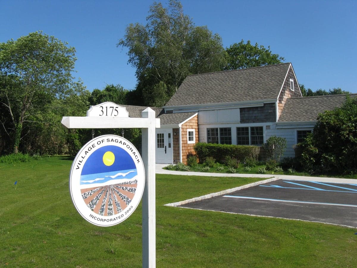
Strategic Assessment of Sagaponack, NY
Multiple tactical vulnerabilities. Population density, target proximity, or disaster risk are likely compounding. A retreat property and exit planning is required.
What does the Strategic Assessment tell us?
Our Strategic Assessment grades tactical survivability of an area. Major population centers, military targets, fallout zones, natural disasters, and border exposure all drive risk — lower exposure means a more defensible position in a crisis.
This is heavily inspired by Joel Skousen's Strategic Relocation book. Highly recommended you checkout the book ($)What does this tell us?
Our Strategic Assessment grades tactical survivability of an area. Major population centers, military targets, fallout zones, natural disasters, and border exposure all drive risk — lower exposure means a more defensible position in a crisis.
This is heavily inspired by Joel Skousen's Strategic Relocation book. Highly recommended you checkout the book ($)Strategic Pillars

Key Distances
Regional Safe Places
Below is our recommended "safe zones" in New York and the surrounding area based on our strategic heuristics. For most people, it's unrealistic to live in a “safe zone” full-time due to work, family or other personal reasons. They tend to be more rural. However, many of these areas are perfect for second homes and retreat properties that double as a vacation home or even a short-term rental.


Important Note: For informational purposes only. This does not mean nothing bad ever happens in the green zones. Please use common sense. This is based on public data and modeled with AI. We tried to take a conservative approach but mistakes happen. We update this regularly as new information becomes available.
Solar Generator Recommendations
Backup power matters more here than in safer locations. We've picked three solar generators across budgets and capacity tiers — start with the budget unit if you only need a few essentials, or step up if you want to run a fridge and HVAC for days at a time.

Jackery Portable Power Station Explorer 300
Budget OptionPower on the Go: Weighing only 11 lbs, it's convenient to set up and store with book-sized foldable solar panels

BLUETTI Portable Power Station AC180
Designed for both indoor and outdoor scenarios, AC180 is highly capable as it has a robost capacity and continuous output power.

EF ECOFLOW DELTA Pro Ultra Power Station
Upgraded PickEcoFlow DELTA Pro Ultra is a whole-home energy system designed to grow with your family. Integrated with the Smart Home Panel 2, it scales to meet your evolving energy needs — keeping your home powered, intelligent, and secure through every stage of life.
We earn a commission, at no additional cost to you.
Strategic Assessment Analysis
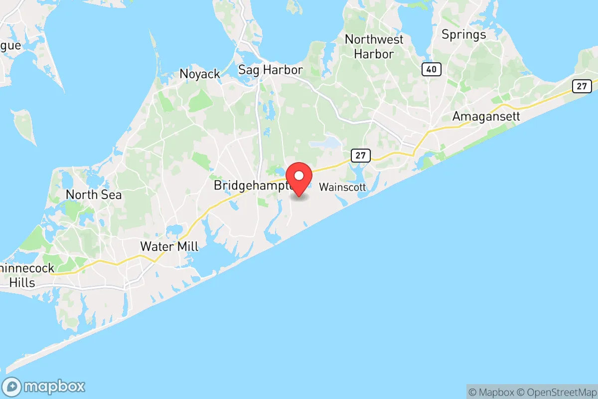
Sagaponack, New York, presents a paradox for the strategic relocator: it offers exceptional natural resilience in the form of a robust local aquifer, fertile soil, and a coastal position that buffers against many inland supply-chain disruptions, yet its extreme wealth and proximity to New York City create a unique set of vulnerabilities. Located on the South Fork of Long Island, roughly 100 miles east of Manhattan, this hamlet sits within the Town of Southampton and is part of the broader Hamptons region. For a prepper or survivalist with a conservative mindset, the area’s advantages are real but come with strings attached—namely, that you are living in a high-value target zone during any major societal breakdown. The key is understanding that Sagaponack’s resilience is not about isolation but about leveraging local resources while mitigating the risks of being a potential evacuation destination for the urban elite.
Geographic position and natural advantages for long-term survival
Sagaponack’s primary strategic asset is its direct access to the Sagaponack Pond and the underlying glacial aquifer system, which provides a reliable, naturally filtered freshwater source independent of municipal infrastructure. The area’s agricultural zoning—much of the land is preserved as farmland under the Peconic Land Trust—means that over 1,000 acres of active potato, corn, and vegetable fields lie within a two-mile radius, offering a local food supply that most suburban areas lack. The coastal position on the Atlantic Ocean provides a moderating effect on temperatures, reducing the risk of extreme winter freezes that could kill crops, and the prevailing westerly winds help disperse airborne contaminants from any urban disaster to the west. For a relocator, the ability to draw water from a shallow well and grow food on sandy loam soil is a tangible advantage, especially when compared to the clay-heavy, polluted ground closer to the city. The area’s low population density—roughly 250 residents per square mile in the hamlet itself—means fewer people competing for resources in a crisis, though that changes dramatically in summer months.
Risks, exposures, and proximity to fallout-relevant landmarks
The most glaring vulnerability is Sagaponack’s proximity to New York City, just 100 miles west, which makes it a primary evacuation corridor for millions of people during any mass casualty event, nuclear incident, or civil unrest. The Long Island Expressway (I-495) and Montauk Highway (NY-27) are the only major routes in and out, and both become impassable choke points within hours of a crisis—as seen during Hurricane Sandy in 2012, when roads were gridlocked for over 12 hours. Additionally, the Shoreham Nuclear Power Plant, though decommissioned, sits 40 miles west and still contains spent fuel rods in dry casks, a potential target for sabotage or a secondary disaster. The Brookhaven National Laboratory, 50 miles west, is another high-risk research facility that could be a target. For the prepper, the summer population surge from 2,000 to over 50,000 in the Hamptons creates a massive resource drain and a security nightmare—everyone with a second home will try to bug out here, bringing urban problems with them. The area is also exposed to nor’easters and hurricane storm surges; the 1938 Hurricane and 2012 Sandy both caused significant coastal flooding, and sea-level rise projections suggest that low-lying areas near the ocean could be inundated within 30 years.
Practical resilience for a relocator: food, water, energy, and defensibility
For a single individual or family willing to invest, Sagaponack offers a rare combination of off-grid potential and local resource abundance. The water table is shallow—typically 10 to 20 feet deep—so a hand pump or solar-powered well can provide drinking and irrigation water without municipal dependency. The agricultural land means you can grow potatoes, corn, beans, and squash with minimal inputs, and the local fishing in the Atlantic and Gardiners Bay provides protein year-round. Energy resilience is moderate: the area has good solar exposure, and many homes already have backup generators due to frequent storm-related outages, but natural gas infrastructure is limited, so propane or diesel storage is essential. Defensibility is the weak point. The terrain is flat and open, with few natural chokepoints, and the nearest police station is 8 miles away in Bridgehampton, with response times that could stretch to 30 minutes in a crisis. The community is overwhelmingly wealthy and liberal-leaning, which may create cultural friction for a conservative prepper, but the upside is that many neighbors are absentee owners, leaving properties vacant for months—reducing the number of people you need to deal with. The Sagaponack General Store and the Bridgehampton Farmers Market are local hubs, but in a collapse, you cannot rely on them; you must have your own stored supplies for at least 90 days.
The overall strategic picture for Sagaponack is one of high potential but equally high risk. It is not a place for the casual prepper; it is a location for someone with the resources to buy a property with a well, solar panels, and a defensible perimeter, and who is willing to accept that the first 72 hours of any major event will be chaos as the urban exodus floods the roads. For a conservative relocator, the trade-off is clear: you get clean water, fertile soil, and a coastal buffer against inland fallout, but you are living in a glass house next to a powder keg. If you can secure a property with a deep well, a greenhouse, and a reliable vehicle that can navigate back roads (like the Sagaponack–Bridgehampton Turnpike or the less-traveled Sagg Road), you can carve out a resilient niche. But do not mistake the Hamptons’ wealth for safety—in a real crisis, the mansions become targets, and the people who own them will be the first to flee, leaving you to deal with the aftermath. Sagaponack works best as a secondary bug-out location for someone who already has a primary retreat further inland, not as a standalone survival homestead. If you are serious about long-term preparedness, look at the North Fork or upstate New York instead; Sagaponack is a beautiful place to live, but it is not a fortress.
* Values derived from national, state, county, city and local statistics and may differ in a specific area. Last updated: 2026-04-24T01:50:22.000Z
Narrative content on this page is AI-generated and may contain mistakes. Verify any details that matter before acting on them.
ReloMaps may earn a commission from affiliate links at no extra cost to you.