
Photo: Wikipedia
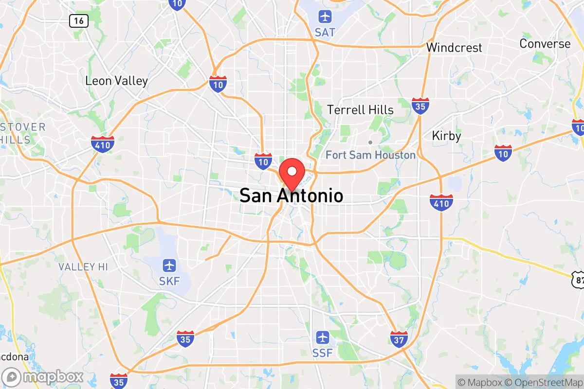
Strategic Assessment of San Antonio, TX
Multiple tactical vulnerabilities. Population density, target proximity, or disaster risk are likely compounding. A retreat property and exit planning is required.
What does the Strategic Assessment tell us?
Our Strategic Assessment grades tactical survivability of an area. Major population centers, military targets, fallout zones, natural disasters, and border exposure all drive risk — lower exposure means a more defensible position in a crisis.
This is heavily inspired by Joel Skousen's Strategic Relocation book. Highly recommended you checkout the book ($)What does this tell us?
Our Strategic Assessment grades tactical survivability of an area. Major population centers, military targets, fallout zones, natural disasters, and border exposure all drive risk — lower exposure means a more defensible position in a crisis.
This is heavily inspired by Joel Skousen's Strategic Relocation book. Highly recommended you checkout the book ($)Strategic Pillars

Key Distances
Regional Safe Places
Below is our recommended "safe zones" in Texas and the surrounding area based on our strategic heuristics. For most people, it's unrealistic to live in a “safe zone” full-time due to work, family or other personal reasons. They tend to be more rural. However, many of these areas are perfect for second homes and retreat properties that double as a vacation home or even a short-term rental.


Important Note: For informational purposes only. This does not mean nothing bad ever happens in the green zones. Please use common sense. This is based on public data and modeled with AI. We tried to take a conservative approach but mistakes happen. We update this regularly as new information becomes available.
Solar Generator Recommendations
Backup power matters more here than in safer locations. We've picked three solar generators across budgets and capacity tiers — start with the budget unit if you only need a few essentials, or step up if you want to run a fridge and HVAC for days at a time.

Jackery Portable Power Station Explorer 300
Budget OptionPower on the Go: Weighing only 11 lbs, it's convenient to set up and store with book-sized foldable solar panels

BLUETTI Portable Power Station AC180
Designed for both indoor and outdoor scenarios, AC180 is highly capable as it has a robost capacity and continuous output power.

EF ECOFLOW DELTA Pro Ultra Power Station
Upgraded PickEcoFlow DELTA Pro Ultra is a whole-home energy system designed to grow with your family. Integrated with the Smart Home Panel 2, it scales to meet your evolving energy needs — keeping your home powered, intelligent, and secure through every stage of life.
We earn a commission, at no additional cost to you.
Strategic Assessment Analysis
San Antonio offers a mixed strategic picture for the conservative prepper: it provides genuine geographic buffers and a strong local culture of self-reliance, but its proximity to major military-industrial targets and a sprawling urban population creates significant exposure. The city sits at a pivot point between the arid West Texas ranchlands and the humid Gulf Coast, giving relocators access to diverse water sources and multiple escape corridors. While the Alamo City’s economic resilience is real—anchored by a massive military presence and a growing medical sector—its position within the I-35 corridor and near critical infrastructure makes it a secondary target zone in any major conflict or national emergency. For the individual or family serious about long-term preparedness, San Antonio functions best as a logistics hub and a stepping stone to more defensible terrain, not as a final retreat location.
Geographic position and natural advantages for long-term survival
San Antonio’s location offers several hard-to-replicate natural advantages for a prepper. The city sits on the Balcones Escarpment, a geological fault line that creates a natural elevation change—the Hill Country to the north and west rises 500 to 1,000 feet above the city, providing defensible high ground and cooler temperatures. The Edwards Aquifer, one of the most productive limestone aquifers in the United States, lies directly beneath the region, supplying the city with over 200,000 acre-feet of water annually. This means that even in a prolonged drought or grid-down scenario, groundwater access is superior to most of Texas. The surrounding terrain is a mix of live oak savannah and limestone hills, offering ample cover and natural chokepoints for anyone who knows the back roads. The climate is subtropical with hot summers and mild winters, reducing the risk of freeze-related infrastructure failures that plague northern cities. For the relocator, the key takeaway is that the land itself provides water, elevation, and concealment—three pillars of any defensible position.
Risks, exposures, and proximity to high-value targets
The biggest strategic liability for San Antonio is its concentration of military and federal assets. Joint Base San Antonio (JBSA) encompasses Fort Sam Houston, Lackland Air Force Base, and Randolph Air Force Base, making the city a top-tier target for any adversary with long-range strike capability. In a major conflict, these installations would be primary objectives, and the resulting fallout—both literal and figurative—would radiate outward. The city also sits within 150 miles of the nation’s strategic petroleum reserve at Bryan Mound and the Port of Corpus Christi, a major energy export hub. A single EMP or coordinated cyberattack on the power grid could paralyze the city’s 1.5 million residents, many of whom lack the water storage or food reserves to survive more than a week. The I-35 corridor, which runs straight through downtown, is a natural chokepoint for evacuation and supply lines; in a crisis, it would become a parking lot. For the prepper, the calculus is clear: San Antonio is not a safe haven from national-level events, but a high-probability impact zone. The prudent strategy is to use the city as a staging area for supplies and intelligence, with a primary retreat located at least 60 miles northwest, past Kerrville or into the Edwards Plateau.
Practical resilience for a relocator: food, water, energy, and defensibility
For those who choose to stay within the San Antonio metro area, practical resilience requires a layered approach. The city’s water supply is robust, but it depends on electric pumps and treatment plants. A prepper should have at least a 30-day supply of stored water (one gallon per person per day) and a means to filter or treat surface water from the San Antonio River or local creeks. The region’s growing season runs from March to November, allowing for substantial home food production—raised beds, fruit trees, and chickens are common even in suburban neighborhoods like Alamo Heights or Stone Oak. Energy resilience is more challenging: the city’s grid is part of ERCOT, which has proven vulnerable to winter storms and summer demand spikes. Solar panels with battery storage are a wise investment, but note that HOA restrictions in many subdivisions limit visible installations. Defensibility at the household level is strong if you choose a home on a cul-de-sac or with a single access point; the Hill Country suburbs north of Loop 1604 offer better terrain for perimeter security than the flat, open areas south of the city. For the single individual or family, the most practical move is to secure a property with a well, septic system, and at least five acres of land in Bexar County’s unincorporated areas or adjacent Medina County, where building codes are minimal and neighbors are sparse.
The overall strategic picture for San Antonio is one of calculated risk. The city offers genuine advantages in water availability, climate, and a culture of self-reliance that aligns with conservative values—gun ownership is high, church attendance is strong, and the local economy is not dependent on coastal trade or finance. But the presence of major military targets, the vulnerability of the power grid, and the sheer population density mean that San Antonio is not a place to ride out a national collapse. The smart play is to treat it as a forward operating base: establish a primary retreat in the Hill Country or West Texas, stockpile supplies in the city for short-term contingencies, and maintain a vehicle capable of off-road travel. For the prepper who understands that survival is about positioning, not just stockpiling, San Antonio is a useful tool—but never the final answer.
* Values derived from national, state, county, city and local statistics and may differ in a specific area. Last updated: 2026-04-28T15:32:18.000Z
Narrative content on this page is AI-generated and may contain mistakes. Verify any details that matter before acting on them.
ReloMaps may earn a commission from affiliate links at no extra cost to you.