Photo: Wikipedia
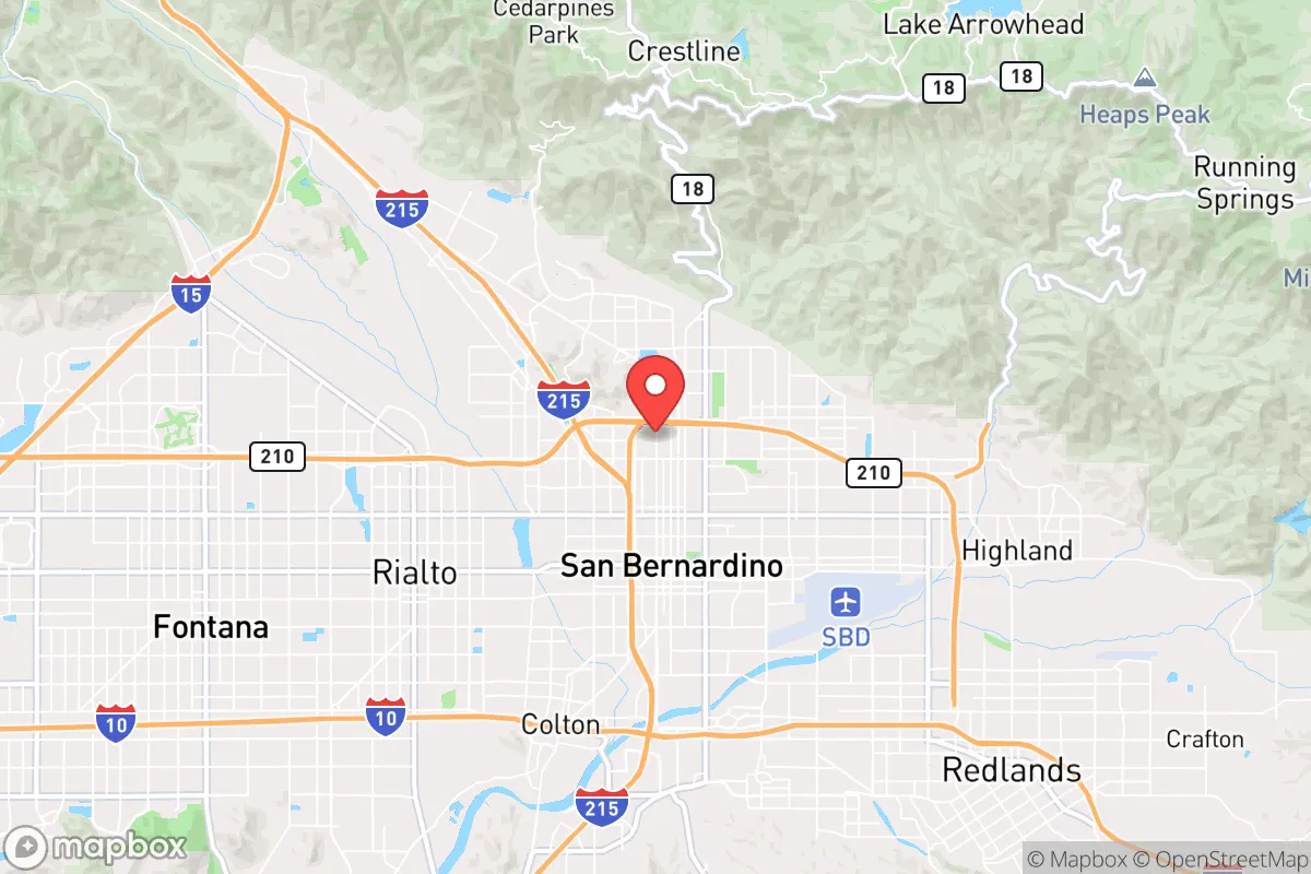
Strategic Assessment of San Bernardino, CA
Multiple tactical vulnerabilities. Population density, target proximity, or disaster risk are likely compounding. A retreat property and exit planning is required.
What does the Strategic Assessment tell us?
Our Strategic Assessment grades tactical survivability of an area. Major population centers, military targets, fallout zones, natural disasters, and border exposure all drive risk — lower exposure means a more defensible position in a crisis.
This is heavily inspired by Joel Skousen's Strategic Relocation book. Highly recommended you checkout the book ($)What does this tell us?
Our Strategic Assessment grades tactical survivability of an area. Major population centers, military targets, fallout zones, natural disasters, and border exposure all drive risk — lower exposure means a more defensible position in a crisis.
This is heavily inspired by Joel Skousen's Strategic Relocation book. Highly recommended you checkout the book ($)Strategic Pillars

Key Distances
Regional Safe Places
Below is our recommended "safe zones" in California and the surrounding area based on our strategic heuristics. For most people, it's unrealistic to live in a “safe zone” full-time due to work, family or other personal reasons. They tend to be more rural. However, many of these areas are perfect for second homes and retreat properties that double as a vacation home or even a short-term rental.


Important Note: For informational purposes only. This does not mean nothing bad ever happens in the green zones. Please use common sense. This is based on public data and modeled with AI. We tried to take a conservative approach but mistakes happen. We update this regularly as new information becomes available.
Solar Generator Recommendations
Backup power matters more here than in safer locations. We've picked three solar generators across budgets and capacity tiers — start with the budget unit if you only need a few essentials, or step up if you want to run a fridge and HVAC for days at a time.

Jackery Portable Power Station Explorer 300
Budget OptionPower on the Go: Weighing only 11 lbs, it's convenient to set up and store with book-sized foldable solar panels

BLUETTI Portable Power Station AC180
Designed for both indoor and outdoor scenarios, AC180 is highly capable as it has a robost capacity and continuous output power.

EF ECOFLOW DELTA Pro Ultra Power Station
Upgraded PickEcoFlow DELTA Pro Ultra is a whole-home energy system designed to grow with your family. Integrated with the Smart Home Panel 2, it scales to meet your evolving energy needs — keeping your home powered, intelligent, and secure through every stage of life.
We earn a commission, at no additional cost to you.
Strategic Assessment Analysis
San Bernardino, California, presents a deeply contradictory picture for the strategic relocator. Its location at the base of the San Bernardino Mountains offers genuine natural-resilience advantages—high ground, water access, and defensible terrain—but these are heavily offset by its position as a major logistics hub and its proximity to the densest population corridor on the West Coast. For someone prioritizing long-term preparedness, the city itself is a high-risk zone, but the surrounding mountain and desert communities offer some of the best fallback positions in Southern California, provided you understand the exposure trade-offs.
Geographic position and natural advantages for long-term survival
The single most important strategic asset of the San Bernardino area is its access to the San Bernardino National Forest and the San Gorgonio Wilderness. This is not flat desert—it's a mountain wall rising to over 11,000 feet, with reliable snowpack, natural springs, and multiple forest service roads that become impassable to vehicles after a few miles. For a prepper, that means defensible retreat options within a 30-minute drive of the city floor. The Cajon Pass and the I-10 corridor are the only practical routes into the Los Angeles Basin from the east, which means any large-scale evacuation or military movement will funnel through this area. In a grid-down scenario, those chokepoints become either a barrier or a target, depending on your position. The area also sits atop the San Bernardino Groundwater Basin, one of the largest in Southern California, with the Santa Ana River providing a perennial surface water source—rare in this region. For a relocator, the key is to be above the city, not in it. The mountain communities of Crestline, Lake Arrowhead, and Running Springs offer elevation, tree cover, and natural water sources that the valley floor lacks entirely.
Risks, exposures, and proximity to fallout-relevant landmarks
The negatives are substantial and cannot be glossed over. San Bernardino is a major rail and trucking hub—the BNSF and Union Pacific intermodal yards move an enormous volume of freight, including hazardous materials, through the city. A derailment or intentional attack on those rail lines could produce a chemical or fire event that would make large portions of the city uninhabitable for weeks. The city also sits directly under the approach path to Ontario International Airport and is within 40 miles of March Air Reserve Base, a major military installation. In a conflict scenario, those are high-value targets. Additionally, the San Andreas Fault runs through the Cajon Pass just northwest of the city. A major earthquake would sever the I-15 and I-10 corridors, isolate the valley floor, and likely trigger gas-line ruptures and fires across the urbanized area. The city itself has a high crime rate and a history of civil unrest—during the 1992 riots, San Bernardino saw significant looting and arson. For a relocator, living inside the city limits is a liability. The risk of being caught in a mass-casualty event tied to the logistics infrastructure or a natural disaster is real and recurring.
Practical resilience for a relocator: food, water, energy, and defensibility
For those willing to live in the mountain communities or the high desert east of the city (areas like Yucaipa, Mentone, or the unincorporated areas near Lytle Creek), the resilience picture improves dramatically. Water is the critical variable. The mountain communities rely on local wells and reservoirs, but many are on private or small-utility systems that can fail in a prolonged outage. A relocator should secure a property with a private well and a backup generator—solar is viable here, with over 280 sunny days per year, but winter storms can knock out grid power for days. Food storage is straightforward: the climate is dry enough that freeze-dried and canned goods store well in cool basements or root cellars. The local growing season is short at elevation (May to September), but the valley floor below has a long growing season and access to the Inland Empire's agricultural supply chain. Defensibility is excellent in the mountains—narrow, winding roads with limited access points make it easy to monitor approach routes. The downside is that medical evacuation and resupply are slow in a crisis. The nearest Level 1 trauma center is Loma Linda University Medical Center, about 20 minutes from the valley floor but 45 minutes to an hour from the mountain communities. For a family, this means you need a robust medical kit and the training to use it. Energy resilience is achievable: propane delivery is common, and many mountain homes already have wood-burning stoves for heat. The key is redundancy—a property with solar, a generator, and a wood stove can ride out most disruptions.
The overall strategic picture for San Bernardino is one of high potential paired with high exposure. If you position yourself in the mountains or the eastern high desert, you gain access to water, defensible terrain, and a buffer from the chaos of the Los Angeles Basin. But the city itself is a trap—a logistics chokepoint with a history of unrest and a high probability of being a primary impact zone in any major disaster. For the conservative relocator who values self-reliance and wants to be within striking distance of urban resources without being consumed by them, the San Bernardino Mountains offer a viable option. Just understand that you are choosing to live on the edge of a powder keg, and your survival depends on being uphill and out of the blast radius when the fuse burns down.
* Values derived from national, state, county, city and local statistics and may differ in a specific area. Last updated: 2026-04-24T09:08:44.000Z
Narrative content on this page is AI-generated and may contain mistakes. Verify any details that matter before acting on them.
ReloMaps may earn a commission from affiliate links at no extra cost to you.