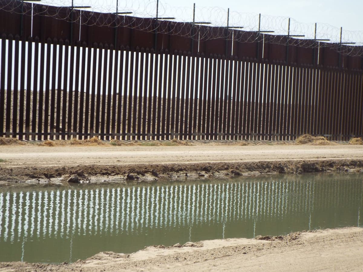

Photo: Wikipedia
Strategic Assessment of San Luis, AZ
Multiple tactical vulnerabilities. Population density, target proximity, or disaster risk are likely compounding. A retreat property and exit planning is required.
What does the Strategic Assessment tell us?
Our Strategic Assessment grades tactical survivability of an area. Major population centers, military targets, fallout zones, natural disasters, and border exposure all drive risk — lower exposure means a more defensible position in a crisis.
This is heavily inspired by Joel Skousen's Strategic Relocation book. Highly recommended you checkout the book ($)What does this tell us?
Our Strategic Assessment grades tactical survivability of an area. Major population centers, military targets, fallout zones, natural disasters, and border exposure all drive risk — lower exposure means a more defensible position in a crisis.
This is heavily inspired by Joel Skousen's Strategic Relocation book. Highly recommended you checkout the book ($)Strategic Pillars

Key Distances
Regional Safe Places
Below is our recommended "safe zones" in Arizona and the surrounding area based on our strategic heuristics. For most people, it's unrealistic to live in a “safe zone” full-time due to work, family or other personal reasons. They tend to be more rural. However, many of these areas are perfect for second homes and retreat properties that double as a vacation home or even a short-term rental.
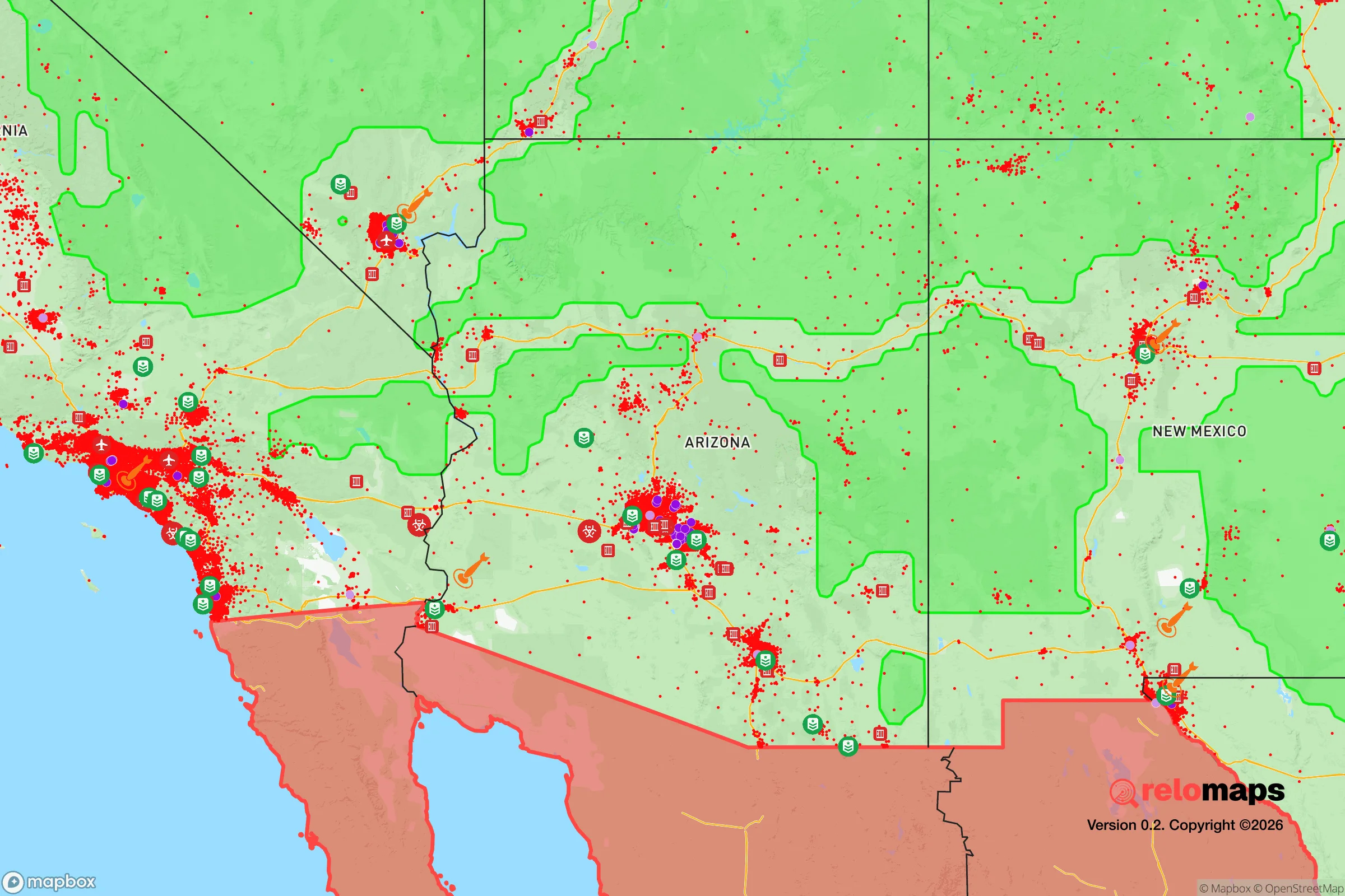
Important Note: For informational purposes only. This does not mean nothing bad ever happens in the green zones. Please use common sense. This is based on public data and modeled with AI. We tried to take a conservative approach but mistakes happen. We update this regularly as new information becomes available.
Solar Generator Recommendations
Backup power matters more here than in safer locations. We've picked three solar generators across budgets and capacity tiers — start with the budget unit if you only need a few essentials, or step up if you want to run a fridge and HVAC for days at a time.

Jackery Portable Power Station Explorer 300
Budget OptionPower on the Go: Weighing only 11 lbs, it's convenient to set up and store with book-sized foldable solar panels

BLUETTI Portable Power Station AC180
Designed for both indoor and outdoor scenarios, AC180 is highly capable as it has a robost capacity and continuous output power.

EF ECOFLOW DELTA Pro Ultra Power Station
Upgraded PickEcoFlow DELTA Pro Ultra is a whole-home energy system designed to grow with your family. Integrated with the Smart Home Panel 2, it scales to meet your evolving energy needs — keeping your home powered, intelligent, and secure through every stage of life.
We earn a commission, at no additional cost to you.
Strategic Assessment Analysis
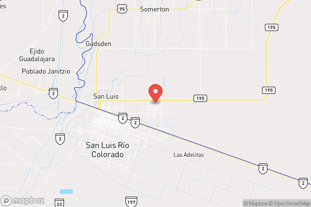
San Luis, Arizona, sits in a unique strategic position that demands serious consideration from anyone prioritizing long-term resilience and self-sufficiency. Located directly on the U.S.-Mexico border in Yuma County, this small city of roughly 35,000 people offers a combination of geographic isolation, agricultural abundance, and proximity to critical infrastructure that is rare in the modern Southwest. For a relocator with a prepper mindset—concerned about civic unrest, supply chain collapse, or mass casualty events—San Luis presents both distinct advantages and hard trade-offs that must be weighed carefully. The area's resilience stems not from being a fortified bunker, but from its position as a working agricultural hub with direct access to the Colorado River and a climate that supports year-round food production.
Geographic position and natural advantages for long-term survival
San Luis occupies the far southwestern corner of Arizona, less than 10 miles from the California border and about 20 miles from the Gulf of California in Mexico. This location places it at the confluence of two major water sources: the Colorado River runs just west of the city, and the Gila River meets it nearby. For anyone serious about water security, this is a foundational advantage. The area sits within the Yuma Mesa, a flat, elevated plain that avoids the flood risks of the river valleys while still allowing groundwater recharge. The climate is extreme—summer highs regularly exceed 110°F—but that same heat creates a natural barrier to population influx. Few people want to live here, which means population density remains low and land prices are among the most affordable in Arizona. The surrounding Yuma County is sparsely populated outside the city limits, offering rural buffer zones that would be difficult for any civil disturbance to penetrate quickly. The region's agricultural dominance—Yuma County produces over 90% of the nation's winter leafy greens—means that local food supply chains are robust and short. In a collapse scenario, San Luis residents would be closer to actual food production than nearly any other urban area in the Southwest.
Risks, exposures, and proximity to fallout-relevant landmarks
No strategic assessment is honest without confronting the downsides. San Luis's border location is a double-edged sword. The city shares a direct border with San Luis Río Colorado, Sonora, a Mexican city of roughly 200,000 people. This creates a constant flow of cross-border traffic that includes both legitimate commerce and illicit activity. Drug cartel violence in Sonora has been documented within miles of the border, and while San Luis, AZ itself has a relatively low violent crime rate, the potential for spillover during a period of national instability is real. The city is also within 30 miles of the Yuma Proving Ground, a U.S. Army test facility that handles artillery, munitions, and occasionally chemical weapons testing. While this is not a nuclear facility, it is a military target of moderate value. More concerning is the proximity to the Palo Verde Nuclear Generating Station, located about 80 miles northeast near Tonopah. That plant is the largest nuclear generator in the country by output, and in a major conflict or terrorist scenario, it would be a high-value target. Fallout patterns depend on wind direction, but prevailing winds in the region blow from west to east, which would carry contamination away from San Luis in most scenarios. Still, 80 miles is close enough to warrant serious consideration. The city also lies within 150 miles of Naval Air Facility El Centro and Marine Corps Air Station Yuma, both of which are active military installations that could become targets or staging areas during a national emergency.
Practical resilience for a relocator: food, water, energy, and defensibility
For the individual or family looking to establish a resilient homestead, San Luis offers concrete advantages that are hard to replicate elsewhere. Water access is the single strongest factor. The Colorado River is managed by the Bureau of Reclamation, and Yuma County holds senior water rights that predate most of the Southwest's allocations. In a drought scenario, Yuma farmers and residents would be among the last to lose access. The local water table is also high, and many rural properties can drill wells at depths of 100-300 feet—shallow by Arizona standards. Food production is year-round. The growing season lasts 365 days, and the local agricultural infrastructure includes seed suppliers, equipment dealers, and processing facilities that would remain operational even if national supply chains faltered. Farmers markets and direct-from-farm purchasing are common, allowing a relocator to build local food networks quickly. Energy is less certain. The grid in Yuma County is served by Arizona Public Service and the Yuma-area municipal utility, but summer demand spikes due to air conditioning loads. Solar power is highly viable—the region averages over 300 sunny days per year—but battery storage is essential for nighttime cooling. Off-grid solar setups are common among rural residents, and local installers are experienced with high-heat environments. Defensibility is moderate. The flat terrain offers few natural chokepoints, but the surrounding agricultural land provides open sightlines. Rural properties with perimeter fencing and well-placed gates can be made secure. The local law enforcement presence is small—the San Luis Police Department has around 40 officers—so in a prolonged crisis, residents would largely need to rely on themselves and their neighbors. The community is tight-knit, with a strong Hispanic cultural foundation that emphasizes family and mutual aid, which is a social resilience factor that cannot be overstated.
The overall strategic picture for San Luis is one of trade-offs that favor the prepared relocator. The city is not a prepper paradise—it lacks the mountainous terrain, forest cover, and isolation of northern Arizona or the Rockies. But it offers something those areas cannot: reliable water, year-round food production, and a low-cost entry point for building a resilient lifestyle. The risks from border activity and nearby military infrastructure are real but manageable with situational awareness and a solid security plan. For the conservative-leaning individual who values self-reliance, distrusts centralized systems, and wants to be positioned for long-term stability rather than short-term comfort, San Luis deserves a hard look. It is not a retreat from the world—it is a working agricultural community that could become a lifeline if the world stops working as expected. The heat will test you, the isolation will challenge you, and the border dynamics will keep you alert. But for those willing to adapt, San Luis offers a foundation that few other locations in the Southwest can match.
* Values derived from national, state, county, city and local statistics and may differ in a specific area. Last updated: 2026-05-01T08:53:36.000Z
Narrative content on this page is AI-generated and may contain mistakes. Verify any details that matter before acting on them.
ReloMaps may earn a commission from affiliate links at no extra cost to you.