
Photo: Wikipedia
Strategic Assessment of Sapulpa, OK
Meaningful friction. Expect exposure to either population pressure, blast zones, or natural disaster risk. Consider buying a retreat property.
What does the Strategic Assessment tell us?
Our Strategic Assessment grades tactical survivability of an area. Major population centers, military targets, fallout zones, natural disasters, and border exposure all drive risk — lower exposure means a more defensible position in a crisis.
This is heavily inspired by Joel Skousen's Strategic Relocation book. Highly recommended you checkout the book ($)What does this tell us?
Our Strategic Assessment grades tactical survivability of an area. Major population centers, military targets, fallout zones, natural disasters, and border exposure all drive risk — lower exposure means a more defensible position in a crisis.
This is heavily inspired by Joel Skousen's Strategic Relocation book. Highly recommended you checkout the book ($)Strategic Pillars

Key Distances
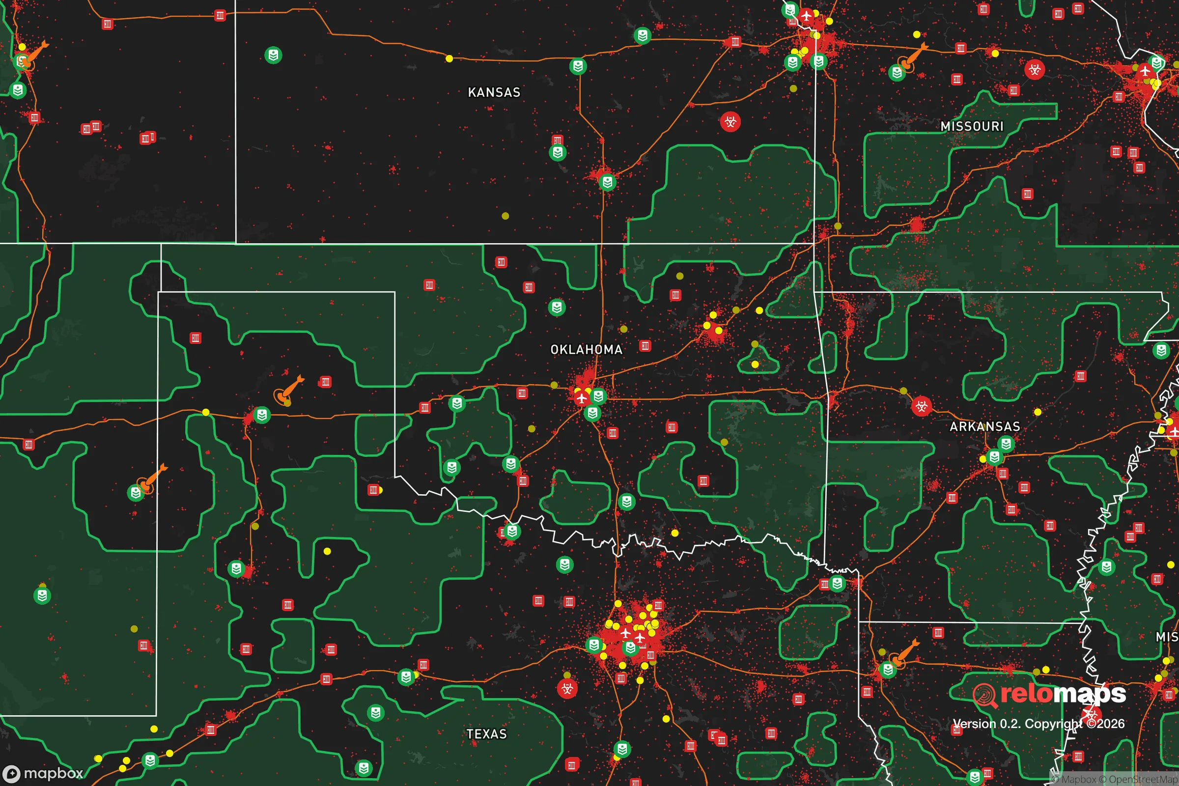
Regional Safe Places
Below is our recommended "safe zones" in Oklahoma and the surrounding area based on our strategic heuristics. For most people, it's unrealistic to live in a “safe zone” full-time due to work, family or other personal reasons. They tend to be more rural. However, many of these areas are perfect for second homes and retreat properties that double as a vacation home or even a short-term rental.
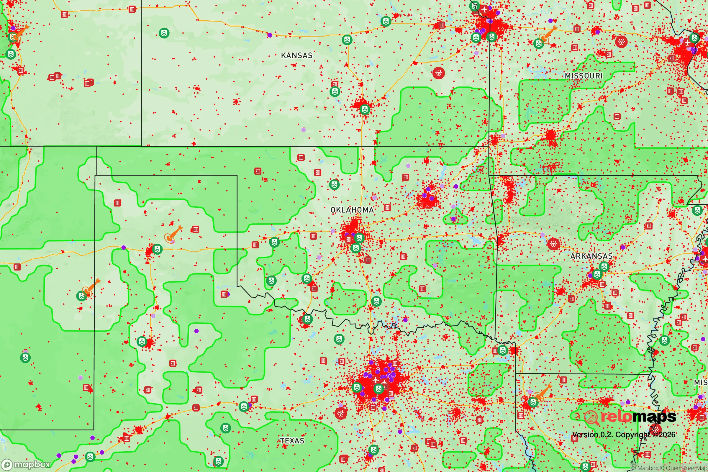
Important Note: For informational purposes only. This does not mean nothing bad ever happens in the green zones. Please use common sense. This is based on public data and modeled with AI. We tried to take a conservative approach but mistakes happen. We update this regularly as new information becomes available.
Solar Generator Recommendations
Backup power matters more here than in safer locations. We've picked three solar generators across budgets and capacity tiers — start with the budget unit if you only need a few essentials, or step up if you want to run a fridge and HVAC for days at a time.

Jackery Portable Power Station Explorer 300
Budget OptionPower on the Go: Weighing only 11 lbs, it's convenient to set up and store with book-sized foldable solar panels

BLUETTI Portable Power Station AC180
Designed for both indoor and outdoor scenarios, AC180 is highly capable as it has a robost capacity and continuous output power.

EF ECOFLOW DELTA Pro Ultra Power Station
Upgraded PickEcoFlow DELTA Pro Ultra is a whole-home energy system designed to grow with your family. Integrated with the Smart Home Panel 2, it scales to meet your evolving energy needs — keeping your home powered, intelligent, and secure through every stage of life.
We earn a commission, at no additional cost to you.
Strategic Assessment Analysis
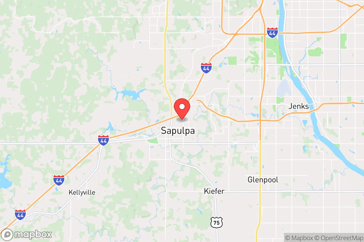
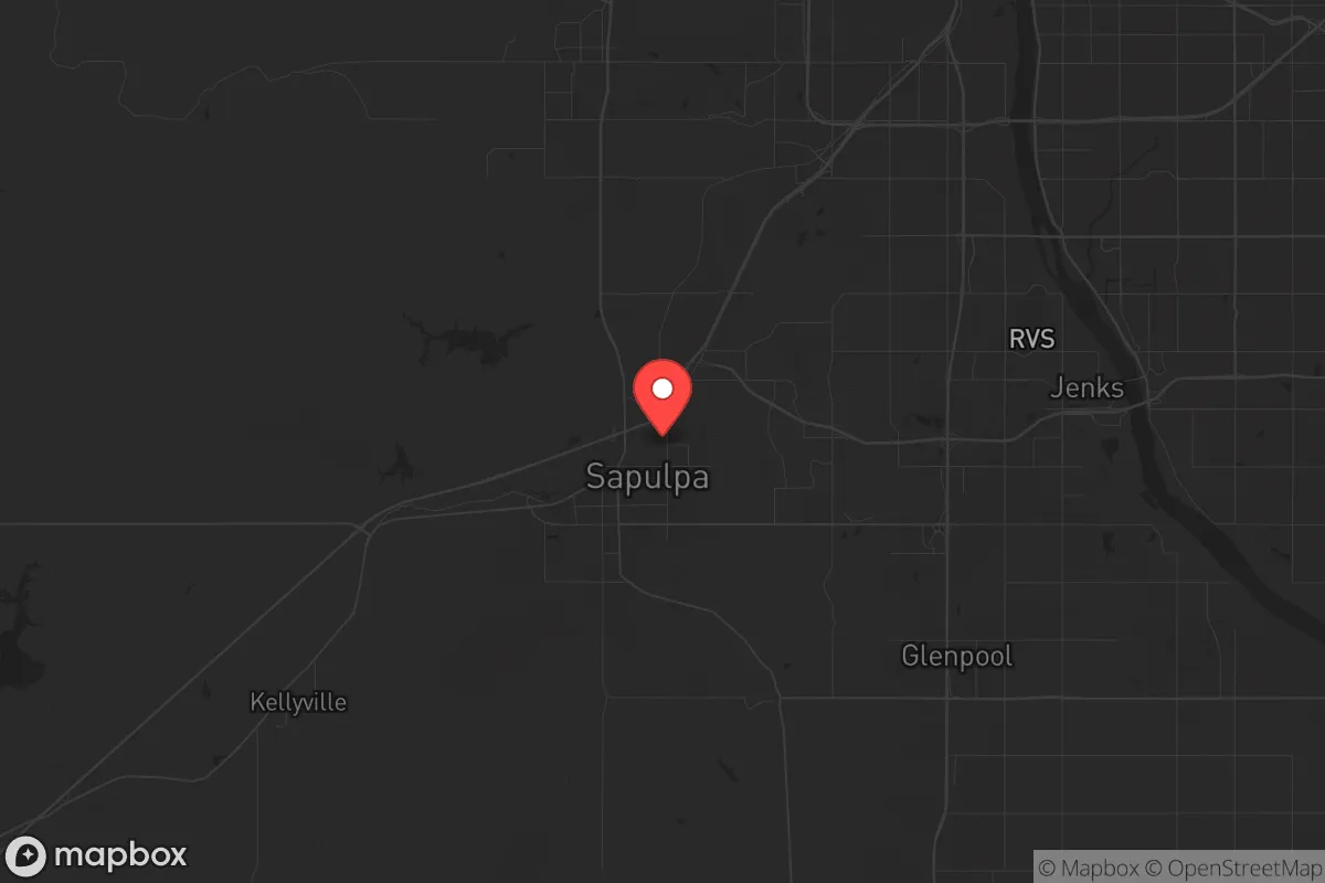
Sapulpa, Oklahoma, occupies a strategic position that balances proximity to economic infrastructure with a degree of separation from the most acute risks of a major metropolitan collapse. Located just southwest of Tulsa, this city of roughly 22,000 sits at the intersection of Route 66 and the Creek Turnpike, offering a practical buffer zone—close enough to access resources and medical care in a stable environment, but far enough to avoid the immediate chaos of a major urban evacuation or grid failure. The area’s resilience is rooted in its geographic and economic positioning: it’s not a primary target, yet it’s not so remote that supply chains vanish overnight. For a relocator thinking in terms of decades, not just election cycles, Sapulpa presents a workable middle ground—provided you understand the specific exposures and prepare accordingly.
Geographic position and natural advantages for long-term stability
Sapulpa sits on the edge of the Ozark Plateau, where the terrain transitions from flat plains to rolling hills and wooded creek bottoms. This topography offers natural defensibility—elevated ridgelines provide observation points, and the dense tree cover along Polecat Creek and the Arkansas River corridor can obscure movement and dampen noise. The area is not seismically active in any meaningful way; the nearest fault lines are the Nemaha Ridge, roughly 100 miles west, and the New Madrid Seismic Zone, about 400 miles east, meaning a catastrophic earthquake is not a primary concern. Water resources are a genuine advantage: the Arkansas River runs within five miles of downtown, and Lake Sahoma and Pretty Water Lake are both within a 15-minute drive, providing redundant surface water sources. The water table in Creek County is generally reliable for shallow wells, though you’ll want to test for local contamination from historic oil and gas operations—more on that below. The climate is continental, with hot summers and cold winters, but tornado risk is real; Sapulpa sits in the heart of “Tornado Alley,” and the 2023 outbreak that struck nearby Barnsdall and Sulphur is a reminder that severe weather is a recurring threat. That said, the rolling terrain and tree cover actually reduce the likelihood of a direct hit compared to the open plains further west, and the local storm shelter culture is well-established.
Risks, exposures, and proximity to fallout-relevant landmarks
The most significant strategic downside is Sapulpa’s proximity to Tulsa, a city of over 400,000 that hosts major refining and aerospace infrastructure. The Tulsa International Airport and the Tulsa Port of Catoosa—a major inland port on the McClellan-Kerr Arkansas River Navigation System—are both within 20 miles. In a national emergency or conflict scenario, these are high-value targets. The refineries in the Tulsa area, including the HollyFrontier facility in Tulsa proper, are obvious industrial targets that could produce secondary hazards like toxic plumes or fires. Sapulpa itself has a smaller industrial base—the city is home to a large Berry Global plastics plant and several metal fabrication shops—but these are not likely to be primary targets. More concerning is the proximity to the Keystone Pipeline system, which runs through the region; a rupture or attack could contaminate local water sources. The city also sits within 50 miles of the Oklahoma City metro area, meaning a major event in either urban center could send evacuees streaming down the Turner Turnpike (I-44) directly through Sapulpa. The city’s position as a transportation hub—with rail lines from the BNSF and Union Pacific running through town—means it could become a chokepoint for both movement and supply disruption. For a prepper, the key takeaway is that Sapulpa is not a remote bug-out location; it’s a semi-urban buffer zone that requires a plan for both sheltering in place and, if necessary, a secondary retreat further south or east into the Ouachita Mountains.
Practical resilience for a relocator: food, water, energy, and defensibility
For a single individual or family looking to establish a resilient homestead, Sapulpa offers a mixed bag. The soil in Creek County is a patchwork of sandy loam and clay, suitable for gardens if amended with organic matter; the growing season runs roughly April through October, allowing for a solid annual harvest of tomatoes, peppers, squash, and beans. Local farmers’ markets are small but functional, and the Creek County Fairgrounds hosts occasional livestock auctions. Water is the strongest asset: in addition to the lakes and rivers mentioned, the city’s municipal water comes from Lake Sahoma, a 300-acre reservoir that is less likely to be contaminated by upstream industrial activity than the Arkansas River. For off-grid water, drilling a well is feasible—depths typically range from 100 to 300 feet, with yields of 10-30 gallons per minute in most areas. Energy resilience is more challenging. Sapulpa is served by Public Service Company of Oklahoma (PSO), a subsidiary of American Electric Power, and the grid is aging. Outages during ice storms and summer heat waves are common, sometimes lasting days. Solar is viable—the region averages about 210 sunny days per year, slightly below the national average but workable—but you’ll need battery storage or a generator for winter cloud cover. Natural gas is widely available in the city limits, which is a plus for heating and cooking, but propane is the standard for rural properties. Defensibility is moderate: the city’s layout is a mix of older neighborhoods with mature trees and newer subdivisions on open lots. A property with a creek or wooded buffer on at least one side is ideal. The local law enforcement presence is adequate for a town this size—the Sapulpa Police Department has about 40 sworn officers—but response times in the outer parts of the county can stretch to 20-30 minutes. For a prepper, the practical recommendation is to secure a property with a well, a south-facing roof for solar, and a defensible perimeter, then stockpile for at least 90 days of self-sufficiency. The local hospital, Hillcrest Hospital Sapulpa, is a 40-bed facility capable of stabilizing trauma but not major surgery; for serious medical needs, you’re looking at a 20-minute drive to Tulsa, which is a vulnerability in a grid-down scenario.
The overall strategic picture for Sapulpa is one of calculated trade-offs. It is not a remote mountain redoubt, nor is it a high-risk urban core. It’s a working-class town with a solid water supply, moderate defensibility, and a location that gives you options—you can stay and ride out a regional crisis, or you can push deeper into rural Oklahoma or Arkansas if the situation deteriorates. The conservative culture is present but not overwhelming; the area leans Republican, with Creek County voting +38 points for Trump in 2024, and the local economy is grounded in manufacturing, logistics, and energy, not government or tech. For a relocator who wants to be within striking distance of urban resources while maintaining a credible level of preparedness, Sapulpa is a viable base of operations. Just don’t mistake it for a fortress—it’s a staging ground, and you’ll need to treat it as such.
* Values derived from national, state, county, city and local statistics and may differ in a specific area. Last updated: 2026-04-21T09:09:34.000Z
Narrative content on this page is AI-generated and may contain mistakes. Verify any details that matter before acting on them.
ReloMaps may earn a commission from affiliate links at no extra cost to you.