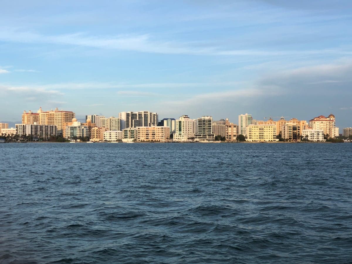
Photo: Wikipedia
Strategic Assessment of Sarasota, FL
Meaningful friction. Expect exposure to either population pressure, blast zones, or natural disaster risk. Consider buying a retreat property.
What does the Strategic Assessment tell us?
Our Strategic Assessment grades tactical survivability of an area. Major population centers, military targets, fallout zones, natural disasters, and border exposure all drive risk — lower exposure means a more defensible position in a crisis.
This is heavily inspired by Joel Skousen's Strategic Relocation book. Highly recommended you checkout the book ($)What does this tell us?
Our Strategic Assessment grades tactical survivability of an area. Major population centers, military targets, fallout zones, natural disasters, and border exposure all drive risk — lower exposure means a more defensible position in a crisis.
This is heavily inspired by Joel Skousen's Strategic Relocation book. Highly recommended you checkout the book ($)Strategic Pillars

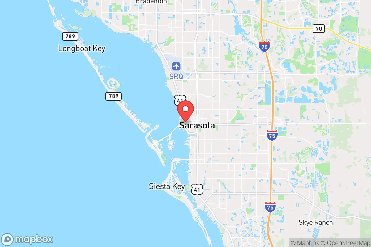
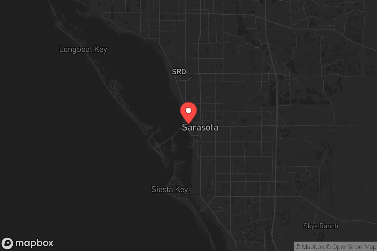
Key Distances
Regional Safe Places
Below is our recommended "safe zones" in Florida and the surrounding area based on our strategic heuristics. For most people, it's unrealistic to live in a “safe zone” full-time due to work, family or other personal reasons. They tend to be more rural. However, many of these areas are perfect for second homes and retreat properties that double as a vacation home or even a short-term rental.

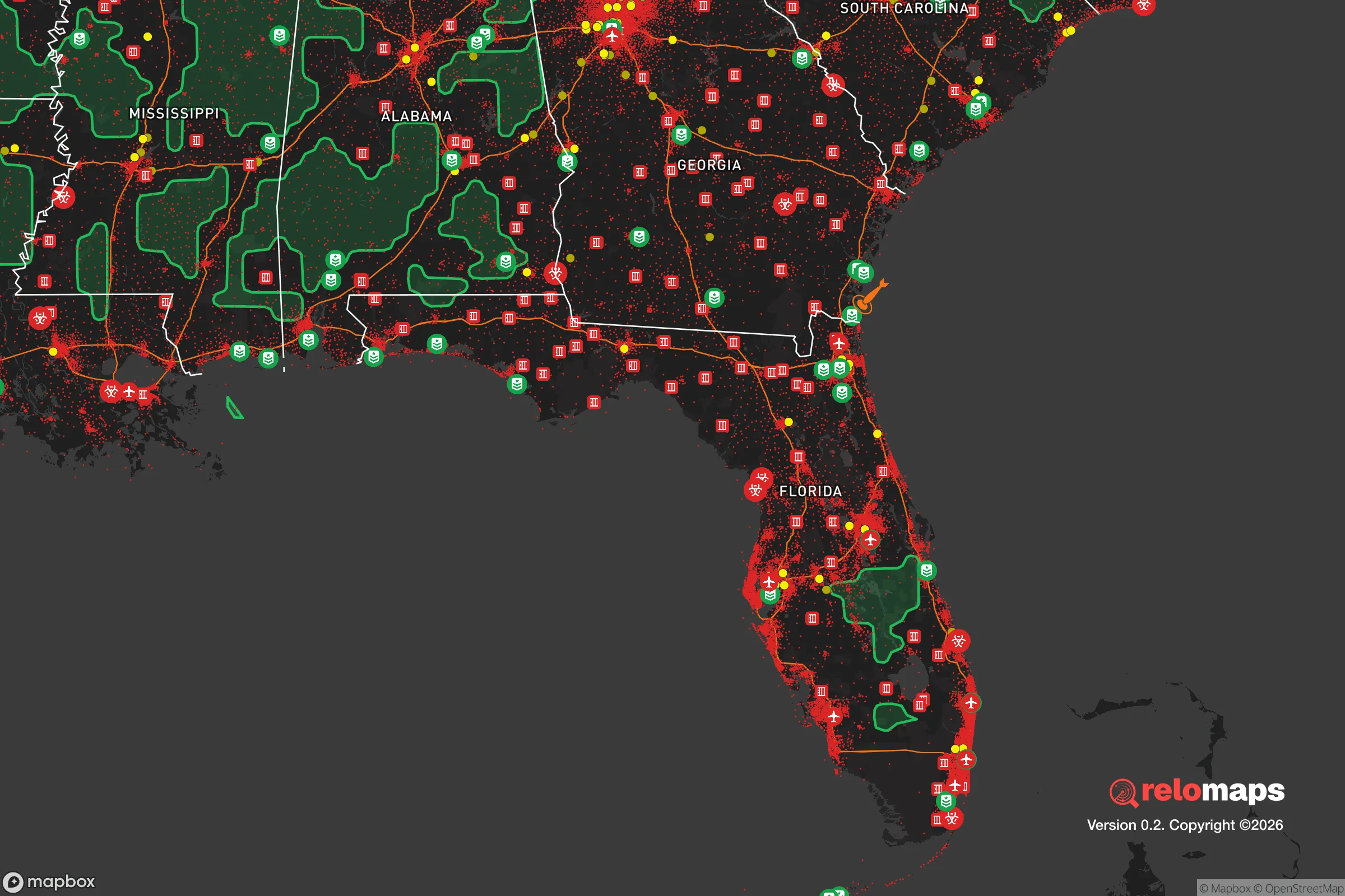
Important Note: For informational purposes only. This does not mean nothing bad ever happens in the green zones. Please use common sense. This is based on public data and modeled with AI. We tried to take a conservative approach but mistakes happen. We update this regularly as new information becomes available.
Solar Generator Recommendations
Backup power matters more here than in safer locations. We've picked three solar generators across budgets and capacity tiers — start with the budget unit if you only need a few essentials, or step up if you want to run a fridge and HVAC for days at a time.

Jackery Portable Power Station Explorer 300
Budget OptionPower on the Go: Weighing only 11 lbs, it's convenient to set up and store with book-sized foldable solar panels

BLUETTI Portable Power Station AC180
Designed for both indoor and outdoor scenarios, AC180 is highly capable as it has a robost capacity and continuous output power.

EF ECOFLOW DELTA Pro Ultra Power Station
Upgraded PickEcoFlow DELTA Pro Ultra is a whole-home energy system designed to grow with your family. Integrated with the Smart Home Panel 2, it scales to meet your evolving energy needs — keeping your home powered, intelligent, and secure through every stage of life.
We earn a commission, at no additional cost to you.
Strategic Assessment Analysis
Sarasota sits in a precarious but potentially advantageous position for the strategic relocator. Its location on Florida’s Gulf Coast offers a mix of natural insulation from some threats while exposing it to others that demand serious preparation. For those with a conservative, self-reliant mindset, the area presents a trade-off: it is far enough from the worst of Florida’s urban chaos to offer breathing room, yet close enough to major population centers that a collapse scenario could bring trouble. The key is understanding where the real risks lie and whether the area’s natural advantages can be leveraged for long-term survival.
Geographic position and natural buffers for long-term security
Sarasota’s geography is defined by its position on a barrier-island complex, with the city proper sitting on the mainland and the barrier islands of Siesta Key, Lido Key, and Longboat Key providing a first line of defense against storm surge. The area is roughly 60 miles south of Tampa and 20 miles north of Fort Myers, placing it in a corridor that is neither too remote nor too exposed. The Intracoastal Waterway runs through the region, offering a natural moat-like barrier that could be used for perimeter defense or waterborne escape routes. The land itself is flat and sandy, with the Myakka River and numerous small creeks providing freshwater sources that are less likely to be contaminated by saltwater intrusion than areas further south. The climate is subtropical, with a wet season from June to September that keeps the landscape green and supports year-round gardening if you know what to plant. For the prepper, the key advantage is that Sarasota is not a primary target for any major strategic strike—it lacks the military bases, major ports, or critical infrastructure that would make it a first-wave target in a conflict. The nearest major military installation is MacDill Air Force Base in Tampa, about 60 miles north, which is a potential fallout magnet but far enough away that Sarasota would likely see only secondary effects. The area’s natural buffers—the Gulf to the west, the vast swamps and preserves to the east—mean that a determined group could hold a defensible position if they chose the right inland property.
Risks, exposures, and proximity to fallout-relevant landmarks
The most immediate risk for Sarasota is not geopolitical but meteorological. The area sits in the heart of Florida’s hurricane alley, and the 2022 Hurricane Ian event demonstrated that even a Category 4 storm can cause catastrophic flooding and wind damage. Storm surge is the primary killer here—the barrier islands are at extreme risk, and even mainland areas within a mile of the coast can see water rise rapidly. For the prepper, this means that any property within the FEMA flood zone is a liability; you want to be at least 10 feet above sea level and at least five miles inland. The second major risk is proximity to Tampa’s population of over 3 million people. In a societal collapse scenario, Tampa would be a source of mass migration south along I-75, and Sarasota sits directly in that path. The city itself has a population of about 55,000, but the metro area swells to over 800,000, meaning that any breakdown in law and order would see a flood of desperate people moving through the area. The nearest fallout-relevant landmarks are the Port of Tampa (a major shipping hub that could be a target in a conflict) and the MacDill Air Force Base. Both are within 60 miles, which is close enough that a nuclear detonation at either location could produce fallout that reaches Sarasota within hours, depending on wind patterns. The prevailing winds in Florida are from the east, which means fallout from Tampa would likely be blown out over the Gulf, but a shift to a westerly wind could put Sarasota in the plume. The area also has a high water table, which makes digging fallout shelters difficult without proper engineering—you’ll need a raised or bermed structure to avoid flooding.
Practical resilience for a relocator: food, water, energy, and defensibility
For the relocator looking to build a resilient setup, Sarasota offers a mixed bag. Water is the most critical resource, and the area’s primary source is the Peace River and the Myakka River, both of which are subject to saltwater intrusion during droughts and can be contaminated by storm surge. The best bet is to drill a well into the Floridan Aquifer, which is deep (300-500 feet) but provides clean, consistent water. Rainwater collection is viable, with an average of 54 inches of rain per year, but you’ll need a large cistern and a filtration system to deal with the high humidity and potential for mold. Food production is possible year-round, but the sandy soil is nutrient-poor and requires heavy amendment. Raised beds with compost and vermiculture are the standard approach, and crops like sweet potatoes, okra, and citrus do well. The area has a strong local farming community, with several farmers’ markets and a growing network of homesteaders, which means you can source seeds, livestock, and knowledge without drawing attention. Energy is a challenge—Florida’s grid is notoriously fragile, and hurricanes can knock out power for weeks. Solar is the obvious solution, but you’ll need a battery bank and a generator backup because the frequent cloud cover from afternoon thunderstorms can reduce solar output significantly. Defensibility is where Sarasota struggles. The terrain is flat and open, with few natural chokepoints. The best defensive positions are on the barrier islands, but those are also the most exposed to storm surge and would be cut off from the mainland if bridges are destroyed. Inland, the Myakka River State Park and the surrounding wilderness areas offer some cover, but they are also public land where you cannot legally build a permanent structure. The most defensible approach is to buy a property with a large lot (at least 5 acres) in the eastern part of the county, near the Myakka River, where you can establish a perimeter with fencing, natural barriers, and a clear line of sight. The area’s population density is low enough that you can maintain a low profile, but high enough that you’ll have neighbors who could be allies or threats depending on how you manage relationships.
The overall strategic picture for Sarasota is one of calculated risk. It is not a survivalist paradise—the hurricane threat is real, the proximity to Tampa is a liability, and the terrain offers limited natural defense. But for the relocator who is willing to invest in proper infrastructure—a well, solar panels, a storm-hardened shelter, and a defensible property—the area offers a climate that supports year-round food production, a community that is generally conservative and self-reliant, and a location that is far enough from the worst of the country’s problems to give you time to react. The key is to avoid the coast, avoid the flood zones, and buy land east of I-75 where you can build a resilient setup without being in the direct path of a mass evacuation. If you do that, Sarasota can be a solid base for weathering the storms—both literal and figurative—that are coming.
* Values derived from national, state, county, city and local statistics and may differ in a specific area. Last updated: 2026-05-14T01:43:34.000Z
Narrative content on this page is AI-generated and may contain mistakes. Verify any details that matter before acting on them.
ReloMaps may earn a commission from affiliate links at no extra cost to you.