Photo: Wikipedia
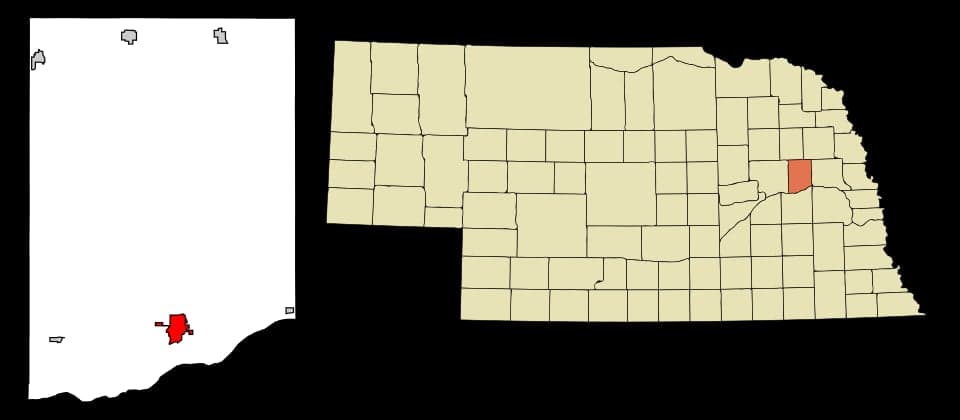
Strategic Assessment of Schuyler, NE
Strong survivability profile. Good buffer from population centers, with manageable environmental and tactical risks.
What does the Strategic Assessment tell us?
Our Strategic Assessment grades tactical survivability of an area. Major population centers, military targets, fallout zones, natural disasters, and border exposure all drive risk — lower exposure means a more defensible position in a crisis.
This is heavily inspired by Joel Skousen's Strategic Relocation book. Highly recommended you checkout the book ($)What does this tell us?
Our Strategic Assessment grades tactical survivability of an area. Major population centers, military targets, fallout zones, natural disasters, and border exposure all drive risk — lower exposure means a more defensible position in a crisis.
This is heavily inspired by Joel Skousen's Strategic Relocation book. Highly recommended you checkout the book ($)Strategic Pillars

Key Distances
Regional Safe Places
Below is our recommended "safe zones" in Nebraska and the surrounding area based on our strategic heuristics. For most people, it's unrealistic to live in a “safe zone” full-time due to work, family or other personal reasons. They tend to be more rural. However, many of these areas are perfect for second homes and retreat properties that double as a vacation home or even a short-term rental.
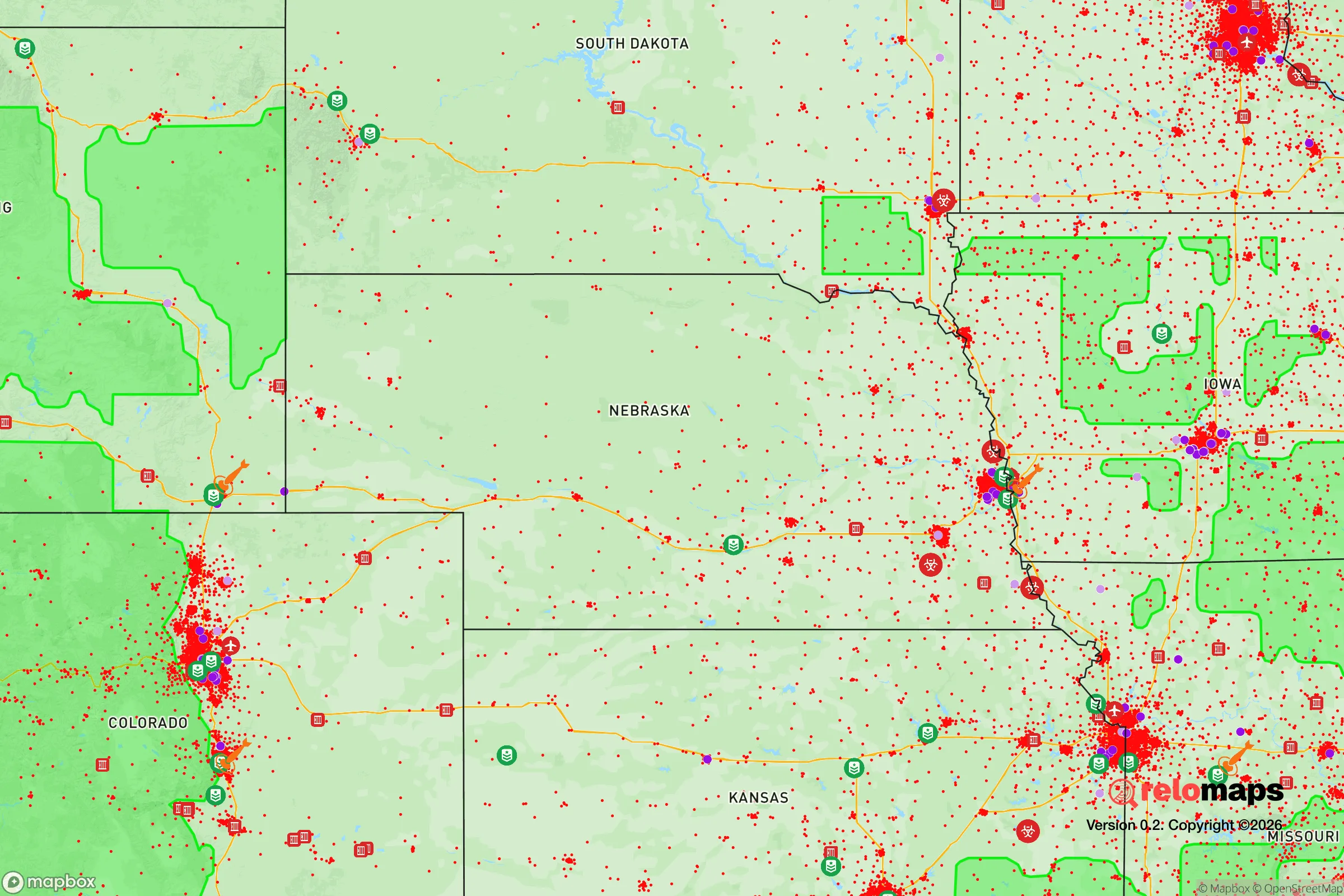
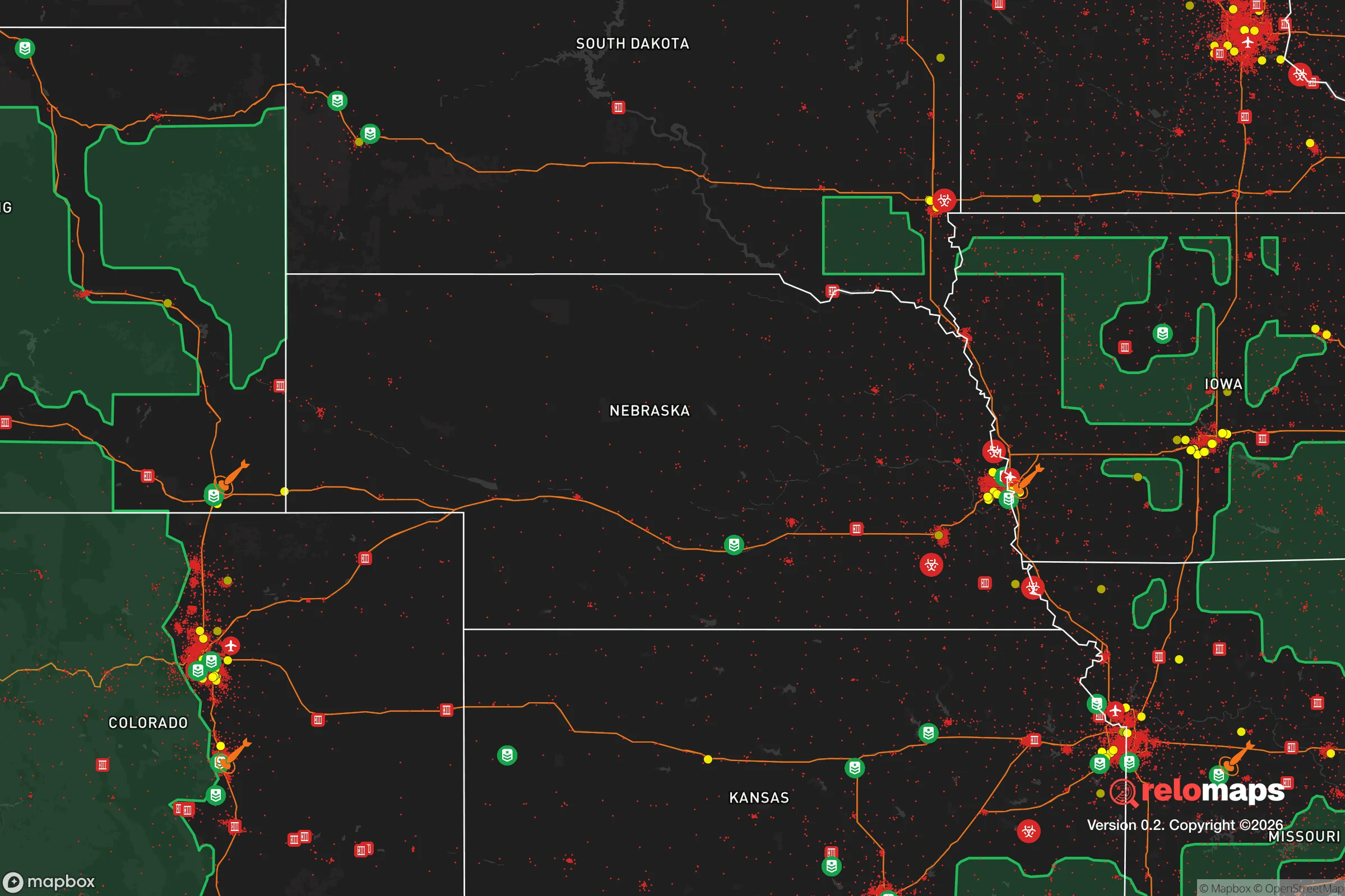
Important Note: For informational purposes only. This does not mean nothing bad ever happens in the green zones. Please use common sense. This is based on public data and modeled with AI. We tried to take a conservative approach but mistakes happen. We update this regularly as new information becomes available.
Solar Generator Recommendations
Backup power matters more here than in safer locations. We've picked three solar generators across budgets and capacity tiers — start with the budget unit if you only need a few essentials, or step up if you want to run a fridge and HVAC for days at a time.

Jackery Portable Power Station Explorer 300
Budget OptionPower on the Go: Weighing only 11 lbs, it's convenient to set up and store with book-sized foldable solar panels

BLUETTI Portable Power Station AC180
Designed for both indoor and outdoor scenarios, AC180 is highly capable as it has a robost capacity and continuous output power.

EF ECOFLOW DELTA Pro Ultra Power Station
Upgraded PickEcoFlow DELTA Pro Ultra is a whole-home energy system designed to grow with your family. Integrated with the Smart Home Panel 2, it scales to meet your evolving energy needs — keeping your home powered, intelligent, and secure through every stage of life.
We earn a commission, at no additional cost to you.
Strategic Assessment Analysis
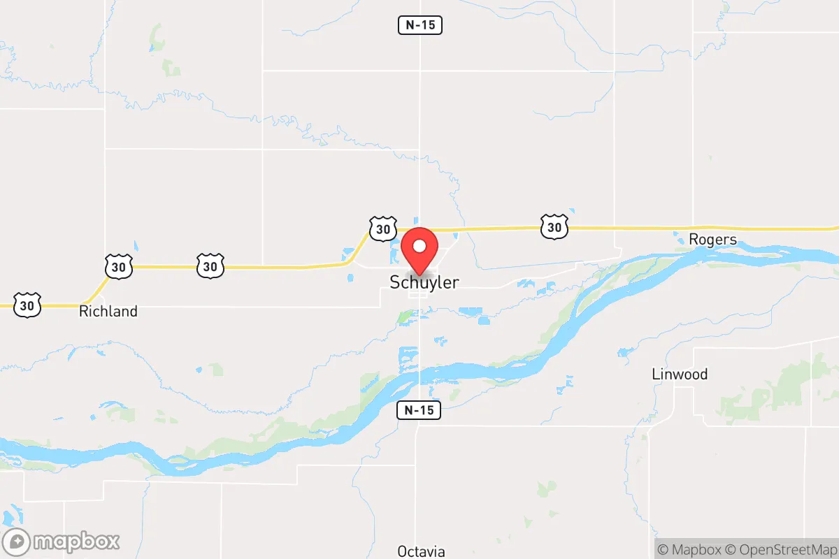
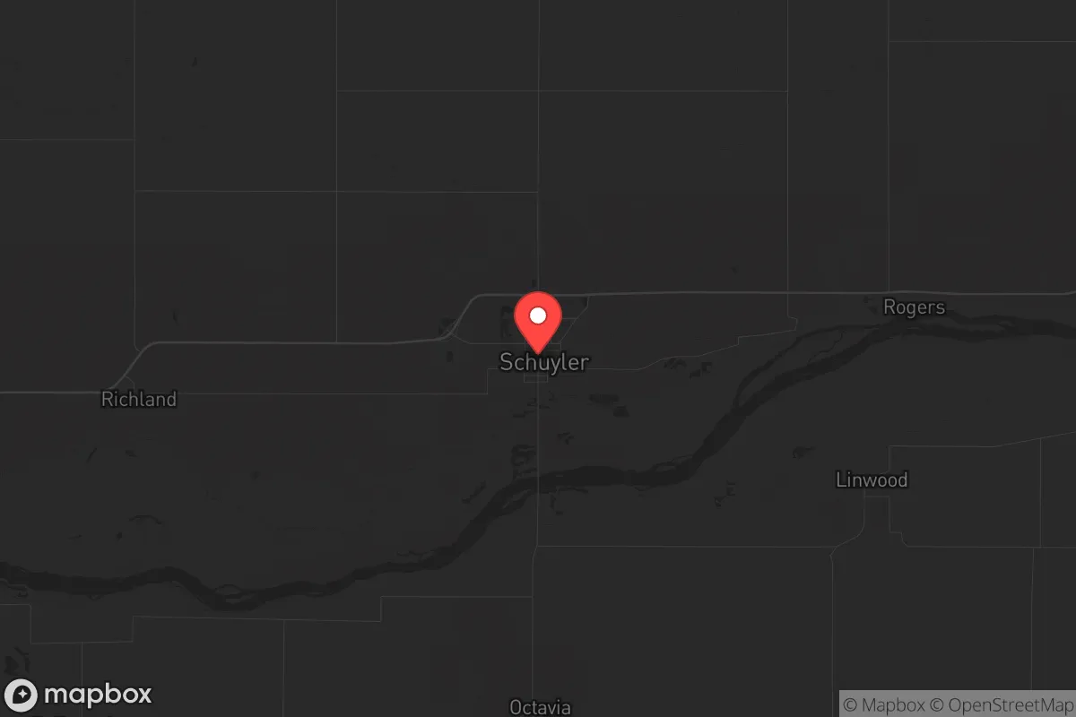
Schuyler, Nebraska, offers a compelling strategic profile for those prioritizing resilience and self-sufficiency in an uncertain future. Its position as a small industrial town on the Platte River, roughly 80 miles northwest of Omaha and 90 miles west of Lincoln, places it far enough from major urban centers to avoid the immediate chaos of a collapse event, yet close enough to access critical supply chains if they remain functional. The town’s population of around 6,200 provides a tight-knit community fabric without the anonymity of a big city, and its agricultural and manufacturing base—anchored by a major Cargill beef processing plant—means local food production is not just a hobby but a core economic driver. For a relocator assessing long-term viability, Schuyler’s combination of water access, industrial capacity, and relative isolation from primary fallout zones makes it a serious contender in a prepper’s calculus.
Geographic position and natural advantages for long-term survival
Schuyler sits in the Platte River Valley, a flat, fertile corridor that has historically been a transportation and agricultural artery. The Platte River itself is a shallow, braided river that provides a reliable surface water source, though it requires filtration and treatment for potable use. The surrounding terrain is open farmland—corn, soybeans, and alfalfa—which means a relocator with land access can achieve significant food sovereignty. The area’s aquifer is robust, and many rural properties have private wells, reducing dependence on municipal systems that could fail during grid-down scenarios. The climate is continental, with hot summers and cold winters, but the growing season (roughly 150 days) is sufficient for staple crops. Natural defensibility is moderate: the flat landscape offers long sightlines but limited cover, meaning a prepared homestead with perimeter awareness can monitor approaches effectively. The lack of dense forest or mountainous terrain reduces wildfire risk but also means less natural concealment—trade-offs that favor a low-profile, community-based security model over a lone-wolf bunker approach.
Risks, exposures, and proximity to fallout-relevant landmarks
Schuyler’s primary risk profile is tied to its industrial and transportation infrastructure, not to direct military or nuclear targets. The Cargill plant is a major employer and a potential target for civil unrest or supply-chain disruption, but it is not a high-value strategic military asset. The town lies roughly 50 miles from the Platte River’s confluence with the Missouri River near Omaha, which is a more likely target for a major disruption scenario. Omaha hosts Offutt Air Force Base (headquarters of U.S. Strategic Command), a primary nuclear command-and-control facility. In a full-scale conflict, Offutt would be a high-priority target, and Schuyler’s 80-mile distance places it outside the immediate blast and thermal zones of a ground burst (which typically extend 5-10 miles for a large warhead) but within the fallout plume corridor if winds blow from the southeast. Prevailing winds in Nebraska are from the northwest, which mitigates this risk somewhat, but a relocator should have a fallout shelter plan and potassium iodide supplies. Other nearby risks include the Union Pacific rail line running through town, which could become a chokepoint or target for sabotage, and the ethanol plants in Columbus (15 miles west) and Fremont (30 miles east), which are industrial targets for economic disruption. Tornadoes are a seasonal hazard—Colfax County averages 2-3 tornadoes per decade—so a reinforced safe room is a non-negotiable investment.
Practical resilience for a relocator: food, water, energy, and defensibility
For a relocator focused on practical self-sufficiency, Schuyler offers several structural advantages. Food security is excellent: the Cargill plant processes thousands of head of cattle daily, and local farmers sell direct to consumers through co-ops and farmers’ markets. A relocator with freezer capacity and a backup generator can stockpile protein for months. The surrounding farmland also supports small-scale grain and vegetable production, and the Platte River provides fishing (catfish, carp, walleye) as a supplemental protein source. Water access is above average: the Platte River is perennial, and the Ogallala Aquifer underlies the region, meaning private wells are viable. Municipal water comes from groundwater wells, but a relocator should install a hand pump or solar-powered well pump for grid-down scenarios. Energy resilience is moderate: Nebraska’s grid is primarily coal and nuclear (Fort Calhoun and Cooper stations are within 60 miles), but both are aging and vulnerable to disruption. Solar is viable—the area gets about 220 sunny days per year—and wind is consistent, making small-scale wind turbines a practical supplement. Natural gas is available in town but not in rural areas; propane tanks are common. Defensibility is community-dependent: Schuyler’s small size means neighbors know each other, and a prepper who integrates into the local church or volunteer fire department will have a social safety net that a lone homesteader lacks. The town has a police department and Colfax County Sheriff’s office, but response times in rural areas can exceed 20 minutes. A relocator should plan for self-defense and community mutual aid rather than relying on law enforcement in a crisis. The nearest hospital is in Columbus (15 miles), which is adequate for routine care but not for major trauma—a medical kit and training are essential.
The overall strategic picture for Schuyler is one of calculated trade-offs. It is not a remote mountain redoubt—it is a working-class agricultural town with industrial ties that could become liabilities in a prolonged collapse. But for a relocator who values community, water access, and food production over absolute isolation, it offers a realistic foundation. The proximity to Omaha and Offutt is a real but manageable risk, mitigated by prevailing winds and distance. The town’s demographic stability (predominantly Hispanic and white, with a strong Catholic and Evangelical presence) suggests a conservative social fabric that aligns with self-reliance and mutual aid. The biggest vulnerability is the lack of natural barriers—flat terrain means a determined group could approach from any direction—but that same openness makes Schuyler less attractive to looters who target denser, more lootable suburbs. For a single individual or family willing to invest in a well, solar panels, a root cellar, and community relationships, Schuyler represents a solid B+ option in a national resilience ranking—not a fantasy, but a workable plan.
* Values derived from national, state, county, city and local statistics and may differ in a specific area. Last updated: 2026-05-03T20:32:08.000Z
Narrative content on this page is AI-generated and may contain mistakes. Verify any details that matter before acting on them.
ReloMaps may earn a commission from affiliate links at no extra cost to you.