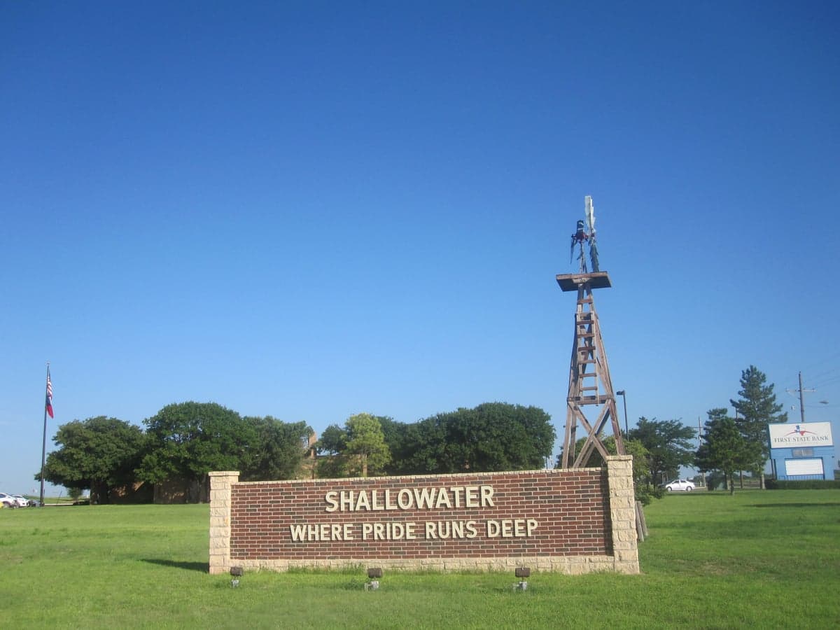
Photo: Wikipedia
Strategic Assessment of Shallowater, TX
Meaningful friction. Expect exposure to either population pressure, blast zones, or natural disaster risk. Consider buying a retreat property.
What does the Strategic Assessment tell us?
Our Strategic Assessment grades tactical survivability of an area. Major population centers, military targets, fallout zones, natural disasters, and border exposure all drive risk — lower exposure means a more defensible position in a crisis.
This is heavily inspired by Joel Skousen's Strategic Relocation book. Highly recommended you checkout the book ($)What does this tell us?
Our Strategic Assessment grades tactical survivability of an area. Major population centers, military targets, fallout zones, natural disasters, and border exposure all drive risk — lower exposure means a more defensible position in a crisis.
This is heavily inspired by Joel Skousen's Strategic Relocation book. Highly recommended you checkout the book ($)Strategic Pillars

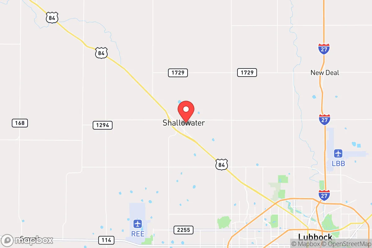
Key Distances
Regional Safe Places
Below is our recommended "safe zones" in Texas and the surrounding area based on our strategic heuristics. For most people, it's unrealistic to live in a “safe zone” full-time due to work, family or other personal reasons. They tend to be more rural. However, many of these areas are perfect for second homes and retreat properties that double as a vacation home or even a short-term rental.

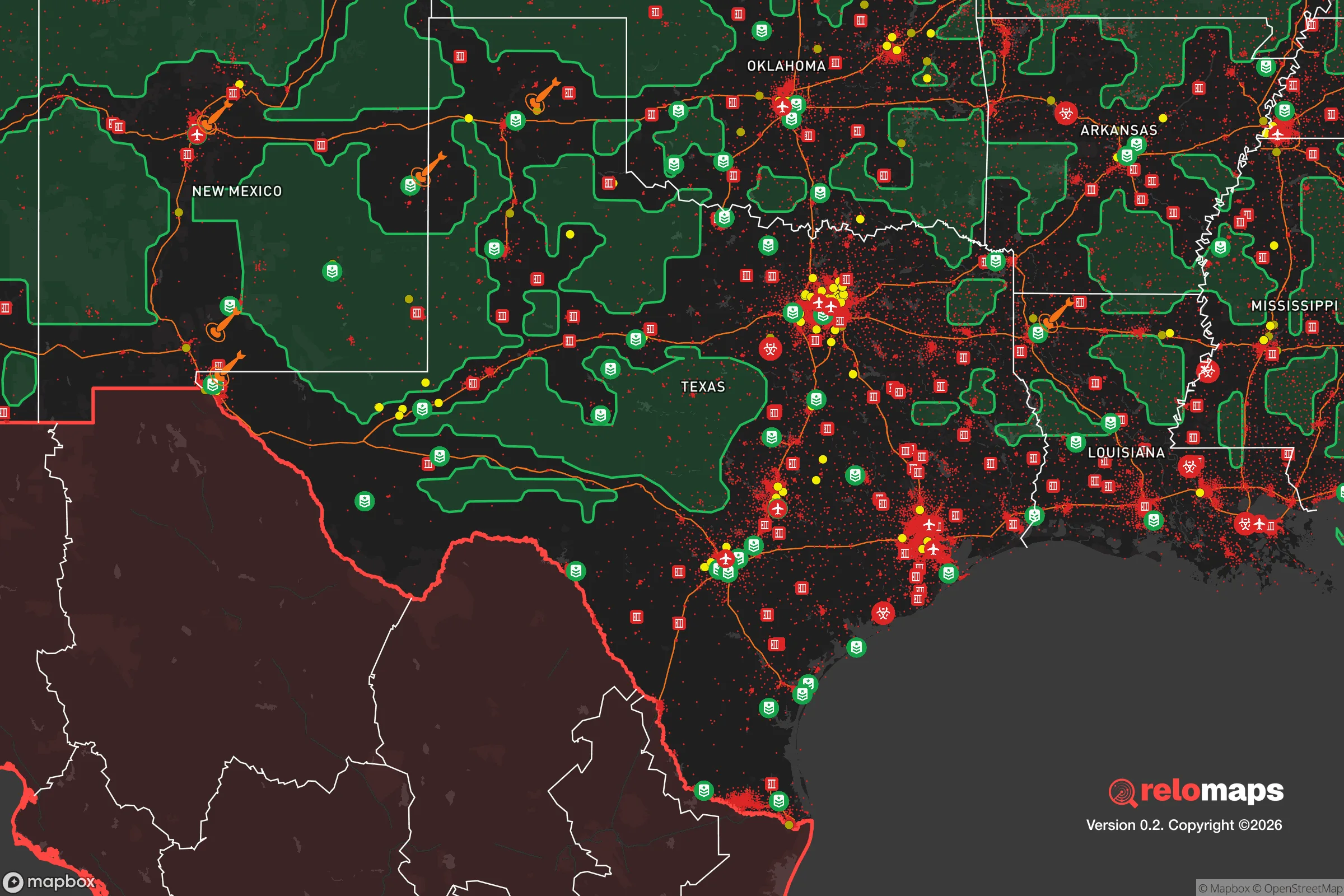


Important Note: For informational purposes only. This does not mean nothing bad ever happens in the green zones. Please use common sense. This is based on public data and modeled with AI. We tried to take a conservative approach but mistakes happen. We update this regularly as new information becomes available.
Solar Generator Recommendations
Backup power matters more here than in safer locations. We've picked three solar generators across budgets and capacity tiers — start with the budget unit if you only need a few essentials, or step up if you want to run a fridge and HVAC for days at a time.

Jackery Portable Power Station Explorer 300
Budget OptionPower on the Go: Weighing only 11 lbs, it's convenient to set up and store with book-sized foldable solar panels

BLUETTI Portable Power Station AC180
Designed for both indoor and outdoor scenarios, AC180 is highly capable as it has a robost capacity and continuous output power.

EF ECOFLOW DELTA Pro Ultra Power Station
Upgraded PickEcoFlow DELTA Pro Ultra is a whole-home energy system designed to grow with your family. Integrated with the Smart Home Panel 2, it scales to meet your evolving energy needs — keeping your home powered, intelligent, and secure through every stage of life.
We earn a commission, at no additional cost to you.
Strategic Assessment Analysis
Shallowater, Texas, offers a compelling strategic position for those prioritizing resilience and self-sufficiency, combining the practical advantages of a small, tight-knit community with the logistical benefits of proximity to Lubbock’s infrastructure. Located roughly 10 miles northwest of Lubbock in western Texas, this town of about 2,500 residents sits on the high, flat plains of the Llano Estacado, an area known for its agricultural productivity and relative isolation from major coastal threats. For a relocator thinking seriously about disaster readiness, Shallowater’s key strength is its location: far enough from major metropolitan centers to avoid the worst of urban collapse scenarios, yet close enough to access critical resources when needed. The town’s agricultural base, low population density, and straightforward access to water and energy make it a practical choice for families and individuals who want a buffer zone without complete isolation.
Geographic position and natural advantages for self-sufficiency
Shallowater’s geography is defined by the Llano Estacado, a vast, flat plateau that provides several natural advantages. The area’s elevation—around 3,200 feet—keeps it above the flood-prone lowlands of the Texas Gulf Coast and the tornado alley hotspots further east, though it is not immune to severe weather. The region’s semi-arid climate means fewer humidity-related issues, less mold, and a lower risk of hurricane damage, which is a significant plus for long-term property durability. The flat terrain also simplifies construction, road maintenance, and the installation of solar panels or wind turbines, both of which are viable energy sources here. The Ogallala Aquifer lies beneath the area, providing a reliable groundwater source for agriculture and residential wells, a critical factor for self-sufficiency. Additionally, the town’s position on the Caprock Escarpment’s western edge offers a natural defensive buffer: the escarpment itself creates a physical barrier to the east, while the open plains to the west and north provide clear lines of sight and limited cover for any potential threats. For a relocator, this means a landscape that is both manageable and defensible, with ample space for gardening, livestock, and rainwater catchment.
Risks, exposures, and proximity to fallout-relevant landmarks
While Shallowater’s isolation is a strength, it is not without risks. The primary natural hazard is severe weather, particularly thunderstorms that can produce large hail, damaging straight-line winds, and occasional tornadoes. The area sits in the southern part of Tornado Alley, and while the frequency is lower than in Oklahoma or Kansas, residents should plan for a storm shelter or reinforced safe room. Wildfire risk is moderate, especially during dry, windy periods, but the flat, agricultural landscape limits fuel loads compared to forested regions. The more significant concern for a resilience-minded relocator is man-made risk. Shallowater is roughly 10 miles from Lubbock, which is home to Reese Technology Center (a former Air Force base) and Lubbock Preston Smith International Airport, both of which could be secondary targets in a major conflict. However, the town itself is not near any high-value military installations, nuclear power plants, or major chemical facilities. The nearest significant fallout-relevant landmark is the Pantex Plant near Amarillo, about 110 miles north, which assembles and disassembles nuclear weapons. While this distance provides a substantial buffer, prevailing winds from the south and west mean that a worst-case incident at Pantex would likely push fallout away from Shallowater. The town’s low population density and lack of critical infrastructure make it a low-priority target, which is a net positive for those seeking to avoid the chaos of urban centers during a crisis.
Practical resilience for a relocator: food, water, energy, and defensibility
Shallowater’s practical resilience is anchored in its agricultural economy and community infrastructure. The town is surrounded by cotton, corn, and sorghum fields, as well as cattle operations, meaning local food production is a reality, not just a theoretical option. The presence of the Ogallala Aquifer ensures that groundwater is accessible for wells, though relocators should budget for a deep well (typically 200–400 feet) and a pump system. Rainwater harvesting is also viable, with the area averaging about 18 inches of annual precipitation, enough to supplement household use with proper storage. Energy resilience is straightforward: the region averages over 260 sunny days per year, making solar power highly effective, and wind speeds are consistently strong enough for small-scale turbines. The local power grid is managed by South Plains Electric Cooperative, a member-owned utility that is generally reliable but can be vulnerable to ice storms in winter. A backup generator or battery system is a wise investment. Defensibility is a mixed picture. The flat, open terrain offers excellent visibility but limited natural cover, meaning a property with a perimeter fence, good lighting, and a clear line of sight to approaching roads is ideal. The town’s small size and tight-knit community mean that neighbors are likely to know each other and look out for one another, a social resilience factor that cannot be overstated. For a family, the local school system (Shallowater ISD) is well-regarded, and the town’s low crime rate—well below national averages—adds to the sense of security. However, relocators should note that the nearest hospital is in Lubbock, a 15-minute drive, which is a consideration for medical emergencies.
Overall, Shallowater presents a balanced strategic picture for the resilience-minded relocator. It is not a bug-out location in the wilderness, but a functioning, self-sufficient community with access to modern amenities and a strong agricultural base. The trade-offs are clear: you gain safety from coastal storms, urban unrest, and high-value target risks, but you must prepare for severe plains weather and the logistical realities of rural living—namely, driving for most services and investing in your own water and energy systems. For a family or individual who wants to be part of a community that already thinks in terms of self-reliance, Shallowater offers a solid foundation. The key is to treat it as a base for building resilience, not a pre-built fortress. With the right preparations—a well, solar panels, a storm shelter, and good relationships with neighbors—this small town on the Llano Estacado can be a genuinely strategic choice for the long haul.

* Values derived from national, state, county, city and local statistics and may differ in a specific area. Last updated: 2026-08-25T23:35:17.000Z
Narrative content on this page is AI-generated and may contain mistakes. Verify any details that matter before acting on them.
ReloMaps may earn a commission from affiliate links at no extra cost to you.

