
Photo: Wikipedia
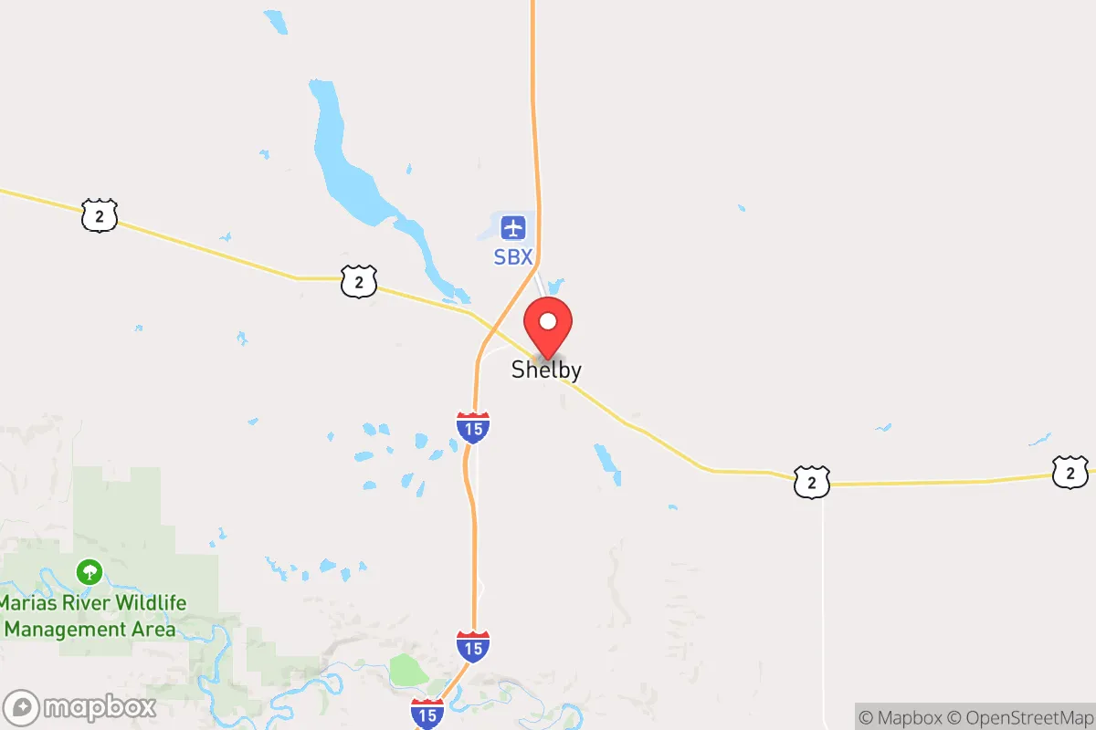
Strategic Assessment of Shelby, MT
Strong survivability profile. Good buffer from population centers, with manageable environmental and tactical risks.
What does the Strategic Assessment tell us?
Our Strategic Assessment grades tactical survivability of an area. Major population centers, military targets, fallout zones, natural disasters, and border exposure all drive risk — lower exposure means a more defensible position in a crisis.
This is heavily inspired by Joel Skousen's Strategic Relocation book. Highly recommended you checkout the book ($)What does this tell us?
Our Strategic Assessment grades tactical survivability of an area. Major population centers, military targets, fallout zones, natural disasters, and border exposure all drive risk — lower exposure means a more defensible position in a crisis.
This is heavily inspired by Joel Skousen's Strategic Relocation book. Highly recommended you checkout the book ($)Strategic Pillars

Key Distances
Regional Safe Places
Below is our recommended "safe zones" in Montana and the surrounding area based on our strategic heuristics. For most people, it's unrealistic to live in a “safe zone” full-time due to work, family or other personal reasons. They tend to be more rural. However, many of these areas are perfect for second homes and retreat properties that double as a vacation home or even a short-term rental.
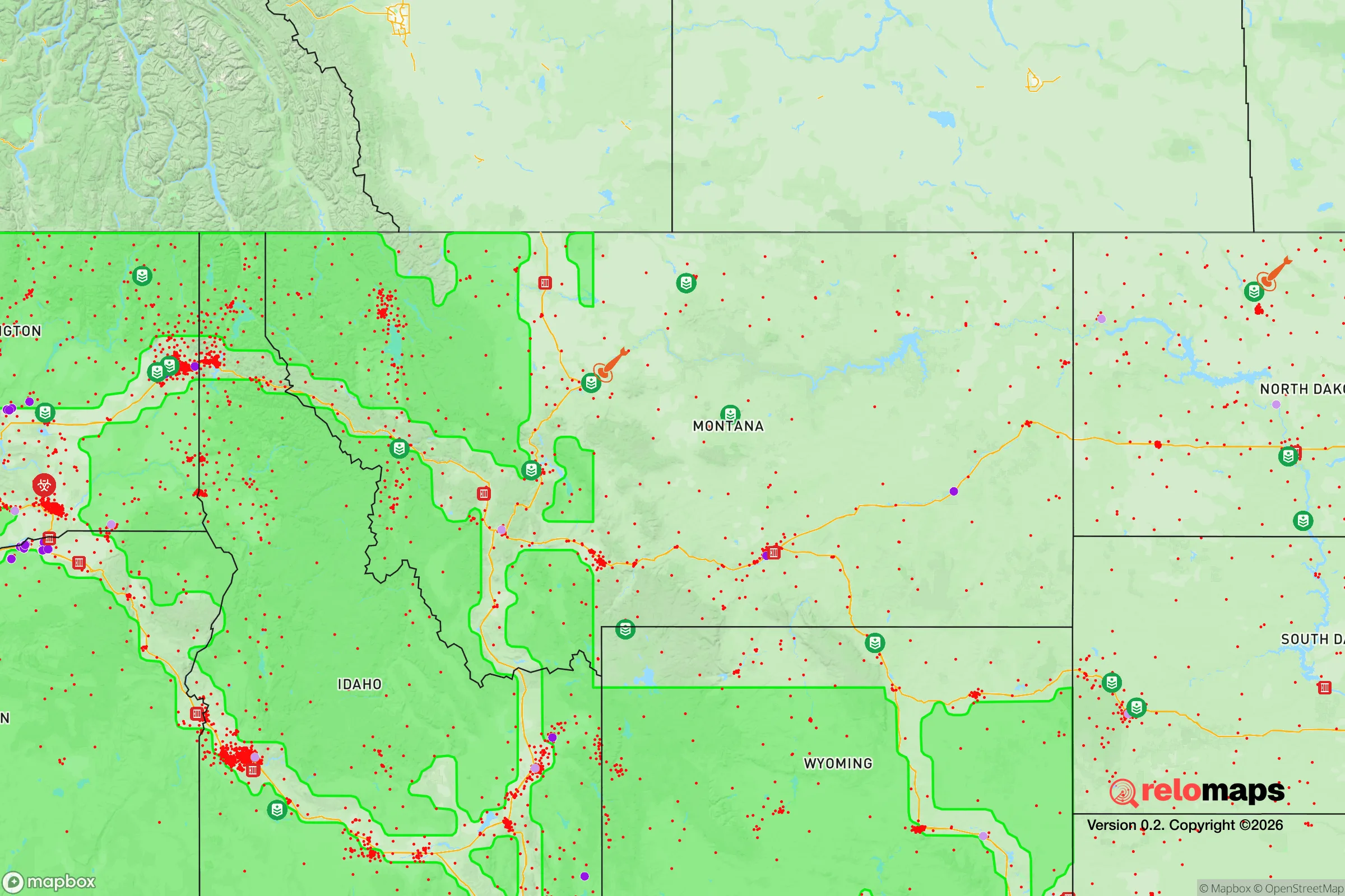

Important Note: For informational purposes only. This does not mean nothing bad ever happens in the green zones. Please use common sense. This is based on public data and modeled with AI. We tried to take a conservative approach but mistakes happen. We update this regularly as new information becomes available.
Solar Generator Recommendations
Backup power matters more here than in safer locations. We've picked three solar generators across budgets and capacity tiers — start with the budget unit if you only need a few essentials, or step up if you want to run a fridge and HVAC for days at a time.

Jackery Portable Power Station Explorer 300
Budget OptionPower on the Go: Weighing only 11 lbs, it's convenient to set up and store with book-sized foldable solar panels

BLUETTI Portable Power Station AC180
Designed for both indoor and outdoor scenarios, AC180 is highly capable as it has a robost capacity and continuous output power.

EF ECOFLOW DELTA Pro Ultra Power Station
Upgraded PickEcoFlow DELTA Pro Ultra is a whole-home energy system designed to grow with your family. Integrated with the Smart Home Panel 2, it scales to meet your evolving energy needs — keeping your home powered, intelligent, and secure through every stage of life.
We earn a commission, at no additional cost to you.
Strategic Assessment Analysis
Shelby, Montana, offers a compelling strategic position for those prioritizing resilience and distance from major population centers, sitting roughly 90 miles from the Canadian border and 120 miles from Great Falls. Its location along the Hi-Line corridor provides a natural buffer from coastal and urban instability, while the surrounding agricultural and energy infrastructure supports a degree of self-sufficiency rare in more developed regions. For a relocator with a prepper or survivalist mindset, Shelby’s low population density—around 3,000 residents—and its access to the Marias River and the Rocky Mountain Front make it a viable base for long-term preparedness, though its isolation also presents logistical challenges that require careful planning.
Geographic position and natural advantages for long-term security
Shelby’s geography is its primary strategic asset. The town sits on the eastern edge of the Rocky Mountain Front, where the plains meet the foothills, offering a mix of open grazing land, river valleys, and forested terrain. This position provides natural defensibility—the area is not a natural chokepoint for mass migration, and the surrounding Toole County has a population density of roughly 2 people per square mile. The Marias River, which flows just south of town, offers a reliable freshwater source, and the region’s high water table supports well drilling for those who secure property outside city limits. The climate is semi-arid, with cold winters and moderate precipitation, which reduces the risk of flooding or wildfire compared to more forested parts of Montana. For a relocator, the key advantage is the ability to establish a homestead with limited exposure to external threats—no major interstate highways run through Shelby, and the nearest city of significant size (Great Falls) is over an hour away, meaning any civil unrest or supply chain disruptions would take time to reach this area.
Risks, exposures, and proximity to fallout-relevant landmarks
While Shelby’s isolation is a strength, it is not immune to risks. The town is located roughly 50 miles from the Malmstrom Air Force Base missile fields, which house Minuteman III intercontinental ballistic missiles. This proximity is a double-edged sword: in a full-scale nuclear exchange, the missile silos are primary targets, but the actual fallout risk depends on wind patterns and yield. The prevailing winds in this region blow from the west, meaning fallout from a strike on the missile fields east of Shelby could drift toward the town, though the distance provides some buffer. More immediate concerns for a prepper include extreme winter weather—temperatures can drop to -40°F with wind chill, and blizzards can cut off roads for days. The town’s reliance on a single rail line (BNSF) and U.S. Highway 2 for resupply means that a major disruption—whether from a derailment, a cyberattack on the rail network, or a coordinated event—could isolate Shelby for extended periods. Additionally, the Marias River is susceptible to drought in dry years, and the region’s agricultural economy is tied to global commodity prices, which could be volatile during economic collapse. For a relocator, the risk profile is moderate: the area is far from coastal targets and major urban centers, but its dependence on external infrastructure and its proximity to strategic military assets require contingency planning.
Practical resilience for a relocator: food, water, energy, and defensibility
Shelby’s practical resilience hinges on its agricultural and energy base. The surrounding Toole County is prime wheat and cattle country, with local farms and ranches producing grain, hay, and livestock. For a relocator, this means access to local food sources—farmers’ markets, direct purchases from ranchers, and the ability to barter for staples. The town has a grain elevator and a co-op that could serve as a community food hub in a crisis, though personal stockpiling is still essential. Water is accessible via wells, but well drilling costs can run $10,000–$20,000 depending on depth, and the water quality varies—some areas have high mineral content requiring filtration. Energy is a mixed picture: Shelby is near the Kevin-Sunburst oil field, which provides local fuel sources, and the town has natural gas lines, but the electrical grid is vulnerable to winter storms and cyberattacks. Solar panels are viable given the region’s 200+ sunny days per year, but battery storage is necessary for winter months. Defensibility is strong for a small group: the open terrain makes it hard for large groups to approach unnoticed, and the local sheriff’s office and a small police force provide basic law enforcement, though response times in rural areas can be 30 minutes or more. For a single individual or family, the key is to secure a property with a well, a backup heat source (wood or propane), and a defensible perimeter—ideally on the outskirts of town, where you can monitor access points. The Shelby airport (a general aviation field) offers a potential evacuation route by air, but it’s not a major facility.
Overall, Shelby represents a moderate-to-high strategic value for a relocator with a survivalist mindset. Its strengths—isolation, local food and water, low population density, and energy resources—outweigh its risks, provided you plan for winter extremes and the potential for supply chain disruptions. The proximity to missile fields is a genuine concern, but it’s a risk shared by much of the northern plains, and the distance from major cities (over 300 miles from Seattle, 400 miles from Denver) means you’re unlikely to face the mass migration or civil unrest that would hit urban corridors. For a conservative-leaning individual or family looking to weather societal instability, Shelby offers a realistic, if austere, option—it’s not a prepper paradise, but it’s a place where you can build a resilient life with careful preparation. The key is to treat it as a base, not a fortress: build community ties with local ranchers and farmers, invest in off-grid energy and water systems, and maintain a vehicle capable of navigating snow and rough roads. If you can handle the isolation and the cold, Shelby is a solid bet for long-term security.
* Values derived from national, state, county, city and local statistics and may differ in a specific area. Last updated: 2026-04-20T08:57:05.000Z
Narrative content on this page is AI-generated and may contain mistakes. Verify any details that matter before acting on them.
ReloMaps may earn a commission from affiliate links at no extra cost to you.