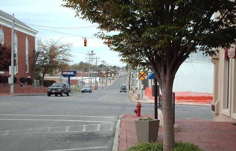
Photo: Wikipedia
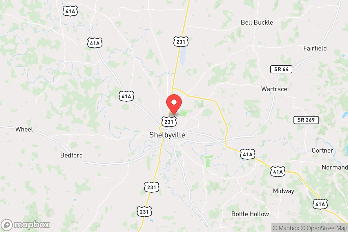
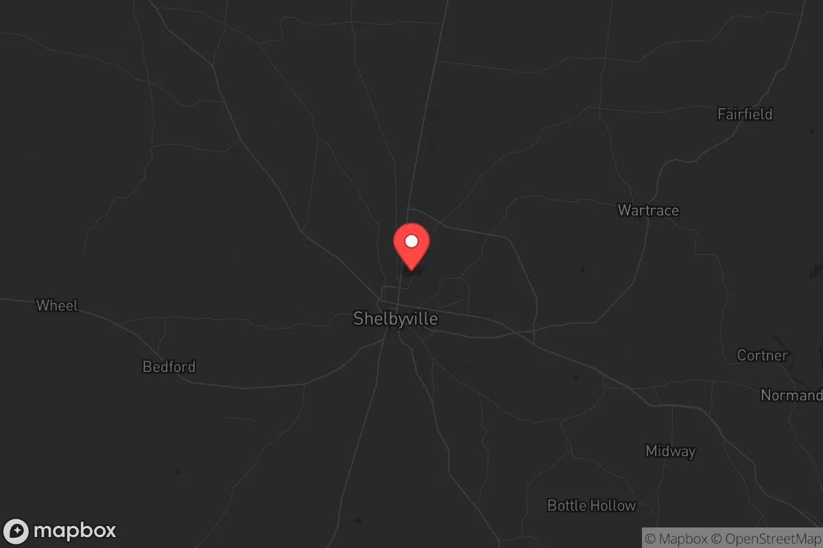
Strategic Assessment of Shelbyville, TN
Meaningful friction. Expect exposure to either population pressure, blast zones, or natural disaster risk. Consider buying a retreat property.
What does the Strategic Assessment tell us?
Our Strategic Assessment grades tactical survivability of an area. Major population centers, military targets, fallout zones, natural disasters, and border exposure all drive risk — lower exposure means a more defensible position in a crisis.
This is heavily inspired by Joel Skousen's Strategic Relocation book. Highly recommended you checkout the book ($)What does this tell us?
Our Strategic Assessment grades tactical survivability of an area. Major population centers, military targets, fallout zones, natural disasters, and border exposure all drive risk — lower exposure means a more defensible position in a crisis.
This is heavily inspired by Joel Skousen's Strategic Relocation book. Highly recommended you checkout the book ($)Strategic Pillars

Key Distances
Regional Safe Places
Below is our recommended "safe zones" in Tennessee and the surrounding area based on our strategic heuristics. For most people, it's unrealistic to live in a “safe zone” full-time due to work, family or other personal reasons. They tend to be more rural. However, many of these areas are perfect for second homes and retreat properties that double as a vacation home or even a short-term rental.
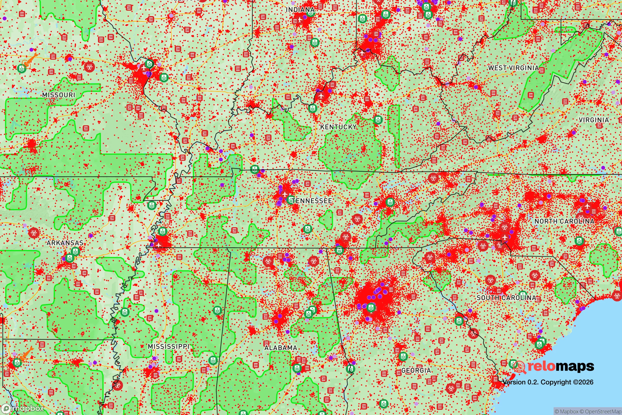
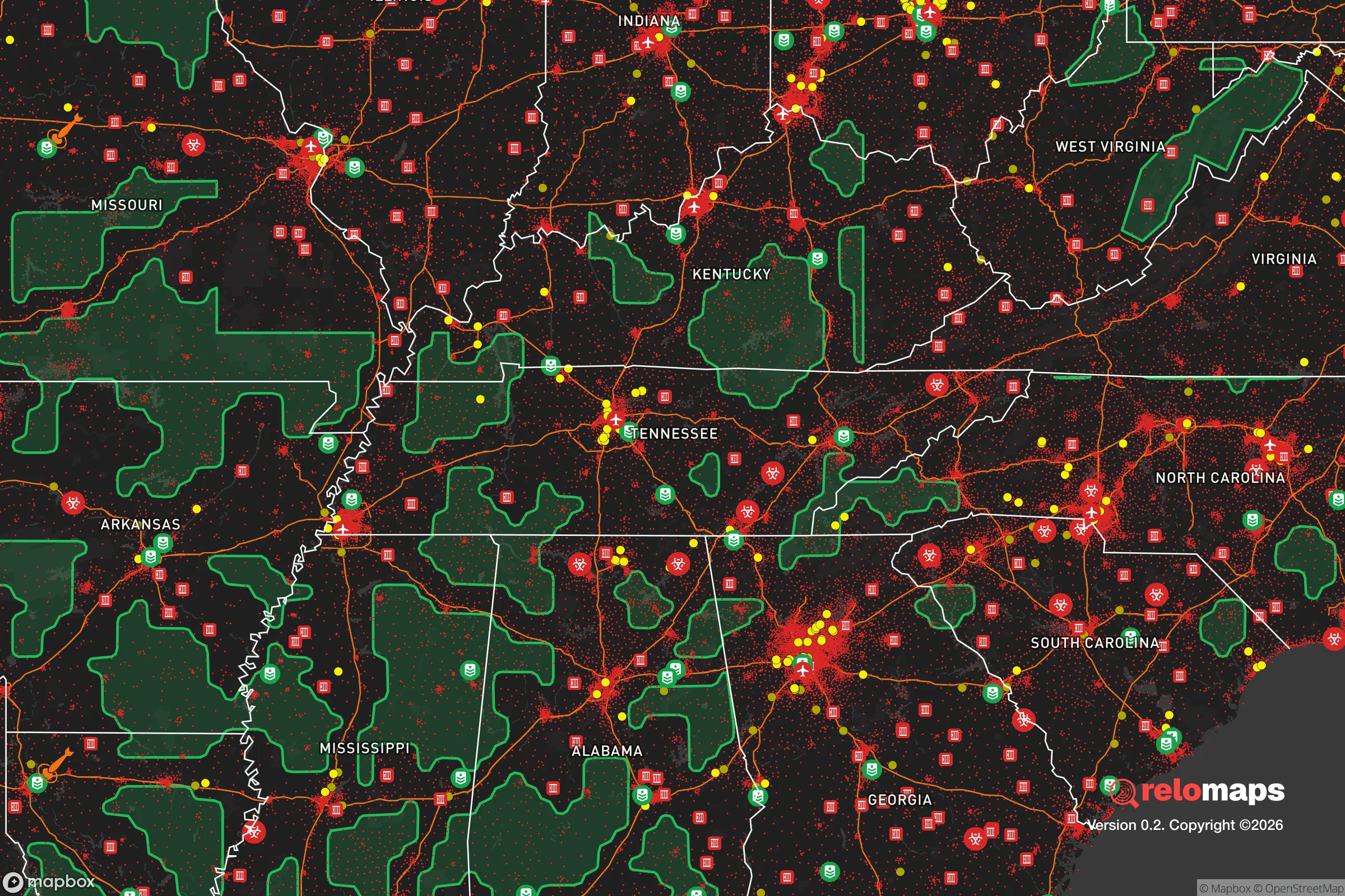
Important Note: For informational purposes only. This does not mean nothing bad ever happens in the green zones. Please use common sense. This is based on public data and modeled with AI. We tried to take a conservative approach but mistakes happen. We update this regularly as new information becomes available.
Solar Generator Recommendations
Backup power matters more here than in safer locations. We've picked three solar generators across budgets and capacity tiers — start with the budget unit if you only need a few essentials, or step up if you want to run a fridge and HVAC for days at a time.

Jackery Portable Power Station Explorer 300
Budget OptionPower on the Go: Weighing only 11 lbs, it's convenient to set up and store with book-sized foldable solar panels

BLUETTI Portable Power Station AC180
Designed for both indoor and outdoor scenarios, AC180 is highly capable as it has a robost capacity and continuous output power.

EF ECOFLOW DELTA Pro Ultra Power Station
Upgraded PickEcoFlow DELTA Pro Ultra is a whole-home energy system designed to grow with your family. Integrated with the Smart Home Panel 2, it scales to meet your evolving energy needs — keeping your home powered, intelligent, and secure through every stage of life.
We earn a commission, at no additional cost to you.
Strategic Assessment Analysis
Shelbyville, Tennessee, sits in a sweet spot for those serious about resilience: far enough from major metro chaos to breathe, but close enough to supply chains and medical access to matter. This Bedford County seat, with a population hovering around 23,000, offers a strategic blend of agricultural self-sufficiency, manufacturing employment, and a geographic position that puts it outside the immediate blast zones of Nashville (about 50 miles northwest) or Huntsville, Alabama (about 60 miles south). For a relocator weighing civic unrest, grid-down scenarios, or mass casualty events, Shelbyville’s real advantage is its position as a secondary hub—not a target, but not a dead-end either.
Geographic position and natural advantages for long-term survival
Shelbyville’s location in the Duck River Valley gives it a critical natural asset: the Duck River itself, one of the most biodiverse rivers in North America and a reliable surface water source for both drinking and irrigation. The surrounding terrain is rolling hills and farmland, not mountainous, which means moderate defensibility without the isolation that makes resupply difficult. The area sits in USDA Hardiness Zone 7a, with a growing season of roughly 200 days—enough for serious food production. Soils in Bedford County are predominantly silt loam, well-suited for row crops and pasture, which is why the county remains one of Tennessee’s top producers of soybeans, corn, and hay. For a prepper, this means you’re not just betting on stored supplies; you’re in a region where local agriculture can actually sustain a population post-disruption. The nearest interstate access is I-24 about 20 miles west, giving you a route out if needed, but Shelbyville itself is off the major trucking corridors, reducing the risk of refugee flows clogging local roads during an evacuation.
Risks, exposures, and proximity to fallout-relevant landmarks
No location is immune, and Shelbyville has specific vulnerabilities that a strategic relocator must weigh. The most obvious is proximity to the Tennessee Valley Authority’s (TVA) Sequoyah Nuclear Plant, located about 70 miles east near Chattanooga. While that’s outside the typical 10-mile emergency planning zone, prevailing winds in Middle Tennessee generally blow from the west and southwest, meaning a plume from Sequoyah would likely move northeast—away from Shelbyville. Still, it’s a risk worth noting. Closer to home, Arnold Air Force Base (about 30 miles southeast in Tullahoma) is a potential target in a conflict scenario, though it’s primarily a testing and engineering center, not a strategic bomber base. The real concern for a prepper is Nashville’s status as a major transportation and logistics hub (I-24, I-40, I-65 converge there). In a mass casualty event or civil unrest, Nashville could become a source of displaced populations moving south along the I-24 corridor. Shelbyville is far enough (50 miles) that most foot traffic would filter out before reaching you, but it’s close enough that you’d see secondary effects—strained local resources, increased law enforcement presence, and potential roadblocks. Natural disaster risks are low: tornadoes are the primary threat (Bedford County averages 2-3 tornado warnings per year), but the terrain lacks the flash-flood danger of East Tennessee or the seismic risk of the New Madrid zone.
Practical resilience for a relocator: food, water, energy, and defensibility
For a relocator serious about self-sufficiency, Shelbyville offers a workable baseline. Water is the strongest card: the Duck River provides a year-round flow, and groundwater in the valley is generally accessible via shallow wells (50-150 feet depth typical). The city’s water treatment plant draws from the river, but in a grid-down scenario, a well with a hand pump or solar-powered pump gives you independent supply. Food production is viable—Bedford County has over 1,200 farms, and the local farmers’ market operates year-round. You can realistically raise poultry, goats, or a family garden on 5-10 acres without needing heavy equipment. The county’s agricultural extension office (UT Extension) offers soil testing and canning workshops, which is a low-key way to network with like-minded locals. Energy resilience is middling: the grid is served by Duck River Electric Membership Corporation, a cooperative that has historically been reliable but is not hardened against EMP or long-term outage. Solar potential is decent (about 4.5 peak sun hours per day), and the county has no zoning restrictions that would prevent off-grid solar or wind installations on rural property. Defensibility is moderate: the terrain is open enough that you can’t hide a compound in a canyon, but the rural road network (mostly two-lane county roads) creates natural chokepoints. The local sheriff’s office (Bedford County Sheriff’s Department) has about 60 sworn deputies for a county of 52,000 people—thin coverage, which means you’re largely responsible for your own security in a crisis. The gun culture is strong and legal: Tennessee is a constitutional carry state, and private sales require no background check, so building a community of armed neighbors is straightforward.
The overall strategic picture for a conservative relocator
Shelbyville’s strategic value comes down to this: it’s a secondary market with primary resources. You’re not in a bunker in the middle of nowhere, but you’re also not in a suburb that will be overrun within 48 hours of a Nashville evacuation order. The local economy is anchored by manufacturing (Nissan’s Smyrna plant is 20 miles north, and several auto parts suppliers operate in Shelbyville itself), which means there’s a working-class population that’s not going to flee at the first sign of trouble—they’ll stay and work. The political climate is reliably conservative: Bedford County voted +35 points for Trump in 2020, and the local culture is church-oriented, family-focused, and suspicious of federal overreach. For a relocator who wants to be part of a community that will organize itself rather than wait for FEMA, that matters. The downsides are real: you’re within a day’s drive of three major cities (Nashville, Huntsville, Chattanooga), and any regional disaster will ripple through. But if you’re looking for a place where you can dig a well, plant a garden, and know your neighbors will have your back when the lights go out, Shelbyville is a solid bet. It’s not a fortress—it’s a farm town with a river and a rifle, and that might be exactly what you need.
* Values derived from national, state, county, city and local statistics and may differ in a specific area. Last updated: 2026-05-01T14:40:15.000Z
Narrative content on this page is AI-generated and may contain mistakes. Verify any details that matter before acting on them.
ReloMaps may earn a commission from affiliate links at no extra cost to you.