Photo: Wikipedia
Strategic Assessment of Siloam Springs, AR
Workable tactical position. Some exposure to population density or targets, but generally defensible in a crisis.
What does the Strategic Assessment tell us?
Our Strategic Assessment grades tactical survivability of an area. Major population centers, military targets, fallout zones, natural disasters, and border exposure all drive risk — lower exposure means a more defensible position in a crisis.
This is heavily inspired by Joel Skousen's Strategic Relocation book. Highly recommended you checkout the book ($)What does this tell us?
Our Strategic Assessment grades tactical survivability of an area. Major population centers, military targets, fallout zones, natural disasters, and border exposure all drive risk — lower exposure means a more defensible position in a crisis.
This is heavily inspired by Joel Skousen's Strategic Relocation book. Highly recommended you checkout the book ($)Strategic Pillars

Key Distances
Regional Safe Places
Below is our recommended "safe zones" in Arkansas and the surrounding area based on our strategic heuristics. For most people, it's unrealistic to live in a “safe zone” full-time due to work, family or other personal reasons. They tend to be more rural. However, many of these areas are perfect for second homes and retreat properties that double as a vacation home or even a short-term rental.


Important Note: For informational purposes only. This does not mean nothing bad ever happens in the green zones. Please use common sense. This is based on public data and modeled with AI. We tried to take a conservative approach but mistakes happen. We update this regularly as new information becomes available.
Solar Generator Recommendations
Backup power matters more here than in safer locations. We've picked three solar generators across budgets and capacity tiers — start with the budget unit if you only need a few essentials, or step up if you want to run a fridge and HVAC for days at a time.

Jackery Portable Power Station Explorer 300
Budget OptionPower on the Go: Weighing only 11 lbs, it's convenient to set up and store with book-sized foldable solar panels

BLUETTI Portable Power Station AC180
Designed for both indoor and outdoor scenarios, AC180 is highly capable as it has a robost capacity and continuous output power.

EF ECOFLOW DELTA Pro Ultra Power Station
Upgraded PickEcoFlow DELTA Pro Ultra is a whole-home energy system designed to grow with your family. Integrated with the Smart Home Panel 2, it scales to meet your evolving energy needs — keeping your home powered, intelligent, and secure through every stage of life.
We earn a commission, at no additional cost to you.
Strategic Assessment Analysis
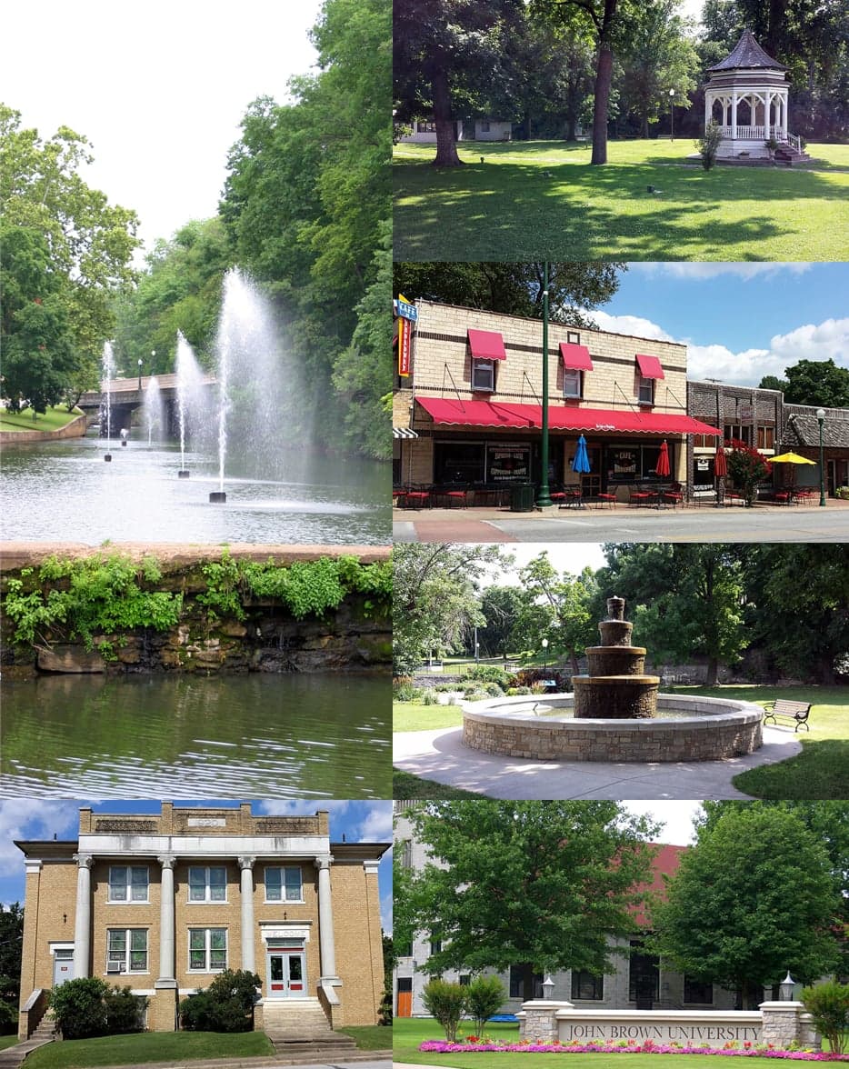
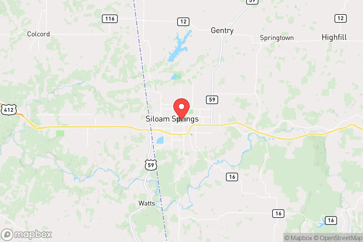
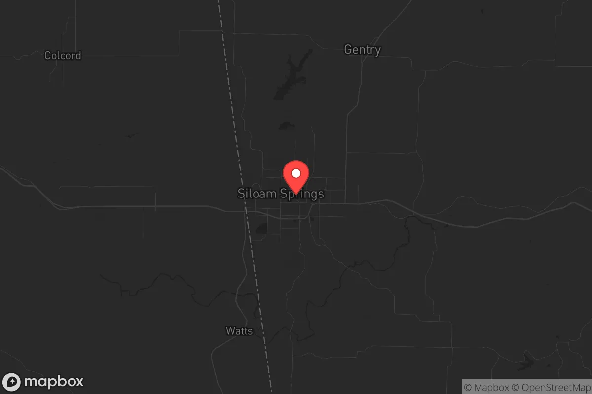
Siloam Springs, Arkansas, offers a surprisingly robust strategic position for those prioritizing resilience and preparedness, combining the economic and logistical benefits of proximity to a major metro with a physical layout that provides natural buffers against cascading urban collapse. Nestled in the far northwest corner of Arkansas, this town of roughly 18,000 sits just six miles from the Oklahoma border and roughly 30 miles northeast of the Fayetteville-Springdale-Rogers corridor—the heart of Northwest Arkansas (NWA). This placement is a double-edged sword that, when analyzed through a prepper lens, leans heavily toward advantage. The area’s location along the Illinois River and its position in the Ozark foothills provide a defensible geography, while the town’s status as a secondary economic node (home to the John Brown University campus and a growing industrial base) means it’s not a primary target for civil unrest but still has enough local infrastructure to sustain a relocated family. The key strategic insight here is that Siloam Springs sits far enough from the NWA urban core to avoid the worst of any metropolitan chaos—think supply chain disruptions, mass evacuations, or civil unrest—while being close enough to access its medical, logistical, and economic resources when things are stable. This is the kind of “gray zone” location that survival-minded relocators should prioritize: not so remote that you’re isolated from critical supplies, but not so integrated that you’re swept up in a city’s collapse.
Geographic position and natural advantages for long-term security
The physical geography around Siloam Springs is a prepper’s quiet asset. The town sits in a valley carved by the Illinois River, with the Ozark Mountains rising to the east and south. This terrain creates natural chokepoints and defensible positions—any approach from the west (Oklahoma plains) or north (Missouri flatlands) is funneled through a few key roads, primarily US-412 and AR-59. For a relocator thinking about security, that means you can monitor and control access to a property more easily than in open prairie or dense suburbia. The Ozarks themselves offer abundant hardwood forests for fuel, game for hunting (deer, turkey, small game), and hundreds of miles of hiking trails and backroads that could serve as escape routes or resupply corridors if main highways become clogged. The Illinois River and its tributaries provide a reliable freshwater source, though you’ll want to test for agricultural runoff from upstream farms. The area’s elevation—roughly 1,100 feet above sea level—puts it above most flood risks while still having enough rainfall (about 45 inches annually) to support rain catchment and gardening without the drought concerns of the western US. One often-overlooked advantage: Siloam Springs is in the heart of the Arkansas “karst” region, meaning limestone bedrock with caves and springs. While not a survival bunker, this geology means groundwater is generally accessible via wells, and the terrain offers natural concealment for off-grid setups. The town’s position also places it within a two-hour drive of the Buffalo National River and the Ozark National Forest—vast public lands that could serve as a fallback zone if things go truly sideways.
Risks, exposures, and proximity to fallout-relevant landmarks
No strategic assessment is honest without weighing the downsides, and Siloam Springs has a few that demand attention. The most immediate risk is its proximity to the NWA metroplex—a region of over 500,000 people that includes the headquarters of Walmart, Tyson Foods, and JB Hunt. In a scenario of civil unrest or mass casualty events (think food shortages, energy grid failure, or political violence), that population center could become a source of refugees, looters, or simply desperate people moving outward along US-412 and AR-59. Siloam Springs sits directly on that outflow path. The town itself has a small police force and no major military or National Guard presence, so don’t expect a rapid law enforcement response if things get bad. Another concern: the area is within 100 miles of the Arkansas Nuclear One plant near Russellville (about 90 miles southeast). While not a direct fallout zone for most scenarios, a catastrophic failure there—unlikely but not impossible—could put Siloam Springs in a downwind plume depending on weather patterns. The town is also roughly 200 miles from the New Madrid Seismic Zone, which could produce earthquakes that disrupt supply chains and infrastructure across the mid-South. On the plus side, there are no major military bases, chemical plants, or high-value government targets within 50 miles, meaning Siloam Springs is unlikely to be a primary target for any coordinated attack or strategic strike. The biggest exposure is simply being a waypoint on the escape route from a major city—something you can mitigate with good OPSEC, a well-stocked property, and a network of like-minded neighbors.
Practical resilience for a relocator: food, water, energy, and defensibility
For a single individual or family looking to set up a resilient homestead, Siloam Springs offers a mix of advantages and gaps that require deliberate planning. Food security is strong: the surrounding Benton County is one of Arkansas’s top agricultural producers, with row crops (soybeans, corn, hay) and livestock operations within a 20-minute drive. The town has a local farmers’ market (the Siloam Springs Farmers Market, May–October) and several feed stores (e.g., Tractor Supply, Orscheln Farm & Home) for seeds, tools, and animal feed. For long-term storage, the Ozarks’ moderate humidity (averaging 65–70%) means you’ll need to invest in proper canning and dehydrating equipment—mold and spoilage are real risks in this climate. Water is the area’s strongest suit: the Illinois River and its tributaries provide surface water, and most rural properties can drill a well at depths of 100–300 feet for under $5,000. The city’s municipal water comes from the Illinois River via the Siloam Springs Water Treatment Plant, but in a grid-down scenario, that plant would likely fail within days. Energy resilience is a mixed bag. The area has decent solar potential (about 4.5 peak sun hours per day), but the tree cover in the Ozarks means you’ll need to clear a south-facing slope for optimal panels. Wood heating is the default backup—firewood is cheap ($150–$200 per cord) and abundant, but you’ll need a good chainsaw and a covered storage shed. The local power grid is served by Ozarks Electric Cooperative, which has a decent reliability record but is vulnerable to ice storms and tornadoes (the area is in Tornado Alley’s southern fringe). Defensibility is where Siloam Springs shines for those who choose the right property. The hilly terrain and winding roads make it easy to find a home with a long driveway, natural sightlines, and limited access points. Rural properties in the surrounding unincorporated areas (e.g., near the Oklahoma border or along AR-59 south of town) can be had for $150,000–$300,000 for 5–20 acres, often with a well and septic already in place. The local gun culture is strong—Arkansas is a constitutional carry state, and there are several gun shops and ranges within 30 minutes (e.g., Ozark Armory in Gentry). The county sheriff’s office is generally supportive of Second Amendment rights, and property crime rates are low (roughly 60% below the national average for burglary), though you should still invest in a good security system and a few trail cameras for perimeter monitoring.
The overall strategic picture for Siloam Springs is that of a solid “B+” relocation option for the conservative prepper—not a perfect fortress, but a practical, livable base with enough natural advantages to ride out most disruptions. It avoids the extremes: not so remote that you’re cut off from medical care (the town has a 25-bed hospital, Siloam Springs Regional Hospital) or supplies (Walmart, Lowe’s, and a grocery store are all within town), but not so integrated into the urban grid that you’re dependent on fragile systems. The biggest strategic risk is the NWA metro’s proximity, but that’s a risk you can manage with good planning—stockpile six months of supplies, build a network of local contacts (the area has a strong church and community culture that’s receptive to like-minded relocators), and have a bug-out route into the Ozark National Forest if needed. For a single individual or family who wants to be prepared for civic unrest, mass casualty events, or a slow-burn societal decline, Siloam Springs offers a defensible, resource-rich, and culturally compatible foothold in a region that’s still relatively under the radar. The key is to act now—property values in NWA have been climbing steadily, and the window for affordable land in this corridor is closing. If you’re serious about resilience, this is a place worth a hard look.
* Values derived from national, state, county, city and local statistics and may differ in a specific area. Last updated: 2026-04-23T03:42:02.000Z
Narrative content on this page is AI-generated and may contain mistakes. Verify any details that matter before acting on them.
ReloMaps may earn a commission from affiliate links at no extra cost to you.