Photo: Wikipedia
Strategic Assessment of Custer County
Deep buffer from population centers and strategic targets. Low natural disaster risk and minimal exposure to border or coastal threats.
What does the Strategic Assessment tell us?
Our Strategic Assessment grades tactical survivability of an area. Major population centers, military targets, fallout zones, natural disasters, and border exposure all drive risk — lower exposure means a more defensible position in a crisis.
This is heavily inspired by Joel Skousen's Strategic Relocation book. Highly recommended you checkout the book ($)What does this tell us?
Our Strategic Assessment grades tactical survivability of an area. Major population centers, military targets, fallout zones, natural disasters, and border exposure all drive risk — lower exposure means a more defensible position in a crisis.
This is heavily inspired by Joel Skousen's Strategic Relocation book. Highly recommended you checkout the book ($)Strategic Pillars

Key Distances
Strategic Assessment Analysis
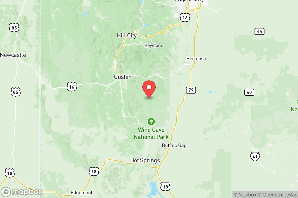
Custer County, South Dakota, offers a compelling strategic position for those prioritizing resilience and distance from major population centers. Located in the Black Hills region, the county provides a natural buffer against the cascading effects of urban unrest, grid failure, or supply chain disruptions that increasingly threaten the lower 48. Its low population density—roughly 9 people per square mile—combined with its elevation and access to the Black Hills National Forest, creates a defensible and resource-rich environment for individuals and families seeking a long-term relocation base.
Geographic position and natural advantages for long-term security
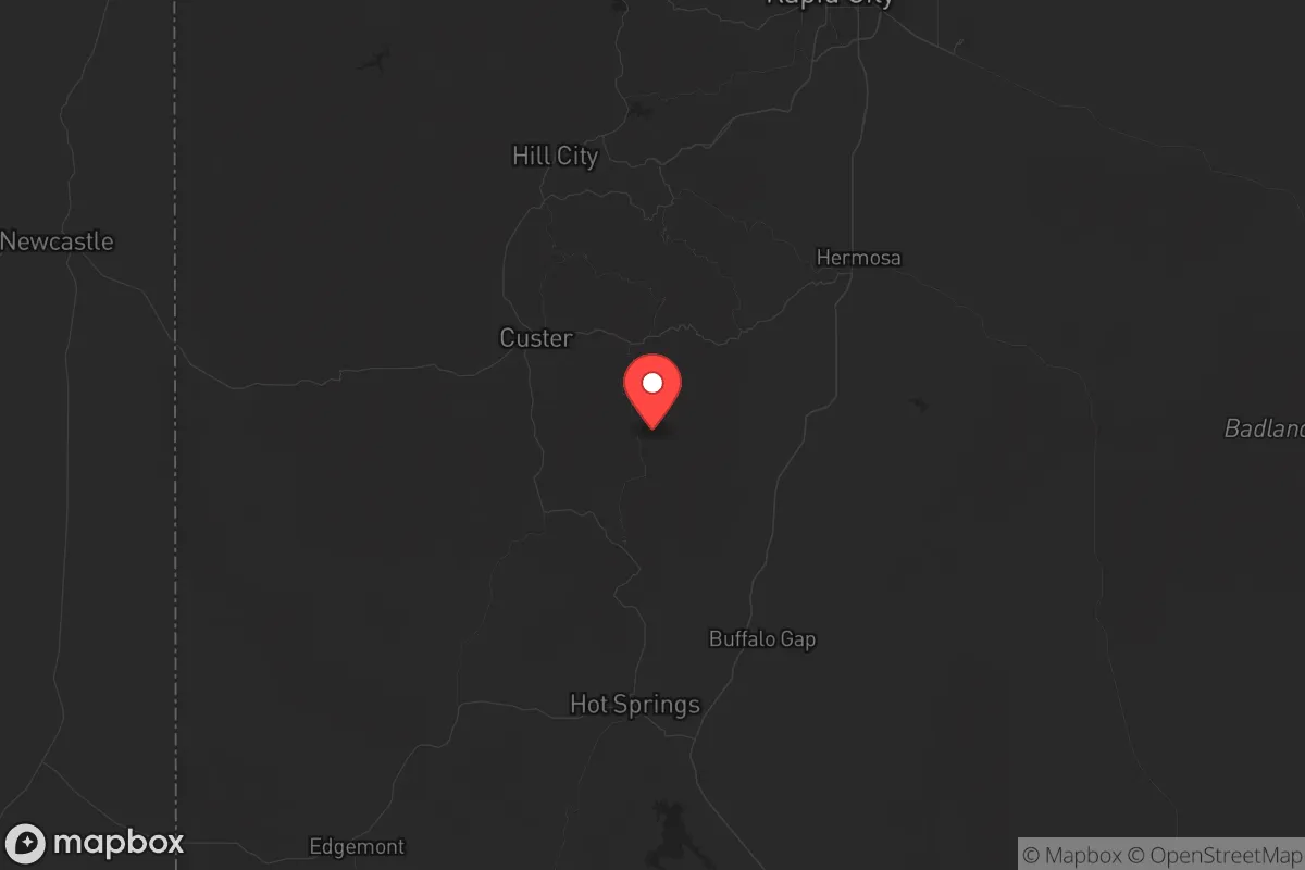
Custer County sits at the heart of the Black Hills, a heavily forested, mountainous island rising from the Great Plains. This geography offers several hard-to-replicate advantages. The county's elevation, averaging over 5,000 feet, provides cooler summers and a shorter growing season, but also reduces the risk of the extreme heat events that plague lower-elevation regions. The Black Hills themselves are a natural fortress: rugged terrain, limited road access, and dense tree cover make large-scale movement difficult for any potential threat. The county is roughly 60 miles from Rapid City, the region's largest urban center (population ~77,000), which is small enough to avoid the systemic collapse risks of a major metro but large enough to provide a regional trade hub. Key named places within the county include the town of Custer (population ~2,000), the county seat, and the historic mining town of Hill City (population ~1,000). Both are situated along U.S. Route 16 and 385, offering controlled access points. The proximity to Mount Rushmore National Memorial and Wind Cave National Park provides additional buffer zones of federally protected land, which are unlikely to see dense development and can serve as natural barriers or resource zones in a crisis.
Risks, exposures, and proximity to fallout-relevant landmarks
While Custer County is far from the coastal megacities and industrial corridors that are primary targets in a major conflict, it is not without exposure. The most significant risk is the Ellsworth Air Force Base, located roughly 50 miles northeast near Rapid City. Ellsworth is home to the 28th Bomb Wing, operating B-1B Lancer bombers and, as of 2025, the new B-21 Raider. This makes the base a high-value strategic target in any peer-level conflict. While Custer County is outside the likely immediate blast radius of a direct strike on Ellsworth, fallout patterns from a ground burst could drift southeast depending on wind conditions. The prevailing winds in the region are from the northwest, which would push fallout away from Custer County toward the plains, but a shift could pose a risk. Additionally, the county is within 200 miles of the Pine Ridge Indian Reservation and the Badlands National Park, areas that could see significant refugee movement from the plains if a crisis unfolds. The county's limited road network—primarily U.S. 16, 385, and 89—means that any large-scale evacuation or movement from Rapid City or the reservation could bottleneck at key chokepoints like the Four Corners intersection (junction of 16 and 385). There are no major refineries, nuclear power plants, or chemical storage facilities within the county, which is a positive. The nearest major industrial hazard is the Rapid City Regional Airport and its associated fuel storage, but that is a minor concern compared to the refinery corridors of Texas or Louisiana.
Practical resilience for a relocator: food, water, energy, and defensibility
For a relocator, Custer County offers a mix of strong natural resources and practical challenges. Water is the single most critical asset. The county sits atop the Madison Aquifer, one of the largest and most reliable groundwater sources in the region. Many homes and properties have private wells, and the numerous creeks and streams—like French Creek and Beaver Creek—provide surface water for filtration. The growing season is short (roughly 100-120 frost-free days), but the soil in valley bottoms is fertile enough for small-scale gardening, and the surrounding forest offers wild game (deer, elk, turkey) and forage. Energy resilience is achievable: the region has excellent solar potential (over 220 sunny days per year), and many off-grid properties already use solar panels with battery storage. Wood heating is practical given the forest cover, but fire risk is a real concern in dry summers. Defensibility is high due to the terrain. Properties in the hills around Custer and Hill City offer natural observation points and limited approach routes. The county's law enforcement presence is small—the Custer County Sheriff's Office has roughly 10 deputies—so community self-reliance is the norm. The local economy is tourism-driven (Custer State Park, Mount Rushmore), which means a seasonal influx of visitors, but this also means a steady supply of goods and services that can be stockpiled. The Custer Regional Hospital provides basic emergency care, but serious trauma cases are airlifted to Rapid City, a vulnerability in a grid-down scenario.
Overall, Custer County presents a strong strategic picture for those willing to trade urban convenience for genuine resilience. Its distance from major targets, abundant water, defensible terrain, and low population density make it one of the better options in the northern Plains for a long-term relocation. The primary exposure—Ellsworth Air Force Base—is a real but manageable risk, mitigated by distance and prevailing wind patterns. For a conservative-leaning individual or family looking to build a self-sufficient life away from the fragility of the coasts and the chaos of the cities, Custer County offers a solid foundation. The key is to secure a property with a reliable well, south-facing solar exposure, and a woodlot, and to build relationships with the local community before a crisis forces a rush. The Black Hills are not a secret, but they remain one of the last truly defensible bastions in the continental United States.
* Values derived from national, state, county, city and local statistics and may differ in a specific area. Last updated: 2026-05-28T12:05:13.000Z
Narrative content on this page is AI-generated and may contain mistakes. Verify any details that matter before acting on them.
ReloMaps may earn a commission from affiliate links at no extra cost to you.