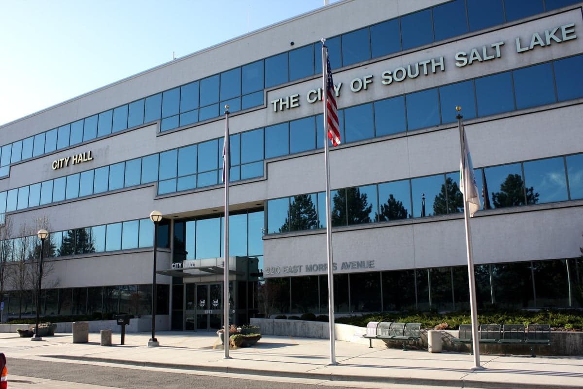
Photo: Wikipedia
Strategic Assessment of South Salt Lake, UT
Meaningful friction. Expect exposure to either population pressure, blast zones, or natural disaster risk. Consider buying a retreat property.
What does the Strategic Assessment tell us?
Our Strategic Assessment grades tactical survivability of an area. Major population centers, military targets, fallout zones, natural disasters, and border exposure all drive risk — lower exposure means a more defensible position in a crisis.
This is heavily inspired by Joel Skousen's Strategic Relocation book. Highly recommended you checkout the book ($)What does this tell us?
Our Strategic Assessment grades tactical survivability of an area. Major population centers, military targets, fallout zones, natural disasters, and border exposure all drive risk — lower exposure means a more defensible position in a crisis.
This is heavily inspired by Joel Skousen's Strategic Relocation book. Highly recommended you checkout the book ($)Strategic Pillars

Key Distances
Regional Safe Places
Below is our recommended "safe zones" in Utah and the surrounding area based on our strategic heuristics. For most people, it's unrealistic to live in a “safe zone” full-time due to work, family or other personal reasons. They tend to be more rural. However, many of these areas are perfect for second homes and retreat properties that double as a vacation home or even a short-term rental.


Important Note: For informational purposes only. This does not mean nothing bad ever happens in the green zones. Please use common sense. This is based on public data and modeled with AI. We tried to take a conservative approach but mistakes happen. We update this regularly as new information becomes available.
Solar Generator Recommendations
Backup power matters more here than in safer locations. We've picked three solar generators across budgets and capacity tiers — start with the budget unit if you only need a few essentials, or step up if you want to run a fridge and HVAC for days at a time.

Jackery Portable Power Station Explorer 300
Budget OptionPower on the Go: Weighing only 11 lbs, it's convenient to set up and store with book-sized foldable solar panels

BLUETTI Portable Power Station AC180
Designed for both indoor and outdoor scenarios, AC180 is highly capable as it has a robost capacity and continuous output power.

EF ECOFLOW DELTA Pro Ultra Power Station
Upgraded PickEcoFlow DELTA Pro Ultra is a whole-home energy system designed to grow with your family. Integrated with the Smart Home Panel 2, it scales to meet your evolving energy needs — keeping your home powered, intelligent, and secure through every stage of life.
We earn a commission, at no additional cost to you.
Strategic Assessment Analysis
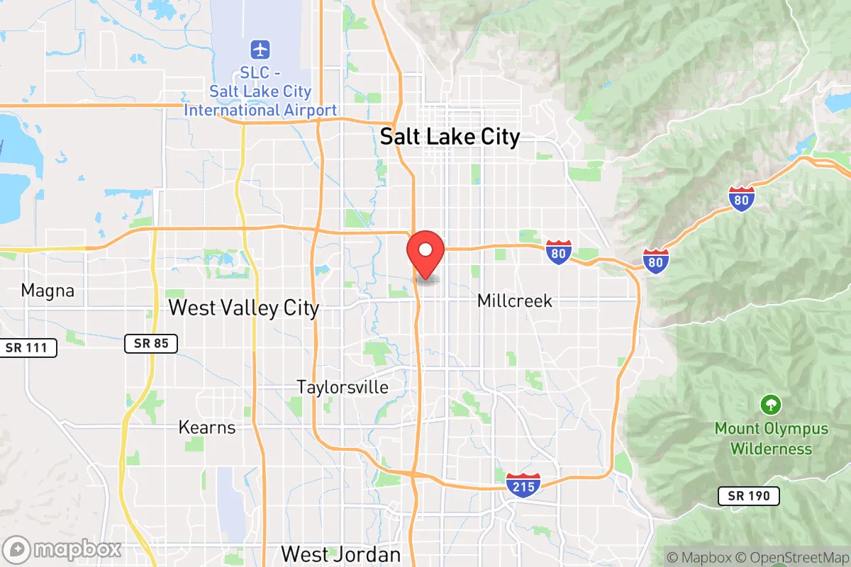
South Salt Lake, Utah, sits in a precarious strategic position that demands a hard look from anyone serious about long-term preparedness. Its resilience is a double-edged sword: the city benefits from the economic and logistical muscle of the greater Salt Lake Valley, but that same proximity to a major urban center and critical infrastructure creates severe vulnerabilities. For a relocator with a survivalist mindset, this isn't a place to hunker down for a collapse—it's a place to stage, resupply, or monitor before moving to a more defensible position. The area's location along the Wasatch Front, with the Great Salt Lake to the west and the Wasatch Mountains to the east, offers natural choke points and escape routes, but also concentrates risk in a narrow corridor.
Geographic position and natural advantages for a prepper
South Salt Lake's geography is defined by its position in the Salt Lake Valley, a flat basin ringed by mountains. The Wasatch Range to the east provides a natural barrier and potential high-ground retreat, with canyons like Parleys and Big Cottonwood offering routes into the Uinta-Wasatch-Cache National Forest. To the west, the Great Salt Lake and the Bonneville Salt Flats create a vast, open buffer zone that would be difficult for any adversary to cross undetected. The city itself sits at roughly 4,200 feet elevation, which means cooler summers and cold winters—a climate that can be harsh but also limits the spread of certain vector-borne diseases. The valley's water supply comes primarily from snowmelt, feeding the Jordan River and several reservoirs, giving a degree of water security if the grid holds. However, the entire region is seismically active; the Wasatch Fault runs directly through the valley, and a major quake would devastate infrastructure, including the pipelines that bring water from the mountains. For a prepper, the natural advantages are real but conditional on the ability to move quickly to higher ground or self-sufficient mountain communities.
Risks, exposures, and proximity to fallout-relevant landmarks
The biggest strategic weakness of South Salt Lake is its location in the shadow of Salt Lake City, just 5 miles north. This puts it within the blast and fallout radius of any attack on the city's critical infrastructure: the Salt Lake City International Airport, the Union Pacific rail yard, the I-15 and I-80 interchange, and the state capitol. The city also sits near the Kennecott Copper Mine (Bingham Canyon), one of the largest open-pit mines in the world, which is a potential target for economic disruption. The Wasatch Front is a major transportation corridor, meaning any disruption—whether from a natural disaster, EMP, or civil unrest—would choke the valley. The concentration of population (over 1.2 million in the metro area) creates a massive resource competition scenario. In a crisis, South Salt Lake would be caught between the urban chaos of Salt Lake City and the suburban sprawl of Sandy and West Jordan. There's also the risk from the Great Salt Lake itself: as it shrinks, toxic dust from the exposed lakebed becomes airborne, posing a long-term respiratory health hazard that could degrade quality of life even without a major event. For a survivalist, this is not a place to ride out a long-term disruption; it's a place to pass through or use as a temporary base before heading to the mountains or rural Utah.
Practical resilience for a relocator: food, water, energy, and defensibility
For a relocator considering South Salt Lake, the practical resilience picture is mixed. Water is the most critical factor: the city gets its water from the Jordan Valley Water Conservancy District, which relies on surface water from the Provo and Weber rivers and groundwater wells. In a grid-down scenario, this system would fail quickly without power for pumps. A prepper would need to secure a private well (possible in some parts of the city but not all) or have a plan to haul water from the Jordan River—though that river is heavily polluted from agricultural and industrial runoff. Food is a minor bright spot: the city is near the Utah Food Bank and has several grocery distribution centers, but in a panic, these would be stripped in hours. Local agriculture is limited to small community gardens and a few farms in the surrounding county; long-term food security would require stockpiling or relocation. Energy is a vulnerability: Rocky Mountain Power supplies electricity from a mix of coal, natural gas, and renewables, but the grid is aging and vulnerable to both earthquakes and EMP. Natural gas lines are widespread, but a quake could rupture them, creating fire hazards. Defensibility is poor: South Salt Lake is a flat, dense suburb with no natural defensive terrain. The street grid is open, and the population density (over 3,000 people per square mile) means any perimeter would be hard to hold. The city's police force is small (about 40 officers), and in a breakdown, law enforcement would be overwhelmed. For a single individual or family, the best strategy here is to have a bug-out vehicle prepped and a route planned to the east into the Wasatch Mountains or south toward the more rural Utah County.
The overall strategic picture for South Salt Lake is one of calculated risk. It offers the logistical advantages of being near a major city—access to medical facilities, hardware stores, and supply chains—but those same advantages become liabilities in a crisis. The city's location in a seismically active, densely populated corridor, with critical infrastructure nearby, makes it a high-risk area for any long-term survival scenario. For a conservative-leaning prepper, the calculus is clear: South Salt Lake works as a temporary staging point, a place to build skills and resources while keeping an eye on the exit. But as a permanent retreat, it falls short. The mountains to the east and the desert to the west offer far better defensibility and resource independence. If you're serious about weathering what's coming, treat South Salt Lake as a waypoint, not a destination.
* Values derived from national, state, county, city and local statistics and may differ in a specific area. Last updated: 2026-04-24T13:25:42.000Z
Narrative content on this page is AI-generated and may contain mistakes. Verify any details that matter before acting on them.
ReloMaps may earn a commission from affiliate links at no extra cost to you.