Photo: Wikipedia
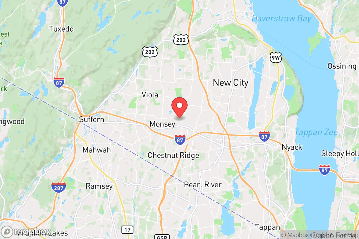
Strategic Assessment of Spring Valley, NY
Multiple tactical vulnerabilities. Population density, target proximity, or disaster risk are likely compounding. A retreat property and exit planning is required.
What does the Strategic Assessment tell us?
Our Strategic Assessment grades tactical survivability of an area. Major population centers, military targets, fallout zones, natural disasters, and border exposure all drive risk — lower exposure means a more defensible position in a crisis.
This is heavily inspired by Joel Skousen's Strategic Relocation book. Highly recommended you checkout the book ($)What does this tell us?
Our Strategic Assessment grades tactical survivability of an area. Major population centers, military targets, fallout zones, natural disasters, and border exposure all drive risk — lower exposure means a more defensible position in a crisis.
This is heavily inspired by Joel Skousen's Strategic Relocation book. Highly recommended you checkout the book ($)Strategic Pillars

Key Distances
Regional Safe Places
Below is our recommended "safe zones" in New York and the surrounding area based on our strategic heuristics. For most people, it's unrealistic to live in a “safe zone” full-time due to work, family or other personal reasons. They tend to be more rural. However, many of these areas are perfect for second homes and retreat properties that double as a vacation home or even a short-term rental.


Important Note: For informational purposes only. This does not mean nothing bad ever happens in the green zones. Please use common sense. This is based on public data and modeled with AI. We tried to take a conservative approach but mistakes happen. We update this regularly as new information becomes available.
Solar Generator Recommendations
Backup power matters more here than in safer locations. We've picked three solar generators across budgets and capacity tiers — start with the budget unit if you only need a few essentials, or step up if you want to run a fridge and HVAC for days at a time.

Jackery Portable Power Station Explorer 300
Budget OptionPower on the Go: Weighing only 11 lbs, it's convenient to set up and store with book-sized foldable solar panels

BLUETTI Portable Power Station AC180
Designed for both indoor and outdoor scenarios, AC180 is highly capable as it has a robost capacity and continuous output power.

EF ECOFLOW DELTA Pro Ultra Power Station
Upgraded PickEcoFlow DELTA Pro Ultra is a whole-home energy system designed to grow with your family. Integrated with the Smart Home Panel 2, it scales to meet your evolving energy needs — keeping your home powered, intelligent, and secure through every stage of life.
We earn a commission, at no additional cost to you.
Strategic Assessment Analysis
Spring Valley, New York, presents a complex strategic picture for the conservative prepper or survivalist family. While its location in the lower Hudson Valley offers some natural advantages in terms of water access and defensible terrain, its proximity to New York City and critical infrastructure nodes introduces significant vulnerabilities that cannot be ignored. For a relocator prioritizing resilience against civic unrest, mass casualty events, and large-scale disasters, Spring Valley requires a sober assessment of both its tactical strengths and its exposure to the cascading effects of a failing system.
Geographic position and natural advantages for long-term survival
Spring Valley sits in Rockland County, roughly 30 miles northwest of Manhattan, placing it in a transitional zone between the dense urban core of the NYC metro area and the more sparsely populated Catskill region. The area benefits from the Ramapo Mountains to the west, which provide a natural barrier and potential retreat terrain, and the Hudson River to the east, which offers a major water source and transportation corridor. The local topography includes hills, forests, and numerous small lakes and reservoirs—notably the Spring Valley Reservoir and the nearby Lake Tappan—which could serve as emergency water sources in a grid-down scenario. The region's climate is temperate, with four distinct seasons, meaning a family with proper gear can manage winter heating and summer gardening, though the growing season is shorter than in the South. The soil in the area is a mix of rocky loam and clay, which requires amendment for serious food production but is workable with raised beds or hugelkultur. For a relocator, the key natural advantage is the ability to tap into multiple water sources and the presence of forested areas for firewood and game, though deer and small game are the primary options—large game like bear is present but not abundant.
Risks, exposures, and proximity to fallout-relevant landmarks
The most glaring strategic liability for Spring Valley is its proximity to New York City and the associated critical infrastructure that makes it a high-value target in any major conflict or terrorist event. The area lies within the blast and fallout radius of potential nuclear or radiological attacks on Manhattan, the Port of New York and New Jersey, or the Indian Point Energy Center (though Indian Point was decommissioned in 2021, the spent fuel pools remain a radiological hazard). Additionally, the Tappan Zee Bridge (now the Mario M. Cuomo Bridge) and the major rail lines running through the county are chokepoints that would be targeted or gridlocked in a crisis. Spring Valley itself is a densely populated suburb with a population density of over 5,000 people per square mile, meaning that any mass evacuation from NYC would funnel hundreds of thousands of people through the area, creating immediate resource competition and security risks. The town's diversity is a strength in normal times, but in a collapse scenario, the ethnic and socioeconomic tensions that simmer beneath the surface could boil over. The local government is heavily Democratic and aligned with state-level policies that prioritize equity over individual preparedness, meaning that any disaster response would likely be centralized and slow, with resources diverted to urban centers first. For the survivalist, the risk of being caught in a refugee wave or a targeted attack on regional infrastructure is high, and the defensibility of a typical suburban home in Spring Valley is poor—close-set houses, limited fields of fire, and multiple points of entry.
Practical resilience for a relocator: food, water, energy, and defensibility
For a family or individual looking to establish a resilient homestead in Spring Valley, the practical challenges are significant but not insurmountable. Water is the strongest asset: the area's numerous lakes, reservoirs, and streams mean that with proper filtration (Berkey, Sawyer, or a DIY sand filter), a household can secure potable water indefinitely. However, municipal water systems are vulnerable to contamination and disruption, so a well or rainwater catchment system is essential. Food production is limited by the short growing season (roughly May to October) and the need for soil amendment, but a family can produce a significant portion of their vegetables with a 1,000-square-foot garden and a greenhouse. Local farmers' markets and CSAs exist, but they rely on supply chains that would fail in a crisis. Energy resilience is a mixed bag: the area has decent solar potential (about 4.5 peak sun hours per day), but many homes are shaded by trees, and local zoning can be restrictive for solar panel installations. Wood heating is viable given the forest cover, but a family needs to secure a woodlot or have a reliable source of firewood, as local supplies would be quickly exhausted in a prolonged grid-down event. Defensibility is the weakest link. Spring Valley's suburban layout means that a single-family home is hard to secure against a determined group. The best option is to find a property on the western edge of town, closer to the Ramapo foothills, where terrain provides natural cover and chokepoints. Alternatively, a relocator might consider a rural property in nearby Orange or Sullivan County, which offers more space and lower population density while still being within a day's drive of the city for supply runs. The local gun culture is moderate—New York's SAFE Act restricts magazine capacity and certain firearms, but Rockland County has a higher-than-average rate of pistol permits for the state. A prepper should plan on a low-profile approach, as open carry is not common and would attract unwanted attention.
The overall strategic picture for Spring Valley is one of calculated risk. The area offers genuine natural advantages in water access and terrain, and its proximity to the city could be leveraged for intelligence gathering or supply runs in the early stages of a crisis. However, the density, political alignment, and infrastructure exposure make it a poor choice for a long-term retreat. For a single individual or a small family with a high tolerance for risk and a well-stocked bug-out location in the Catskills or Adirondacks, Spring Valley could serve as a forward operating base—a place to monitor events and gather resources before moving deeper into the woods. For those seeking a permanent, defensible homestead with low risk of refugee influx or targeted attack, the Hudson Valley offers better options further north, such as Greene or Delaware counties. In the end, Spring Valley is a place to pass through, not to dig in. The smart prepper will use it as a staging ground, not a final destination.
* Values derived from national, state, county, city and local statistics and may differ in a specific area. Last updated: 2026-05-01T10:30:58.000Z
Narrative content on this page is AI-generated and may contain mistakes. Verify any details that matter before acting on them.
ReloMaps may earn a commission from affiliate links at no extra cost to you.