
Photo: Wikipedia
Strategic Assessment of Springville, UT
Strong survivability profile. Good buffer from population centers, with manageable environmental and tactical risks.
What does the Strategic Assessment tell us?
Our Strategic Assessment grades tactical survivability of an area. Major population centers, military targets, fallout zones, natural disasters, and border exposure all drive risk — lower exposure means a more defensible position in a crisis.
This is heavily inspired by Joel Skousen's Strategic Relocation book. Highly recommended you checkout the book ($)What does this tell us?
Our Strategic Assessment grades tactical survivability of an area. Major population centers, military targets, fallout zones, natural disasters, and border exposure all drive risk — lower exposure means a more defensible position in a crisis.
This is heavily inspired by Joel Skousen's Strategic Relocation book. Highly recommended you checkout the book ($)Strategic Pillars

Key Distances
Regional Safe Places
Below is our recommended "safe zones" in Utah and the surrounding area based on our strategic heuristics. For most people, it's unrealistic to live in a “safe zone” full-time due to work, family or other personal reasons. They tend to be more rural. However, many of these areas are perfect for second homes and retreat properties that double as a vacation home or even a short-term rental.


Important Note: For informational purposes only. This does not mean nothing bad ever happens in the green zones. Please use common sense. This is based on public data and modeled with AI. We tried to take a conservative approach but mistakes happen. We update this regularly as new information becomes available.
Solar Generator Recommendations
Backup power matters more here than in safer locations. We've picked three solar generators across budgets and capacity tiers — start with the budget unit if you only need a few essentials, or step up if you want to run a fridge and HVAC for days at a time.

Jackery Portable Power Station Explorer 300
Budget OptionPower on the Go: Weighing only 11 lbs, it's convenient to set up and store with book-sized foldable solar panels

BLUETTI Portable Power Station AC180
Designed for both indoor and outdoor scenarios, AC180 is highly capable as it has a robost capacity and continuous output power.

EF ECOFLOW DELTA Pro Ultra Power Station
Upgraded PickEcoFlow DELTA Pro Ultra is a whole-home energy system designed to grow with your family. Integrated with the Smart Home Panel 2, it scales to meet your evolving energy needs — keeping your home powered, intelligent, and secure through every stage of life.
We earn a commission, at no additional cost to you.
Strategic Assessment Analysis
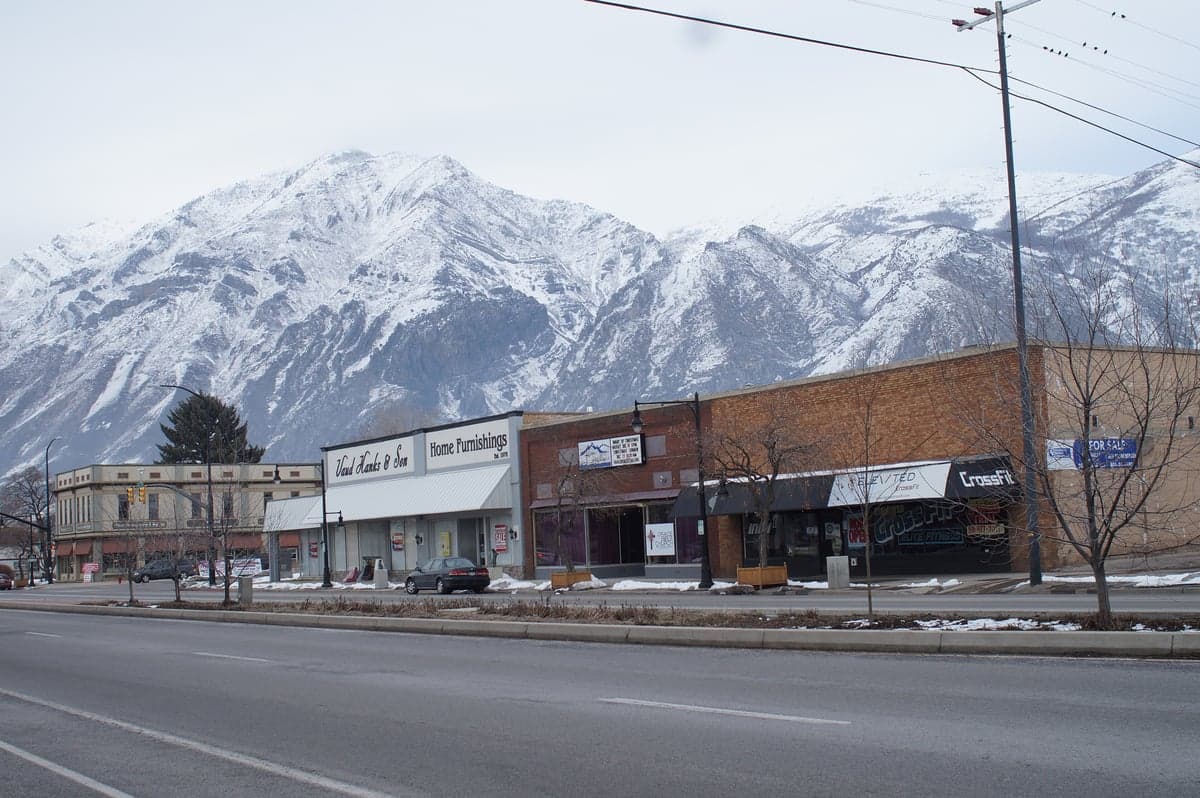
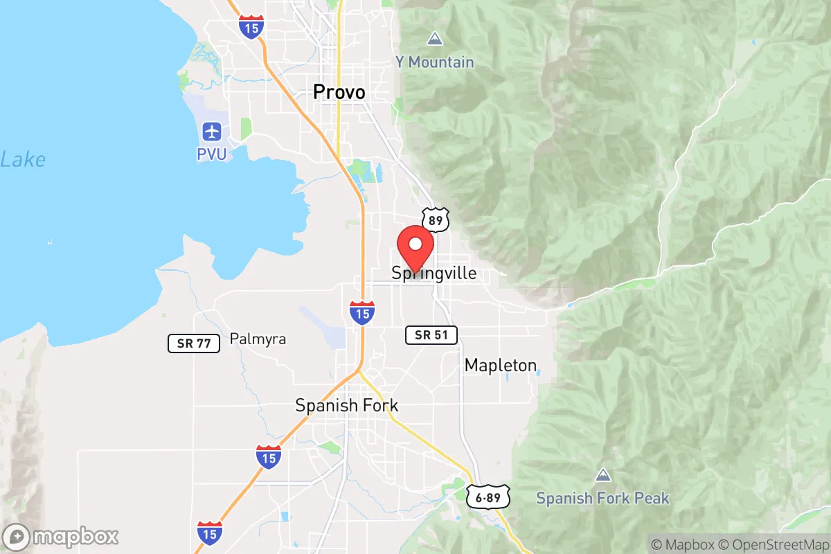
Springville, Utah, positioned at the mouth of the stunning Spanish Fork Canyon, offers a strategic blend of mountain redoubt access and valley-floor practicality that makes it a serious contender for a relocation focused on long-term resilience. Its location, roughly 50 miles south of Salt Lake City and 10 miles south of Provo, places it close enough to tap into regional resources but far enough from the immediate blast zones and civil unrest corridors of the Wasatch Front’s major population centers. The city’s geography—nestled against the Wasatch Range with a direct line to the Uinta National Forest—provides a natural buffer and a clear egress route into high-altitude refugia, a feature that separates it from the more exposed valley-floor suburbs to the north.
Geographic position and natural advantages for long-term security
Springville’s primary strategic asset is its position at the base of the Wasatch Mountains, with the Spanish Fork River cutting a canyon that leads directly into the Uinta-Wasatch-Cache National Forest. This canyon system offers a viable escape route into the high country—a critical consideration for anyone planning for grid-down scenarios or regional instability. The city sits at an elevation of roughly 4,600 feet, which provides a cooler climate and reduced wildfire risk compared to lower-elevation desert communities, while still maintaining a relatively mild winter that allows for year-round food production in protected microclimates. The surrounding mountains act as a natural barrier to the east, limiting approach vectors from that direction and creating a defensible terrain pocket. Water is the real prize here: the Spanish Fork River, fed by snowmelt from the high Uintas, runs through the city year-round, and the nearby Strawberry Reservoir and Deer Creek Reservoir provide backup sources that are less likely to be contaminated by upstream industrial activity than the Jordan River system farther north. For a relocator thinking in decades, not days, this water security is the single most compelling reason to consider Springville over more arid options in southern Utah or the Great Basin.
Risks, exposures, and proximity to fallout-relevant landmarks
No location is without vulnerabilities, and Springville’s proximity to the Wasatch Front’s critical infrastructure is the primary concern. The city lies within 50 miles of Hill Air Force Base, a major nuclear-capable installation and a likely target in any conflict involving strategic weapons. While Springville is far enough south to avoid the immediate blast radius of a ground burst at Hill, it sits in the prevailing wind pattern that could carry fallout from a strike on the base or on the Salt Lake City metropolitan area. The I-15 corridor, which runs through the city, is a double-edged sword: it provides rapid access to supplies and medical care in normal times, but it also creates a funnel for refugees fleeing a disaster in the urban core. In a civil unrest scenario, Springville could see a wave of evacuees from Provo and Orem, which are only 10–15 minutes north. The city’s own population of roughly 35,000 is manageable, but the surrounding Utah County population of over 700,000 creates a pressure gradient that could overwhelm local resources in a crisis. The Spanish Fork Canyon itself, while a valuable escape route, is also a choke point that could be blocked by a single accident or deliberate obstruction. Earthquakes are a real risk here—the Wasatch Fault runs through the valley, and a major quake (7.0+) would likely destroy the I-15 bridges and disrupt the natural gas and power lines that feed the city. The 2020 Magna earthquake was a wake-up call, but a larger event on the Salt Lake City segment would be catastrophic for the entire region.
Practical resilience for a relocator: food, water, energy, and defensibility
For a family or individual serious about self-sufficiency, Springville offers a workable baseline that requires deliberate investment to harden. The city’s water rights are tied to the Central Utah Project, which is generally reliable, but a grid-down scenario would require private well access or a gravity-fed system from the mountain streams above the city. Properties on the east bench, above 5,000 feet, have better access to spring water and are less vulnerable to valley-floor flooding, but they also face longer winter access issues. The growing season in Springville runs roughly April through October, which is sufficient for cold-hardy crops like potatoes, carrots, and kale, but not for long-season staples like corn or tomatoes without greenhouse protection. The local soil is a mix of clay and loam, workable but requiring amendment for high-yield production. Energy resilience is a mixed bag: the city is served by Rocky Mountain Power, which has a decent track record for grid stability, but the mountainous terrain limits solar exposure in the winter months, especially on north-facing slopes. A hybrid system with battery storage and a backup propane generator is the minimum viable setup. Defensibility is where Springville shines relative to flatter valley towns. The east bench neighborhoods offer natural observation points over the valley floor, and the canyon roads can be monitored with minimal manpower. The city’s police force is professional but small—about 40 officers—so community watch and mutual aid networks are essential for any serious security plan. The local gun culture is strong, with several shooting ranges and a high rate of private ownership, which aligns with a prepper mindset but also means that any conflict could involve armed parties on both sides.
The overall strategic picture for Springville is one of calculated trade-offs. It offers genuine water security, mountain access, and a defensible terrain that few other Utah Valley locations can match, but it sits close enough to the Wasatch Front’s critical targets to require serious fallout planning and a robust evacuation protocol. For a relocator who is willing to invest in a well, a greenhouse, and a solid community network, Springville provides a viable base for weathering the kinds of disruptions—civil unrest, economic collapse, or natural disaster—that are increasingly plausible in the current national climate. The key is to treat it as a starting point, not a finished solution: secure the water, harden the energy, and build relationships with the neighbors who are already thinking the same way. The canyon is your lifeline; the valley is your vulnerability. Plan accordingly.
* Values derived from national, state, county, city and local statistics and may differ in a specific area. Last updated: 2026-05-03T20:35:00.000Z
Narrative content on this page is AI-generated and may contain mistakes. Verify any details that matter before acting on them.
ReloMaps may earn a commission from affiliate links at no extra cost to you.