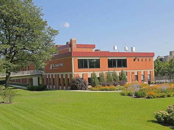
Photo: Wikipedia
Strategic Assessment of St Louis Park, MN
Multiple tactical vulnerabilities. Population density, target proximity, or disaster risk are likely compounding. A retreat property and exit planning is required.
What does the Strategic Assessment tell us?
Our Strategic Assessment grades tactical survivability of an area. Major population centers, military targets, fallout zones, natural disasters, and border exposure all drive risk — lower exposure means a more defensible position in a crisis.
This is heavily inspired by Joel Skousen's Strategic Relocation book. Highly recommended you checkout the book ($)What does this tell us?
Our Strategic Assessment grades tactical survivability of an area. Major population centers, military targets, fallout zones, natural disasters, and border exposure all drive risk — lower exposure means a more defensible position in a crisis.
This is heavily inspired by Joel Skousen's Strategic Relocation book. Highly recommended you checkout the book ($)Strategic Pillars

Key Distances
Regional Safe Places
Below is our recommended "safe zones" in Minnesota and the surrounding area based on our strategic heuristics. For most people, it's unrealistic to live in a “safe zone” full-time due to work, family or other personal reasons. They tend to be more rural. However, many of these areas are perfect for second homes and retreat properties that double as a vacation home or even a short-term rental.


Important Note: For informational purposes only. This does not mean nothing bad ever happens in the green zones. Please use common sense. This is based on public data and modeled with AI. We tried to take a conservative approach but mistakes happen. We update this regularly as new information becomes available.
Solar Generator Recommendations
Backup power matters more here than in safer locations. We've picked three solar generators across budgets and capacity tiers — start with the budget unit if you only need a few essentials, or step up if you want to run a fridge and HVAC for days at a time.

Jackery Portable Power Station Explorer 300
Budget OptionPower on the Go: Weighing only 11 lbs, it's convenient to set up and store with book-sized foldable solar panels

BLUETTI Portable Power Station AC180
Designed for both indoor and outdoor scenarios, AC180 is highly capable as it has a robost capacity and continuous output power.

EF ECOFLOW DELTA Pro Ultra Power Station
Upgraded PickEcoFlow DELTA Pro Ultra is a whole-home energy system designed to grow with your family. Integrated with the Smart Home Panel 2, it scales to meet your evolving energy needs — keeping your home powered, intelligent, and secure through every stage of life.
We earn a commission, at no additional cost to you.
Strategic Assessment Analysis
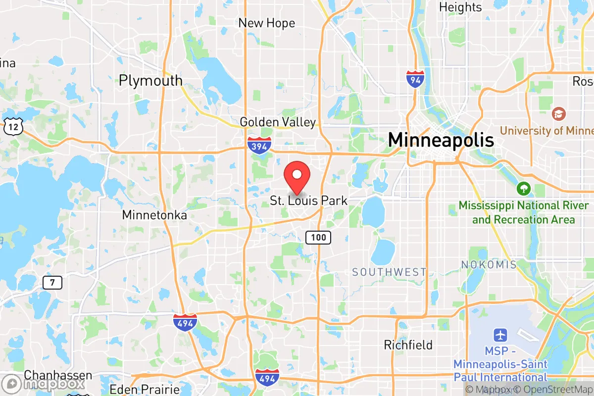
St. Louis Park, Minnesota, presents a complex strategic picture for the conservative-leaning relocator focused on resilience. While its immediate proximity to Minneapolis is a clear liability in a collapse scenario, the suburb’s robust infrastructure, redundant utility grids, and position along major transportation corridors offer a surprising degree of short-to-medium-term survivability. The key is understanding that this is not a bug-out location but a potential staging ground—a place to build resources and networks before a crisis, or a location to hold if the crisis is economic or social rather than a full-scale breakdown. The calculus hinges on whether you view the Twin Cities as a threat magnet or a resource zone, and St. Louis Park sits right on that knife’s edge.
Geographic position and natural advantages for long-term survival
St. Louis Park occupies a roughly 11-square-mile area west of Minneapolis, bordered by the cities of Golden Valley, Edina, and Hopkins. Its most significant natural asset is the Minnesota River, which forms its southern boundary and provides a reliable, if not pristine, water source. The area sits on a relatively flat glacial plain, which is both a blessing and a curse: it offers clear sightlines and easy movement, but little natural cover or defensible high ground. The Chain of Lakes (Cedar, Lake of the Isles, Bde Maka Ska) are within a 15-minute drive, offering secondary water access and fishing potential. The region’s abundant groundwater is a major plus—the Prairie du Chien-Jordan aquifer lies beneath much of the metro, and St. Louis Park’s municipal wells tap into it, meaning even if surface water is compromised, deep wells remain viable. The area’s four-season climate is a double-edged sword: harsh winters provide a natural barrier to movement and can slow the spread of disease or unrest, but they also demand serious cold-weather preparedness (fuel, shelter, clothing). The Minnesota River Valley to the south offers some limited terrain for concealment and small-scale agriculture, but the soil is heavy clay, requiring significant amendment for productive gardening.
Risks, exposures, and proximity to fallout-relevant landmarks
The elephant in the room is Minneapolis, less than 5 miles east. In a major civil unrest or mass casualty event, St. Louis Park would be directly in the path of any exodus from the city. The I-394 and I-494 corridors run through the city, making it a natural chokepoint for both fleeing populations and looters. The Mall of America in Bloomington (12 miles southeast) is a high-value target for both terrorism and looting, and its proximity means secondary effects (panic, resource competition) will ripple outward. The Minneapolis-St. Paul International Airport (MSP) is 10 miles east—a likely staging area for federal response or, in a worst-case, a target for a dirty bomb or conventional attack. The Xcel Energy Riverside Plant in Minneapolis is a natural gas-fired power plant; its failure could cause regional blackouts. More critically, the Monticello Nuclear Generating Plant is 40 miles northwest—within the 50-mile ingestion exposure zone. A major release would force evacuation or shelter-in-place for St. Louis Park residents. The BNSF Railway line running through the city carries hazardous materials (ammonia, chlorine, crude oil) daily; a derailment near the downtown corridor could force a rapid evacuation. Civil unrest risks are moderate but real—the 2020 George Floyd protests saw looting and arson reach the western suburbs, including a Target store in St. Louis Park being looted. The city’s dense population (50,000+ in 11 sq mi) means any localized event will cascade quickly. Flooding is a minor risk along Minnehaha Creek and the Minnesota River, but the city’s stormwater system is generally adequate.
Practical resilience for a relocator: food, water, energy, and defensibility
For the individual or family looking to hunker down, St. Louis Park offers a mixed bag. Water is the strongest suit: the municipal supply is drawn from deep aquifers, and the city has multiple well fields (including the 94th Avenue and Louisiana Avenue wells) that are hardened against surface contamination. A backup generator and a hand pump on a private well (if you can find a property with one) would give you near-independence. Food is a vulnerability: the city is a food desert in the sense that it relies entirely on just-in-time grocery delivery. The Lunds & Byerlys and Hy-Vee stores will empty within 48 hours of a crisis. However, the St. Louis Park Farmers Market (May-October) and nearby urban farms (e.g., the Minnesota Food Association’s Big River Farms in Hugo, 30 miles east) offer some local sourcing. For long-term food security, you’d need to establish a community garden or partner with a rural grower—the city’s zoning allows backyard chickens and bees, but not livestock. Energy is decent: Xcel Energy’s grid is relatively modern, and the city has underground power lines in many newer developments, reducing storm-related outages. Solar is viable (the area gets about 200 sunny days per year), but HOA restrictions in some neighborhoods may limit panel installation. A whole-house generator running on natural gas or propane is a must—the city’s gas lines are reliable, but a major earthquake (rare but possible) could sever them. Defensibility is the weakest link: the city is flat, with a grid-like street pattern and few natural chokepoints. The Minnehaha Creek corridor offers some cover, but most neighborhoods are open and easily traversed. A hardened safe room or basement with a steel door and reinforced walls is essential. The St. Louis Park Police Department is well-funded and has a good response time (under 5 minutes on average), but in a widespread event, they’ll be overwhelmed. Community networks are your best bet—the city has active neighborhood associations (e.g., the Birchwood Neighborhood group) that could be organized into a mutual-aid network. Medical care is excellent: Park Nicollet Methodist Hospital is a Level II trauma center with a helipad, and the Minneapolis VA Medical Center is 10 minutes away. But in a mass casualty event, these facilities will be swamped.
The overall strategic picture for St. Louis Park is one of calculated risk. It is not a retreat or a fortress—it’s a forward operating base for someone who needs to stay close to the Twin Cities for work, family, or resource access but wants better odds than living inside Minneapolis proper. The water security and medical infrastructure are genuine advantages, and the proximity to rural farmland (within 30 minutes) means you can establish a secondary cache or bug-out location in places like Carver or Chanhassen. The political climate is reliably blue (Hennepin County voted 70% for Biden in 2020), but the city’s practical governance is competent—the city council has focused on infrastructure and public safety, not radical social experiments. For the conservative prepper, St. Louis Park works best as a Phase 1 location: build your resources, network with like-minded neighbors, and have a clear trigger to relocate to a more defensible rural property if the situation deteriorates. The I-394 corridor gives you a direct route to the exurbs of Wayzata and Orono, where larger lots and lake access offer better long-term options. In short, St. Louis Park is a high-functioning suburb with real resilience potential, but only if you treat it as a base camp, not a final destination.
* Values derived from national, state, county, city and local statistics and may differ in a specific area. Last updated: 2026-04-24T08:04:19.000Z
Narrative content on this page is AI-generated and may contain mistakes. Verify any details that matter before acting on them.
ReloMaps may earn a commission from affiliate links at no extra cost to you.