Photo: Wikipedia
Strategic Assessment of Stevensville, MT
Workable tactical position. Some exposure to population density or targets, but generally defensible in a crisis.
What does the Strategic Assessment tell us?
Our Strategic Assessment grades tactical survivability of an area. Major population centers, military targets, fallout zones, natural disasters, and border exposure all drive risk — lower exposure means a more defensible position in a crisis.
This is heavily inspired by Joel Skousen's Strategic Relocation book. Highly recommended you checkout the book ($)What does this tell us?
Our Strategic Assessment grades tactical survivability of an area. Major population centers, military targets, fallout zones, natural disasters, and border exposure all drive risk — lower exposure means a more defensible position in a crisis.
This is heavily inspired by Joel Skousen's Strategic Relocation book. Highly recommended you checkout the book ($)Strategic Pillars

Key Distances
Regional Safe Places
Below is our recommended "safe zones" in Montana and the surrounding area based on our strategic heuristics. For most people, it's unrealistic to live in a “safe zone” full-time due to work, family or other personal reasons. They tend to be more rural. However, many of these areas are perfect for second homes and retreat properties that double as a vacation home or even a short-term rental.

Important Note: For informational purposes only. This does not mean nothing bad ever happens in the green zones. Please use common sense. This is based on public data and modeled with AI. We tried to take a conservative approach but mistakes happen. We update this regularly as new information becomes available.
Solar Generator Recommendations
Backup power matters more here than in safer locations. We've picked three solar generators across budgets and capacity tiers — start with the budget unit if you only need a few essentials, or step up if you want to run a fridge and HVAC for days at a time.

Jackery Portable Power Station Explorer 300
Budget OptionPower on the Go: Weighing only 11 lbs, it's convenient to set up and store with book-sized foldable solar panels

BLUETTI Portable Power Station AC180
Designed for both indoor and outdoor scenarios, AC180 is highly capable as it has a robost capacity and continuous output power.

EF ECOFLOW DELTA Pro Ultra Power Station
Upgraded PickEcoFlow DELTA Pro Ultra is a whole-home energy system designed to grow with your family. Integrated with the Smart Home Panel 2, it scales to meet your evolving energy needs — keeping your home powered, intelligent, and secure through every stage of life.
We earn a commission, at no additional cost to you.
Strategic Assessment Analysis
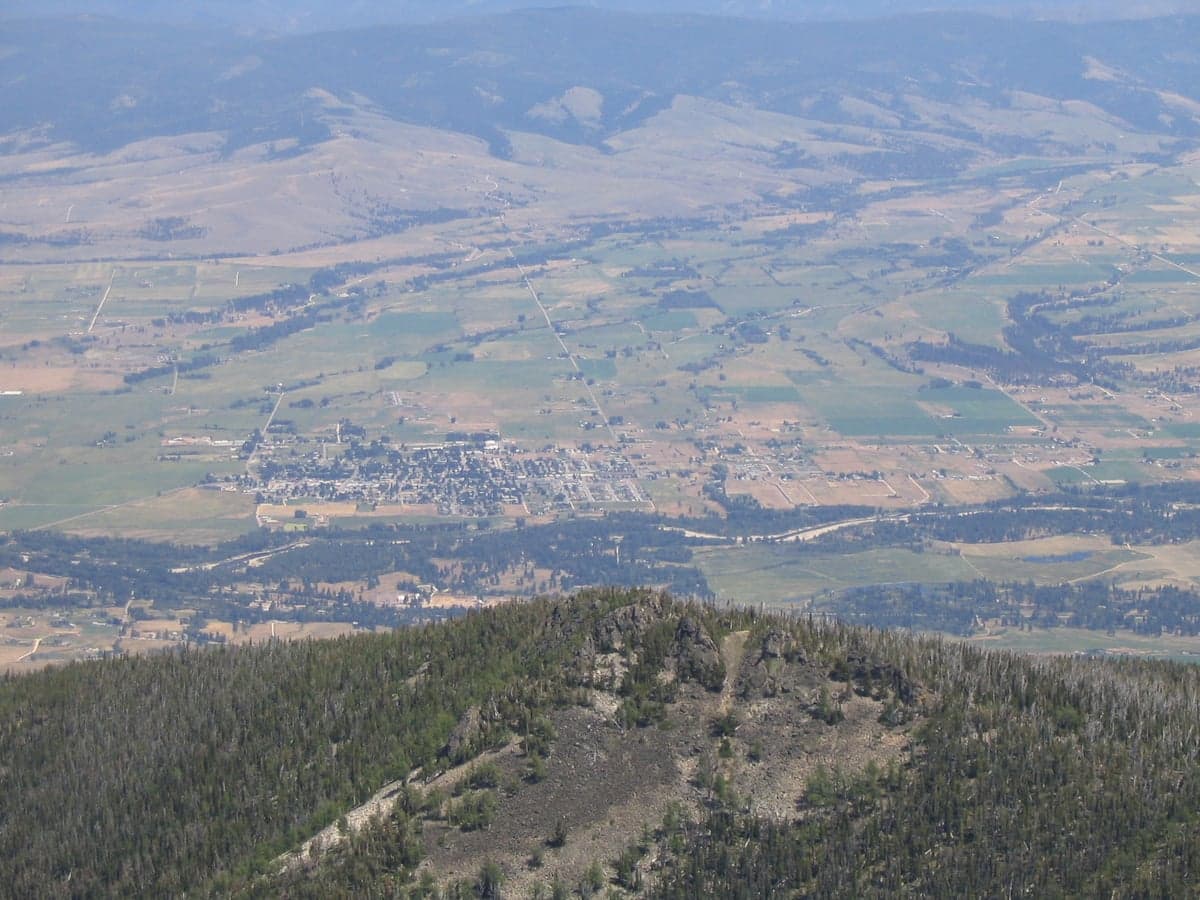
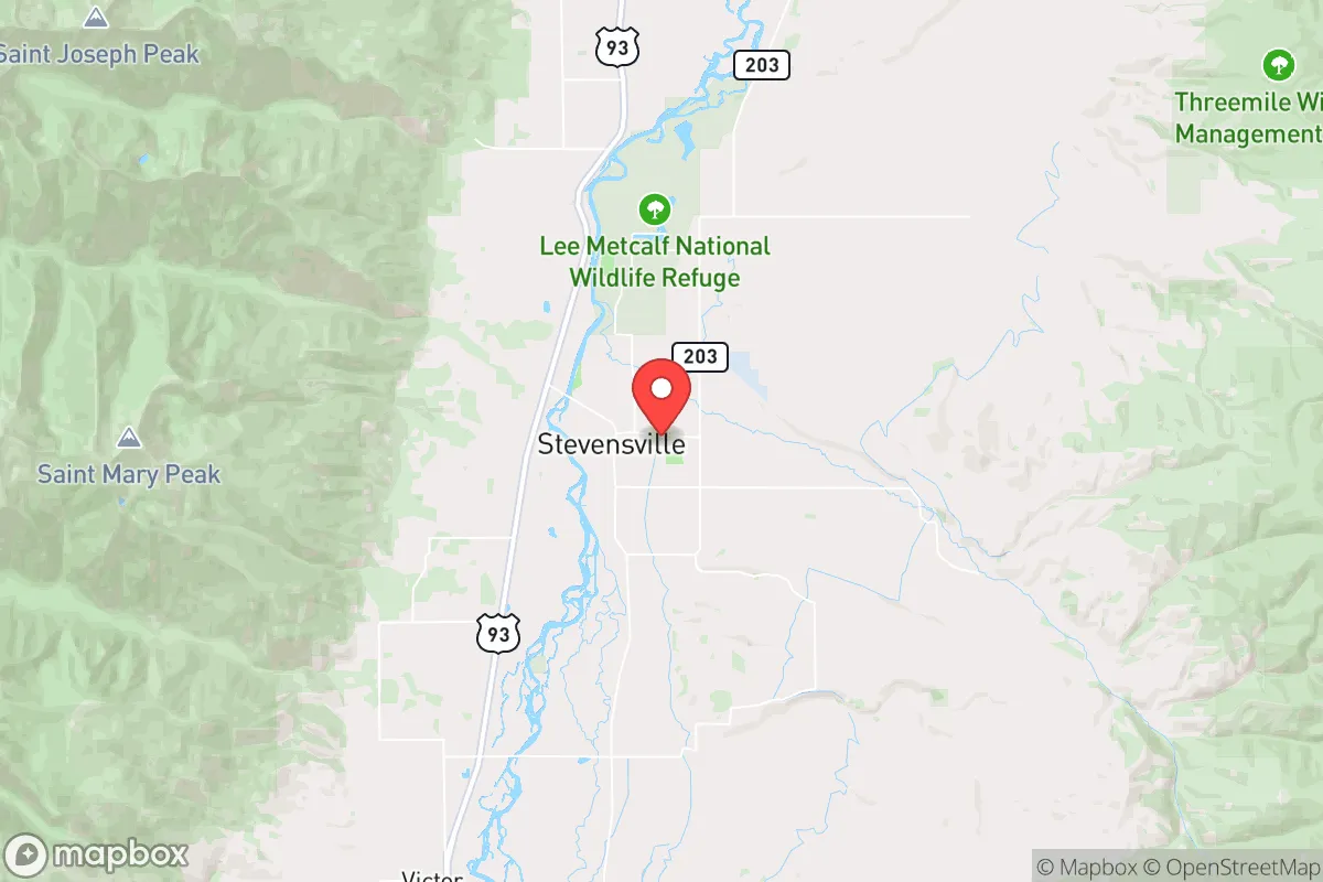
Stevensville, Montana, offers a strategic relocation option for those prioritizing long-term resilience, sitting in the Bitterroot Valley roughly 25 miles south of Missoula. Its position provides a meaningful buffer from major population centers while retaining access to essential supply routes and regional medical infrastructure. For a conservative-leaning individual or family focused on preparedness, Stevensville’s combination of agricultural land, mountain water sources, and low population density creates a defensible and self-sufficient base of operations. The town’s historical roots as a farming community and its current trajectory of steady, not explosive, growth suggest a community that values stability and self-reliance over rapid urbanization.
Geographic position and natural advantages for long-term security
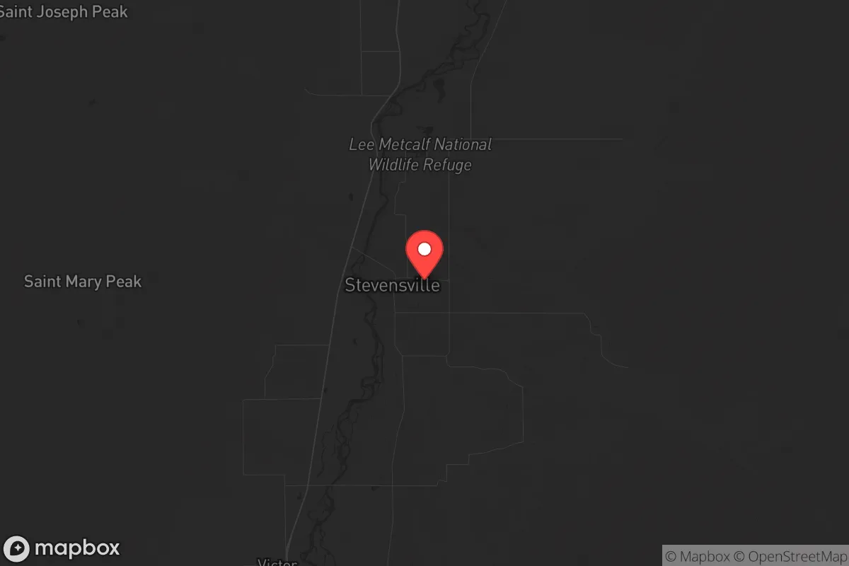
Stevensville sits at the foot of the Saint Mary Peak and the Sapphire Mountains, with the Bitterroot River running just west of town. This geography provides natural chokepoints and observation points, making it difficult for large-scale, unmonitored movement into the valley from the east or west. The valley floor is flat and fertile, supporting small-scale agriculture and livestock operations that are critical for food security in a grid-down scenario. The surrounding national forests—the Bitterroot National Forest and the Sapphire Mountains—offer abundant game, timber, and water, but also require knowledge of backcountry navigation and wildlife management. The elevation (around 3,300 feet) and four-season climate mean that winter preparedness is non-negotiable; heavy snow can isolate the valley for days, which is both a security advantage and a logistical challenge. The area’s distance from major interstate highways (I-90 runs through Missoula, 25 miles north) means that any large-scale evacuation or movement of people from the coast or urban centers would likely bypass Stevensville unless the Bitterroot Valley itself becomes a destination. This isolation is a double-edged sword: it reduces exposure to cascading urban failures but also limits rapid resupply or medical evacuation if the roads are compromised.
Risks, exposures, and proximity to fallout-relevant landmarks
Stevensville’s primary risk exposure comes from its proximity to Missoula, which houses a regional airport, a major hospital (Providence St. Patrick Hospital), and the University of Montana. In a civil unrest or mass casualty event, Missoula could become a focal point for displaced populations, resource competition, or secondary effects from infrastructure failures. The Bitterroot Valley is a natural funnel for anyone moving south from Missoula, meaning Stevensville could see an influx of people if the city becomes untenable. The valley’s single main road—U.S. Highway 93—runs north-south and is the only paved route in and out for most of the valley. A single accident, bridge failure, or deliberate blockage could cut off the town entirely. There are no major military installations, nuclear power plants, or high-value industrial targets within 50 miles, which reduces the risk of direct kinetic or radiological fallout. However, the nearby Lolo Peak and the Bitterroot Mountains create potential for wildfire corridors; the 2017 Lolo Peak Fire burned over 50,000 acres and came within a few miles of Stevensville, forcing evacuations. Flooding along the Bitterroot River is a periodic concern, particularly in spring snowmelt years, but the town itself sits on slightly higher ground than the floodplain. For a prepper, the key takeaway is that Stevensville’s risks are natural and logistical, not man-made or strategic—meaning they are predictable and manageable with proper planning.
Practical resilience for a relocator: food, water, energy, and defensibility
Water availability in Stevensville is excellent for a dry western climate. The Bitterroot River and its tributaries (including Burnt Fork Creek and Bear Creek) provide surface water, and the valley’s aquifer is generally reliable for well drilling, though permits and water rights are regulated by the Montana Department of Natural Resources. A relocator should plan for a well with a hand-pump or solar-powered backup, as grid power outages are common during winter storms. The growing season is short (roughly 100-120 frost-free days), but the valley’s soil supports potatoes, carrots, beans, squash, and hardy grains. Local farmers markets and the Stevensville Growers’ Cooperative provide seasonal produce, but a serious prepper should plan for greenhouse or cold-frame production to extend the season. Livestock—particularly chickens, goats, and cattle—are common in the area, and the local agricultural extension office offers resources for new homesteaders. Energy resilience is achievable: solar panels are viable given the valley’s 200+ sunny days per year, but winter snow accumulation requires panel tilting or manual clearing. Wood heat is the dominant backup heating source, and the surrounding national forests provide firewood with a permit. Defensibility is moderate: the town itself is spread out, with no natural defensive perimeter, but the surrounding mountains and river create natural barriers. A rural property with a clear line of sight to the main road and a secondary egress route (e.g., a Forest Service road or a neighbor’s property) is ideal. The local sheriff’s office (Ravalli County) is small but responsive, and the community culture leans heavily toward self-reliance and mutual aid rather than dependence on government services. Gun ownership is common, and the county has a strong hunting and shooting culture, which means a relocator will not stand out for being armed.
The overall strategic picture for Stevensville is one of moderate isolation with strong natural resource buffers, but it is not a fortress. It is a place where a prepared individual or family can thrive if they invest in winterization, water security, and local community relationships. The town’s distance from major targets and its agricultural base make it a viable fallback location for those who can handle the climate and the logistical realities of rural living. However, the single-road vulnerability and the potential for Missoula’s problems to spill south mean that a relocator must have a plan for both staying put and, if necessary, moving deeper into the mountains or east toward the Sapphires. Stevensville is not a bug-out location for the unprepared; it is a long-term homesteading and community-building play for those who value quiet, competence, and the ability to weather both natural and man-made storms.
* Values derived from national, state, county, city and local statistics and may differ in a specific area. Last updated: 2026-04-30T04:41:02.000Z
Narrative content on this page is AI-generated and may contain mistakes. Verify any details that matter before acting on them.
ReloMaps may earn a commission from affiliate links at no extra cost to you.