Photo: Jairph via Unsplash
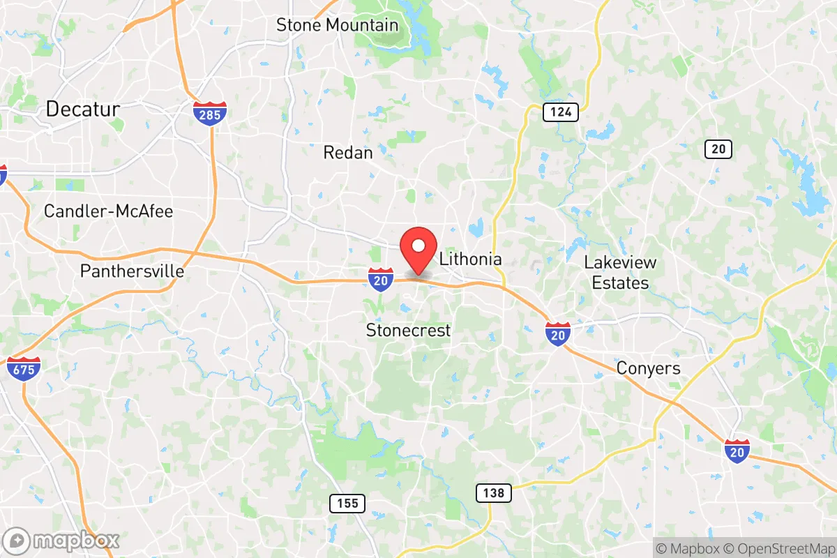
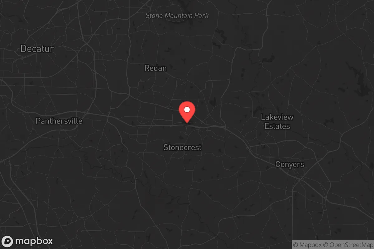
Strategic Assessment of Stonecrest, GA
Multiple tactical vulnerabilities. Population density, target proximity, or disaster risk are likely compounding. A retreat property and exit planning is required.
What does the Strategic Assessment tell us?
Our Strategic Assessment grades tactical survivability of an area. Major population centers, military targets, fallout zones, natural disasters, and border exposure all drive risk — lower exposure means a more defensible position in a crisis.
This is heavily inspired by Joel Skousen's Strategic Relocation book. Highly recommended you checkout the book ($)What does this tell us?
Our Strategic Assessment grades tactical survivability of an area. Major population centers, military targets, fallout zones, natural disasters, and border exposure all drive risk — lower exposure means a more defensible position in a crisis.
This is heavily inspired by Joel Skousen's Strategic Relocation book. Highly recommended you checkout the book ($)Strategic Pillars

Key Distances
Regional Safe Places
Below is our recommended "safe zones" in Georgia and the surrounding area based on our strategic heuristics. For most people, it's unrealistic to live in a “safe zone” full-time due to work, family or other personal reasons. They tend to be more rural. However, many of these areas are perfect for second homes and retreat properties that double as a vacation home or even a short-term rental.


Important Note: For informational purposes only. This does not mean nothing bad ever happens in the green zones. Please use common sense. This is based on public data and modeled with AI. We tried to take a conservative approach but mistakes happen. We update this regularly as new information becomes available.
Solar Generator Recommendations
Backup power matters more here than in safer locations. We've picked three solar generators across budgets and capacity tiers — start with the budget unit if you only need a few essentials, or step up if you want to run a fridge and HVAC for days at a time.

Jackery Portable Power Station Explorer 300
Budget OptionPower on the Go: Weighing only 11 lbs, it's convenient to set up and store with book-sized foldable solar panels

BLUETTI Portable Power Station AC180
Designed for both indoor and outdoor scenarios, AC180 is highly capable as it has a robost capacity and continuous output power.

EF ECOFLOW DELTA Pro Ultra Power Station
Upgraded PickEcoFlow DELTA Pro Ultra is a whole-home energy system designed to grow with your family. Integrated with the Smart Home Panel 2, it scales to meet your evolving energy needs — keeping your home powered, intelligent, and secure through every stage of life.
We earn a commission, at no additional cost to you.
Strategic Assessment Analysis
Stonecrest, Georgia, sits in a precarious but potentially advantageous position for those serious about strategic relocation. Located roughly 20 miles east of downtown Atlanta, this city of roughly 60,000 offers a buffer from the immediate chaos of a major metropolitan collapse while still being close enough to access resources—if you move fast. The area’s resilience hinges on its position within the Piedmont region, with rolling hills, clay soils, and a network of creeks that provide natural water sources, but its proximity to I-20 and the Atlanta metroplex means you’re never truly isolated. For a conservative-leaning prepper, Stonecrest is a mixed bag: it offers escape routes and some defensible terrain, but the shadow of Atlanta’s vulnerabilities—civil unrest, infrastructure strain, and target-rich environments—looms large.
Geographic position and natural advantages for long-term survival
Stonecrest’s geography is defined by its location on the eastern edge of the Atlanta metropolitan area, where suburban sprawl gives way to more rural DeKalb and Rockdale counties. The area sits atop the Piedmont plateau, characterized by gently rolling hills, hardwood forests, and clay-based soils that drain well—important for both gardening and avoiding flood zones. The South River runs along the city’s western boundary, offering a perennial water source that, with proper filtration, could sustain a household. The elevation averages around 800 feet, which provides some relief from the heat and humidity of lower-lying areas, but more critically, it offers vantage points for observation. The natural cover of mixed pine and oak forests can obscure movement and provide materials for shelter or fuel, but it’s not dense enough to hinder travel. For a relocator, the key advantage is the network of state highways—like GA-124 and GA-212—that connect to less populated areas to the east and south, including the Oconee National Forest about 60 miles away, a viable bug-out destination if Stonecrest itself becomes compromised. The presence of the Arabia Mountain National Heritage Area to the south provides additional green space and potential foraging grounds, though it’s a public park, so don’t count on it being secure in a crisis.
Risks, exposures, and proximity to fallout-relevant landmarks
The biggest liability for Stonecrest is its proximity to Atlanta, a city that, in a national emergency, would become a magnet for unrest, resource competition, and potential military or law enforcement lockdowns. The Hartsfield-Jackson Atlanta International Airport, roughly 25 miles southwest, is a prime target for any coordinated attack or disruption, and its fallout—both literal and figurative—could affect air quality and travel corridors. The city is also within 30 miles of several major industrial and chemical facilities along the I-20 corridor, including the Covington and Conyers areas, which host manufacturing plants and rail yards that could become secondary hazards in a disaster. Stonecrest itself has a population density of about 1,200 people per square mile, which is moderate but still high enough that a sudden influx of refugees from Atlanta would overwhelm local resources within days. The city’s infrastructure is tied to the regional power grid (Georgia Power) and water systems (DeKalb County), both of which are vulnerable to cyberattacks or physical sabotage. On the plus side, Stonecrest is not directly on a major fault line, and tornado risk is moderate—but the real threat is human: the area’s diversity and proximity to Atlanta mean that in a breakdown of civil order, you’d be dealing with a mix of desperate urbanites and organized criminal elements moving outward. The presence of the Stonecrest Mall and several big-box retail centers makes these locations likely flashpoints for looting and violence.
Practical resilience for a relocator: food, water, energy, and defensibility
For a single individual or family looking to hunker down in Stonecrest, the practicalities of self-sufficiency are challenging but not impossible. Water is the first concern: while the South River and several smaller creeks (like Snapfinger Creek) are accessible, they’re also likely to be contaminated by runoff or upstream sewage in a disaster. A deep well is the gold standard, but most suburban homes in Stonecrest are on municipal water, so you’d need to invest in a high-capacity filtration system (like a Berkey or a sand filter) and store at least 50 gallons per person. Rainwater collection is viable given the region’s 50 inches of annual rainfall, but you’ll need a large catchment area and proper storage. Food production is limited by the clay soil, which requires amendment with compost or raised beds, but the growing season is long (March to November), and you can get two crops of greens or root vegetables per year. Local zoning allows for backyard chickens and small livestock in most residential areas, but check HOA rules if you’re in a planned community. Energy resilience is a weak point: the grid is reliable day-to-day but fragile in a crisis. Solar panels with battery storage (like a Tesla Powerwall or DIY setup) are a smart investment, but the tree cover in many neighborhoods reduces solar gain—you’ll need to clear a south-facing roof or install ground-mounted panels. For defensibility, look for properties on cul-de-sacs, with natural barriers (creeks, dense woods) on at least two sides, and avoid homes near major roads or the mall. The police presence in Stonecrest is moderate, but response times will stretch to hours in a widespread event, so personal security—firearms, reinforced doors, and a neighborhood watch network—is non-negotiable. The city’s location on I-20 also means you have a viable escape route east toward Augusta or the coast, but that road will be a parking lot in a panic, so plan for secondary routes via GA-124 or local farm roads.
The overall strategic picture for Stonecrest is one of calculated risk. It’s not a remote survivalist paradise—you’re still within the blast radius of Atlanta’s collapse, and the area’s suburban character means you’ll be competing with neighbors for limited resources. But for a relocator who values access to medical facilities (the nearby Emory Hillandale Hospital), supply runs to smaller towns like Conyers or Covington, and a climate that supports year-round gardening, it’s a viable intermediate option. The key is to treat Stonecrest as a staging ground, not a final destination: build your resilience here, but have a bug-out plan for the Oconee National Forest or a rural property further east. If you’re willing to invest in water storage, off-grid power, and a low profile, you can ride out the first wave of a crisis here—just don’t expect to stay long-term if the situation deteriorates. The conservative prepper’s calculus is simple: Stonecrest gives you time and options, but it demands constant vigilance and a willingness to move when the math stops adding up.
* Values derived from national, state, county, city and local statistics and may differ in a specific area. Last updated: 2026-04-30T12:31:35.000Z
Narrative content on this page is AI-generated and may contain mistakes. Verify any details that matter before acting on them.
ReloMaps may earn a commission from affiliate links at no extra cost to you.