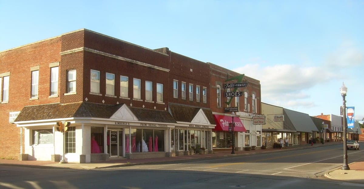
Photo: Wikipedia
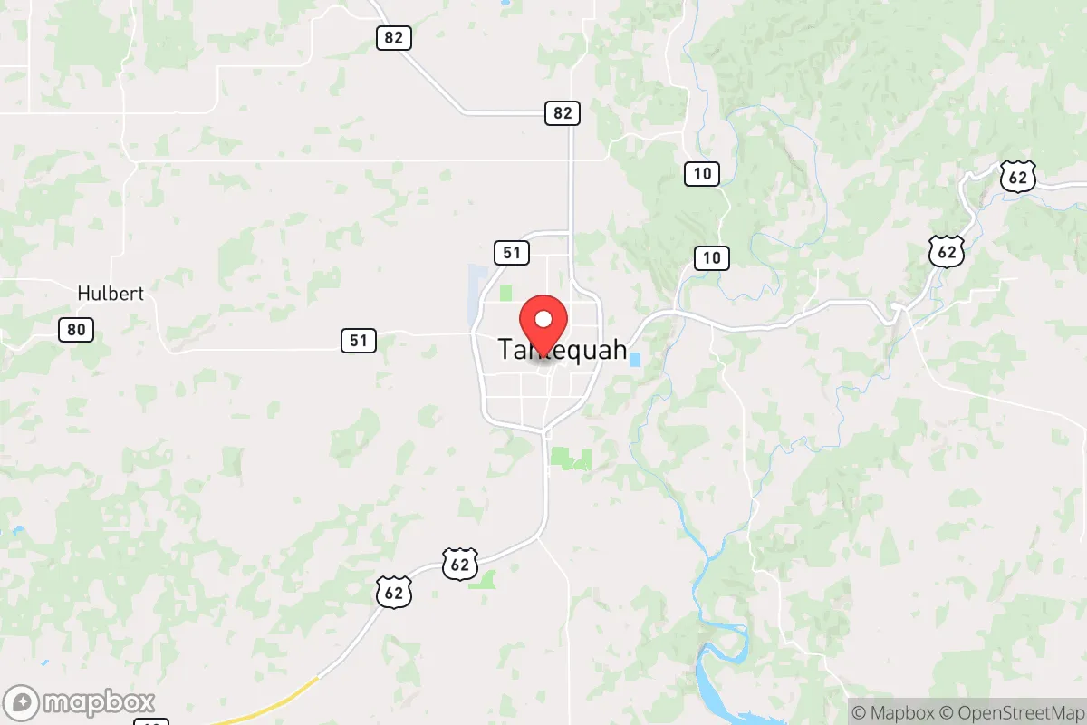
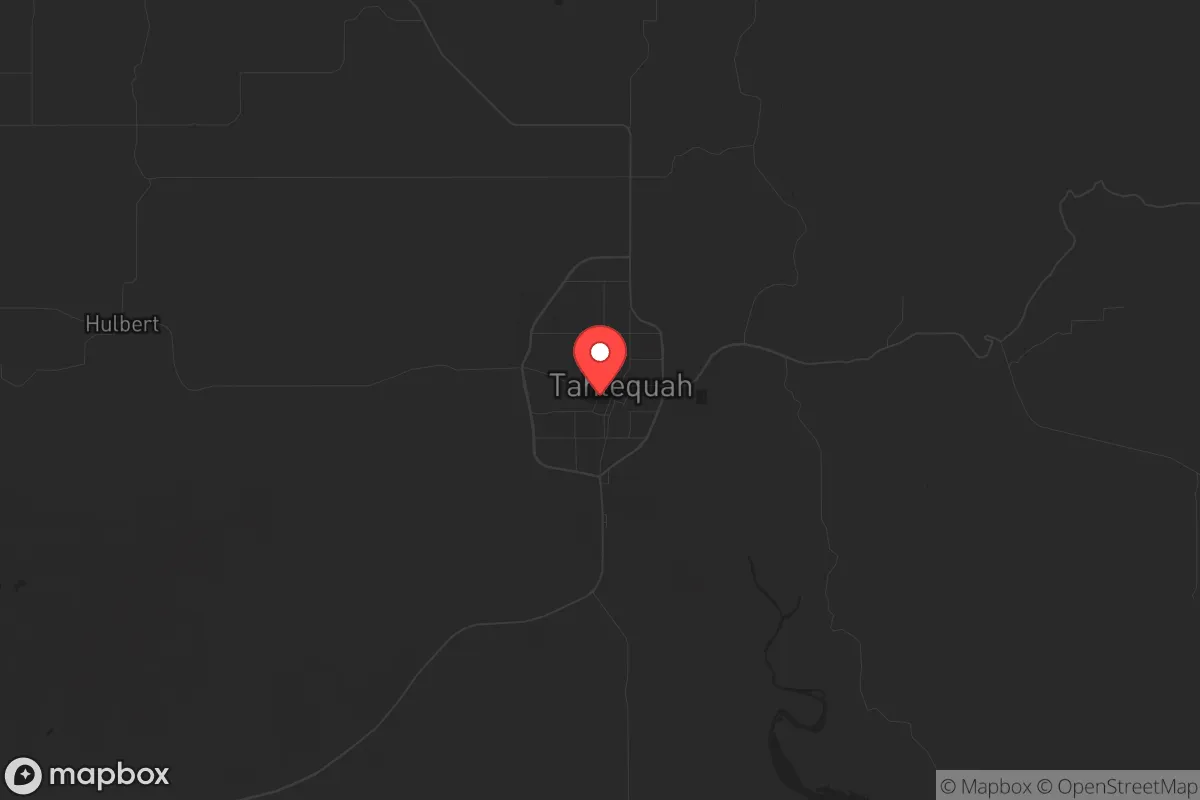
Strategic Assessment of Tahlequah, OK
Strong survivability profile. Good buffer from population centers, with manageable environmental and tactical risks.
What does the Strategic Assessment tell us?
Our Strategic Assessment grades tactical survivability of an area. Major population centers, military targets, fallout zones, natural disasters, and border exposure all drive risk — lower exposure means a more defensible position in a crisis.
This is heavily inspired by Joel Skousen's Strategic Relocation book. Highly recommended you checkout the book ($)What does this tell us?
Our Strategic Assessment grades tactical survivability of an area. Major population centers, military targets, fallout zones, natural disasters, and border exposure all drive risk — lower exposure means a more defensible position in a crisis.
This is heavily inspired by Joel Skousen's Strategic Relocation book. Highly recommended you checkout the book ($)Strategic Pillars

Key Distances
Regional Safe Places
Below is our recommended "safe zones" in Oklahoma and the surrounding area based on our strategic heuristics. For most people, it's unrealistic to live in a “safe zone” full-time due to work, family or other personal reasons. They tend to be more rural. However, many of these areas are perfect for second homes and retreat properties that double as a vacation home or even a short-term rental.
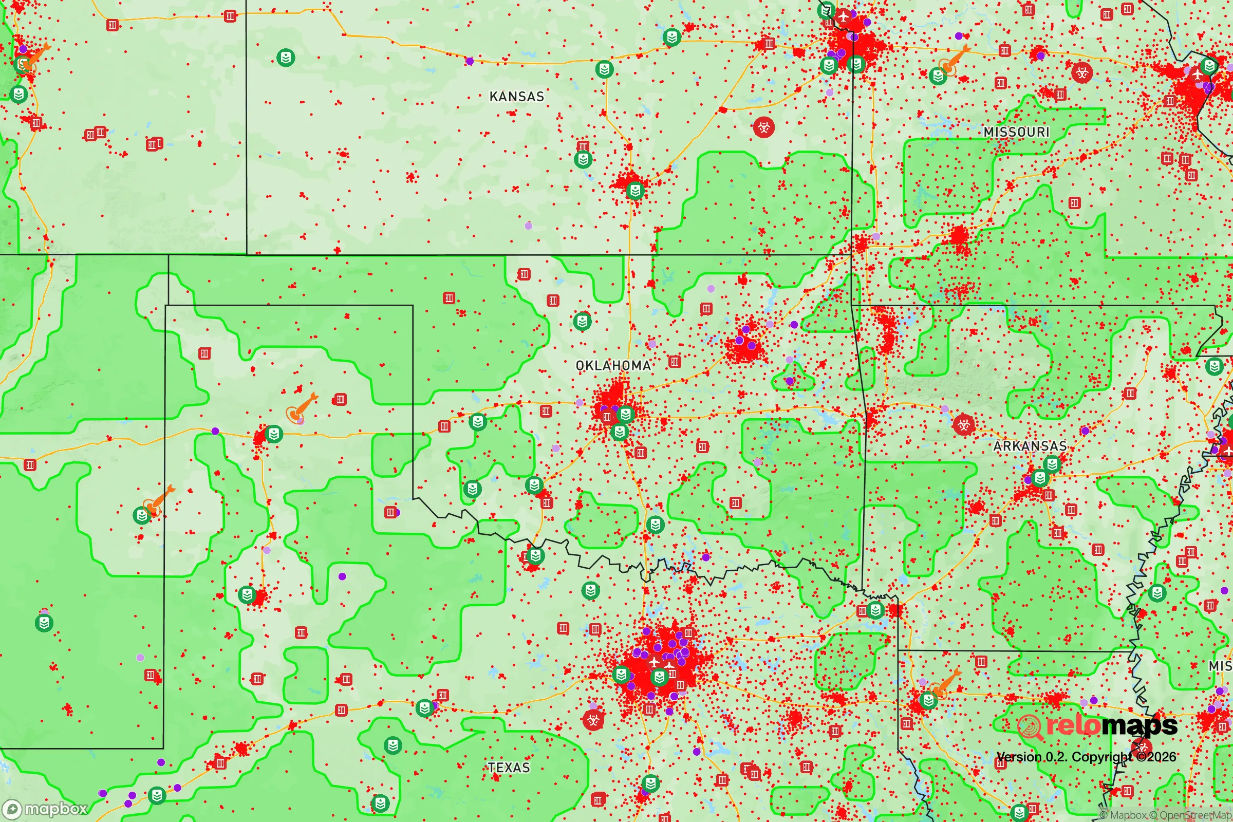
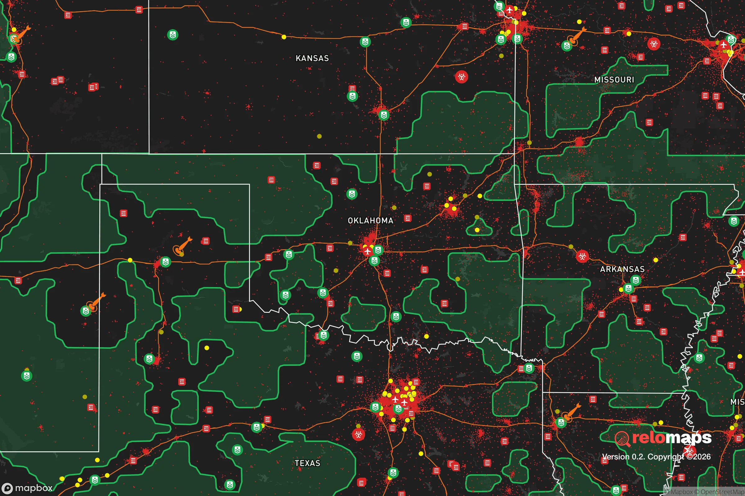
Important Note: For informational purposes only. This does not mean nothing bad ever happens in the green zones. Please use common sense. This is based on public data and modeled with AI. We tried to take a conservative approach but mistakes happen. We update this regularly as new information becomes available.
Solar Generator Recommendations
Backup power matters more here than in safer locations. We've picked three solar generators across budgets and capacity tiers — start with the budget unit if you only need a few essentials, or step up if you want to run a fridge and HVAC for days at a time.

Jackery Portable Power Station Explorer 300
Budget OptionPower on the Go: Weighing only 11 lbs, it's convenient to set up and store with book-sized foldable solar panels

BLUETTI Portable Power Station AC180
Designed for both indoor and outdoor scenarios, AC180 is highly capable as it has a robost capacity and continuous output power.

EF ECOFLOW DELTA Pro Ultra Power Station
Upgraded PickEcoFlow DELTA Pro Ultra is a whole-home energy system designed to grow with your family. Integrated with the Smart Home Panel 2, it scales to meet your evolving energy needs — keeping your home powered, intelligent, and secure through every stage of life.
We earn a commission, at no additional cost to you.
Strategic Assessment Analysis
Tahlequah, Oklahoma, offers a compelling mix of strategic depth and practical resilience for those looking to put distance between themselves and the volatility of major metropolitan areas. Nestled in the foothills of the Ozarks within the Cookson Hills, this Cherokee Nation capital provides a natural buffer from the chaos that often accompanies coastal and urban collapse scenarios. Its location—roughly 70 miles southeast of Tulsa and 130 miles northeast of Oklahoma City—places it far enough from those population centers to avoid the immediate fallout of a major civic disruption, yet close enough to access their resources if the situation stabilizes. For the prepper or survivalist, Tahlequah’s combination of rugged terrain, water abundance, and a deeply rooted community culture makes it a serious candidate for a relocation base.
Geographic position and natural defensive advantages
Tahlequah sits at the edge of the Ozark Plateau, where the terrain shifts from flat plains to steep, forested hills. This topography is a natural asset for anyone concerned with defensibility and escape routes. The area is laced with the Illinois River, Baron Fork Creek, and numerous smaller streams, providing reliable surface water sources—a critical factor when municipal systems might fail. The surrounding Cookson Hills and the nearby Sparrow Hawk Mountain offer elevation advantages for observation and communication, while the dense hardwood forests provide cover and a source of timber for construction or fuel. The region’s karst geology, with its limestone caves and springs, also offers potential for off-grid water storage and shelter. From a strategic standpoint, Tahlequah’s position is a natural choke point: the major roads—US-62 and OK-51—are the primary arteries, and both can be monitored or controlled with relative ease in a grid-down scenario. The area’s distance from the New Madrid Seismic Zone (roughly 250 miles east) and the Gulf Coast hurricane paths reduces the risk of natural disasters that could trigger mass displacement or infrastructure collapse.
Risks, exposures, and proximity to fallout-relevant landmarks
No location is without vulnerabilities, and Tahlequah has its share. The most immediate concern is the proximity to the Keowee Dam and the Tenkiller Ferry Dam on the Illinois River, both of which are downstream from the town. A catastrophic dam failure—whether from sabotage, earthquake, or neglect—could inundate low-lying areas along the river, including parts of Tahlequah itself. The town sits at an elevation of roughly 850 feet, but the floodplain along the Illinois River is a real risk for those settling too close to the water. Additionally, Tahlequah is within a 100-mile radius of the Tulsa International Airport and the Port of Catoosa, both of which are potential targets for a coordinated attack or a major industrial accident. The nearby Muskogee area hosts a large fertilizer plant and rail yards that handle hazardous materials, meaning a derailment or explosion could send a toxic plume across the region depending on wind patterns. For those concerned with electromagnetic pulse (EMP) or cyber attacks, the town’s reliance on the regional power grid—fed by the Grand River Dam Authority—is a vulnerability, though the rural nature of the area means fewer high-value electronic targets than in a city. The Cherokee Nation’s tribal sovereignty also introduces a layer of legal complexity; while this can be an advantage for community governance, it may complicate interactions with state and federal authorities during a crisis.
Practical resilience for a relocator: food, water, energy, and defensibility
For a single individual or a family looking to establish a resilient homestead, Tahlequah offers a solid foundation. The growing season runs roughly from April to October, with average annual rainfall around 45 inches—enough to support rain catchment systems and dryland farming. The local soil, while rocky in the hills, is workable in the valleys, and the Cherokee Nation’s agricultural extension programs provide resources for heirloom seed saving and permaculture techniques. Wild game is abundant: white-tailed deer, wild turkey, and squirrel are common, and the rivers hold catfish, bass, and crappie. For those willing to hunt, the public lands of the Cookson Hills Wildlife Management Area and the Spavinaw Creek area offer thousands of acres of accessible terrain. Water is the standout advantage here. The Illinois River and its tributaries are perennial, and the local water table is high enough that hand-dug wells are feasible in many areas. For energy, the region’s average wind speed is modest (around 10 mph), but solar potential is good, with over 200 sunny days per year. The hilly terrain also provides opportunities for micro-hydro if you have a reliable stream with sufficient drop. Defensibility is where Tahlequah truly shines. The winding roads and dense forest make it difficult for large groups to move quickly, and the local culture of self-reliance—rooted in Cherokee traditions and rural Oklahoma independence—means that neighbors are more likely to band together than to turn on each other. The town itself has a population of roughly 16,000, with the county at around 48,000, so it’s small enough to maintain social cohesion but large enough to have a hospital (Northeastern Health System) and a university (Northeastern State University) that could serve as a community hub or rally point.
The overall strategic picture for Tahlequah is one of cautious optimism for the prepared relocator. It is not a fortress, but it is a sanctuary—a place where the land itself provides a buffer against the worst of what’s coming. The risks are real: dam failures, industrial accidents, and the ever-present threat of a cascading grid collapse. But the advantages—abundant water, defensible terrain, a self-sufficient community culture, and distance from major targets—outweigh them for those willing to put in the work. If you are looking for a location that balances isolation with access, natural resources with legal stability, and community with independence, Tahlequah deserves a serious look. Just remember: the hills will keep you safe, but they will also test you. Come prepared, keep your head down, and build your network before the storm hits.
* Values derived from national, state, county, city and local statistics and may differ in a specific area. Last updated: 2026-04-25T13:51:00.000Z
Narrative content on this page is AI-generated and may contain mistakes. Verify any details that matter before acting on them.
ReloMaps may earn a commission from affiliate links at no extra cost to you.