
Photo: Wikipedia
Strategic Assessment of Carter County
Workable tactical position. Some exposure to population density or targets, but generally defensible in a crisis.
What does the Strategic Assessment tell us?
Our Strategic Assessment grades tactical survivability of an area. Major population centers, military targets, fallout zones, natural disasters, and border exposure all drive risk — lower exposure means a more defensible position in a crisis.
This is heavily inspired by Joel Skousen's Strategic Relocation book. Highly recommended you checkout the book ($)What does this tell us?
Our Strategic Assessment grades tactical survivability of an area. Major population centers, military targets, fallout zones, natural disasters, and border exposure all drive risk — lower exposure means a more defensible position in a crisis.
This is heavily inspired by Joel Skousen's Strategic Relocation book. Highly recommended you checkout the book ($)Strategic Pillars

Key Distances
Strategic Assessment Analysis
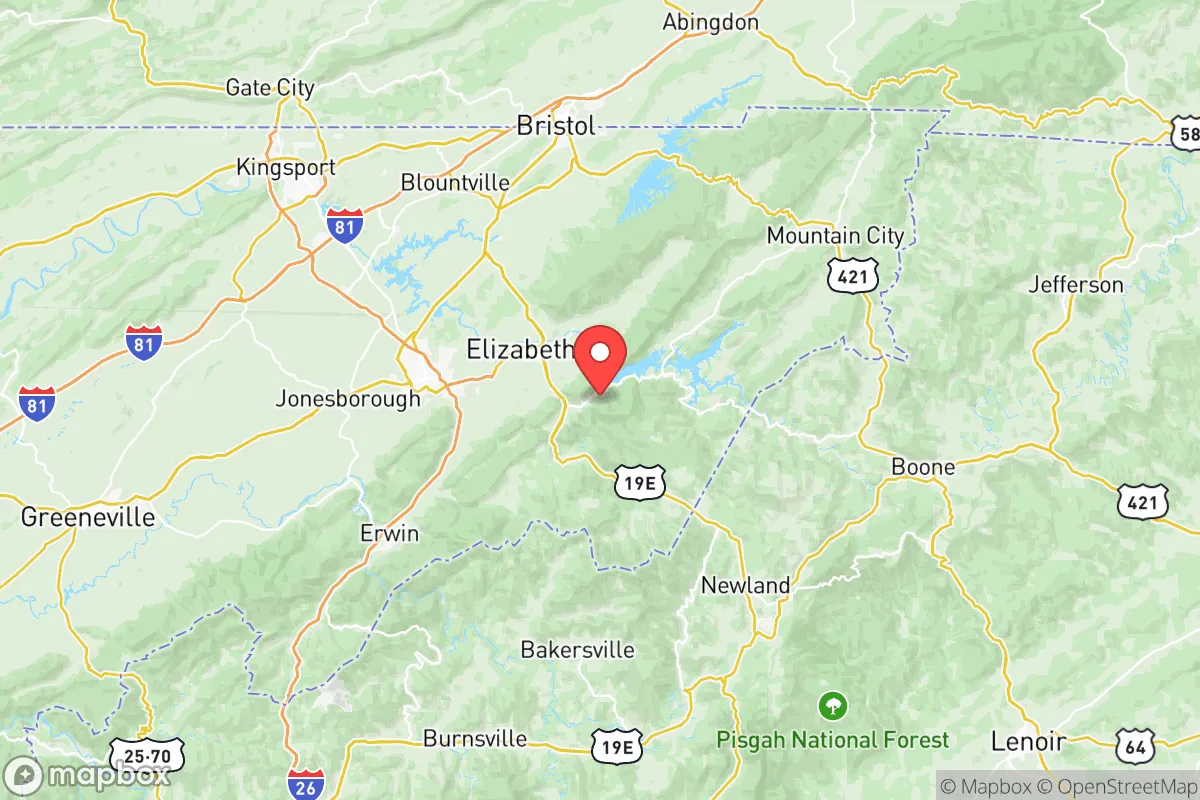
Carter County, Tennessee, offers a compelling strategic position for relocators prioritizing resilience and self-sufficiency, balancing the isolation of the Southern Appalachian region with practical access to essential infrastructure. Nestled in the northeastern corner of the state, the county provides a natural buffer from the densest population corridors while maintaining connectivity to regional hubs like Johnson City and Bristol. For those assessing long-term preparedness, Carter County’s geography, resource availability, and risk profile present a mixed but generally favorable picture, particularly for families and individuals seeking a defensible, resource-rich home base away from major metropolitan vulnerabilities.
Geographic position and natural advantages for long-term security
Carter County’s location is defined by the Blue Ridge Mountains and the Watauga River watershed, offering significant natural advantages for resilience. The county seat, Elizabethton, sits at the confluence of the Watauga and Doe Rivers, providing abundant freshwater resources that are less contested than in arid or heavily populated regions. The surrounding mountains—including Roan Mountain and the Unaka Range—create natural barriers that limit easy access from major population centers, a key factor for defensibility. The area’s elevation, ranging from roughly 1,500 to over 6,000 feet, reduces risks from flooding in higher zones while offering cooler temperatures and lower humidity than the Tennessee Valley below. Proximity to the Cherokee National Forest and the Appalachian Trail provides a vast, sparsely populated buffer zone to the south and east, which can serve as both a resource and a retreat area. For a relocator, this means a lower likelihood of being caught in mass evacuation routes or supply chain disruptions that affect flatter, more interconnected regions.
Risks, exposures, and proximity to fallout-relevant landmarks
While Carter County’s remote geography is a strength, it is not without exposures. The county lies roughly 90 miles from the Oak Ridge National Laboratory complex, a major federal nuclear facility that, while well-regulated, represents a potential fallout-relevant landmark in a major crisis scenario. Prevailing wind patterns in the region generally move from west to east, meaning a worst-case event at Oak Ridge could affect parts of Carter County, though the distance and mountain terrain would likely dilute any fallout significantly. Closer to home, the Tennessee Valley Authority’s (TVA) coal and natural gas plants, such as the John Sevier Fossil Plant in nearby Hawkins County, present industrial risks, though these are conventional rather than nuclear. The county’s mountainous terrain also poses natural hazards: flash flooding in narrow valleys, particularly around the Watauga River and its tributaries, is a recurring issue, and winter ice storms can isolate higher-elevation communities like Roan Mountain for days. However, the absence of major military bases, refineries, or large ports within 50 miles reduces the risk of being a primary target in a conflict scenario. The nearest significant military installation is the Kingsport-based Army National Guard armory, which is a minor asset rather than a strategic target. For a relocator, the key takeaway is that Carter County is far enough from high-value targets to avoid direct strikes but close enough to Oak Ridge to warrant awareness of fallout patterns and emergency planning.
Practical resilience for a relocator: food, water, energy, and defensibility
For those serious about self-sufficiency, Carter County offers strong fundamentals. Water is abundant: the Watauga River, Doe River, and numerous mountain springs provide reliable sources, and the county’s average annual rainfall of over 45 inches supports rainwater catchment systems. The Watauga Lake, a TVA reservoir, offers a large, protected water body that can serve as a long-term resource, though its dam (Watauga Dam) is a critical infrastructure point that could be a vulnerability in a prolonged grid-down scenario. Food production is viable: the county’s fertile river valleys and moderate growing season (roughly 160 frost-free days) support gardens, orchards, and small-scale livestock. Local agriculture is modest but present, with farmers’ markets in Elizabethton and Johnson City providing some local food security. Energy resilience is mixed: the region is served by TVA’s grid, which is relatively reliable but dependent on centralized generation. However, the mountainous terrain offers excellent potential for micro-hydro and solar generation, and the area has a growing culture of off-grid living, particularly in the more remote parts of Roan Mountain and Hampton. Defensibility is a standout feature: the narrow valleys, winding roads, and forested ridges create natural chokepoints that would be difficult for large groups to navigate. A property situated on a ridge or in a dead-end hollow offers significant tactical advantages. The local population is generally rural and self-reliant, with a strong hunting and firearms culture, which can be a double-edged sword—it means a community that can defend itself but also one where newcomers should integrate respectfully. The nearest major medical center is Johnson City Medical Center, about 20 minutes from Elizabethton, which is a reasonable distance for routine care but a vulnerability if regional infrastructure collapses.
Overall, Carter County presents a strong strategic picture for the resilience-minded relocator, particularly for those who value natural resources, defensible terrain, and distance from major urban and industrial targets. The county’s greatest strengths—abundant water, mountainous geography, and low population density—are balanced by moderate risks from Oak Ridge proximity and natural hazards like flooding and ice storms. For a family or individual willing to invest in off-grid infrastructure (solar, rainwater, food storage) and integrate into a rural community with a self-sufficient ethos, Carter County offers one of the better combinations of security and livability in the Southern Appalachians. It is not a bunker location, but it is a practical, resource-rich home base for those who want to be prepared without living in constant fear.

* Values derived from national, state, county, city and local statistics and may differ in a specific area. Last updated: 2026-10-05T13:01:46.000Z
Narrative content on this page is AI-generated and may contain mistakes. Verify any details that matter before acting on them.
ReloMaps may earn a commission from affiliate links at no extra cost to you.

