
Photo: Wikipedia
Strategic Assessment of Marion County
Workable tactical position. Some exposure to population density or targets, but generally defensible in a crisis.
What does the Strategic Assessment tell us?
Our Strategic Assessment grades tactical survivability of an area. Major population centers, military targets, fallout zones, natural disasters, and border exposure all drive risk — lower exposure means a more defensible position in a crisis.
This is heavily inspired by Joel Skousen's Strategic Relocation book. Highly recommended you checkout the book ($)What does this tell us?
Our Strategic Assessment grades tactical survivability of an area. Major population centers, military targets, fallout zones, natural disasters, and border exposure all drive risk — lower exposure means a more defensible position in a crisis.
This is heavily inspired by Joel Skousen's Strategic Relocation book. Highly recommended you checkout the book ($)Strategic Pillars

Key Distances
Strategic Assessment Analysis
Marion County, Tennessee, offers a compelling mix of strategic resilience and practical self-sufficiency for those prioritizing disaster readiness, sitting in a geographic sweet spot that balances rural security with access to critical infrastructure. Its position along the Tennessee River, coupled with the protective barrier of the Cumberland Plateau, provides natural advantages that few other counties in the Southeast can match. For a relocator thinking seriously about long-term stability, the area around the county seat of Jasper and the historic river town of South Pittsburg presents a defensible, resource-rich environment that is close enough to major supply chains but far enough from the highest-risk urban and industrial targets.
Geographic position and natural advantages for long-term stability
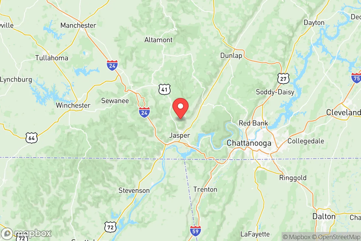
Marion County’s primary strategic asset is its location within the Cumberland Plateau, a rugged, forested escarpment that rises several hundred feet above the surrounding valleys. This topography creates natural chokepoints and defensible positions, particularly along the eastern side of the county near the Sequatchie Valley. The plateau’s elevation provides a degree of protection from flooding and storm surge, while its dense hardwood forests offer abundant cover, building materials, and fuel. The county is bisected by the Tennessee River, which flows through the Nickajack Lake reservoir, a 46-mile-long impoundment that provides a reliable, year-round water source. This is not a minor detail—in a grid-down scenario, surface water access is a primary determinant of a location’s carrying capacity. The river also historically connected the region to the broader Tennessee Valley, but today it serves more as a natural barrier and resource than a transit corridor. The county’s position roughly 30 miles west of Chattanooga and 50 miles north of Huntsville, Alabama means it is within a comfortable day-trip range for resupply or medical access during normal times, yet far enough from those cities’ population centers to avoid the worst of urban collapse dynamics.
Risks, exposures, and proximity to fallout-relevant landmarks
No strategic assessment is honest without weighing the risks, and Marion County has several that demand attention. The most significant man-made risk is the Sequoyah Nuclear Plant, located just across the river in Hamilton County, roughly 15 miles northeast of Jasper. This two-unit pressurized water reactor is a primary fallout-relevant landmark. While the plant has a strong safety record, its proximity means that a catastrophic event—whether from accident, sabotage, or a direct strike—would place large portions of Marion County within the plume exposure pathway. The prevailing winds in the region are from the southwest, which would push any airborne contamination toward the county. Additionally, the county lies within the broader shadow of the Tennessee Valley Authority (TVA) power grid, with multiple substations and transmission lines running through the area. These are potential targets for electromagnetic pulse (EMP) or cyber-attack, though their distributed nature reduces the likelihood of a complete, long-term blackout. On the natural hazard side, the county is in a moderate seismic zone, with the New Madrid Seismic Zone roughly 200 miles to the west. A major quake there could cause ground shaking and liquefaction along the river bottoms, but the plateau’s bedrock provides a more stable foundation. Tornado risk is real but not extreme—the county averages 2-3 tornado warnings per year, with the Jasper area having been hit by an EF-2 in 2020. Flooding is the most consistent natural threat, particularly in the low-lying areas around South Pittsburg and the riverfront communities, where the Tennessee River can rise 10-15 feet during heavy rain events. The Nickajack Dam upstream provides some flood control, but it is not a complete solution.
Practical resilience for a relocator: food, water, energy, and defensibility
For a relocator focused on self-sufficiency, Marion County’s practical resilience is strong but requires deliberate planning. Water access is the standout advantage. The Tennessee River and Nickajack Lake provide an essentially unlimited surface water source, but it must be treated. The county’s groundwater is generally good, with wells in the plateau areas yielding 5-15 gallons per minute at depths of 100-300 feet. The Jasper Water Treatment Plant serves the central corridor, but rural properties will likely need private wells or rainwater catchment. Food production is viable but not effortless. The valley soils along the river are rich alluvial loams, ideal for row crops and orchards, while the plateau’s thinner, rocky soils are better suited for pasture, goats, and timber. The growing season is long—roughly 200 days—and the climate supports a wide range of vegetables, fruits, and grains. Local food infrastructure is modest but present: the Marion County Farmers Market in Jasper operates seasonally, and there are several small-scale producers selling meat, eggs, and honey. For long-term storage, the county has no major grain elevators or food distribution hubs, so relocators should plan to bring their own seed stock and preservation equipment. Energy resilience is a mixed picture. The grid is served by Volunteer Electric Cooperative, which has a decent reliability record but is vulnerable to ice storms and tree falls. Solar potential is good—the region averages 4.5-5.0 peak sun hours per day—and net metering is available, though policies can shift. Wood heating is the most practical backup, given the abundant timber. Defensibility is where the county’s geography shines. The plateau’s steep, winding roads create natural ambush points and observation posts. The Sequatchie Valley is a narrow, elongated basin that can be monitored from the ridges above. The county’s population density is low—roughly 28,000 people across 500 square miles—meaning that a determined group could secure a defensible perimeter around a homestead or small community. The Marion County Sheriff’s Office is professional but small, with about 30 sworn deputies, so in a prolonged crisis, residents would largely be responsible for their own security.
The overall strategic picture for Marion County is one of high potential tempered by specific, manageable risks. Its combination of abundant water, defensible terrain, and moderate distance from major urban and industrial targets makes it a strong candidate for a relocation-minded individual or family. The proximity to the Sequoyah Nuclear Plant is the single greatest vulnerability, but it is a known, static risk that can be mitigated through planning—such as stockpiling potassium iodide, having a shelter-in-place protocol, and understanding wind patterns. The county’s location within the Tennessee Valley also provides access to a broader network of like-minded communities, from the Chattanooga preparedness community to the rural homesteading networks in Grundy County to the north. For a relocator who values self-sufficiency, strategic depth, and a community that is independent-minded without being isolationist, Marion County offers a realistic, grounded option—not a fantasy of total safety, but a place where the odds of long-term stability are meaningfully better than in most of the country.

* Values derived from national, state, county, city and local statistics and may differ in a specific area. Last updated: 2026-10-19T03:30:23.000Z
Narrative content on this page is AI-generated and may contain mistakes. Verify any details that matter before acting on them.
ReloMaps may earn a commission from affiliate links at no extra cost to you.

