Photo: Wikipedia
Strategic Assessment of Valley City, ND
Strong survivability profile. Good buffer from population centers, with manageable environmental and tactical risks.
What does the Strategic Assessment tell us?
Our Strategic Assessment grades tactical survivability of an area. Major population centers, military targets, fallout zones, natural disasters, and border exposure all drive risk — lower exposure means a more defensible position in a crisis.
This is heavily inspired by Joel Skousen's Strategic Relocation book. Highly recommended you checkout the book ($)What does this tell us?
Our Strategic Assessment grades tactical survivability of an area. Major population centers, military targets, fallout zones, natural disasters, and border exposure all drive risk — lower exposure means a more defensible position in a crisis.
This is heavily inspired by Joel Skousen's Strategic Relocation book. Highly recommended you checkout the book ($)Strategic Pillars

Key Distances
Regional Safe Places
Below is our recommended "safe zones" in North Dakota and the surrounding area based on our strategic heuristics. For most people, it's unrealistic to live in a “safe zone” full-time due to work, family or other personal reasons. They tend to be more rural. However, many of these areas are perfect for second homes and retreat properties that double as a vacation home or even a short-term rental.
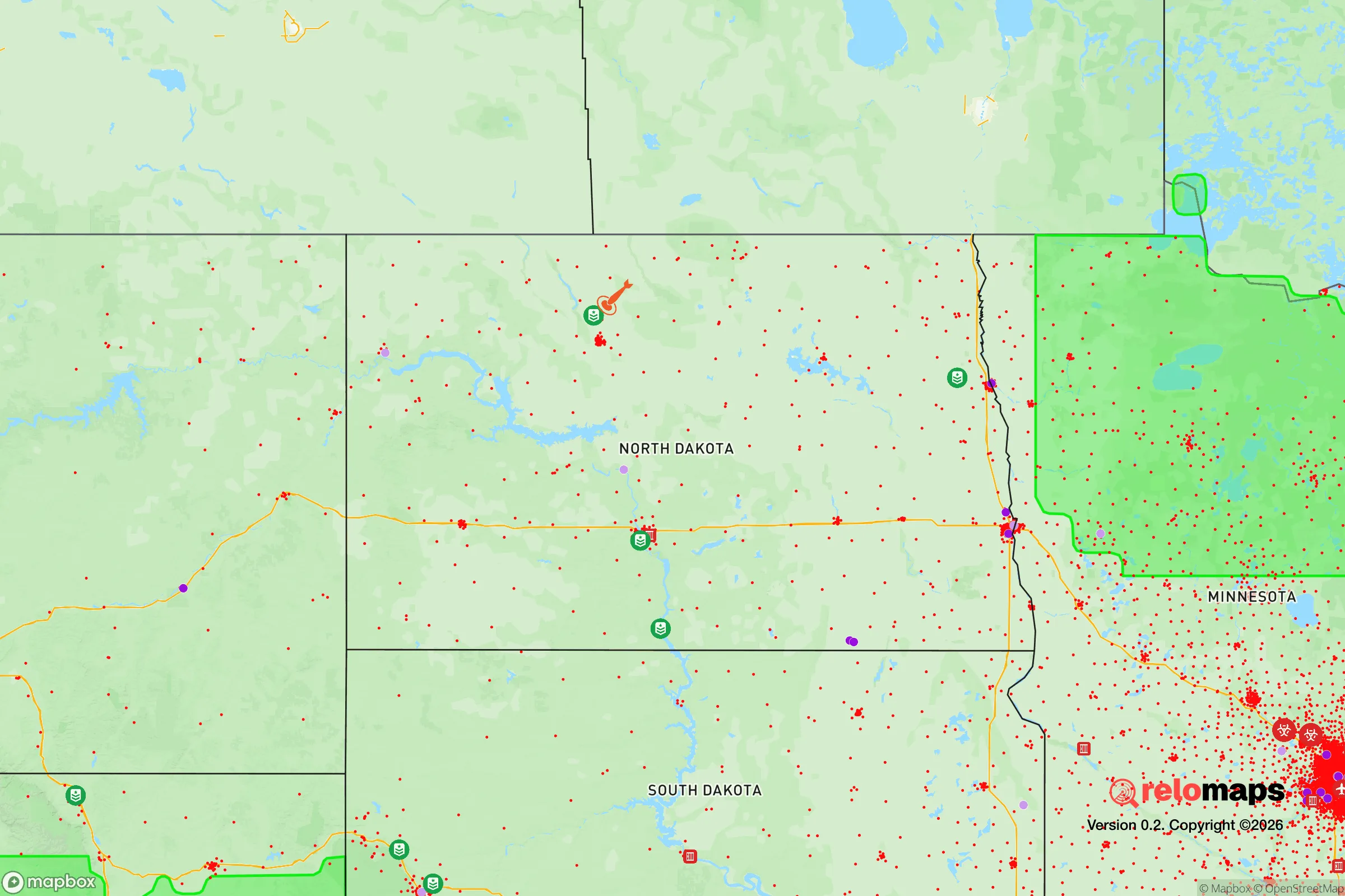
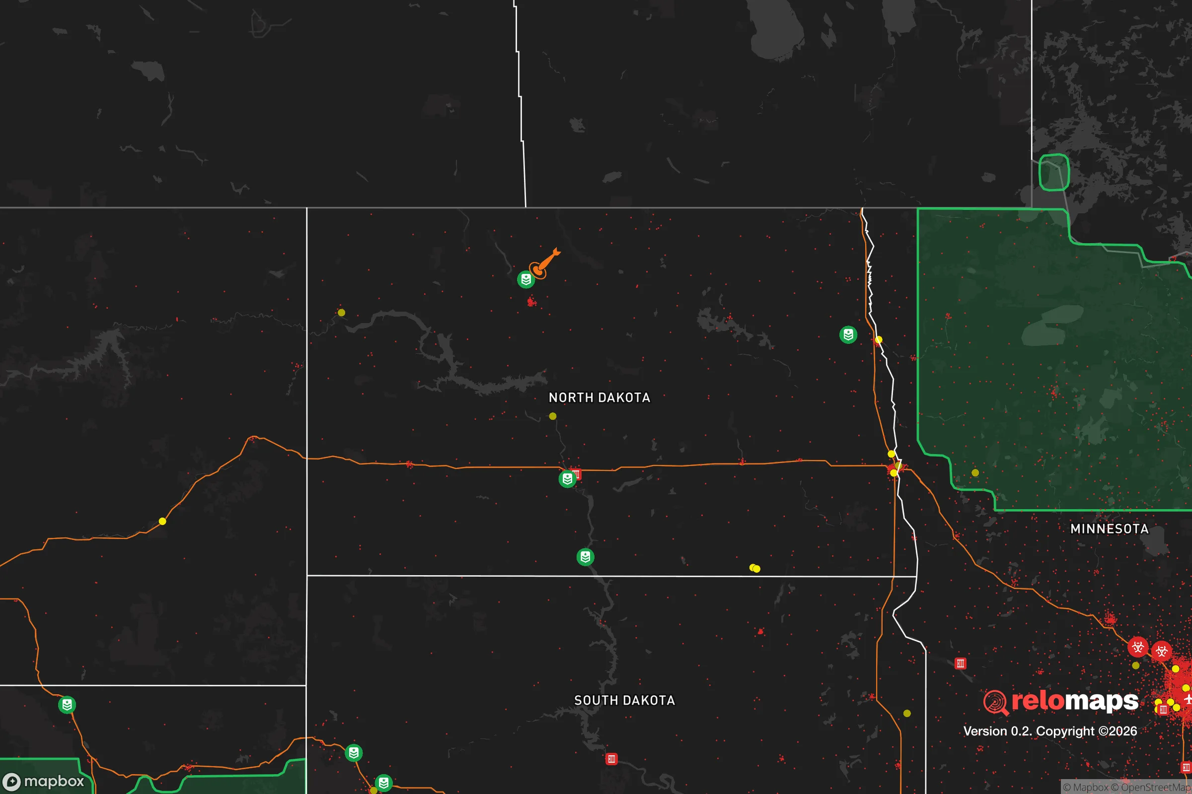
Important Note: For informational purposes only. This does not mean nothing bad ever happens in the green zones. Please use common sense. This is based on public data and modeled with AI. We tried to take a conservative approach but mistakes happen. We update this regularly as new information becomes available.
Solar Generator Recommendations
Backup power matters more here than in safer locations. We've picked three solar generators across budgets and capacity tiers — start with the budget unit if you only need a few essentials, or step up if you want to run a fridge and HVAC for days at a time.

Jackery Portable Power Station Explorer 300
Budget OptionPower on the Go: Weighing only 11 lbs, it's convenient to set up and store with book-sized foldable solar panels

BLUETTI Portable Power Station AC180
Designed for both indoor and outdoor scenarios, AC180 is highly capable as it has a robost capacity and continuous output power.

EF ECOFLOW DELTA Pro Ultra Power Station
Upgraded PickEcoFlow DELTA Pro Ultra is a whole-home energy system designed to grow with your family. Integrated with the Smart Home Panel 2, it scales to meet your evolving energy needs — keeping your home powered, intelligent, and secure through every stage of life.
We earn a commission, at no additional cost to you.
Strategic Assessment Analysis
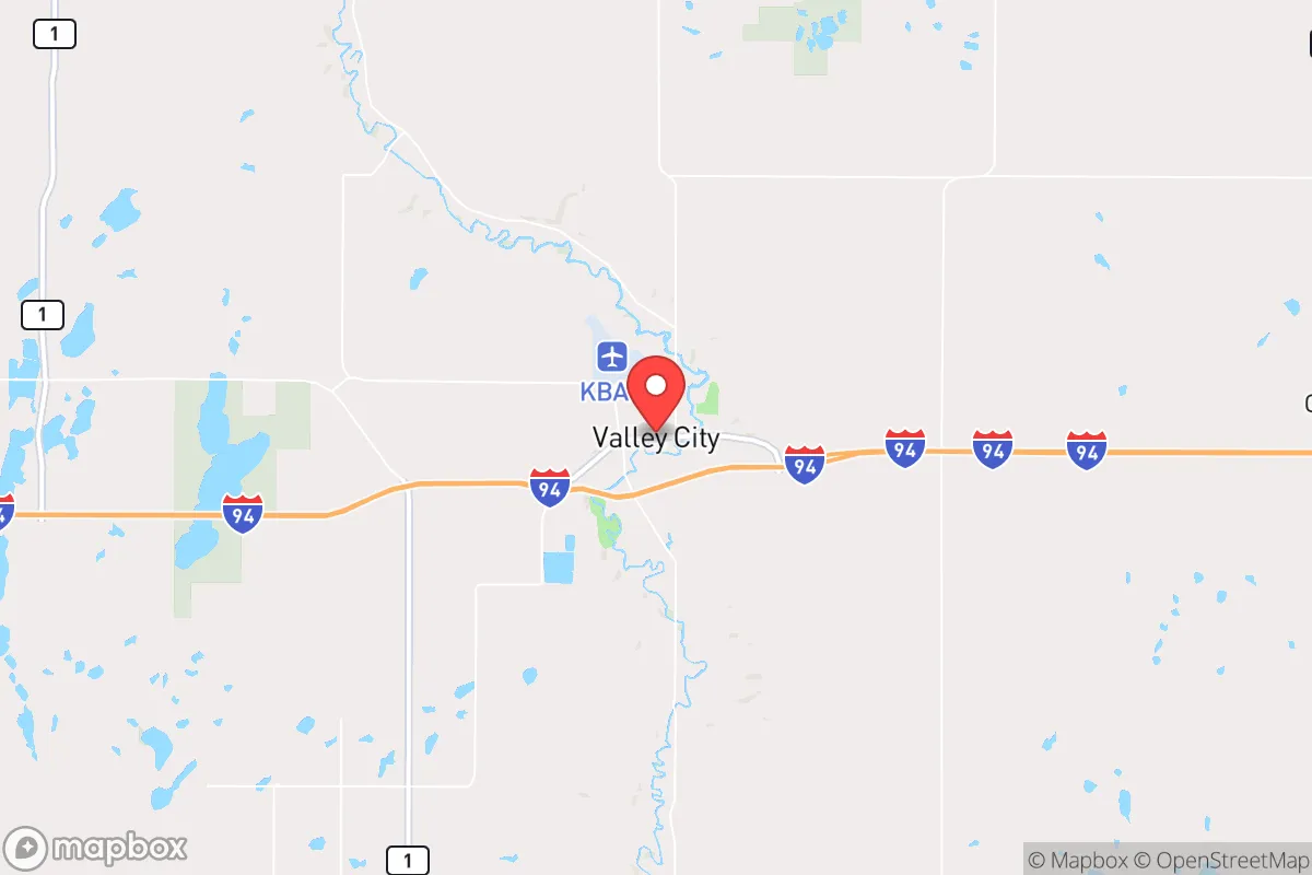
Valley City, North Dakota, sits as a quiet outlier in the Great Plains—a place where the calculus of resilience shifts from avoiding threats to securing long-term sustainability. Its location along the Sheyenne River and the I-94 corridor offers a rare combination: enough isolation to dodge the chaos of major metro areas, yet enough connectivity to move people and supplies when the grid flickers. For a relocator thinking in terms of decades, not election cycles, this town of roughly 6,500 people presents a strategic anchor point that most preppers overlook because it lacks flashy terrain or a national profile.
Geographic position and natural advantages for long-term security
Valley City’s geography is its primary asset. The city sits in the Sheyenne River Valley, a glacial-carved depression that provides natural drainage, fertile bottomland, and a defensible low-profile against the flat prairie winds. The river itself is a perennial water source—not a trickle that dries up in August, but a steady flow that supports irrigation and municipal supply. The surrounding Barnes County is agricultural land, meaning local food production isn’t a hypothetical; it’s the baseline economy. Within a 30-mile radius, you’ve got wheat, corn, soybeans, and cattle operations that don’t depend on just-in-time logistics from California warehouses. For a survivalist, that’s the difference between a pantry and a supply chain.
The elevation here is modest—around 1,200 feet—but the lack of significant topographic relief means you’re not dealing with flash floods or landslide risks common in mountain refuges. Winters are brutal, with average January lows around -2°F, but that cold itself is a defensive layer: it discourages transient populations and limits the viability of pest-borne diseases. The growing season is short (roughly 130 days), but with proper cold-frame techniques and root cellars, a family can produce a meaningful portion of its calories. The city’s position along I-94 also gives it a direct line to Fargo (60 miles east) and Bismarck (100 miles west), which matters for resupply runs or medical evacuations, but the distance is enough that Valley City won’t be a refugee spillover zone if those cities collapse.
Risks, exposures, and proximity to fallout-relevant landmarks
No location is a fortress, and Valley City has its share of exposure. The most obvious risk is the Fargo-to-Bismarck corridor itself. I-94 is a double-edged sword: it’s your lifeline for trade, but it’s also a highway for any mass movement of people fleeing coastal or urban collapse. If civil unrest erupts in the Twin Cities (250 miles southeast), that population could push west along I-94, and Valley City sits directly in that path. The city’s small police force and county sheriff’s office (Barnes County has about 11 deputies) would be overwhelmed by even a few hundred desperate people. This isn’t a defensible mountain pass; it’s a river valley with open fields on both sides. You’d need a perimeter plan, not just a locked door.
Fallout exposure is a more nuanced concern. The nearest major military or nuclear infrastructure is Minot Air Force Base (about 200 miles northwest), which houses nuclear-capable B-52s and missile silos. In a full-scale conflict, Minot is a high-priority target. Valley City is far enough to avoid direct blast effects, but prevailing winds in the region are from the west-northwest, meaning fallout from a Minot strike could drift southeast toward the Sheyenne Valley. The same logic applies to the ICBM silos scattered across central North Dakota—there are dozens of them in the state, and any major exchange would put the entire region under a radioactive plume risk. Concrete basements and sealed shelters aren’t optional here; they’re baseline requirements. On the plus side, the flat terrain means fallout dispersion is relatively predictable, and the low population density means you’re not competing with millions for underground space.
Practical resilience for a relocator: food, water, energy, and defensibility
Water is Valley City’s strongest card. The Sheyenne River provides a surface source that’s treated by the city’s municipal plant, but for off-grid scenarios, shallow wells in the valley hit the Spiritwood Aquifer at depths of 50 to 100 feet—accessible with a hand pump or a small solar-powered rig. The river itself is reliable, but you’ll want to filter and boil due to agricultural runoff (nitrates and pesticides from upstream farms). Rainwater catchment is viable, though annual precipitation is only about 20 inches, so it’s a supplement, not a primary source.
Energy resilience is mixed. The local grid is served by Xcel Energy and Otter Tail Power, with a mix of coal, natural gas, and wind. North Dakota is a wind powerhouse, and you’ll see turbines on the horizon—that’s good for grid stability, but in a prolonged outage, those turbines won’t spin without grid maintenance. Solar is viable, but winter days are short (8 hours of daylight in December) and snow cover reduces panel efficiency. A practical setup would combine a small wind turbine (rated for the prairie’s consistent 10-15 mph winds) with a propane generator and a battery bank. Propane is widely available from local suppliers like CHS and Farmers Union Oil, and you can store enough for months in a 500-gallon tank.
Food production is where Valley City shines. The surrounding farmland grows hard red spring wheat, which stores for years if kept dry and cool. Local farmers sell direct at the Barnes County Farmers Market (June through October), and there are several U-pick operations for berries and vegetables. For meat, you’ve got cattle ranches and a few hog operations within a 20-minute drive. The North Dakota State University Extension office in Valley City offers workshops on canning, dehydrating, and root cellaring—practical knowledge that’s dying out in suburban America. Defensibility is the weak link. The city is laid out on a grid, with open fields to the north and south. The river provides a natural barrier on the west side, but the east side is flat and exposed. A relocator should prioritize a property on the western edge, near the river, with a clear line of sight to the east. Reinforced doors, window bars, and a buried shelter are not paranoid here; they’re prudent.
The overall strategic picture for Valley City is one of calculated trade-offs. It’s not a bug-out paradise with mountains and forests—it’s a working agricultural town that offers water security, local food production, and genuine isolation from the chaos of the coasts. The risks are real: a nuclear exchange would put this region in the fallout path, and the I-94 corridor is a vulnerability during mass migration events. But for a relocator who wants to build a self-sufficient life without the drama of urban collapse, Valley City provides the raw materials. The winters will test your grit, the politics lean conservative (Barnes County voted +37 R in 2024), and the pace of life is slow enough that you can actually prepare without the noise of a city. If you’re looking for a place to dig in and ride out the next decade, this valley deserves a hard look.
* Values derived from national, state, county, city and local statistics and may differ in a specific area. Last updated: 2026-04-19T07:55:33.000Z
Narrative content on this page is AI-generated and may contain mistakes. Verify any details that matter before acting on them.
ReloMaps may earn a commission from affiliate links at no extra cost to you.