Photo: Wikipedia
Strategic Assessment of Van Buren, AR
Workable tactical position. Some exposure to population density or targets, but generally defensible in a crisis.
What does the Strategic Assessment tell us?
Our Strategic Assessment grades tactical survivability of an area. Major population centers, military targets, fallout zones, natural disasters, and border exposure all drive risk — lower exposure means a more defensible position in a crisis.
This is heavily inspired by Joel Skousen's Strategic Relocation book. Highly recommended you checkout the book ($)What does this tell us?
Our Strategic Assessment grades tactical survivability of an area. Major population centers, military targets, fallout zones, natural disasters, and border exposure all drive risk — lower exposure means a more defensible position in a crisis.
This is heavily inspired by Joel Skousen's Strategic Relocation book. Highly recommended you checkout the book ($)Strategic Pillars

Key Distances
Regional Safe Places
Below is our recommended "safe zones" in Arkansas and the surrounding area based on our strategic heuristics. For most people, it's unrealistic to live in a “safe zone” full-time due to work, family or other personal reasons. They tend to be more rural. However, many of these areas are perfect for second homes and retreat properties that double as a vacation home or even a short-term rental.


Important Note: For informational purposes only. This does not mean nothing bad ever happens in the green zones. Please use common sense. This is based on public data and modeled with AI. We tried to take a conservative approach but mistakes happen. We update this regularly as new information becomes available.
Solar Generator Recommendations
Backup power matters more here than in safer locations. We've picked three solar generators across budgets and capacity tiers — start with the budget unit if you only need a few essentials, or step up if you want to run a fridge and HVAC for days at a time.

Jackery Portable Power Station Explorer 300
Budget OptionPower on the Go: Weighing only 11 lbs, it's convenient to set up and store with book-sized foldable solar panels

BLUETTI Portable Power Station AC180
Designed for both indoor and outdoor scenarios, AC180 is highly capable as it has a robost capacity and continuous output power.

EF ECOFLOW DELTA Pro Ultra Power Station
Upgraded PickEcoFlow DELTA Pro Ultra is a whole-home energy system designed to grow with your family. Integrated with the Smart Home Panel 2, it scales to meet your evolving energy needs — keeping your home powered, intelligent, and secure through every stage of life.
We earn a commission, at no additional cost to you.
Strategic Assessment Analysis
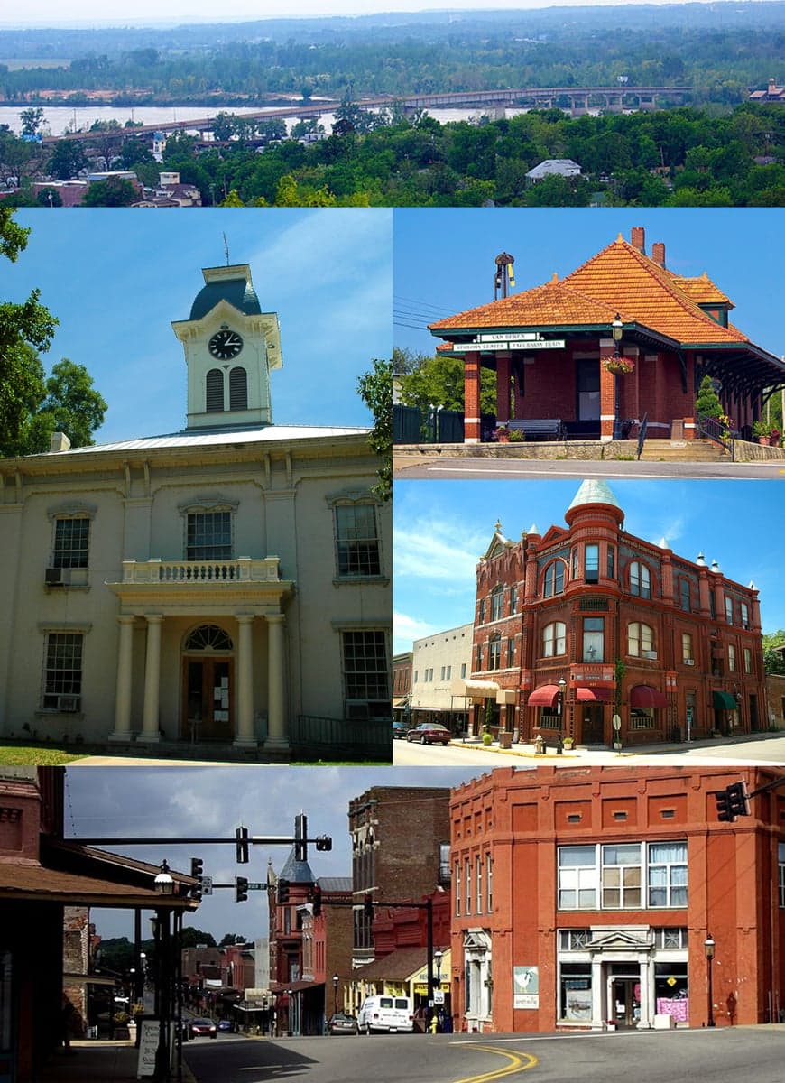
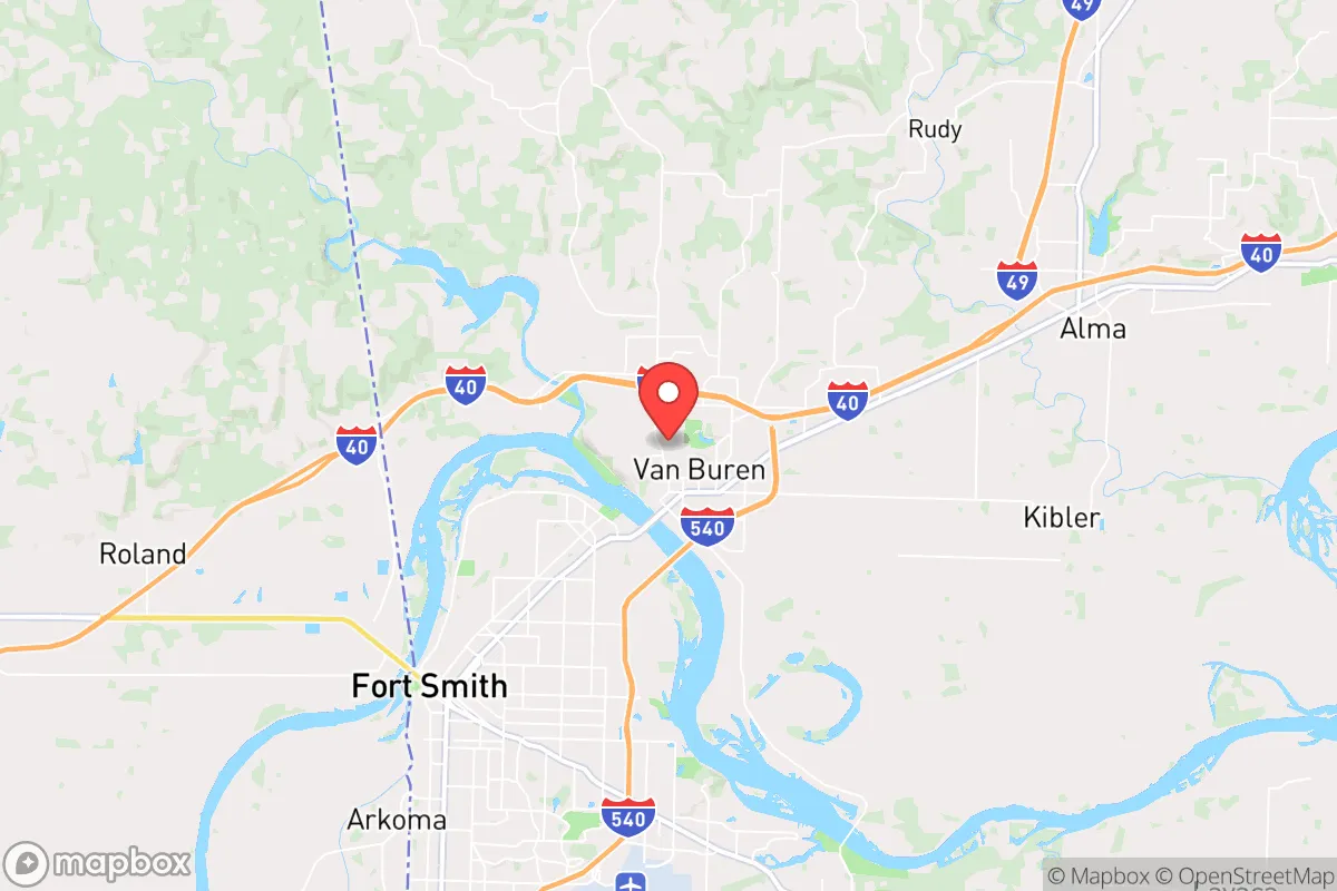
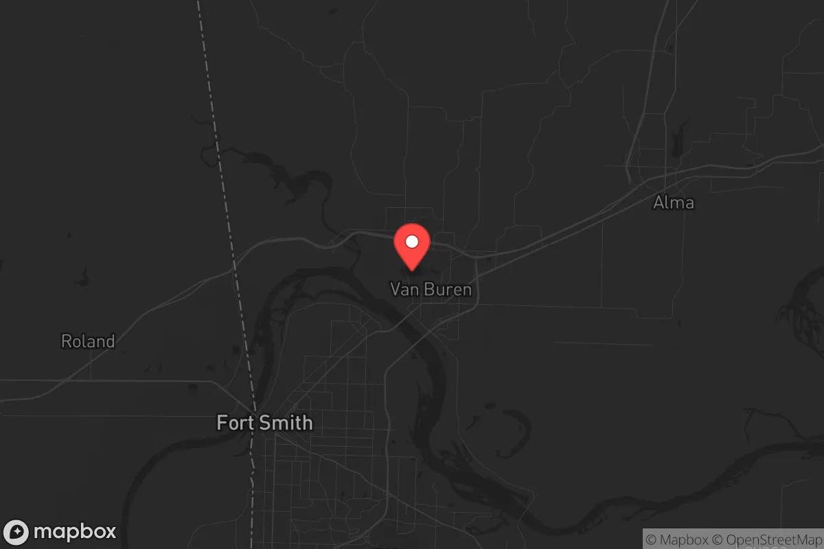
Van Buren, Arkansas, sits in a position that demands serious consideration for anyone thinking about long-term strategic relocation. Its location along the Arkansas River, just across from Fort Smith, gives it a blend of access and buffer that is increasingly rare. The town itself has a population around 24,000, which is large enough to support infrastructure but small enough to avoid the chaos of a major metro area. For a prepper or survivalist mindset, the key question is whether this place offers genuine resilience or just the illusion of safety.
Geographic position and natural advantages for long-term security
Van Buren’s primary strategic asset is its position in the Arkansas River Valley, flanked by the Boston Mountains to the north and the Ouachita Mountains to the south. This terrain provides natural barriers that slow movement and create defensible chokepoints. The Arkansas River itself is a reliable water source, which is critical for any extended disruption scenario. The area sits in a temperate climate zone with four distinct seasons, meaning you can grow food for about seven months of the year, and the surrounding forests offer ample firewood and building materials. The elevation is moderate, around 400 feet, which reduces flood risk compared to low-lying river towns. For a relocator, the ability to tap into local water, timber, and arable land without relying on fragile supply chains is a major plus. The region also has relatively low population density outside the immediate Fort Smith metro, with Crawford County averaging about 100 people per square mile. That gives you breathing room without being completely isolated.
Risks, exposures, and proximity to fallout-relevant landmarks
The most significant downside is Van Buren’s proximity to Fort Smith, which sits just across the river with a population of about 90,000. In a major civic unrest or disaster scenario, that population could become a liability. Fort Smith has a federal courthouse, a large VA hospital, and a regional airport, all of which are potential targets for disruption or crowd convergence. The interstate highway I-40 runs directly through Van Buren, connecting it to Oklahoma City and Little Rock. In a mass evacuation event, that road could become a choke point or a vector for unwanted movement. There is also the nearby Fort Chaffee training facility, which is a National Guard base and could be a focal point for military activity or refugee processing. On the natural disaster front, the area is in Tornado Alley, with a moderate risk of severe storms and the occasional earthquake from the New Madrid Seismic Zone, which is about 200 miles northeast. Flooding along the Arkansas River is a real concern, especially in low-lying areas near the riverbank. For a survivalist, these risks are manageable with proper planning, but they are not negligible.
Practical resilience for a relocator: food, water, energy, and defensibility
For someone looking to set up a resilient homestead, Van Buren offers several practical advantages. The soil in the river valley is fertile, and there is a strong local farming community with farmers markets and agricultural supply stores. Water access is straightforward: the Arkansas River is a surface water source, and the Ozark aquifer provides reliable groundwater at reasonable depths. Many rural properties in the area already have wells. Energy resilience is mixed. The grid is served by the Southwestern Power Administration, which is stable but vulnerable to ice storms and tornadoes. Solar potential is decent, with about 210 sunny days per year, but you will need battery storage for winter cloud cover. Natural gas is available in town, but rural properties may rely on propane. Defensibility is where Van Buren shines. The surrounding hills and river create natural lines of sight and limited entry points. The town itself has a historic downtown with brick buildings that could serve as rally points, but the real value is in the outlying areas north of the river, where you can find properties with good cover and limited road access. The local law enforcement presence is modest, with the Crawford County Sheriff’s Office covering a large area, so you cannot rely on rapid response in a crisis. That means you need to be self-sufficient, which is exactly the mindset this analysis assumes.
The overall strategic picture for Van Buren is cautiously positive for a relocator with a prepper mindset. It offers genuine natural advantages in water, terrain, and climate, with enough population to support basic services but not so much that it becomes a target. The main liabilities are the proximity to Fort Smith and the I-40 corridor, which could become problematic in a regional collapse scenario. If you are willing to invest in off-grid infrastructure and maintain a low profile, this area provides a solid foundation for long-term resilience. It is not a remote bunker location, but it is a practical, livable place where you can build a sustainable setup without being completely cut off from the outside world. For someone who wants to be prepared without living in a compound, Van Buren is worth a hard look.
* Values derived from national, state, county, city and local statistics and may differ in a specific area. Last updated: 2026-04-23T03:01:48.000Z
Narrative content on this page is AI-generated and may contain mistakes. Verify any details that matter before acting on them.
ReloMaps may earn a commission from affiliate links at no extra cost to you.