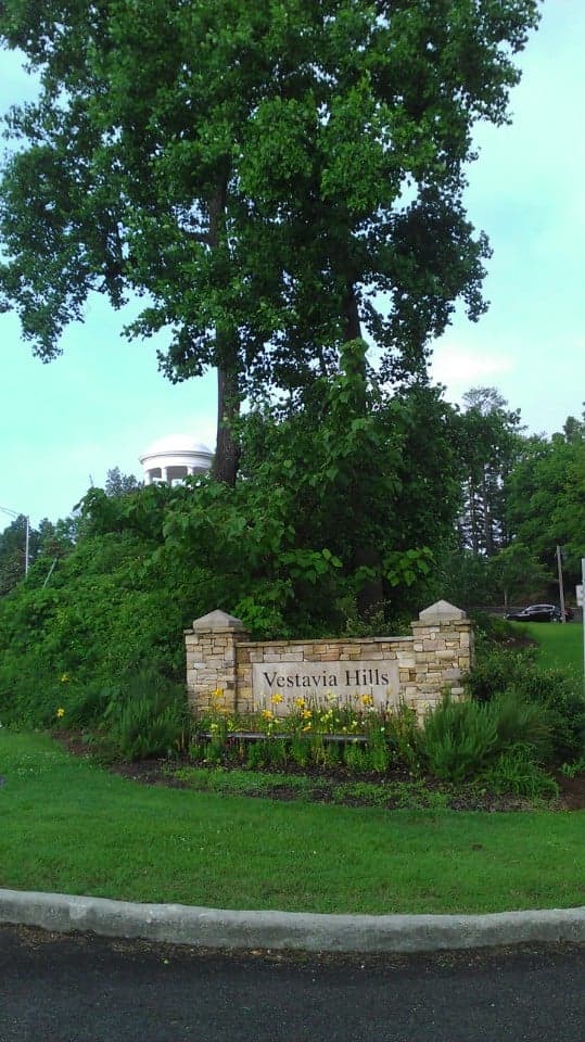
Photo: Wikipedia
Strategic Assessment of Vestavia Hills, AL
Meaningful friction. Expect exposure to either population pressure, blast zones, or natural disaster risk. Consider buying a retreat property.
What does the Strategic Assessment tell us?
Our Strategic Assessment grades tactical survivability of an area. Major population centers, military targets, fallout zones, natural disasters, and border exposure all drive risk — lower exposure means a more defensible position in a crisis.
This is heavily inspired by Joel Skousen's Strategic Relocation book. Highly recommended you checkout the book ($)What does this tell us?
Our Strategic Assessment grades tactical survivability of an area. Major population centers, military targets, fallout zones, natural disasters, and border exposure all drive risk — lower exposure means a more defensible position in a crisis.
This is heavily inspired by Joel Skousen's Strategic Relocation book. Highly recommended you checkout the book ($)Strategic Pillars

Key Distances
Regional Safe Places
Below is our recommended "safe zones" in Alabama and the surrounding area based on our strategic heuristics. For most people, it's unrealistic to live in a “safe zone” full-time due to work, family or other personal reasons. They tend to be more rural. However, many of these areas are perfect for second homes and retreat properties that double as a vacation home or even a short-term rental.
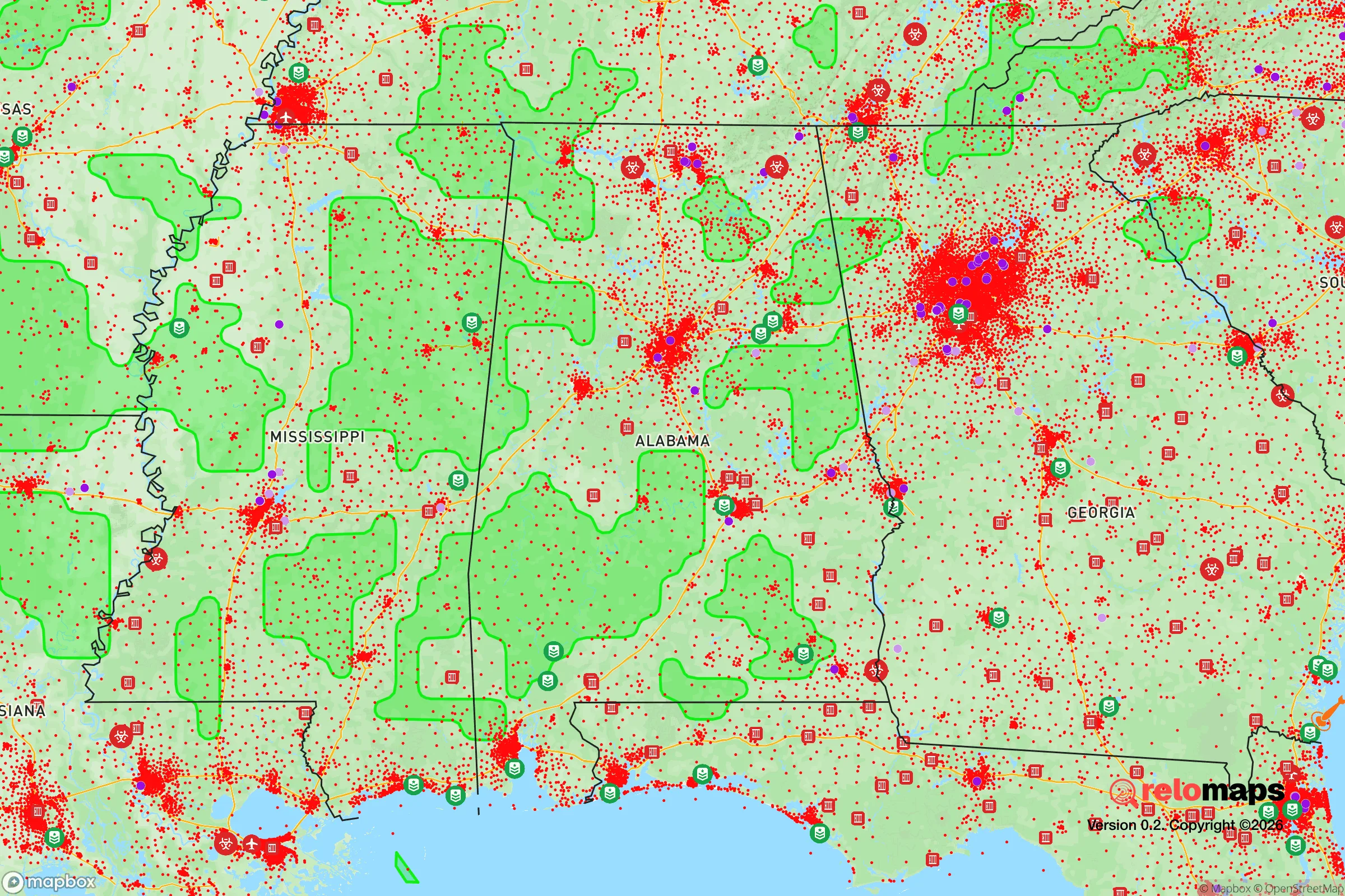
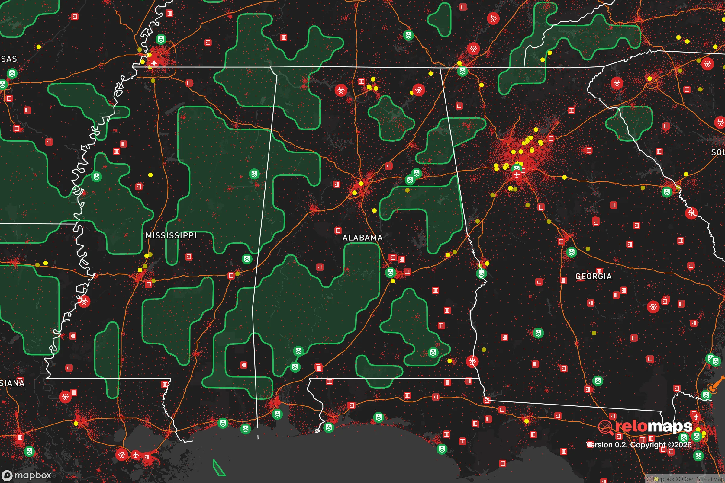
Important Note: For informational purposes only. This does not mean nothing bad ever happens in the green zones. Please use common sense. This is based on public data and modeled with AI. We tried to take a conservative approach but mistakes happen. We update this regularly as new information becomes available.
Solar Generator Recommendations
Backup power matters more here than in safer locations. We've picked three solar generators across budgets and capacity tiers — start with the budget unit if you only need a few essentials, or step up if you want to run a fridge and HVAC for days at a time.

Jackery Portable Power Station Explorer 300
Budget OptionPower on the Go: Weighing only 11 lbs, it's convenient to set up and store with book-sized foldable solar panels

BLUETTI Portable Power Station AC180
Designed for both indoor and outdoor scenarios, AC180 is highly capable as it has a robost capacity and continuous output power.

EF ECOFLOW DELTA Pro Ultra Power Station
Upgraded PickEcoFlow DELTA Pro Ultra is a whole-home energy system designed to grow with your family. Integrated with the Smart Home Panel 2, it scales to meet your evolving energy needs — keeping your home powered, intelligent, and secure through every stage of life.
We earn a commission, at no additional cost to you.
Strategic Assessment Analysis
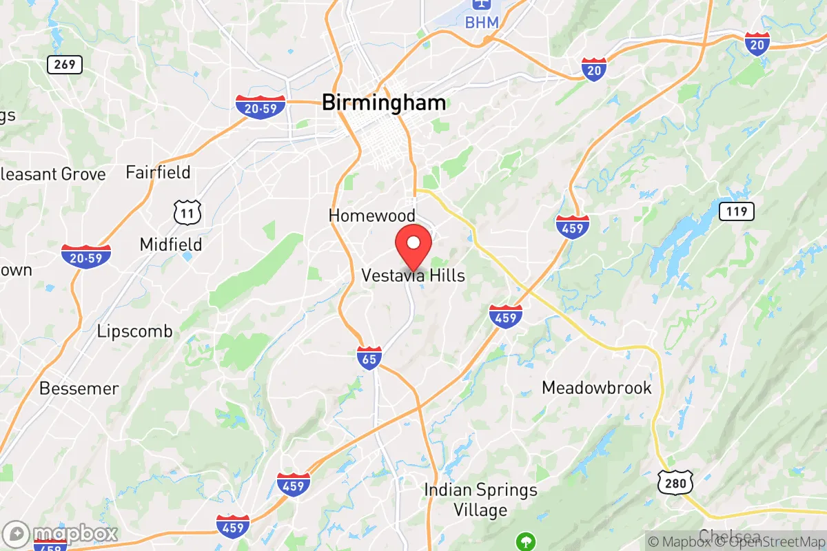
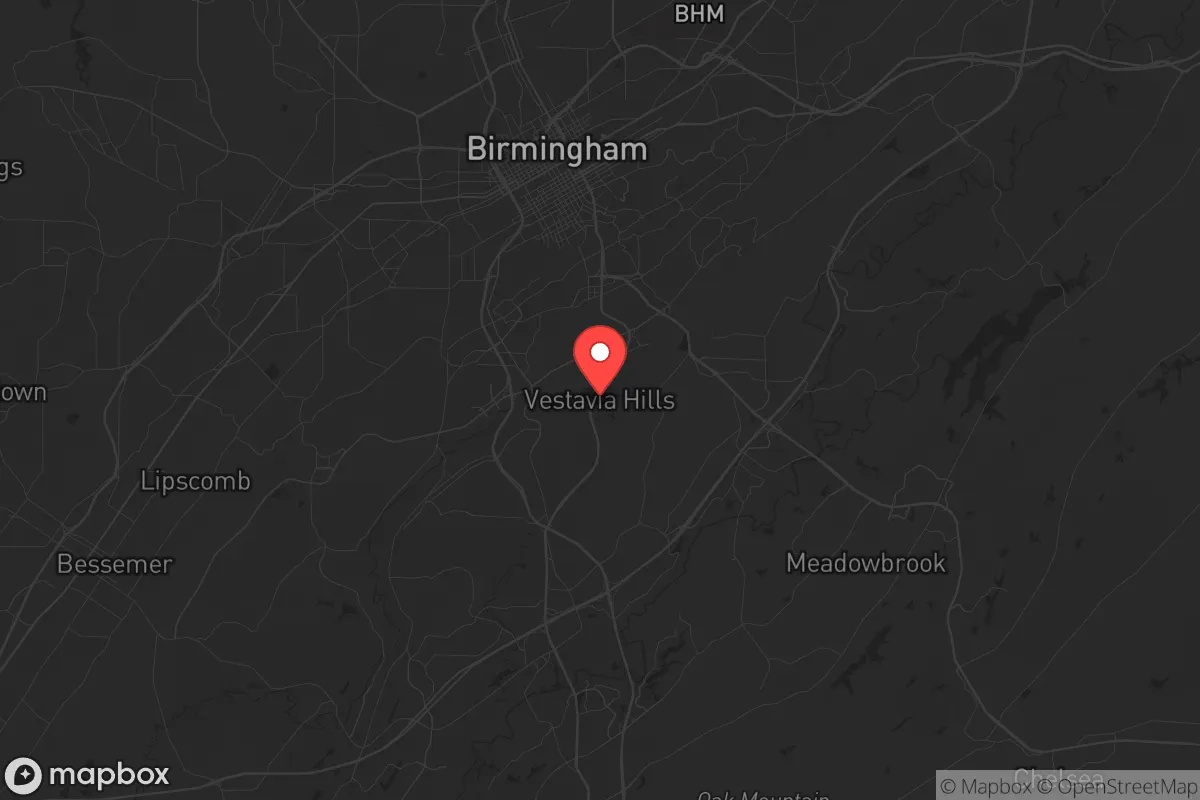
Vestavia Hills, Alabama, sits atop the ridge line that defines Birmingham’s southern suburbs, and from a strategic relocation standpoint, that elevation is more than a scenic bonus—it’s a defensive asset. The city’s position on the crest of Shades Mountain gives it natural drainage advantages, cooler summer temperatures by a few degrees than the valley floor, and a commanding view of approaches from the north and east. For someone thinking in terms of long-term stability, Vestavia Hills offers a blend of suburban insulation and proximity to critical infrastructure that few other Birmingham-area communities can match, though the trade-offs are real and worth examining closely.
Geographic position and natural advantages for long-term stability
Vestavia Hills occupies roughly 20 square miles of the Appalachian foothills, with elevations ranging from 600 to over 1,000 feet above sea level. That elevation is not just a comfort factor—it means the area is largely outside the 100-year floodplain, a meaningful consideration as weather patterns become less predictable. The underlying geology is primarily limestone and sandstone, which provides decent drainage and reduces the risk of the kind of foundation problems that plague areas with heavy clay soils. The city is bounded by the Cahaba River to the east and south, a reliable water source that flows year-round and is less prone to contamination than the industrial waterways closer to downtown Birmingham. The river also creates a natural buffer zone; the Cahaba River Wildlife Management Area and several nature preserves along its banks mean that development is limited on the eastern flank, reducing the chance of urban creep from that direction. For a relocator thinking about defensible space, that’s a meaningful advantage—fewer entry points to monitor, and a green corridor that can serve as both a resource and a barrier.
Risks, exposures, and proximity to fallout-relevant landmarks
The most significant strategic downside of Vestavia Hills is its proximity to Birmingham, which sits just 7 miles north. Birmingham is a major transportation and industrial hub, with rail yards, chemical plants, and the University of Alabama at Birmingham (UAB) medical complex—a massive 168-acre campus that would be a primary target in any large-scale disruption, whether natural or man-made. The city is also within 15 miles of the Birmingham-Shuttlesworth International Airport, a FedEx hub and potential point of origin for supply chain disruptions or civil unrest. Interstate 65 runs along the western edge of Vestavia Hills, and I-459 cuts through the southern portion; these are evacuation routes in a crisis, but they are also choke points that could become impassable during a mass evacuation event. The area is not in a designated hurricane zone, but it sits in the heart of Dixie Alley, where tornado activity is a genuine seasonal risk—the April 2011 super outbreak produced an EF-4 that tracked within 10 miles of the city. Earthquake risk is low, but the Birmingham area has experienced minor tremors from mining-related subsidence. For the prepper mindset, the biggest exposure is population density: Vestavia Hills itself has about 35,000 residents, but the greater Birmingham metro pushes 1.1 million. In a grid-down scenario, that many people within a 20-mile radius means competition for resources will be fierce, and the suburbs will not be immune to spillover from the urban core.
Practical resilience for a relocator: food, water, energy, and defensibility
Water is the first concern, and Vestavia Hills has a mixed picture. The city draws its municipal water from the Cahaba River and the Birmingham Water Works system, which treats and distributes from the Shades Mountain Filter Plant—a facility that sits on the ridge itself. In a prolonged power outage, that plant would be a critical point of failure; the system has backup generators, but fuel resupply is a vulnerability. For a relocator, the presence of the Cahaba River within a 10-minute drive from most neighborhoods is a significant asset, provided you have the means to treat or filter it. The river is generally clean in its upper reaches, but agricultural runoff and occasional sewage overflows during heavy rains are real concerns. Food security is better than in the urban core: Jefferson County has a robust farmers’ market network, and the surrounding areas of Shelby and Blount counties are agricultural, with cattle, poultry, and row crops within a 30-mile radius. The city itself has several grocery stores, but they are concentrated along the main commercial corridors (U.S. 31 and I-65), which would be among the first areas to empty in a crisis. Energy infrastructure is typical for the region: Alabama Power provides electricity from a mix of coal, natural gas, and nuclear (the Browns Ferry plant is about 90 miles northwest). The grid is aging but generally reliable, though ice storms in 2014 and 2022 caused multi-day outages in parts of Vestavia Hills. Solar potential is moderate—the area gets about 210 sunny days per year, which is below the national average but workable for a modest off-grid setup. Defensibility is where Vestavia Hills shines relative to other Birmingham suburbs. The ridge-top layout means many neighborhoods have only one or two access roads, and the terrain is hilly enough to provide natural cover. The city has its own police department with about 60 sworn officers, and the fire department is well-equipped, but in a prolonged crisis, law enforcement presence would thin quickly. The community is predominantly single-family homes with yards, which allows for gardening, rainwater collection, and the kind of low-profile self-sufficiency that apartment dwellers cannot achieve. The downside is that most homes are built on slabs or with crawl spaces, not basements—tornado shelters are a worthwhile investment here.
Overall, Vestavia Hills presents a solid B+ on the strategic relocation scorecard. It offers genuine natural advantages—elevation, water access, defensible terrain—and sits far enough from Birmingham’s core to avoid the worst of urban collapse scenarios, yet close enough to access medical care and supply chains when things are stable. The trade-offs are real: the population density of the metro area is a liability in a crisis, and the reliance on a single water treatment plant and a fragile power grid are vulnerabilities that require personal mitigation. For a relocator with a conservative, self-reliant mindset, the key is to treat Vestavia Hills not as a fortress but as a base of operations—a place where you can build relationships with like-minded neighbors, stock supplies, and develop the skills to handle the gaps in the system. If you are willing to invest in backup power, water storage, and a solid community network, this ridge-top suburb can serve as a stable anchor in an increasingly uncertain landscape. Just do not mistake its manicured lawns and good schools for invulnerability—preparation is still the price of admission.
* Values derived from national, state, county, city and local statistics and may differ in a specific area. Last updated: 2026-04-19T19:12:36.000Z
Narrative content on this page is AI-generated and may contain mistakes. Verify any details that matter before acting on them.
ReloMaps may earn a commission from affiliate links at no extra cost to you.