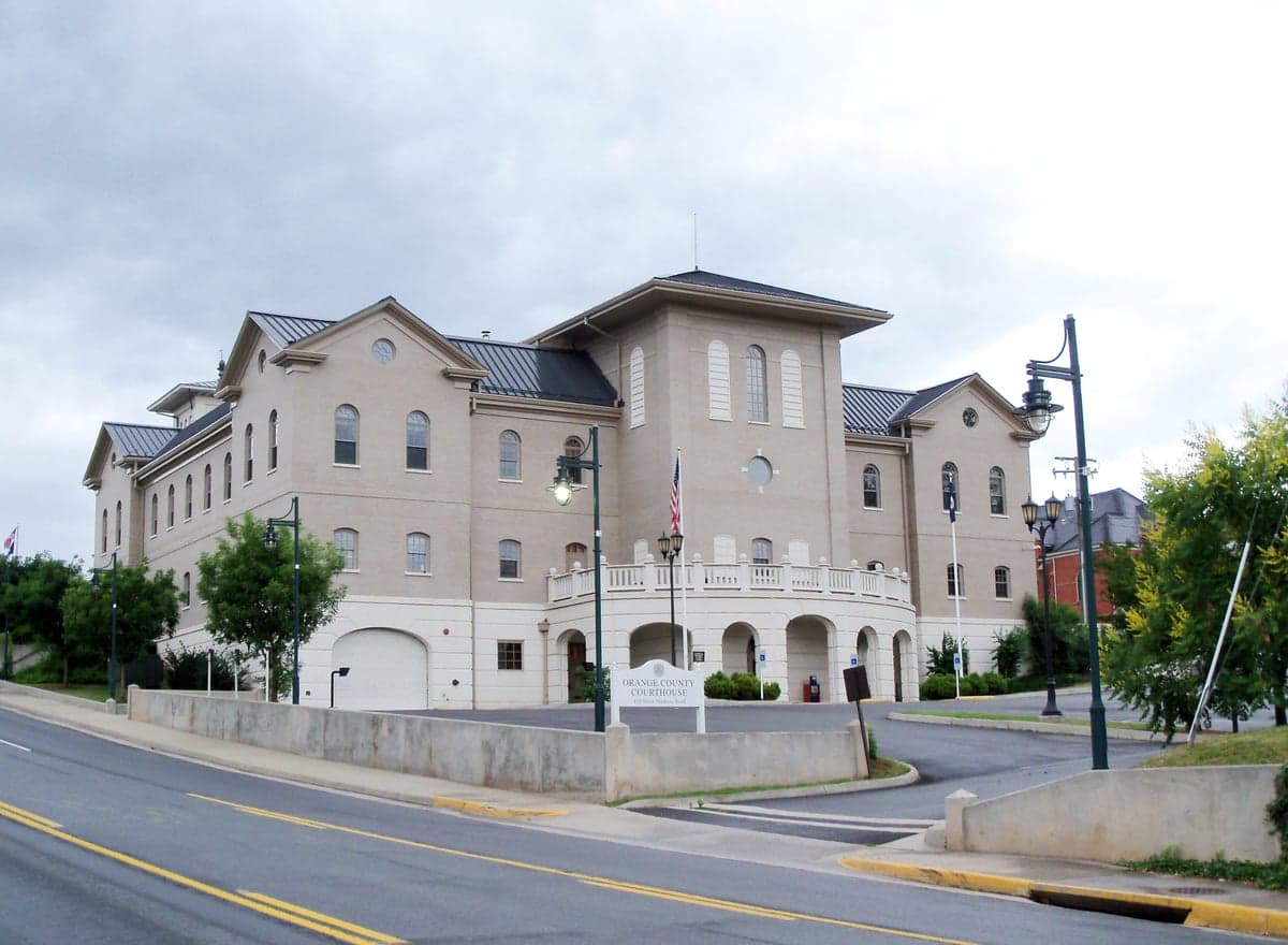
Photo: Wikipedia
Strategic Assessment of Orange County
Workable tactical position. Some exposure to population density or targets, but generally defensible in a crisis.
What does the Strategic Assessment tell us?
Our Strategic Assessment grades tactical survivability of an area. Major population centers, military targets, fallout zones, natural disasters, and border exposure all drive risk — lower exposure means a more defensible position in a crisis.
This is heavily inspired by Joel Skousen's Strategic Relocation book. Highly recommended you checkout the book ($)What does this tell us?
Our Strategic Assessment grades tactical survivability of an area. Major population centers, military targets, fallout zones, natural disasters, and border exposure all drive risk — lower exposure means a more defensible position in a crisis.
This is heavily inspired by Joel Skousen's Strategic Relocation book. Highly recommended you checkout the book ($)Strategic Pillars

Key Distances
Strategic Assessment Analysis
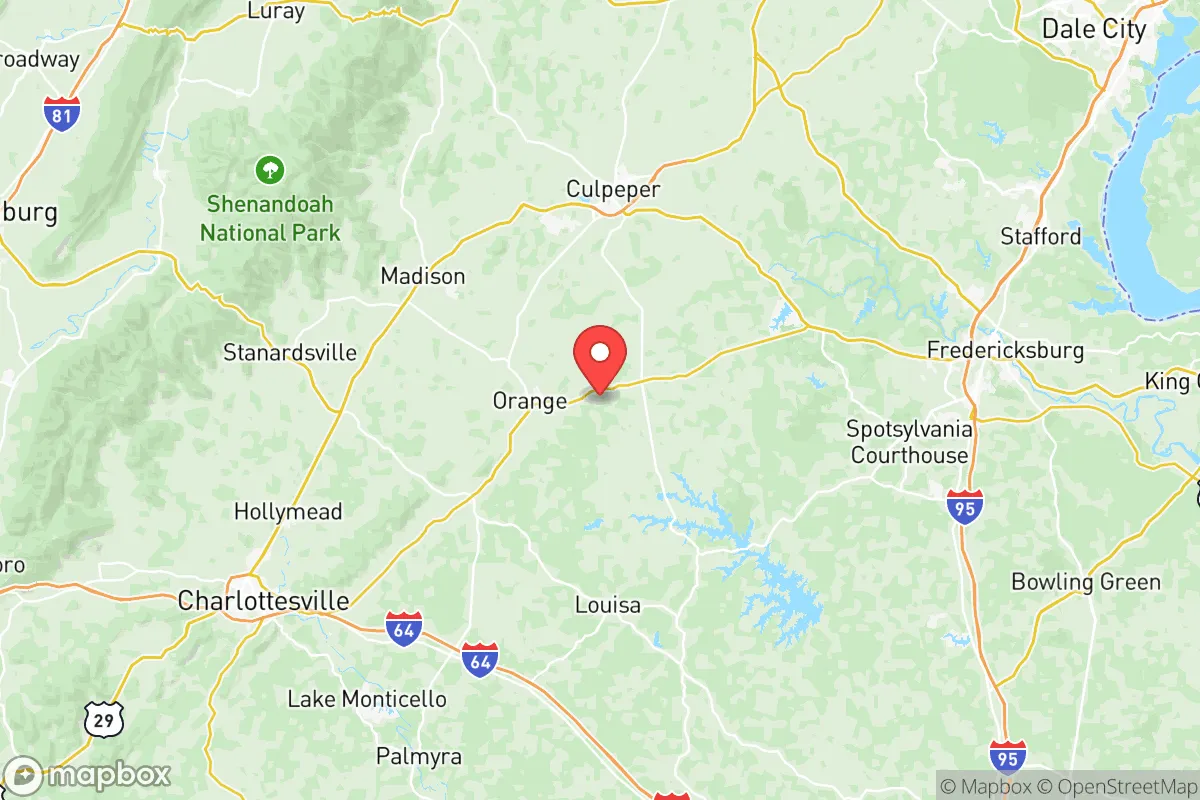
Orange County, Virginia, offers a compelling mix of strategic depth and everyday livability for the relocation-minded reader who values resilience, self-sufficiency, and a buffer from the densest urban corridors. Situated in the Piedmont region, roughly 30 miles northeast of Charlottesville and 70 miles southwest of Washington, D.C., the county occupies a sweet spot: close enough to access major employment and medical hubs, yet far enough to avoid the sprawl, congestion, and primary target risks of the I-95 and I-64 corridors. The area’s resilience profile is anchored by its rural character, low population density (about 14,000 residents across 343 square miles), and a diversified economic base that includes agriculture, light manufacturing, and the growing presence of data centers and renewable energy projects. For a family or individual thinking seriously about disaster readiness and long-term stability, Orange County presents a defensible, resource-rich environment with manageable exposure to both natural and man-made threats.
Geographic position and natural advantages for long-term stability
Orange County’s geography is a first-order asset for resilience. The county sits atop the Piedmont plateau, with elevations ranging from 300 to 600 feet, providing natural drainage and reducing flood risk compared to low-lying coastal or riverine areas. The Rapidan River forms the county’s northern border, and the larger Rappahannock River runs through its eastern edge, offering reliable surface water sources without the catastrophic floodplain exposure seen in communities like Fredericksburg or Richmond. The terrain is rolling hills and mixed hardwood forests, which provide natural cover, moderate temperatures, and ample building sites with good line-of-sight defensibility. The county is also part of the larger Virginia Piedmont region, which has historically been a breadbasket—fertile soils and a moderate climate support small-scale farming, orchards, and livestock operations. The town of Orange, the county seat, sits at the intersection of U.S. Route 15 and State Route 20, providing two-lane road access that is less congested and harder to block than major interstates. For a relocator, this means a location that is naturally buffered from coastal storm surges, major earthquake zones, and the worst of hurricane wind damage, while still being within a two-hour drive of the University of Virginia Medical Center in Charlottesville and the Inova Fairfax Hospital system.
Risks, exposures, and proximity to fallout-relevant landmarks
No location is risk-free, and Orange County’s strategic assessment must account for its proximity to several high-value targets and natural hazards. The most significant man-made risk comes from the county’s location within the broader Washington, D.C., metropolitan area’s outer ring. While Orange itself is 70 miles from the Capitol, the region includes multiple military installations and defense-related facilities within a 100-mile radius: Marine Corps Base Quantico (about 50 miles east), Fort Belvoir (60 miles east), and the Dahlgren Naval Surface Warfare Center (70 miles southeast). Additionally, the North Anna Nuclear Generating Station, a two-unit pressurized water reactor, is located just 20 miles southeast of Orange County in Louisa County. In a worst-case scenario involving a nuclear event or major attack on D.C., Orange County would likely experience fallout patterns depending on wind direction—prevailing winds from the west-northwest would carry fallout away, but a shift could bring contamination. The county also sits near the I-64 corridor, which connects Richmond to Charlottesville and is a potential evacuation route. Natural hazards include occasional tornadoes (rated EF-1 or EF-2 historically), ice storms, and the risk of drought during summer months. The county’s wildfire risk is moderate, with the Virginia Department of Forestry noting that the Piedmont region sees an average of 200-300 wildfires per year, mostly small and human-caused. Flooding is localized to the Rapidan and Rappahannock floodplains, but most residential areas are on higher ground. For the resilience-minded relocator, the key takeaway is that Orange County is not a primary target zone but sits within the secondary risk radius of major military and energy infrastructure—a reality that demands a personal preparedness plan, not panic.
Practical resilience for a relocator: food, water, energy, and defensibility
For a family or individual serious about self-sufficiency, Orange County offers a strong baseline. Food security is a standout: the county has a robust agricultural sector, with over 200 farms producing livestock, hay, corn, soybeans, and vegetables. The Orange County Farmers Market operates year-round in the town of Orange, and there are multiple u-pick orchards and CSAs within a 20-minute drive. The county’s soil and climate support home gardening for most of the year, with a growing season from April to October. Water availability is generally good—the county’s groundwater aquifers are productive, and most rural properties rely on private wells with yields of 5-20 gallons per minute. The town of Orange and the village of Gordonsville have municipal water systems drawing from the Rapidan River, but the majority of the county is on well and septic, which is a resilience advantage in a grid-down scenario. Energy resilience is mixed: the county is served by Dominion Energy, with above-ground power lines that are vulnerable to ice storms and wind. However, the growing presence of data centers (including a major Google facility in neighboring Louisa County) has spurred investment in grid reliability, and many rural properties are well-suited for solar panel installation. The county’s topography allows for passive solar orientation, and wood heating is common—firewood is abundant and affordable. Defensibility is a strong point: the county’s low population density, winding secondary roads, and forested terrain make it difficult for large-scale incursions. The town of Orange itself has a historic downtown with a compact layout, but most residential areas are spread out, providing natural standoff. The county has a sheriff’s office with about 30 sworn deputies, and the Virginia State Police have a presence along Route 15. For a relocator, the practical picture is one of manageable vulnerabilities and high potential for self-reliance, especially if you invest in a well, solar panels, and a wood stove.
The overall strategic picture for Orange County is that of a balanced, low-profile location with genuine resilience advantages for the conservative-leaning family or individual who values preparedness without isolation. It is not a remote bunker—it is a working rural county with a functioning local economy, good schools (Orange County High School and several private options), and a community that leans conservative politically, with the county voting +18 for Trump in 2020. The proximity to Charlottesville and D.C. provides access to specialized medical care, airports, and supply chains, while the county’s own resources—farmland, water, timber, and a growing renewable energy sector—offer a buffer against supply chain disruptions. The risks from nearby military bases and the North Anna nuclear plant are real but manageable with a basic preparedness plan (potassium iodide, a fallout shelter plan, and a go-bag). For the reader thinking seriously about disaster readiness, Orange County represents a smart, middle-ground choice: close enough to civilization to thrive, far enough to survive.

* Values derived from national, state, county, city and local statistics and may differ in a specific area. Last updated: 2026-09-23T19:19:17.000Z
Narrative content on this page is AI-generated and may contain mistakes. Verify any details that matter before acting on them.
ReloMaps may earn a commission from affiliate links at no extra cost to you.

