Photo: Wikipedia
Strategic Assessment of Virginia
Meaningful friction. Expect exposure to either population pressure, blast zones, or natural disaster risk. Consider buying a retreat property.
What does the Strategic Assessment tell us?
Our Strategic Assessment grades tactical survivability of an area. Major population centers, military targets, fallout zones, natural disasters, and border exposure all drive risk — lower exposure means a more defensible position in a crisis.
This is heavily inspired by Joel Skousen's Strategic Relocation book. Highly recommended you checkout the book ($)What does this tell us?
Our Strategic Assessment grades tactical survivability of an area. Major population centers, military targets, fallout zones, natural disasters, and border exposure all drive risk — lower exposure means a more defensible position in a crisis.
This is heavily inspired by Joel Skousen's Strategic Relocation book. Highly recommended you checkout the book ($)Regional Safe Places
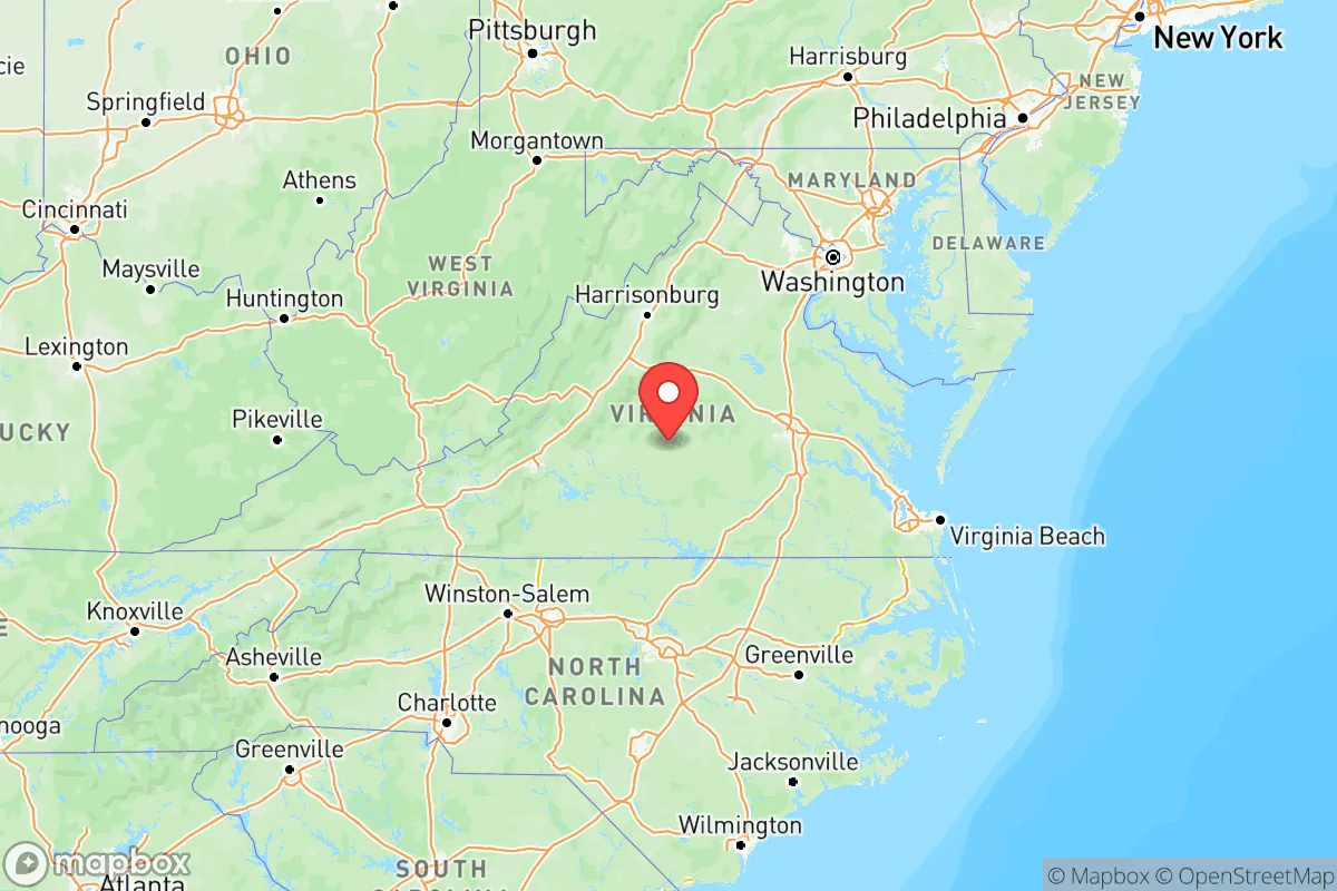
Below is our recommended "safe zones" in Virginia and the surrounding area based on our strategic heuristics. For most people, it's unrealistic to live in a “safe zone” full-time due to work, family or other personal reasons. They tend to be more rural. However, many of these areas are perfect for second homes and retreat properties that double as a vacation home or even a short-term rental.


Important Note: For informational purposes only. This does not mean nothing bad ever happens in the green zones. Please use common sense. This is based on public data and modeled with AI. We tried to take a conservative approach but mistakes happen. We update this regularly as new information becomes available.
Solar Generator Recommendations
Backup power matters more here than in safer locations. We've picked three solar generators across budgets and capacity tiers — start with the budget unit if you only need a few essentials, or step up if you want to run a fridge and HVAC for days at a time.

Jackery Portable Power Station Explorer 300
Budget OptionPower on the Go: Weighing only 11 lbs, it's convenient to set up and store with book-sized foldable solar panels

BLUETTI Portable Power Station AC180
Designed for both indoor and outdoor scenarios, AC180 is highly capable as it has a robost capacity and continuous output power.

EF ECOFLOW DELTA Pro Ultra Power Station
Upgraded PickEcoFlow DELTA Pro Ultra is a whole-home energy system designed to grow with your family. Integrated with the Smart Home Panel 2, it scales to meet your evolving energy needs — keeping your home powered, intelligent, and secure through every stage of life.
We earn a commission, at no additional cost to you.
Strategic Assessment Analysis
Virginia offers a mixed strategic picture for the conservative relocator seeking resilience. The state’s geography—stretching from the Atlantic coast to the Appalachian spine—provides both natural buffers and significant exposure to fallout-relevant targets. While the western half of the state offers defensible terrain and relative isolation from major threats, the eastern corridor is dense with military installations, federal infrastructure, and population centers that make it a high-risk zone in any national crisis scenario. For the prepper or survivalist, the key is understanding that Virginia is not one region but several, each with vastly different risk profiles.
Geographic position and natural advantages for long-term survival
Virginia’s position along the Mid-Atlantic gives it access to multiple escape corridors. The Blue Ridge Mountains and Shenandoah Valley provide rugged, forested terrain with natural chokepoints—useful for anyone planning to bug out from the I-95 corridor. The state’s western counties, such as Bath, Highland, and Grayson, sit at elevations above 3,000 feet, offering cooler temperatures, reliable water sources from springs and creeks, and limited road access that slows both panic-driven urban evacuees and potential looters. The George Washington and Jefferson National Forests cover over 1.8 million acres, giving ample room for dispersed, off-grid living. For the relocator prioritizing defensibility, the Shenandoah Valley’s limestone geology also supports natural caves and root cellars—practical for long-term food storage and shelter from fallout. The downside: Virginia’s central location means it’s within a day’s drive of nearly half the U.S. population, so any major event on the East Coast will send waves of refugees westward through the valley.
Risks, exposures, and proximity to fallout-relevant landmarks
This is where Virginia’s strategic value drops sharply for the prepper. The state hosts some of the most high-value targets on the Eastern Seaboard. Norfolk Naval Station is the world’s largest naval base, home to the Atlantic Fleet—a prime target in any conflict with a peer adversary. Quantico Marine Corps Base and Fort Belvoir near Washington, D.C., are major command and logistics hubs. The Pentagon itself sits just across the Potomac. Any nuclear exchange or large-scale conventional attack would likely render the entire I-95 corridor from Fredericksburg northward uninhabitable for weeks. Additionally, the Dominion Energy North Anna Nuclear Power Station in Louisa County is a dual-reactor facility that, while well-built, becomes a secondary hazard if struck or if grid failures cause cooling issues. For the relocator, living within 50 miles of any of these sites means accepting a high probability of being in a blast zone, fallout plume, or evacuation gridlock. The state’s eastern ports—Newport News Shipbuilding and the Port of Virginia—are also industrial choke points that would attract sabotage or targeting. Even the Richmond metro area, with its concentration of federal agencies and biotech labs, presents a soft-target risk for biological or chemical incidents.
Practical resilience for a relocator: food, water, energy, and defensibility
For those willing to settle in Virginia’s western half, practical resilience is achievable but requires deliberate planning. Water is generally abundant—the James, Roanoke, and Shenandoah river systems drain the mountains, and most rural properties can tap into springs or shallow wells. However, groundwater contamination from agricultural runoff or upstream industrial sites (like the old DuPont plant in Waynesboro) is a concern; testing and filtration are non-negotiable. Food production is viable in the Shenandoah Valley, which has some of the best agricultural soil on the East Coast, but the growing season is shorter than in the Deep South—about 150–180 days. Livestock, especially goats and heritage-breed pigs, do well in the hill country. Energy independence is harder: Virginia’s grid is heavily dependent on natural gas and nuclear, and rural co-ops are slow to restore power after storms. Solar with battery backup is a must, but tree cover in the mountains can limit panel efficiency. Defensibility is strong in the western counties—narrow two-lane roads, steep ridges, and limited cell coverage make it easy to monitor approach routes. But the same isolation means slower emergency response; the nearest hospital in Hot Springs or Marion might be 45 minutes away, and trauma care is even farther. For the single individual or family, this trade-off is acceptable if you stock medical supplies and train in basic field medicine.
The overall strategic picture for Virginia is one of stark regional contrast. The eastern third of the state is a high-risk, high-exposure zone that no serious prepper should consider for a primary residence—too many military targets, too much population density, and too little escape room. The western third, particularly the counties west of the Blue Ridge, offers genuine resilience: defensible terrain, reliable water, and distance from the most likely fallout zones. But it’s not a standalone solution. Virginia’s central location means any national crisis will bring waves of displaced people from the Northeast and Mid-Atlantic, straining local resources. The smart play for the conservative relocator is to treat western Virginia as a secondary retreat or a base for regional networking, not a final redoubt. Pair it with a more remote property in West Virginia or Tennessee for true depth. Virginia works best as a buffer zone—close enough to monitor events in D.C. and Norfolk, far enough to survive the initial shock, but not so isolated that you lose all connection to the outside world. If you’re looking for a place to ride out the storm while staying within striking distance of the action, western Virginia is a solid choice. If you want to disappear entirely, keep looking west.
Top 10 Cities by Strategic Assessment in Virginia


* Values derived from national, state, county, city and local statistics and may differ in a specific area. Last updated: 2026-04-19T08:36:37.000Z
Narrative content on this page is AI-generated and may contain mistakes. Verify any details that matter before acting on them.
ReloMaps may earn a commission from affiliate links at no extra cost to you.