Photo: Wikipedia
Strategic Assessment of Warwick, RI
Multiple tactical vulnerabilities. Population density, target proximity, or disaster risk are likely compounding. A retreat property and exit planning is required.
What does the Strategic Assessment tell us?
Our Strategic Assessment grades tactical survivability of an area. Major population centers, military targets, fallout zones, natural disasters, and border exposure all drive risk — lower exposure means a more defensible position in a crisis.
This is heavily inspired by Joel Skousen's Strategic Relocation book. Highly recommended you checkout the book ($)What does this tell us?
Our Strategic Assessment grades tactical survivability of an area. Major population centers, military targets, fallout zones, natural disasters, and border exposure all drive risk — lower exposure means a more defensible position in a crisis.
This is heavily inspired by Joel Skousen's Strategic Relocation book. Highly recommended you checkout the book ($)Strategic Pillars

Key Distances
Regional Safe Places
Below is our recommended "safe zones" in Rhode Island and the surrounding area based on our strategic heuristics. For most people, it's unrealistic to live in a “safe zone” full-time due to work, family or other personal reasons. They tend to be more rural. However, many of these areas are perfect for second homes and retreat properties that double as a vacation home or even a short-term rental.


Important Note: For informational purposes only. This does not mean nothing bad ever happens in the green zones. Please use common sense. This is based on public data and modeled with AI. We tried to take a conservative approach but mistakes happen. We update this regularly as new information becomes available.
Solar Generator Recommendations
Backup power matters more here than in safer locations. We've picked three solar generators across budgets and capacity tiers — start with the budget unit if you only need a few essentials, or step up if you want to run a fridge and HVAC for days at a time.

Jackery Portable Power Station Explorer 300
Budget OptionPower on the Go: Weighing only 11 lbs, it's convenient to set up and store with book-sized foldable solar panels

BLUETTI Portable Power Station AC180
Designed for both indoor and outdoor scenarios, AC180 is highly capable as it has a robost capacity and continuous output power.

EF ECOFLOW DELTA Pro Ultra Power Station
Upgraded PickEcoFlow DELTA Pro Ultra is a whole-home energy system designed to grow with your family. Integrated with the Smart Home Panel 2, it scales to meet your evolving energy needs — keeping your home powered, intelligent, and secure through every stage of life.
We earn a commission, at no additional cost to you.
Strategic Assessment Analysis
Warwick, Rhode Island, presents a mixed bag for the strategic relocator operating from a prepper or survivalist mindset. Its primary advantage is its position within a state that, while politically aligned with the Northeast corridor, offers a degree of geographic insulation from the densest population centers and a robust, if aging, infrastructure. However, its proximity to Providence, Boston, and the critical infrastructure of the East Coast means that any major civic unrest, mass casualty event, or disaster will ripple through this area with significant force. The key is understanding that Warwick is not a retreat; it is a forward operating base with specific, calculable risks and rewards.
Geographic position and natural advantages for long-term security
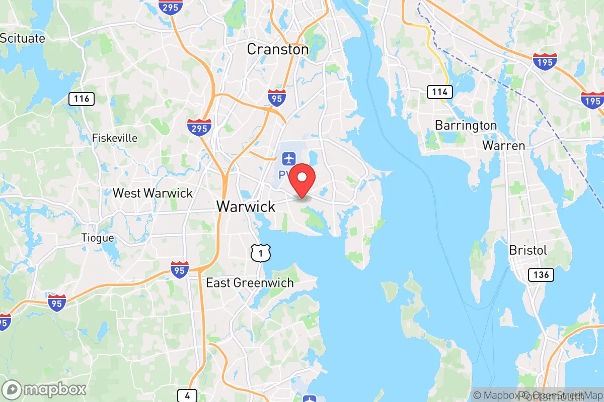
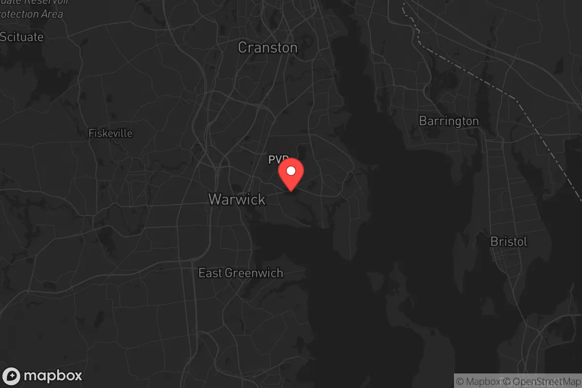
Warwick sits on the western shore of Narragansett Bay, a position that offers both maritime access and a natural buffer from the immediate chaos of a major metropolitan collapse. The city’s location along the I-95 corridor is a double-edged sword, but for the prepared individual, it provides multiple egress routes. The presence of T.F. Green Airport (PVD) is a strategic liability in a crisis—it is a prime target for disruption—but in a pre-crisis phase, it offers rapid evacuation options. The surrounding landscape, including the nearby forests of the Arcadia Management Area and the coastal wetlands, provides limited but real opportunities for off-grid subsistence and water sourcing. The bay itself is a source of seafood and a potential transportation route, though it is also a choke point. The area’s natural advantages are modest: a temperate climate that avoids the extremes of the interior, a reliable rainfall pattern, and proximity to fresh water sources like the Pawtuxet River. For a relocator, the key takeaway is that Warwick is not a self-sufficient wilderness; it is a suburban node with access to natural resources that require significant pre-positioning to exploit effectively.
Risks, exposures, and proximity to high-value fallout targets
The most significant risk for a Warwick-based prepper is its proximity to high-value, high-density targets. Providence is 12 miles north, Boston is 60 miles north, and the submarine base at Naval Station Newport is a direct line across the bay. In a scenario involving a mass casualty event, a nuclear incident, or a coordinated attack on critical infrastructure, Warwick is within the fallout zone of multiple potential targets. The Quonset Business Park, a major industrial and logistics hub, is a secondary risk—it is a concentration of fuel depots, warehousing, and transportation assets that would be a magnet for looting or disruption. The city’s reliance on the I-95 bridge network is a critical vulnerability; a single bridge failure, whether from attack or natural disaster, would effectively sever the city from the rest of the state. Furthermore, the dense suburban layout of much of Warwick means that a biological or chemical event would spread rapidly through the population. The presence of a major airport and a deep-water port means that the area is a likely staging ground for federal response, which in a crisis could mean martial law, checkpoints, and forced evacuations. For the conservative-minded relocator, the calculus is clear: Warwick offers proximity to resources but at the cost of being in a high-probability zone for both direct and secondary effects of a major event.
Practical resilience for a relocator: food, water, energy, and defensibility
Practical resilience in Warwick requires a deliberate, pre-planned approach. The city’s water supply is drawn from the Scituate Reservoir, a single-point-of-failure system that serves most of the state. A contamination event or infrastructure failure would leave residents dependent on bottled water or private wells, which are rare in the denser neighborhoods. Pre-positioning a minimum of 90 days of water storage is non-negotiable. Food security is similarly dependent on the supply chain; the city has multiple grocery stores, but these would empty within hours of a panic event. Local agriculture is minimal, and the growing season is short (roughly May to October), meaning a long-term grid-down scenario would require a robust seed bank and knowledge of coastal foraging. Energy resilience is a mixed picture. The grid is aging and prone to outages from nor’easters and hurricanes. Solar is viable but requires battery storage, as net metering is less reliable during grid failures. Natural gas is available in most areas, but a pipeline disruption would cut heating and cooking. Defensibility is the weakest point. Warwick is a sprawling, low-density suburb with few natural chokepoints. The best option for a relocator is a property on the western edge, near the Coventry line, where larger lots and wooded areas provide some buffer. A home with a basement, a well, and a wood-burning stove is the gold standard. The city’s police force is professional but would be overwhelmed in a widespread event; personal security, including a well-stocked armory and a neighborhood watch network, is essential. The overall picture is that Warwick is not a fortress, but it can be a viable location for a prepared individual who is willing to invest in hardening their property and building a local network.
The strategic picture for Warwick is one of calculated risk. It offers the benefits of a stable, mid-sized city with access to healthcare, transportation, and a moderate cost of living relative to the rest of New England. For a single individual or a family with a conservative, preparedness-oriented mindset, it is a location that requires constant vigilance and significant pre-positioning of supplies. The proximity to Providence and Boston means that the first 72 hours of any major event will be the most dangerous, as the population surges outward. However, for those who have secured a defensible property, established a water and food cache, and built relationships with like-minded neighbors, Warwick can serve as a viable base of operations. It is not a retreat into the wilderness, but a strategic foothold in a region that, while vulnerable, also offers the resources and infrastructure needed to weather a crisis. The final assessment: Warwick is a location for the active prepper, not the passive survivalist. It demands preparation, not hope.
* Values derived from national, state, county, city and local statistics and may differ in a specific area. Last updated: 2026-04-22T22:51:39.000Z
Narrative content on this page is AI-generated and may contain mistakes. Verify any details that matter before acting on them.
ReloMaps may earn a commission from affiliate links at no extra cost to you.