
Photo: Wikipedia
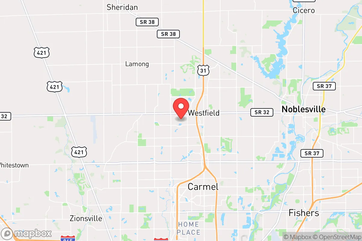
Strategic Assessment of Westfield, IN
Multiple tactical vulnerabilities. Population density, target proximity, or disaster risk are likely compounding. A retreat property and exit planning is required.
What does the Strategic Assessment tell us?
Our Strategic Assessment grades tactical survivability of an area. Major population centers, military targets, fallout zones, natural disasters, and border exposure all drive risk — lower exposure means a more defensible position in a crisis.
This is heavily inspired by Joel Skousen's Strategic Relocation book. Highly recommended you checkout the book ($)What does this tell us?
Our Strategic Assessment grades tactical survivability of an area. Major population centers, military targets, fallout zones, natural disasters, and border exposure all drive risk — lower exposure means a more defensible position in a crisis.
This is heavily inspired by Joel Skousen's Strategic Relocation book. Highly recommended you checkout the book ($)Strategic Pillars

Key Distances
Regional Safe Places
Below is our recommended "safe zones" in Indiana and the surrounding area based on our strategic heuristics. For most people, it's unrealistic to live in a “safe zone” full-time due to work, family or other personal reasons. They tend to be more rural. However, many of these areas are perfect for second homes and retreat properties that double as a vacation home or even a short-term rental.

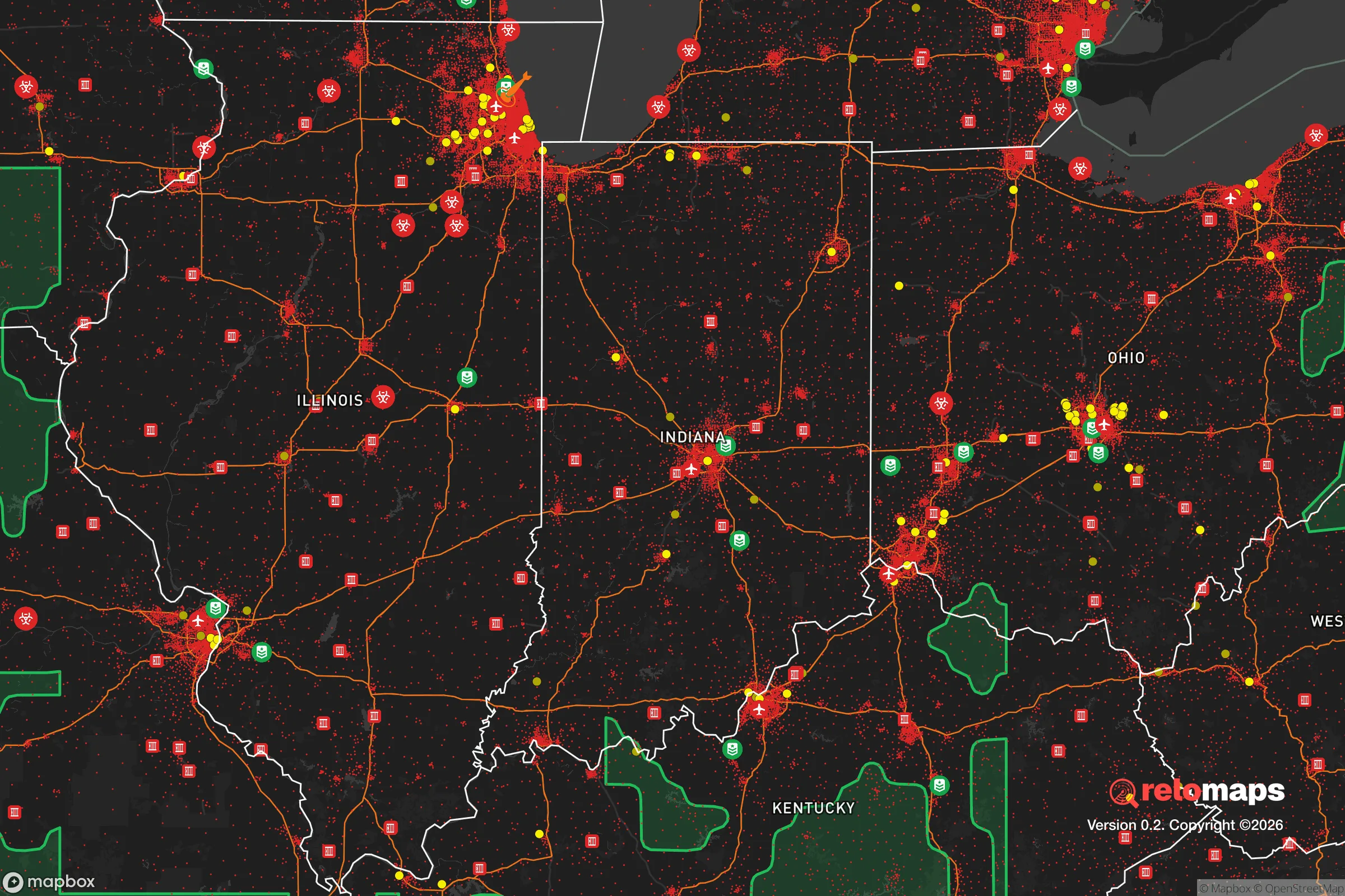
Important Note: For informational purposes only. This does not mean nothing bad ever happens in the green zones. Please use common sense. This is based on public data and modeled with AI. We tried to take a conservative approach but mistakes happen. We update this regularly as new information becomes available.
Solar Generator Recommendations
Backup power matters more here than in safer locations. We've picked three solar generators across budgets and capacity tiers — start with the budget unit if you only need a few essentials, or step up if you want to run a fridge and HVAC for days at a time.

Jackery Portable Power Station Explorer 300
Budget OptionPower on the Go: Weighing only 11 lbs, it's convenient to set up and store with book-sized foldable solar panels

BLUETTI Portable Power Station AC180
Designed for both indoor and outdoor scenarios, AC180 is highly capable as it has a robost capacity and continuous output power.

EF ECOFLOW DELTA Pro Ultra Power Station
Upgraded PickEcoFlow DELTA Pro Ultra is a whole-home energy system designed to grow with your family. Integrated with the Smart Home Panel 2, it scales to meet your evolving energy needs — keeping your home powered, intelligent, and secure through every stage of life.
We earn a commission, at no additional cost to you.
Strategic Assessment Analysis
Westfield, Indiana, sits in a curious strategic pocket: close enough to Indianapolis to access resources and medical infrastructure, yet far enough to avoid the worst of urban collapse scenarios. The city’s growth trajectory—population nearly doubling since 2010 to over 45,000—signals a community that’s building, not decaying, which matters when you’re thinking about long-term stability. Its position along the White River corridor and near major interstate arteries (I-65, I-69, and US 31) gives it both logistical reach and a degree of natural insulation from the kind of cascading failures that plague dense metro cores. For a relocator with a prepper mindset, Westfield offers a rare blend: a functioning small-city infrastructure with enough distance from the worst fallout zones to buy you time.
Geographic position and natural advantages for long-term stability
Westfield’s geography is its first line of defense. The city sits on the Tipton Till Plain, a flat, fertile expanse that historically made this area a breadbasket—and that soil still supports local agriculture today. The White River flows just west of town, providing a surface water source that, while not pristine, is treatable with basic filtration. The area’s aquifer depth (roughly 100-200 feet) means private wells are feasible for those who want off-grid water security, though you’ll need to test for agricultural runoff. The terrain itself is gently rolling, offering no dramatic defensible high ground, but the lack of major natural barriers also means no chokepoints that funnel unrest into the city. What Westfield lacks in dramatic geography, it makes up for in agricultural self-sufficiency: Hamilton County is among Indiana’s top producers of corn and soybeans, and the surrounding farmland means food production isn’t a hypothetical—it’s the local economy. The climate is continental, with cold winters that can be harsh but also serve as a natural deterrent to sustained civil unrest (people stay inside). Tornado risk is real—Indiana averages 20-30 tornadoes annually—but Westfield’s position in the central part of the state puts it slightly west of the more active “Hoosier Alley” corridor. For a prepper, the key takeaway is that this is a place where you can grow food, access water, and hunker down without the constant threat of coastal flooding, wildfire, or seismic activity.
Risks, exposures, and proximity to fallout-relevant landmarks
No strategic assessment is honest without naming the threats. Westfield’s biggest liability is its proximity to Indianapolis—roughly 20 miles south. While that distance provides a buffer, it’s not enough to insulate you from the fallout of a major urban disaster. If civil unrest, a terrorist attack, or a grid-down event hits the Indianapolis metro (population 2 million), expect a refugee flow north along US 31 and I-65. Westfield sits directly in that funnel. The city’s own population density is low enough to absorb some influx, but the infrastructure—roads, hospitals, food supply—is not designed for a sudden doubling. More concerning is the proximity to critical infrastructure targets: the Indianapolis International Airport (a major FedEx hub) and the Plainfield rail yard are both within 30 miles. A coordinated attack or EMP event hitting those nodes would ripple north quickly. On the plus side, Westfield is far from any nuclear power plant (the nearest is Cook Nuclear Plant in Michigan, 120 miles away) and has no major military bases within 50 miles that would be primary targets. The biggest industrial risk is the BP Whiting Refinery in northwest Indiana (150 miles away), but that’s far enough to avoid direct blast effects. For the prepper, the calculus is: you’re not in the blast zone, but you’re in the evacuation zone. That means you need a plan for the first 72 hours of any major event—either to secure your property or to move further north toward Kokomo or rural Miami County.
Practical resilience for a relocator: food, water, energy, and defensibility
Let’s get tactical. Water: Westfield’s municipal supply comes from the White River and groundwater wells, treated at the Westfield Water Treatment Plant. In a grid-down scenario, that plant stops. Your backup should be a well (permitted and drilled to at least 100 feet) or a rainwater catchment system—the area gets about 40 inches of rain annually, enough to sustain a household with proper storage. The White River itself is a last-resort source, but plan on heavy filtration and boiling due to agricultural runoff. Food: The local farmers’ market operates May through October, but for year-round security, you want acreage. Zoning in Westfield’s outskirts allows for small-scale livestock (chickens, goats) and gardens on lots as small as one acre. The city’s growth has pushed farmland further out, but within a 10-mile radius, you can still find parcels with agricultural zoning. Energy: Duke Energy provides the grid, and outages are common during storms (typically 2-4 hours, but ice storms can stretch to days). Solar is viable—Indiana gets about 4.5 peak sun hours daily—but net metering policies are less favorable than in states like California. A generator running on propane or natural gas is the more practical backup, and Westfield’s gas infrastructure is reliable. Defensibility: This is the weak point. Westfield is a suburban grid with multiple entry points and no natural barriers. Your best bet is a property on a cul-de-sac or at the end of a gravel road in the unincorporated areas north of town (near 236th Street or east of SR 31). The local police department is well-funded (Hamilton County is one of Indiana’s wealthiest), but in a SHTF scenario, response times will stretch. Community: This is where the conservative angle matters. Westfield’s population is predominantly white, middle-to-upper class, and politically red (Hamilton County voted +18 R in 2024). That doesn’t guarantee neighborly cooperation, but it does mean a higher baseline of self-reliance and lower crime rates (violent crime is about 1/3 the national average). Church networks and local gun culture are strong—there are three gun shops within city limits and a shooting range at the Hamilton County 4-H Fairgrounds. For a prepper, the social fabric here is more resilient than in a blue urban core, but it’s not a survivalist compound. You’ll need to build relationships before the crisis.
The overall strategic picture for Westfield is one of moderate security with manageable risks. It’s not a remote bunker location—you’re 20 miles from a major city and 30 miles from critical infrastructure targets. But it’s also not a high-risk coastal zone or a dense urban kill box. The area offers genuine advantages: fertile soil, reliable water, a conservative social base, and a growing economy that means your property value won’t crater in a downturn. The downsides are the refugee corridor risk and the lack of natural defensibility. For a single individual or family willing to invest in a well, solar, and a solid perimeter plan, Westfield provides a realistic base for riding out the next decade’s turbulence. The smart play is to buy on the northern edge, stock for 90 days, and get to know your neighbors before you need them. This isn’t a place to disappear—it’s a place to dig in and build a network. In a world where the grid is fragile and the cities are tinderboxes, that’s a solid bet.
* Values derived from national, state, county, city and local statistics and may differ in a specific area. Last updated: 2026-04-22T12:25:36.000Z
Narrative content on this page is AI-generated and may contain mistakes. Verify any details that matter before acting on them.
ReloMaps may earn a commission from affiliate links at no extra cost to you.