Photo: Wikipedia
Strategic Assessment of Westfield, MA
Multiple tactical vulnerabilities. Population density, target proximity, or disaster risk are likely compounding. A retreat property and exit planning is required.
What does the Strategic Assessment tell us?
Our Strategic Assessment grades tactical survivability of an area. Major population centers, military targets, fallout zones, natural disasters, and border exposure all drive risk — lower exposure means a more defensible position in a crisis.
This is heavily inspired by Joel Skousen's Strategic Relocation book. Highly recommended you checkout the book ($)What does this tell us?
Our Strategic Assessment grades tactical survivability of an area. Major population centers, military targets, fallout zones, natural disasters, and border exposure all drive risk — lower exposure means a more defensible position in a crisis.
This is heavily inspired by Joel Skousen's Strategic Relocation book. Highly recommended you checkout the book ($)Strategic Pillars

Key Distances
Regional Safe Places
Below is our recommended "safe zones" in Massachusetts and the surrounding area based on our strategic heuristics. For most people, it's unrealistic to live in a “safe zone” full-time due to work, family or other personal reasons. They tend to be more rural. However, many of these areas are perfect for second homes and retreat properties that double as a vacation home or even a short-term rental.


Important Note: For informational purposes only. This does not mean nothing bad ever happens in the green zones. Please use common sense. This is based on public data and modeled with AI. We tried to take a conservative approach but mistakes happen. We update this regularly as new information becomes available.
Solar Generator Recommendations
Backup power matters more here than in safer locations. We've picked three solar generators across budgets and capacity tiers — start with the budget unit if you only need a few essentials, or step up if you want to run a fridge and HVAC for days at a time.

Jackery Portable Power Station Explorer 300
Budget OptionPower on the Go: Weighing only 11 lbs, it's convenient to set up and store with book-sized foldable solar panels

BLUETTI Portable Power Station AC180
Designed for both indoor and outdoor scenarios, AC180 is highly capable as it has a robost capacity and continuous output power.

EF ECOFLOW DELTA Pro Ultra Power Station
Upgraded PickEcoFlow DELTA Pro Ultra is a whole-home energy system designed to grow with your family. Integrated with the Smart Home Panel 2, it scales to meet your evolving energy needs — keeping your home powered, intelligent, and secure through every stage of life.
We earn a commission, at no additional cost to you.
Strategic Assessment Analysis
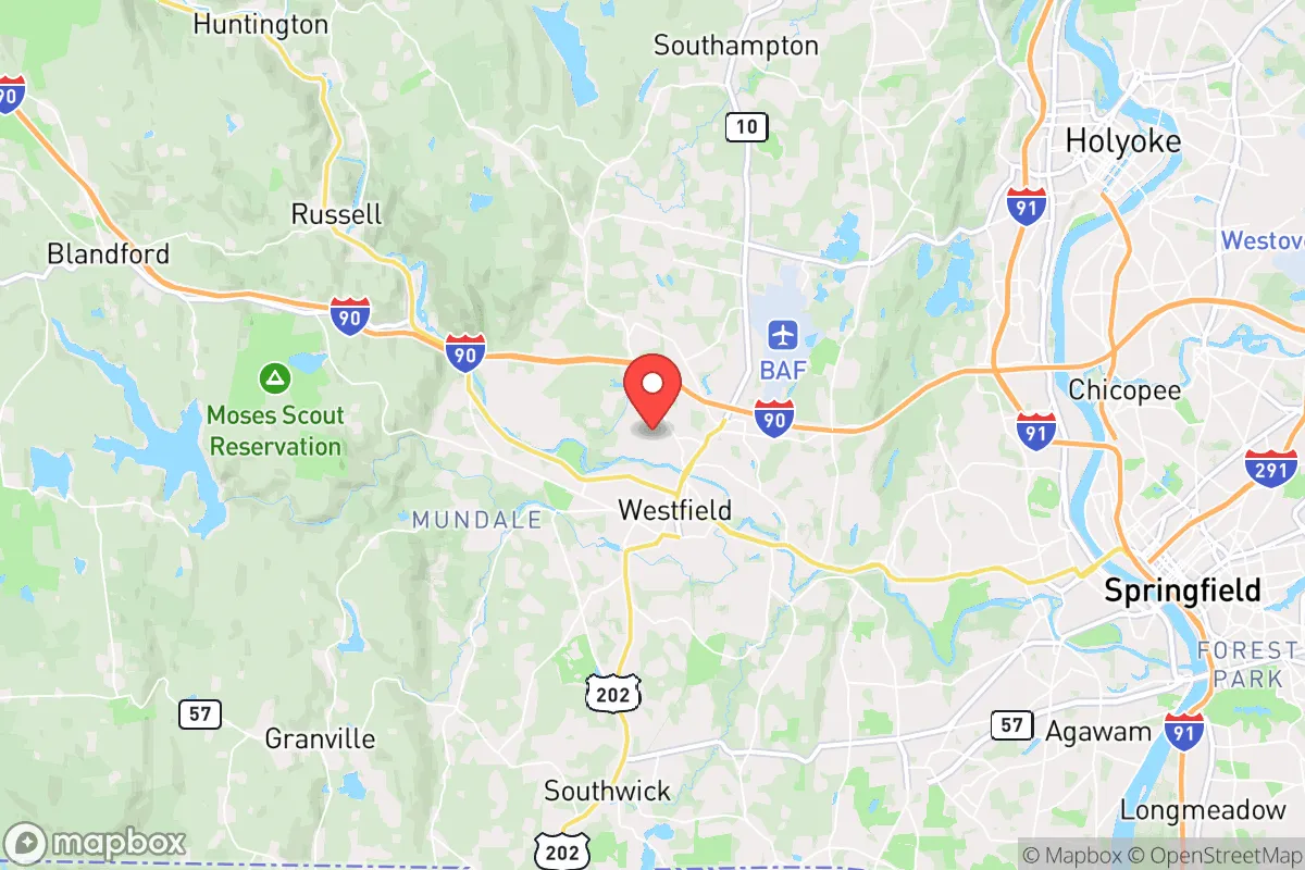
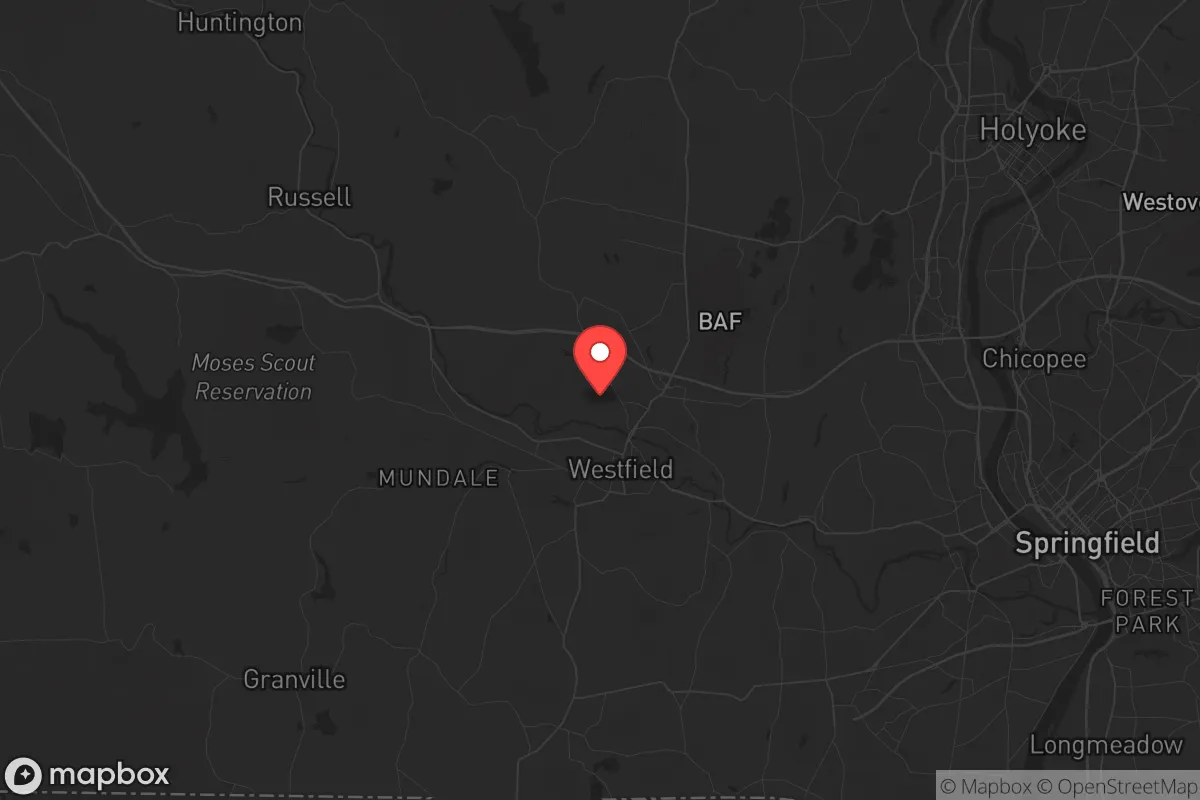
Westfield, Massachusetts, sits in a geographic pocket that offers a mixed bag for the strategic relocator. Its position along the Westfield River and I-90 gives it logistical access, but that same connectivity is a double-edged sword in a crisis scenario. For those thinking in terms of resilience—food security, water access, and defensibility—Westfield provides some genuine advantages, but it also sits uncomfortably close to several high-value targets that could become fallout zones or chokepoints during civil unrest or a major disaster. The key is understanding where the real risks lie and whether the area’s natural buffers are enough to offset its proximity to larger population centers.
Geographic position and natural advantages for long-term survival
Westfield’s location in the Pioneer Valley, roughly 10 miles west of Springfield and 30 miles north of Hartford, places it at the western edge of the Connecticut River corridor. This puts it within a day’s drive of Boston, New York, and Albany—which is a liability for security but an asset for pre-disaster supply runs. The area is ringed by the Berkshire Hills to the west and the Holyoke Range to the north, offering natural terrain that can slow movement and provide cover. The Westfield River, a major tributary of the Connecticut, runs through the city and provides a reliable surface water source, though it’s not potable without treatment. The surrounding farmland in Hampden County is some of the most productive in New England, with a strong local farming community that includes orchards, dairy operations, and vegetable growers. For a relocator, this means local food production is viable year-round, especially if you secure land or build relationships with growers before a crisis hits. The area’s moderate climate—cold winters but not extreme—allows for four-season gardening with proper infrastructure, and the ample rainfall (averaging 45 inches per year) reduces dependence on irrigation. The real natural advantage here is the combination of water, arable soil, and forest cover for timber and game. The Berkshires to the west also act as a buffer against coastal storm surges and provide a retreat zone if the Connecticut River valley becomes contested.
Risks, exposures, and proximity to fallout-relevant landmarks
The biggest strategic downside of Westfield is its proximity to Springfield, a city of roughly 150,000 that has seen significant economic decline and periodic civil unrest. In a mass casualty event or societal collapse scenario, Springfield’s population could become a source of refugees moving west along I-90, directly through Westfield. The city itself is not a primary nuclear target—no major military bases or command centers are nearby—but it sits within the fallout plume zone of several potential targets. The Westover Air Reserve Base in Chicopee, just 8 miles east, is a major Air Force Reserve and Air National Guard installation with a large fuel depot and aircraft storage. That’s a legitimate target in a conflict with a near-peer adversary. Similarly, the Bradley Air National Guard Base in Windsor Locks, Connecticut, 20 miles south, is another high-value military asset. Fallout from a strike on either base could contaminate the Westfield area depending on wind direction, especially if prevailing westerlies shift. The Connecticut River itself is a major transportation corridor for hazardous materials, including ammonia and chlorine, which are shipped by rail and barge. A derailment or industrial accident—like the 2013 Lac-Mégantic disaster—could release toxic clouds that drift into the valley. Westfield also has its own industrial risks: the city hosts a large chemical plant (formerly a Monsanto facility, now operated by Solvay) that produces specialty chemicals. A fire or explosion there could render parts of the city uninhabitable for days. For the prepper, the takeaway is that Westfield is not a remote sanctuary—it’s a suburban buffer zone with real exposure to both man-made and natural cascading failures.
Practical resilience for a relocator: food, water, energy, and defensibility
For someone serious about self-sufficiency, Westfield offers a workable but not ideal baseline. The city’s water supply comes from the Westfield River and several reservoirs in the nearby Granville State Forest, but the municipal system is vulnerable to power outages and contamination. Private wells are common in the outlying areas of town, especially west of the city center, and those provide a more resilient water source if you have a hand pump or solar-powered backup. The soil in the river valley is rich loam, excellent for growing vegetables, but the growing season is only about 150 days—short by national standards. You’ll need cold frames or a greenhouse to extend it. The local energy grid is part of the ISO New England system, which has faced reliability issues during winter storms. Solar is viable here, with about 200 sunny days per year, but you’ll need battery storage to handle the long, overcast stretches. Wood heat is a strong option: the surrounding forests are predominantly hardwood (oak, maple, birch), and firewood permits are available from state forests. Defensibility is the weak point. Westfield is a classic New England town with a dense downtown and sprawling suburban neighborhoods. There are no natural chokepoints that make the city easy to defend—the river is fordable in several spots, and the interstate provides easy access for outsiders. The best bet for a relocator is to buy land in the western part of town, toward the Granville line, where lots are larger, tree cover is dense, and the terrain becomes hillier. That area offers better line of sight and more difficult approach routes. The local gun culture is present but not dominant; Massachusetts has strict firearms laws, including an assault weapons ban and a licensing system that requires a Firearms Identification Card (FID) or License to Carry (LTC). You can own rifles and shotguns, but magazine capacity is limited to 10 rounds, and suppressors are illegal. For a prepper, this is a significant limitation—you’ll need to train with what’s legal and consider alternative defensive tools like bows, crossbows, or less-lethal options. The community itself is a mixed bag: Westfield has a strong sense of local identity, with a population of about 41,000 that is predominantly white and working-class. There are active farming and hunting communities, but also a significant college population (Westfield State University) that could become a transient burden in a crisis. Building relationships with local farmers and tradespeople before things go sideways is essential—they’ll be the ones with the skills and resources you need.
Overall, Westfield is a location for the prepper who wants to be close enough to urban resources to stock up before a crisis but far enough to have a fighting chance when things break down. It’s not a bug-out destination—it’s a live-in-place option with moderate risks and moderate rewards. The proximity to Springfield and the military bases means you cannot ignore the possibility of fallout or refugee flows. But the natural resources—water, timber, farmland—are real, and the terrain offers some buffer if you choose your specific plot wisely. For a single individual or a family willing to invest in off-grid infrastructure and build local ties, Westfield can work. Just don’t mistake it for a fortress. It’s a foothold, not a final redoubt.
* Values derived from national, state, county, city and local statistics and may differ in a specific area. Last updated: 2026-05-01T11:37:58.000Z
Narrative content on this page is AI-generated and may contain mistakes. Verify any details that matter before acting on them.
ReloMaps may earn a commission from affiliate links at no extra cost to you.