Photo: Wikipedia
Strategic Assessment of Westhampton, NY
Meaningful friction. Expect exposure to either population pressure, blast zones, or natural disaster risk. Consider buying a retreat property.
What does the Strategic Assessment tell us?
Our Strategic Assessment grades tactical survivability of an area. Major population centers, military targets, fallout zones, natural disasters, and border exposure all drive risk — lower exposure means a more defensible position in a crisis.
This is heavily inspired by Joel Skousen's Strategic Relocation book. Highly recommended you checkout the book ($)What does this tell us?
Our Strategic Assessment grades tactical survivability of an area. Major population centers, military targets, fallout zones, natural disasters, and border exposure all drive risk — lower exposure means a more defensible position in a crisis.
This is heavily inspired by Joel Skousen's Strategic Relocation book. Highly recommended you checkout the book ($)Strategic Pillars

Key Distances
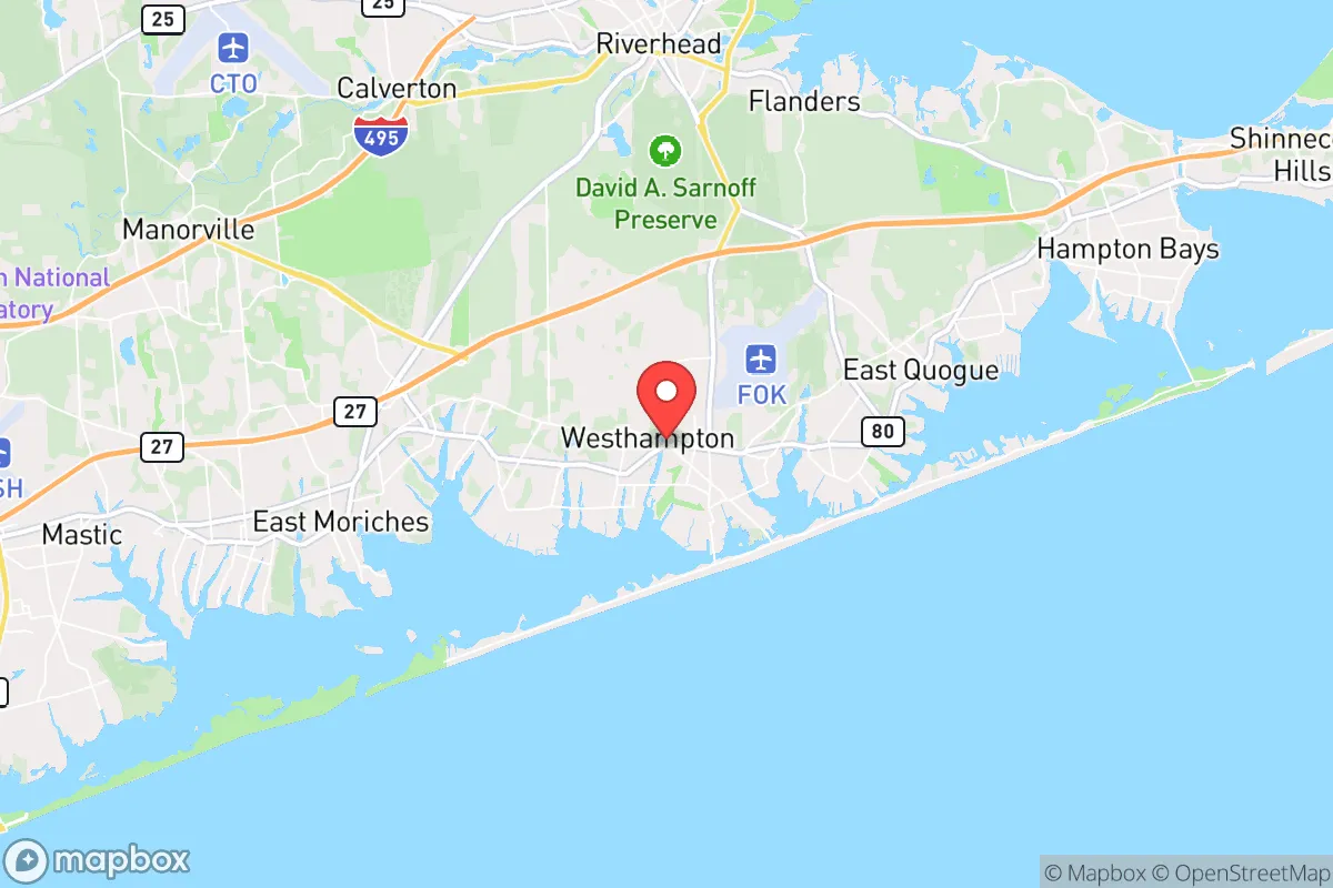
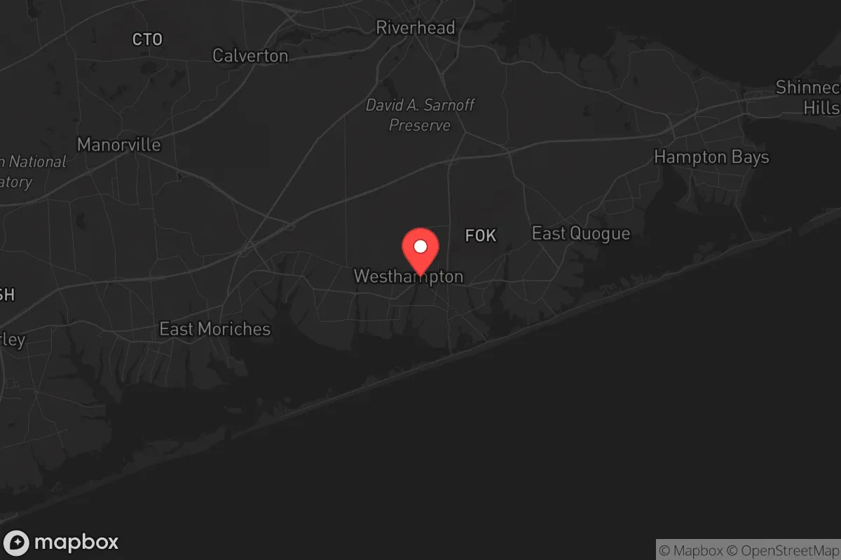
Regional Safe Places
Below is our recommended "safe zones" in New York and the surrounding area based on our strategic heuristics. For most people, it's unrealistic to live in a “safe zone” full-time due to work, family or other personal reasons. They tend to be more rural. However, many of these areas are perfect for second homes and retreat properties that double as a vacation home or even a short-term rental.


Important Note: For informational purposes only. This does not mean nothing bad ever happens in the green zones. Please use common sense. This is based on public data and modeled with AI. We tried to take a conservative approach but mistakes happen. We update this regularly as new information becomes available.
Solar Generator Recommendations
Backup power matters more here than in safer locations. We've picked three solar generators across budgets and capacity tiers — start with the budget unit if you only need a few essentials, or step up if you want to run a fridge and HVAC for days at a time.

Jackery Portable Power Station Explorer 300
Budget OptionPower on the Go: Weighing only 11 lbs, it's convenient to set up and store with book-sized foldable solar panels

BLUETTI Portable Power Station AC180
Designed for both indoor and outdoor scenarios, AC180 is highly capable as it has a robost capacity and continuous output power.

EF ECOFLOW DELTA Pro Ultra Power Station
Upgraded PickEcoFlow DELTA Pro Ultra is a whole-home energy system designed to grow with your family. Integrated with the Smart Home Panel 2, it scales to meet your evolving energy needs — keeping your home powered, intelligent, and secure through every stage of life.
We earn a commission, at no additional cost to you.
Strategic Assessment Analysis
Westhampton, New York, occupies a unique strategic position on Long Island’s South Fork, offering a blend of coastal isolation and proximity to critical infrastructure that demands careful evaluation from a preparedness standpoint. Its location roughly 75 miles east of Manhattan places it beyond the immediate blast radius of a major urban event, yet close enough to regional supply chains and medical hubs to avoid total self-reliance. The area’s resilience is rooted in its geography—a barrier beach peninsula with limited road access—which naturally restricts both casual traffic and potential threats, but also creates chokepoints that could become liabilities during a mass evacuation or civil unrest scenario.
Geographic position and natural defensive advantages
Westhampton sits on the eastern end of the barrier island system that shields the South Shore, with the Atlantic Ocean to the south and Moriches Bay to the north. This configuration provides a natural moat effect: the only vehicular access is via the William Floyd Parkway (Suffolk County Road 46) and the Sunrise Highway (NY-27) bridge over the bay. In a grid-down or civil unrest scenario, these two bridges become both a lifeline and a vulnerability. The surrounding wetlands, pine barrens, and tidal marshes offer limited cover for foot traffic, making the area relatively defensible against large-scale incursions. The local topography is flat and sandy, with no significant elevation changes, but the dense scrub oak and pitch pine forests of the nearby Pine Barrens provide excellent concealment for cached supplies or retreat positions. The Atlantic coastline offers a potential maritime escape route, though small craft would be exposed in open water during severe weather. The area’s position relative to the New York City metroplex—roughly a 90-minute drive under normal conditions—means that fallout from a nuclear detonation in Manhattan would likely be carried east by prevailing westerly winds, placing Westhampton in a moderate risk zone for radioactive particulate deposition, though far less severe than western Long Island or New York City proper.
Risks, exposures, and proximity to fallout-relevant landmarks
The most significant strategic liability is Westhampton’s proximity to the Brookhaven National Laboratory, located about 20 miles west in Upton. This Department of Energy research facility houses several nuclear reactors, including the High Flux Beam Reactor, and stores radioactive materials. A catastrophic accident or targeted attack on Brookhaven could release a plume that would sweep eastward over Westhampton within hours. Additionally, the area lies within 50 miles of the Indian Point Energy Center (now decommissioned but still storing spent fuel) and the Millstone Nuclear Power Station in Connecticut, both of which represent potential fallout sources. The Long Island Power Authority’s grid is heavily dependent on submarine cables from New Jersey and Connecticut, making the region vulnerable to cascading blackouts if those interconnections are severed. Westhampton is also directly in the path of Atlantic hurricane tracks; Superstorm Sandy in 2012 caused widespread flooding and power outages lasting up to two weeks in some parts of the South Fork. The area’s low elevation—much of it at sea level—makes it susceptible to storm surge, with the barrier island’s narrow width meaning that a Category 3 or higher storm could cut off road access entirely. For the conservative relocator concerned with civil unrest, the summer tourist season brings an influx of transient populations that could strain local resources and create friction points, particularly during a crisis when outsiders might attempt to flee the city and overwhelm the limited bridge capacity.
Practical resilience for a relocator: food, water, energy, and defensibility
Water security is a mixed bag. The area relies on groundwater from the Upper Glacial and Magothy aquifers, which are generally clean but vulnerable to saltwater intrusion from overpumping and rising sea levels. Private wells are common in the more rural parts of Westhampton, offering a degree of independence from municipal systems, but well owners should test for salinity and nitrates regularly. Surface water from Moriches Bay and the Atlantic is brackish and requires reverse osmosis or distillation for potable use—a feasible but energy-intensive solution. Food resilience is moderate: the surrounding agricultural areas of the East End produce potatoes, corn, and some livestock, but the region is not self-sufficient in staples like grains or legumes. The local fishing and shellfishing industry (bay scallops, clams, flounder) provides a reliable protein source, but contamination from runoff or fallout could render it unsafe for extended periods. Energy infrastructure is the weak point. The local grid is above-ground and prone to storm damage; backup solar with battery storage is advisable, but the area’s frequent overcast conditions (especially in winter) reduce solar yield. Natural gas is piped in via the Iroquois Pipeline, which runs through the region, but a disruption to that system would leave residents dependent on propane deliveries or wood heat. Defensibility is enhanced by the limited access points, but the dense suburban development in the village center means that a determined group could move through neighborhoods with relative ease. A better strategic choice for the prepper is the more rural areas east of the village, such as the Westhampton Dunes or the Pine Barrens edge, where larger lots and natural barriers provide more standoff. The local police presence is modest—Suffolk County Police’s Seventh Precinct covers the area—and response times could stretch significantly during a widespread event. The nearest trauma center is Stony Brook University Hospital, about 30 miles west, which could be unreachable if the bridges are blocked.
Overall, Westhampton offers a viable but not ideal strategic position for the conservative relocator prioritizing preparedness. Its natural isolation and maritime resources are genuine assets, but the vulnerabilities—proximity to nuclear infrastructure, low elevation, single-point-of-failure road access, and reliance on external energy and water systems—demand serious mitigation planning. For a single individual or family willing to invest in off-grid water treatment, solar backup, and a well-stocked pantry, the area can serve as a defensible coastal retreat. However, those seeking a truly hardened location with minimal fallout risk and robust self-sufficiency should look further east to the less populated reaches of the North Fork or consider inland alternatives in the Hudson Valley or Adirondacks. Westhampton is a compromise: better than the city, but not a fortress. It works if you’re prepared to work around its limitations.
* Values derived from national, state, county, city and local statistics and may differ in a specific area. Last updated: 2026-04-24T01:46:36.000Z
Narrative content on this page is AI-generated and may contain mistakes. Verify any details that matter before acting on them.
ReloMaps may earn a commission from affiliate links at no extra cost to you.