Photo: Wikipedia
Strategic Assessment of Westminster, CO
Multiple tactical vulnerabilities. Population density, target proximity, or disaster risk are likely compounding. A retreat property and exit planning is required.
What does the Strategic Assessment tell us?
Our Strategic Assessment grades tactical survivability of an area. Major population centers, military targets, fallout zones, natural disasters, and border exposure all drive risk — lower exposure means a more defensible position in a crisis.
This is heavily inspired by Joel Skousen's Strategic Relocation book. Highly recommended you checkout the book ($)What does this tell us?
Our Strategic Assessment grades tactical survivability of an area. Major population centers, military targets, fallout zones, natural disasters, and border exposure all drive risk — lower exposure means a more defensible position in a crisis.
This is heavily inspired by Joel Skousen's Strategic Relocation book. Highly recommended you checkout the book ($)Strategic Pillars

Key Distances
Regional Safe Places
Below is our recommended "safe zones" in Colorado and the surrounding area based on our strategic heuristics. For most people, it's unrealistic to live in a “safe zone” full-time due to work, family or other personal reasons. They tend to be more rural. However, many of these areas are perfect for second homes and retreat properties that double as a vacation home or even a short-term rental.


Important Note: For informational purposes only. This does not mean nothing bad ever happens in the green zones. Please use common sense. This is based on public data and modeled with AI. We tried to take a conservative approach but mistakes happen. We update this regularly as new information becomes available.
Solar Generator Recommendations
Backup power matters more here than in safer locations. We've picked three solar generators across budgets and capacity tiers — start with the budget unit if you only need a few essentials, or step up if you want to run a fridge and HVAC for days at a time.

Jackery Portable Power Station Explorer 300
Budget OptionPower on the Go: Weighing only 11 lbs, it's convenient to set up and store with book-sized foldable solar panels

BLUETTI Portable Power Station AC180
Designed for both indoor and outdoor scenarios, AC180 is highly capable as it has a robost capacity and continuous output power.

EF ECOFLOW DELTA Pro Ultra Power Station
Upgraded PickEcoFlow DELTA Pro Ultra is a whole-home energy system designed to grow with your family. Integrated with the Smart Home Panel 2, it scales to meet your evolving energy needs — keeping your home powered, intelligent, and secure through every stage of life.
We earn a commission, at no additional cost to you.
Strategic Assessment Analysis
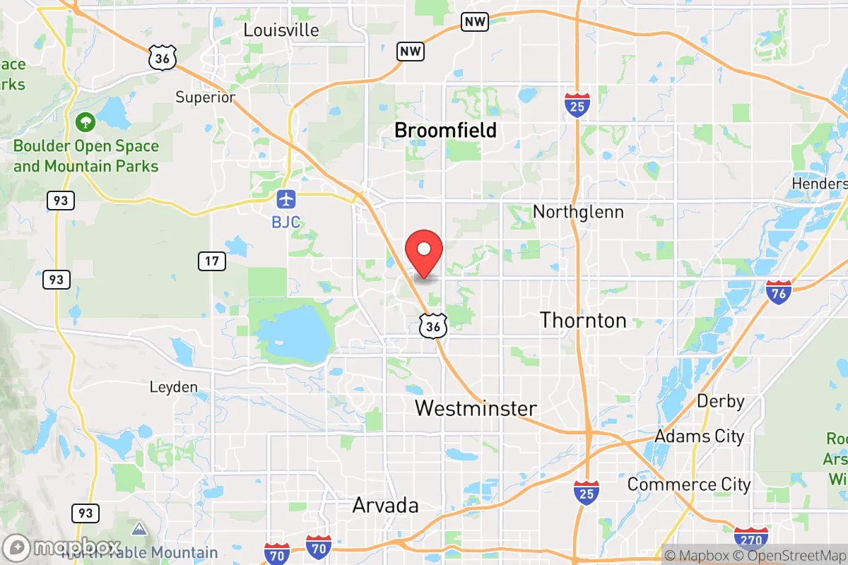
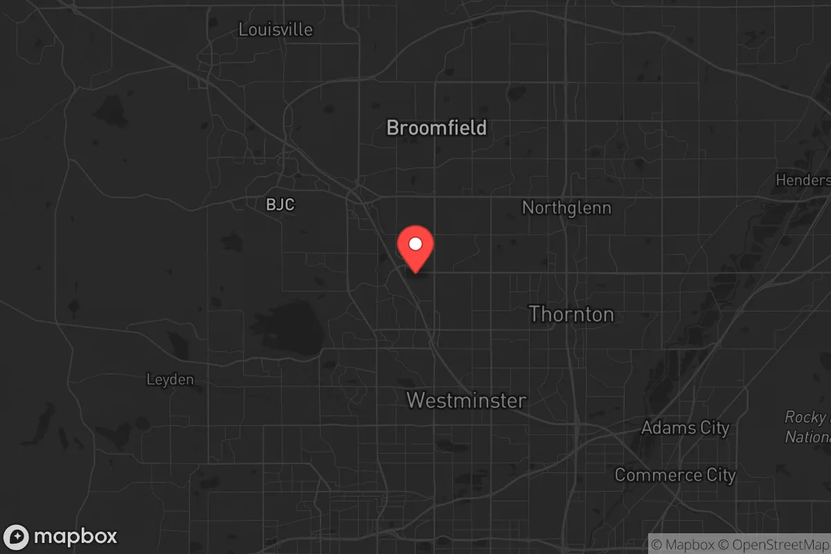
Westminster, Colorado, sits in a precarious strategic position: close enough to Denver to be vulnerable to the cascading effects of a major urban collapse, yet far enough to offer a narrow window of reaction time. Its location along the Front Range urban corridor—a 150-mile stretch of dense population from Colorado Springs to Fort Collins—means that any major disaster, whether natural or man-made, will ripple through this area within hours. For a relocator with a survivalist mindset, Westminster’s resilience is a mixed bag: it has solid infrastructure and access to water, but its proximity to high-value targets like Denver International Airport (DIA) and the Rocky Flats National Wildlife Refuge (a former nuclear weapons plant) introduces risks that cannot be ignored. This analysis weighs those factors for a conservative-leaning audience prioritizing self-reliance and strategic depth.
Geographic position and natural advantages for long-term survival
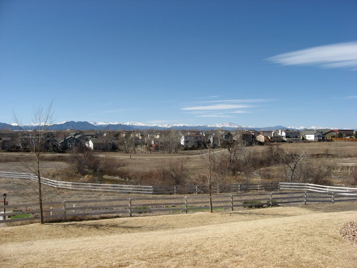
Westminster’s geography offers a few genuine advantages for those planning for extended disruption. The city sits at roughly 5,400 feet elevation, which provides a natural buffer against the worst of a pandemic or airborne biological agent—thinner air and lower humidity reduce transmission efficiency compared to sea-level cities. The South Platte River and Standley Lake are within city limits, offering surface water sources that, with proper filtration, can sustain a household for weeks. The area’s semi-arid climate means fewer mold and rot issues for stored supplies, and the 300+ days of sunshine per year make solar panels a viable long-term energy play. However, the Front Range is also a high-risk zone for wildfires—the 2021 Marshall Fire, just 20 miles north, destroyed over 1,000 homes in a single afternoon. Westminster’s defensible space is limited by suburban sprawl; most neighborhoods are interconnected by cul-de-sacs and arterial roads that can become choke points during an evacuation. The city’s position on the I-25 and US-36 corridors means that any mass evacuation from Denver will funnel through Westminster, turning its streets into a parking lot within minutes. For a relocator, the natural advantages are real but narrow—they buy time, not safety.
Risks, exposures, and proximity to fallout-relevant landmarks
The most significant risk for Westminster is its proximity to Rocky Flats, a former nuclear weapons production facility located just 12 miles southwest. While the site was cleaned up and converted to a wildlife refuge in 2007, residual plutonium contamination remains in the soil and groundwater. A major earthquake along the nearby Front Range fault system—which has a 10-15% probability of a magnitude 6.5+ event in the next 50 years, per USGS data—could resuspend contaminated dust, creating a localized fallout hazard. Additionally, Westminster is within 30 miles of DIA, a primary FEMA logistics hub and a likely target for any coordinated attack on national infrastructure. The city also sits under the approach path for Buckley Space Force Base in Aurora, a key NORAD and space surveillance facility. In a scenario of civil unrest or mass casualty events, Westminster would be a secondary evacuation zone for Denver’s population, meaning its resources—grocery stores, gas stations, hospitals—would be stripped within 48 hours. The city’s police force, while professional, is sized for suburban crime, not for managing a refugee wave of 100,000+ people. For a prepper, the risk calculus is clear: Westminster is a buffer zone, not a redoubt.
Practical resilience for a relocator: food, water, energy, and defensibility
For a single individual or family looking to establish a resilient household in Westminster, the practical picture requires significant upfront investment. Water is the most critical factor: the city draws from a mix of surface water (South Platte, Standley Lake) and groundwater wells, but the municipal system is vulnerable to power outages and contamination events. A 55-gallon drum of stored water per person is the minimum, but a Berkey or similar gravity filter is essential for treating local sources. Food storage is easier—Westminster has several Costco and Walmart locations, but these will be emptied within hours of a crisis. A 3-6 month supply of shelf-stable food, rotated regularly, is non-negotiable. Energy is a bright spot: Colorado’s net metering laws are favorable, and a 5kW solar array with battery backup can keep a fridge, lights, and communications running indefinitely. However, HOA restrictions in many Westminster neighborhoods limit visible solar installations and rainwater collection—check covenants before buying. Defensibility is the weakest link. Most homes are in subdivisions with open floor plans and large windows, offering little tactical advantage. A rural property in Weld County or the foothills west of Boulder would provide better standoff distance and natural cover. For those committed to Westminster, a basement or interior safe room, reinforced doors, and a perimeter fence are mandatory upgrades. The city’s population density (roughly 4,500 people per square mile) means that any extended grid-down scenario will lead to neighbor-vs-neighbor competition for resources within two weeks.
The overall strategic picture for Westminster is that of a high-risk, moderate-reward location for a survivalist relocator. It offers proximity to jobs and amenities during stable times, but its position along the Front Range chokepoint and near multiple high-value targets makes it a poor choice for those prioritizing long-term self-sufficiency. For a conservative-leaning individual or family who can afford the land and infrastructure, a move to a more remote county—like Costilla or Conejos in the San Luis Valley—would provide better defensibility, water security, and distance from fallout risks. Westminster works as a temporary base for building skills and networks, but it should not be the final destination for anyone serious about weathering the next decade’s uncertainties. The city’s best use is as a staging area: stockpile supplies, establish a retreat property elsewhere, and be ready to bug out within 24 hours of a major event. Anything less is a gamble with odds that favor the prepared.
* Values derived from national, state, county, city and local statistics and may differ in a specific area. Last updated: 2026-05-01T10:00:27.000Z
Narrative content on this page is AI-generated and may contain mistakes. Verify any details that matter before acting on them.
ReloMaps may earn a commission from affiliate links at no extra cost to you.