

Photo: John Kostyk via Unsplash
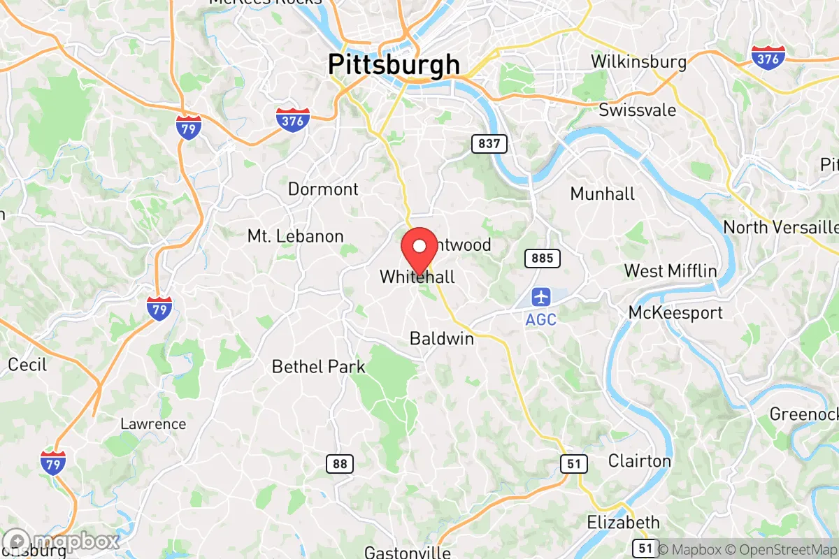
Strategic Assessment of Whitehall, PA
Multiple tactical vulnerabilities. Population density, target proximity, or disaster risk are likely compounding. A retreat property and exit planning is required.
What does the Strategic Assessment tell us?
Our Strategic Assessment grades tactical survivability of an area. Major population centers, military targets, fallout zones, natural disasters, and border exposure all drive risk — lower exposure means a more defensible position in a crisis.
This is heavily inspired by Joel Skousen's Strategic Relocation book. Highly recommended you checkout the book ($)What does this tell us?
Our Strategic Assessment grades tactical survivability of an area. Major population centers, military targets, fallout zones, natural disasters, and border exposure all drive risk — lower exposure means a more defensible position in a crisis.
This is heavily inspired by Joel Skousen's Strategic Relocation book. Highly recommended you checkout the book ($)Strategic Pillars

Key Distances
Regional Safe Places
Below is our recommended "safe zones" in Pennsylvania and the surrounding area based on our strategic heuristics. For most people, it's unrealistic to live in a “safe zone” full-time due to work, family or other personal reasons. They tend to be more rural. However, many of these areas are perfect for second homes and retreat properties that double as a vacation home or even a short-term rental.


Important Note: For informational purposes only. This does not mean nothing bad ever happens in the green zones. Please use common sense. This is based on public data and modeled with AI. We tried to take a conservative approach but mistakes happen. We update this regularly as new information becomes available.
Solar Generator Recommendations
Backup power matters more here than in safer locations. We've picked three solar generators across budgets and capacity tiers — start with the budget unit if you only need a few essentials, or step up if you want to run a fridge and HVAC for days at a time.

Jackery Portable Power Station Explorer 300
Budget OptionPower on the Go: Weighing only 11 lbs, it's convenient to set up and store with book-sized foldable solar panels

BLUETTI Portable Power Station AC180
Designed for both indoor and outdoor scenarios, AC180 is highly capable as it has a robost capacity and continuous output power.

EF ECOFLOW DELTA Pro Ultra Power Station
Upgraded PickEcoFlow DELTA Pro Ultra is a whole-home energy system designed to grow with your family. Integrated with the Smart Home Panel 2, it scales to meet your evolving energy needs — keeping your home powered, intelligent, and secure through every stage of life.
We earn a commission, at no additional cost to you.
Strategic Assessment Analysis
Whitehall, Pennsylvania, offers a mixed strategic picture for the conservative prepper: it sits in a densely populated corridor of the Northeast, which is a clear liability for long-term resilience, but its specific geography and infrastructure provide some tactical advantages for weathering short-to-medium-term disruptions. Located in Lehigh County, roughly 5 miles north of Allentown and 50 miles northwest of Philadelphia, Whitehall is embedded in the I-78 and Route 22 corridor—a major east-west logistics artery. For a relocator prioritizing self-sufficiency and low profile, the area’s primary value lies in its access to the Lehigh River watershed, its position on the edge of the Appalachian foothills, and its proximity to rural escape routes, rather than any inherent defensibility or isolation. The key question is whether these advantages outweigh the risks of being within 60 miles of a major metropolitan area and its associated fallout targets.
Geographic position and natural advantages for a prepper
Whitehall’s location at the confluence of the Lehigh River and Coplay Creek gives it a reliable freshwater source, which is a non-negotiable asset for any resilience plan. The Lehigh River flows south from the Pocono Mountains, and its watershed is relatively clean compared to more industrialized waterways in the region. The area sits in the Lehigh Valley, a broad, fertile plain that historically supported agriculture—meaning local soil and climate are viable for small-scale food production, though much of the land is now suburbanized. To the north and west, the terrain rises into the Blue Mountain ridge and the Appalachian Trail corridor, offering potential bug-out routes into less populated, forested areas of Schuylkill and Carbon counties. The valley’s microclimate is moderate, with cold winters but no extreme weather patterns that would make off-grid living impossible. For a relocator, the natural advantage here is not isolation—it’s the availability of water, arable land, and a nearby wilderness buffer that could serve as a secondary position if Whitehall itself becomes compromised.
Risks, exposures, and proximity to fallout-relevant landmarks
The most significant strategic downside is Whitehall’s proximity to multiple high-value targets. Allentown, Bethlehem, and Easton form a metropolitan area of over 800,000 people, and the Lehigh Valley is a major industrial and logistics hub. The I-78 and Route 22 corridors are critical supply routes for the Northeast, meaning they would be choke points during any large-scale disruption—whether from civil unrest, fuel shortages, or a coordinated attack. Within a 30-mile radius, there are several chemical plants, power substations, and rail yards that could become secondary hazards. More concerning is the proximity to Philadelphia (50 miles south) and New York City (90 miles east), both of which are prime targets for any state-level or non-state actor seeking to destabilize the region. Fallout from a nuclear event at either city would likely reach Whitehall within hours, depending on wind patterns. Additionally, the Lehigh Valley International Airport (ABE) is just 3 miles from Whitehall’s center—a potential target for air-based attacks or a staging area for military or federal response, which could draw unwanted attention. For a prepper, the area’s density and infrastructure connections are a double-edged sword: they provide economic opportunity in stable times, but they also make Whitehall a likely zone of secondary effects during a major crisis.
Practical resilience for a relocator: food, water, energy, and defensibility
For a single individual or family willing to invest in hardening a property, Whitehall offers a few practical advantages. The water table is high in the Lehigh Valley, meaning wells can be drilled in many residential lots, though suburban zoning may restrict this. Rainwater collection is legal in Pennsylvania, and the average annual precipitation of 45 inches provides a reliable catchment source. The area’s electrical grid is served by PPL Electric Utilities, which has a mixed reliability record—outages from storms are common, but the grid is well-maintained compared to rural areas. Solar panels are a viable option, though homeowners’ associations in some Whitehall neighborhoods may restrict them; checking local covenants is essential. Natural gas is widely available, which can be used for backup heating and cooking with minimal infrastructure. Food resilience is more challenging: the Lehigh Valley has lost most of its small farms to development, but there are still farmers’ markets and a few U-pick operations within a 15-minute drive. For long-term storage, the area has several big-box retailers (Costco, Walmart, Sam’s Club) within 10 miles, but these would be quickly depleted in a crisis. Defensibility is poor in the suburban core—most homes are on standard lots with neighbors close by, and the road network is grid-like, offering few natural chokepoints. However, properties on the northern edge of Whitehall, near the Ironton Rail Trail or the Lehigh River, have better sightlines and more limited access points. A relocator should prioritize a home with a basement (common in older construction) for shelter and storage, and consider reinforcing entry points. The local police department is responsive, but during a widespread event, response times would lengthen significantly. For a prepper, the practical takeaway is that Whitehall is not a bug-out location—it’s a place to hunker down with robust supplies and a low profile, not a fortress.
The overall strategic picture for Whitehall is one of calculated risk. It is not a remote sanctuary, nor is it a high-probability survival zone. Its value lies in its access to water, its position on the edge of a wilderness corridor, and its economic stability during normal times—factors that make it a reasonable choice for a relocator who wants to maintain a conventional lifestyle while building a preparedness buffer. The downsides—proximity to major cities, industrial targets, and population density—are real and should not be dismissed. For a conservative prepper who is willing to invest in a well-stocked basement, a reliable vehicle for evacuation, and a secondary property further north in the Poconos, Whitehall can serve as a base of operations. But for anyone seeking true isolation or a low-risk fallout zone, the Lehigh Valley is not the answer. The best use of this area is as a transitional location: close enough to urban resources to sustain a career and family, but with a clear exit strategy if the situation deteriorates. If you are serious about resilience, treat Whitehall as a staging ground, not a final destination.
* Values derived from national, state, county, city and local statistics and may differ in a specific area. Last updated: 2026-05-01T10:55:07.000Z
Narrative content on this page is AI-generated and may contain mistakes. Verify any details that matter before acting on them.
ReloMaps may earn a commission from affiliate links at no extra cost to you.