Photo: Wikipedia
Strategic Assessment of Wilmington, DE
Multiple tactical vulnerabilities. Population density, target proximity, or disaster risk are likely compounding. A retreat property and exit planning is required.
What does the Strategic Assessment tell us?
Our Strategic Assessment grades tactical survivability of an area. Major population centers, military targets, fallout zones, natural disasters, and border exposure all drive risk — lower exposure means a more defensible position in a crisis.
This is heavily inspired by Joel Skousen's Strategic Relocation book. Highly recommended you checkout the book ($)What does this tell us?
Our Strategic Assessment grades tactical survivability of an area. Major population centers, military targets, fallout zones, natural disasters, and border exposure all drive risk — lower exposure means a more defensible position in a crisis.
This is heavily inspired by Joel Skousen's Strategic Relocation book. Highly recommended you checkout the book ($)Strategic Pillars

Key Distances
Regional Safe Places
Below is our recommended "safe zones" in Delaware and the surrounding area based on our strategic heuristics. For most people, it's unrealistic to live in a “safe zone” full-time due to work, family or other personal reasons. They tend to be more rural. However, many of these areas are perfect for second homes and retreat properties that double as a vacation home or even a short-term rental.


Important Note: For informational purposes only. This does not mean nothing bad ever happens in the green zones. Please use common sense. This is based on public data and modeled with AI. We tried to take a conservative approach but mistakes happen. We update this regularly as new information becomes available.
Solar Generator Recommendations
Backup power matters more here than in safer locations. We've picked three solar generators across budgets and capacity tiers — start with the budget unit if you only need a few essentials, or step up if you want to run a fridge and HVAC for days at a time.

Jackery Portable Power Station Explorer 300
Budget OptionPower on the Go: Weighing only 11 lbs, it's convenient to set up and store with book-sized foldable solar panels

BLUETTI Portable Power Station AC180
Designed for both indoor and outdoor scenarios, AC180 is highly capable as it has a robost capacity and continuous output power.

EF ECOFLOW DELTA Pro Ultra Power Station
Upgraded PickEcoFlow DELTA Pro Ultra is a whole-home energy system designed to grow with your family. Integrated with the Smart Home Panel 2, it scales to meet your evolving energy needs — keeping your home powered, intelligent, and secure through every stage of life.
We earn a commission, at no additional cost to you.
Strategic Assessment Analysis
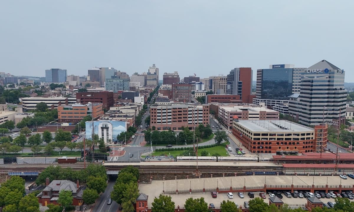
Wilmington, Delaware, sits in a precarious strategic position that demands a clear-eyed assessment for anyone prioritizing long-term security and self-reliance. While its location along the I-95 corridor offers economic advantages, for the survivalist or prepper, this same geography is a double-edged sword—providing access to resources while placing you squarely in the path of potential fallout from major metropolitan collapse. The city’s resilience is fundamentally tied to its ability to function as a secondary node in a region dominated by Philadelphia, Baltimore, and Washington D.C., meaning any major disruption in those hubs will ripple directly into Wilmington. For a conservative-leaning individual or family focused on weathering civic unrest, mass casualty events, or systemic breakdowns, the assessment here is one of calculated risk: the area offers some natural buffers and logistical perks, but the proximity to high-density population centers and critical infrastructure targets introduces vulnerabilities that cannot be ignored.
Geographic position and natural advantages for long-term security
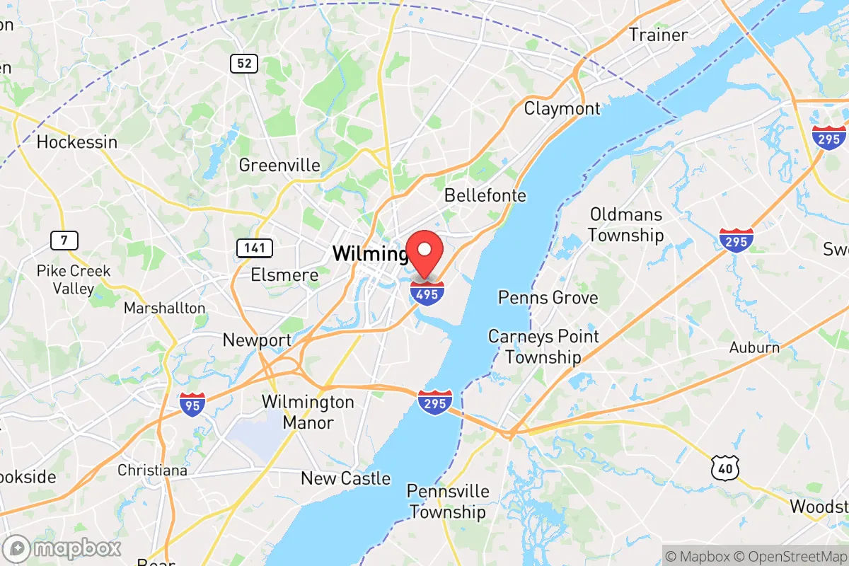
Wilmington’s location at the confluence of the Christina River and the Brandywine Creek, near the Delaware River, provides a meaningful water resource for both consumption and transportation in a grid-down scenario. The surrounding Piedmont region offers slightly elevated terrain compared to the flat coastal plain to the south, which aids in drainage and reduces flood risk in many neighborhoods—though the low-lying areas near the rivers remain vulnerable. The city sits roughly 25 miles southwest of Philadelphia and 70 miles northeast of Baltimore, placing it within a 100-mile radius of three major metropolitan areas that would become epicenters of chaos during a national emergency. For the prepper, this proximity is a liability: any large-scale event—whether economic collapse, pandemic resurgence, or civil unrest—would send waves of displaced populations south and west along I-95 and I-495, funneling directly through Wilmington. On the positive side, the area’s access to the Delaware Bay and Atlantic shipping lanes means that in a prolonged crisis, maritime resupply routes remain viable, and the state’s lack of sales tax could be leveraged for bulk purchasing of supplies before a collapse. The natural tree cover in northern New Castle County provides some concealment and microclimate moderation, but the overall density of the region—over 570,000 people in the county—means that true rural retreat is not an option within city limits.
Risks, exposures, and proximity to fallout-relevant landmarks
The most glaring strategic weakness for Wilmington is its proximity to high-value targets that would be primary or secondary objectives in a major conflict or terrorist attack. The Port of Wilmington, a major deepwater port handling cargo and automobiles, is a critical infrastructure node that would be a likely target for disruption or seizure. Additionally, the city lies within 50 miles of the Philadelphia Naval Shipyard, the Delaware City Refinery (a major petroleum processing facility), and the Salem Nuclear Power Plant in New Jersey—just 20 miles across the Delaware River. Any catastrophic failure at the nuclear plant, whether from accident or sabotage, would place much of Wilmington in the plume zone, depending on wind direction. The I-95 corridor itself is a choke point: a single bridge collapse or targeted attack on the I-495 viaduct could trap residents in the city or block evacuation routes. For the prepper, the concentration of population in Wilmington’s urban core—roughly 70,000 residents—means that civil unrest, food shortages, or disease outbreaks would spread rapidly through dense row-house neighborhoods and apartment complexes. The city’s history of racial and economic tensions, combined with a high poverty rate (around 25%), creates a volatile mix that could ignite during a crisis, making defensibility a serious concern. The presence of major corporate headquarters (like DuPont, Bank of America, and JPMorgan Chase) also makes Wilmington a potential target for cyberattacks or economic warfare aimed at disrupting financial systems.
Practical resilience for a relocator: food, water, energy, and defensibility
For a relocator serious about self-sufficiency, Wilmington presents a mixed bag. The city’s water supply comes from the Brandywine Creek and the Hoopes Reservoir, both surface sources that are vulnerable to contamination or sabotage. A well-maintained private well is rare within city limits, so reliance on municipal water means you need robust filtration and storage—at least a 55-gallon drum per person for a two-week supply, plus a high-quality Berkey or similar system. Food security is a challenge: the city has a handful of farmers’ markets and community gardens, but the surrounding agricultural land is mostly in southern New Castle County and Kent County, requiring a vehicle and time to access. For energy, the grid is reliable under normal conditions, but the region is prone to nor’easters and occasional hurricanes that can knock out power for days. A whole-house generator with a 500-gallon propane tank is a wise investment, but zoning restrictions in some neighborhoods may limit installation. Defensibility is the hardest factor: Wilmington’s urban layout—narrow streets, attached homes, and limited sightlines—makes it difficult to secure a property without significant modifications. A single-family home on a corner lot with a fenced yard and reinforced doors is preferable, but such properties are expensive (median home price around $280,000) and often in transitional neighborhoods. For the prepper, the best strategy is to establish a network of like-minded neighbors and maintain a low profile—avoiding visible stockpiles or political signage that could make you a target. The state’s gun laws are relatively permissive compared to neighboring New Jersey or Maryland, with no permit required for open carry and a shall-issue concealed carry system, which is a plus for self-defense planning.
The overall strategic picture for Wilmington is one of calculated vulnerability. It offers some logistical advantages—access to water, proximity to shipping routes, and a relatively low cost of living compared to the Northeast corridor—but these are outweighed by the risks of being a secondary fallout zone for Philadelphia, Baltimore, and Washington D.C. For the conservative-minded prepper, the city is best viewed as a temporary staging point or a location for economic opportunity rather than a long-term retreat. If you must relocate here, focus on the northern suburbs like Hockessin or Greenville, where population density drops, tree cover increases, and access to rural escape routes via Route 41 and Route 7 improves. But the honest assessment is that Wilmington is not a survival-friendly destination for those serious about riding out a major societal disruption. The smart play is to treat it as a place to build financial resources and a network, while maintaining a bug-out location at least 100 miles inland, away from the I-95 corridor and the nuclear plant. In a world where the state of the country and the world grows increasingly unstable, Wilmington demands constant vigilance and a plan B that doesn’t rely on the city itself.
* Values derived from national, state, county, city and local statistics and may differ in a specific area. Last updated: 2026-04-29T17:53:39.000Z
Narrative content on this page is AI-generated and may contain mistakes. Verify any details that matter before acting on them.
ReloMaps may earn a commission from affiliate links at no extra cost to you.