
Photo: Wikipedia
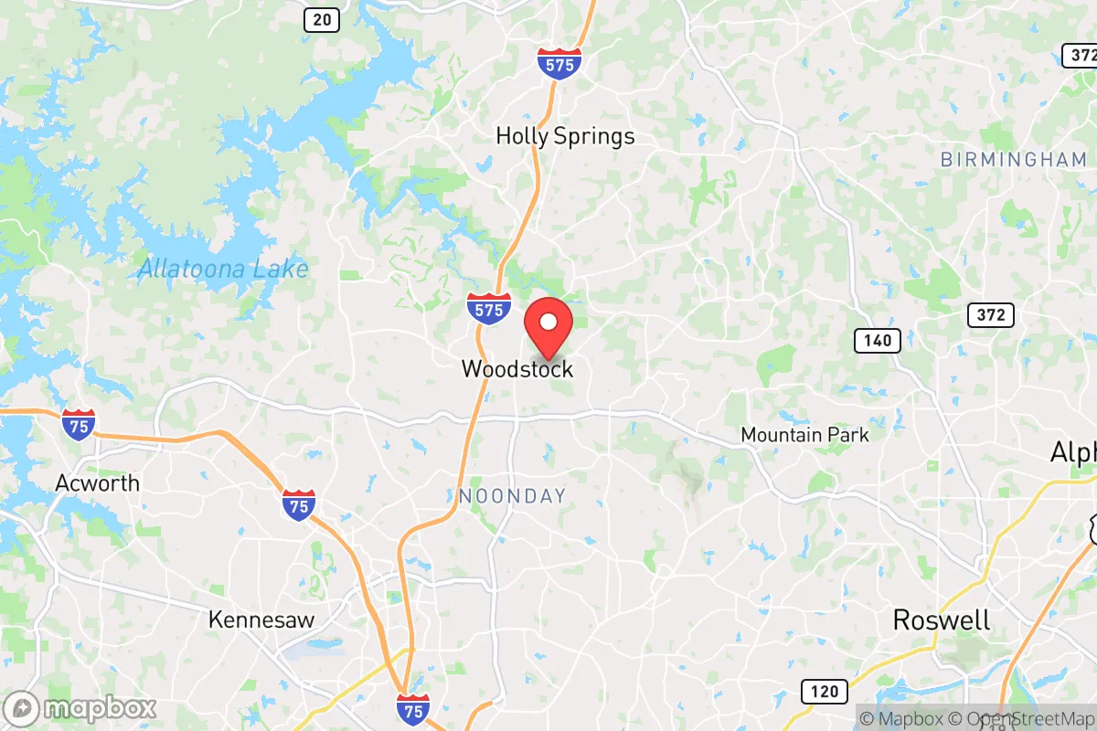
Strategic Assessment of Woodstock, GA
Meaningful friction. Expect exposure to either population pressure, blast zones, or natural disaster risk. Consider buying a retreat property.
What does the Strategic Assessment tell us?
Our Strategic Assessment grades tactical survivability of an area. Major population centers, military targets, fallout zones, natural disasters, and border exposure all drive risk — lower exposure means a more defensible position in a crisis.
This is heavily inspired by Joel Skousen's Strategic Relocation book. Highly recommended you checkout the book ($)What does this tell us?
Our Strategic Assessment grades tactical survivability of an area. Major population centers, military targets, fallout zones, natural disasters, and border exposure all drive risk — lower exposure means a more defensible position in a crisis.
This is heavily inspired by Joel Skousen's Strategic Relocation book. Highly recommended you checkout the book ($)Strategic Pillars

Key Distances
Regional Safe Places
Below is our recommended "safe zones" in Georgia and the surrounding area based on our strategic heuristics. For most people, it's unrealistic to live in a “safe zone” full-time due to work, family or other personal reasons. They tend to be more rural. However, many of these areas are perfect for second homes and retreat properties that double as a vacation home or even a short-term rental.


Important Note: For informational purposes only. This does not mean nothing bad ever happens in the green zones. Please use common sense. This is based on public data and modeled with AI. We tried to take a conservative approach but mistakes happen. We update this regularly as new information becomes available.
Solar Generator Recommendations
Backup power matters more here than in safer locations. We've picked three solar generators across budgets and capacity tiers — start with the budget unit if you only need a few essentials, or step up if you want to run a fridge and HVAC for days at a time.

Jackery Portable Power Station Explorer 300
Budget OptionPower on the Go: Weighing only 11 lbs, it's convenient to set up and store with book-sized foldable solar panels

BLUETTI Portable Power Station AC180
Designed for both indoor and outdoor scenarios, AC180 is highly capable as it has a robost capacity and continuous output power.

EF ECOFLOW DELTA Pro Ultra Power Station
Upgraded PickEcoFlow DELTA Pro Ultra is a whole-home energy system designed to grow with your family. Integrated with the Smart Home Panel 2, it scales to meet your evolving energy needs — keeping your home powered, intelligent, and secure through every stage of life.
We earn a commission, at no additional cost to you.
Strategic Assessment Analysis
Woodstock, Georgia, sits in a deceptive sweet spot: close enough to Atlanta’s economic engine to matter, but far enough that when the grid goes down or the unrest starts, you’re not in the kill box. The city’s position along the I-575 corridor, nestled against the foothills of the North Georgia mountains, gives it a resilience profile that’s better than 90% of metro-adjacent suburbs—but it’s not a bunker. For a relocator thinking about civic unrest, mass casualty events, or long-term disaster scenarios, Woodstock offers a workable balance of access and buffer, provided you understand where the real vulnerabilities lie.
Geographic position and natural advantages for long-term security
Woodstock’s geography is its strongest card. The city sits at roughly 1,000 feet elevation in the Piedmont region, with the Blue Ridge Mountains less than 30 miles north. That elevation means slightly cooler summers, better drainage, and—critically—a position above the worst of any potential flood zones along the Etowah River or Lake Allatoona. The surrounding terrain is rolling hills with mixed hardwood forest, offering natural cover and defensible chokepoints along the narrow two-lane roads that feed into the area. The Etowah River and Lake Allatoona provide surface water sources within a 10- to 15-minute drive, and the region’s average annual rainfall of 52 inches means catchment systems are viable year-round. For a prepper, the key advantage is that Woodstock is not a floodplain, not a coastal hurricane target, and not in a known seismic zone. The biggest natural threat is severe thunderstorms and the occasional tornado—Cherokee County averages about 2-3 tornado warnings per year, but direct hits are rare. The Georgia Piedmont’s clay soils are a mixed blessing: they hold water well for cisterns but make digging deep bunkers or root cellars a serious engineering project.
Risks, exposures, and proximity to fallout-relevant landmarks
Here’s where the analysis gets real. Woodstock’s biggest liability is its proximity to Atlanta—roughly 35 miles south as the crow flies. In a mass casualty event, a major terrorist strike, or a grid-down scenario, Atlanta becomes a dead zone of desperate people moving outward. I-575 is the primary evacuation route, and it will clog instantly. Woodstock sits directly in the path of any Atlanta exodus heading north toward the mountains. That means you need a plan for filtering refugees, securing your perimeter, and having alternate routes that don’t involve the interstate. The city also lies within 50 miles of Dobbins Air Reserve Base and Lockheed Martin’s Marietta plant—both high-value military-industrial targets in a conflict scenario. A conventional or dirty-bomb strike on Dobbins would put Woodstock in a moderate fallout zone depending on wind direction. Closer to home, the Georgia Power Plant Bowen (coal) and Plant Scherer (coal) are about 40 miles south, but the real concern is Lake Allatoona’s Allatoona Dam, just 12 miles west. A dam failure or targeted breach would flood downstream areas, but Woodstock sits high enough to be safe—though the resulting chaos would still affect supply lines and evacuation routes. On the plus side, there are no nuclear power plants within 100 miles, no major chemical weapons depots, and no large-scale ammunition storage facilities nearby. The risk profile is moderate: not a target-rich environment, but not a remote sanctuary either.
Practical resilience for a relocator: food, water, energy, and defensibility
For someone serious about self-sufficiency, Woodstock offers a mixed bag. Water is the biggest win. The Etowah River and Lake Allatoona are reliable surface sources, and the county’s groundwater is accessible via wells at depths of 100-300 feet. Rainwater catchment is legal and practical—just be aware that Georgia’s water rights laws are complex, and you’ll want to keep your system off the grid’s radar. Food production is doable but not easy. The growing season runs from April to October, and the clay soil requires raised beds or heavy amendment. Local farmers’ markets exist, but in a collapse scenario, you’d need to rely on your own garden, hunting (deer and turkey are abundant in the national forest land north of town), and barter networks. Cherokee County has a strong agricultural history, and there are still working farms within 15 minutes of downtown Woodstock—good for establishing local supply chains. Energy resilience is a weak point. The grid here is typical suburban: overhead lines, prone to outages from ice storms and wind. Solar is viable—the area gets about 210 sunny days per year—but you’ll need battery storage and a backup generator for the cloudy stretches. Natural gas is available in most neighborhoods, which is a plus for heating and cooking if the grid stays up. Defensibility is situational. Woodstock’s suburban layout—cul-de-sacs, winding roads, and tree cover—makes it harder for a large force to move through quickly, but it also means your neighbors are close. In a long-term SHTF scenario, you’re better off on the northern edge of town, closer to the national forest and away from the commercial corridors. The Cherokee County Sheriff’s Office is well-funded and professional, but in a mass unrest event, they’ll be overwhelmed. Your security plan needs to account for the fact that Woodstock is a bedroom community with a lot of families—good for community cohesion, bad for operational security if you’re trying to keep a low profile.
The overall strategic picture for Woodstock is one of cautious viability. It’s not a remote retreat, and it’s not a hardened fortress. What it offers is a realistic middle ground: a place where a prepared individual or family can live a normal life while maintaining the ability to pivot when things go sideways. The proximity to Atlanta is a double-edged sword—economic opportunity now, but a liability in crisis. The natural advantages of water, elevation, and defensible terrain are real, but they require work to exploit. If you’re looking for a location that balances modern convenience with a workable prepper setup, Woodstock deserves a serious look. Just don’t mistake it for a bug-out location. It’s a place to hunker down and ride out the storm, provided you’ve done the prep work and have a plan for the 35 miles of asphalt that separate you from the chaos to the south.
* Values derived from national, state, county, city and local statistics and may differ in a specific area. Last updated: 2026-04-30T07:38:47.000Z
Narrative content on this page is AI-generated and may contain mistakes. Verify any details that matter before acting on them.
ReloMaps may earn a commission from affiliate links at no extra cost to you.