Photo: Wikipedia
Strategic Assessment of Copper River County
Deep buffer from population centers and strategic targets. Low natural disaster risk and minimal exposure to border or coastal threats.
What does the Strategic Assessment tell us?
Our Strategic Assessment grades tactical survivability of an area. Major population centers, military targets, fallout zones, natural disasters, and border exposure all drive risk — lower exposure means a more defensible position in a crisis.
This is heavily inspired by Joel Skousen's Strategic Relocation book. Highly recommended you checkout the book ($)What does this tell us?
Our Strategic Assessment grades tactical survivability of an area. Major population centers, military targets, fallout zones, natural disasters, and border exposure all drive risk — lower exposure means a more defensible position in a crisis.
This is heavily inspired by Joel Skousen's Strategic Relocation book. Highly recommended you checkout the book ($)Strategic Pillars

Key Distances
Strategic Assessment Analysis
Copper River County, Alaska, offers a strategic relocation option for those prioritizing resilience and self-sufficiency, combining extreme geographic isolation with access to the state's primary transportation corridor. The county's position—straddling the Glenn and Richardson Highways—provides a rare balance of remoteness from major population centers and practical connectivity to Anchorage and Fairbanks for resupply and medical evacuation. For a conservative-leaning individual or family assessing long-term preparedness, the area's low population density, harsh but manageable climate, and distance from high-value targets present a compelling case for a deliberate, off-grid lifestyle.
Geographic position and natural advantages for long-term security
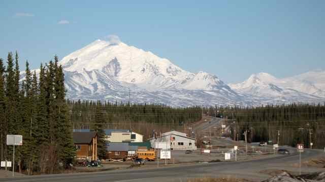
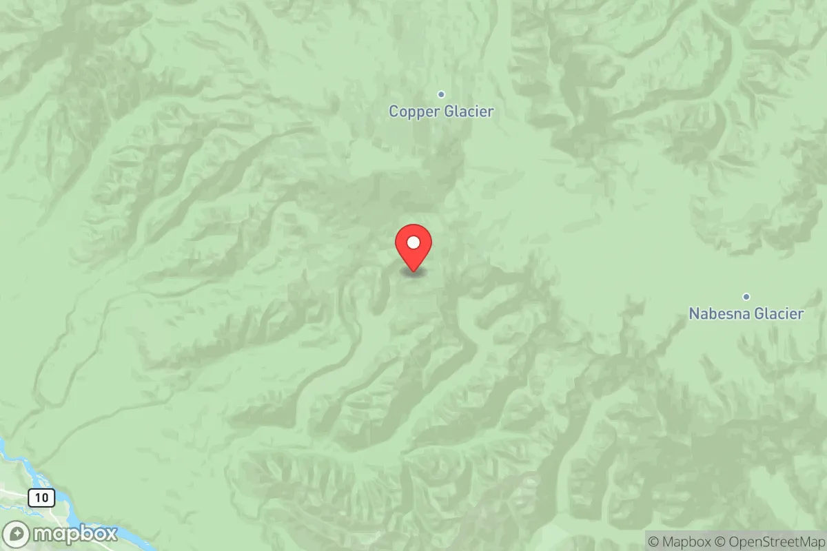
Copper River County's defining feature is its location at the intersection of the Copper River Basin and the Chugach Mountains, roughly 150 miles east of Anchorage and 200 miles south of Fairbanks. The county seat, Glennallen, sits at the junction of the Glenn and Richardson Highways, making it a logistical hub for the region while remaining far from any major metropolitan area. The terrain includes river valleys, boreal forest, and alpine tundra, offering multiple microclimates and natural barriers that limit easy access. The Wrangell-St. Elias National Park borders the county to the east, providing a vast, undeveloped buffer zone. This geographic isolation means the area is far removed from the primary fallout-relevant landmarks of the state—namely, the Port of Anchorage, Joint Base Elmendorf-Richardson, and the trans-Alaska pipeline terminal in Valdez. The county's elevation (averaging 1,500 feet) and inland position reduce tsunami risk, while the surrounding mountains deflect the worst coastal storms.
Risks, exposures, and proximity to fallout-relevant landmarks
While Copper River County is distant from Alaska's primary strategic targets, it is not entirely free of risk. The trans-Alaska pipeline runs through the western edge of the county, roughly 20 miles west of Glennallen, and the Richardson Highway parallels it for much of its route. A disruption to the pipeline—whether from seismic activity, sabotage, or cascading infrastructure failure—would have immediate economic and logistical consequences for the region, as the county depends on trucked fuel and supplies. The county also lies within the Denali Fault zone, and while major earthquakes are infrequent, the 1964 Good Friday earthquake (magnitude 9.2) caused significant ground deformation in the Copper River Basin. Wildfire risk is moderate but increasing with warmer summers; the 2015 Sockeye Fire near Willow demonstrated how quickly boreal forest fires can threaten remote communities. No nuclear power plants, major military bases, or large industrial refineries exist within the county, which is a net positive for fallout avoidance. The nearest significant military installation is Fort Wainwright in Fairbanks, roughly 200 miles north, and the closest port is Valdez, 120 miles south—both are plausible secondary targets in a major conflict, but the distance and intervening terrain provide substantial protection.
Practical resilience for a relocator: food, water, energy, and defensibility
For a relocator serious about self-sufficiency, Copper River County offers strong fundamentals but requires significant preparation. Water is abundant: the Copper River and its tributaries (including the Tazlina and Gulkana rivers) provide year-round surface water, though treatment is necessary due to glacial silt and microbial content. Groundwater wells are feasible in the valley bottoms, with typical depths of 50–150 feet. Food production is limited by a short growing season (roughly 90 frost-free days) and poor soil in many areas, but cold-hardy crops (potatoes, carrots, cabbage) and greenhouse cultivation can supplement hunting and fishing. Moose, caribou, and salmon are plentiful; the Copper River salmon run is world-famous and provides a reliable annual protein source. Energy is the weak point: the county is not connected to the Railbelt electrical grid, and most residents rely on diesel generators or propane for power, with fuel trucked in from Anchorage or Valdez. Solar is viable for 6–7 months of the year, but winter generation is minimal. Wood heating is common and sustainable given the surrounding boreal forest. Defensibility is high: the low population density (roughly 0.3 people per square mile) and limited road network mean that any approaching group would be visible from miles away. The Glenn Highway is the only primary route in and out, and it can be monitored or blocked at several choke points near Mendeltna and Tolsona. However, the same isolation that provides security also makes resupply difficult; a relocator should plan for at least 12 months of stored food, fuel, and medical supplies before considering the area viable for long-term habitation.
Overall, Copper River County presents a high-resilience, low-exposure option for a relocator who values geographic buffer over convenience. The area's distance from Alaska's primary strategic targets—Anchorage, Fairbanks, Valdez, and the pipeline terminal—reduces fallout risk significantly, while its position on the state highway system allows for periodic resupply and emergency evacuation. The climate and growing season demand serious preparation, but the abundance of wild game, fish, and timber provides a renewable resource base that few other remote areas in the United States can match. For a family or individual willing to invest in off-grid infrastructure and accept the logistical challenges of subarctic living, Copper River County offers one of the strongest strategic positions in the state for long-term self-sufficiency.

* Values derived from national, state, county, city and local statistics and may differ in a specific area. Last updated: 2026-10-13T15:59:36.000Z
Narrative content on this page is AI-generated and may contain mistakes. Verify any details that matter before acting on them.
ReloMaps may earn a commission from affiliate links at no extra cost to you.

