Photo: Wikipedia
Strategic Assessment of Albany, OR
Meaningful friction. Expect exposure to either population pressure, blast zones, or natural disaster risk. Consider buying a retreat property.
What does the Strategic Assessment tell us?
Our Strategic Assessment grades tactical survivability of an area. Major population centers, military targets, fallout zones, natural disasters, and border exposure all drive risk — lower exposure means a more defensible position in a crisis.
This is heavily inspired by Joel Skousen's Strategic Relocation book. Highly recommended you checkout the book ($)What does this tell us?
Our Strategic Assessment grades tactical survivability of an area. Major population centers, military targets, fallout zones, natural disasters, and border exposure all drive risk — lower exposure means a more defensible position in a crisis.
This is heavily inspired by Joel Skousen's Strategic Relocation book. Highly recommended you checkout the book ($)Strategic Pillars

Key Distances
Regional Safe Places
Below is our recommended "safe zones" in Oregon and the surrounding area based on our strategic heuristics. For most people, it's unrealistic to live in a “safe zone” full-time due to work, family or other personal reasons. They tend to be more rural. However, many of these areas are perfect for second homes and retreat properties that double as a vacation home or even a short-term rental.


Important Note: For informational purposes only. This does not mean nothing bad ever happens in the green zones. Please use common sense. This is based on public data and modeled with AI. We tried to take a conservative approach but mistakes happen. We update this regularly as new information becomes available.
Solar Generator Recommendations
Backup power matters more here than in safer locations. We've picked three solar generators across budgets and capacity tiers — start with the budget unit if you only need a few essentials, or step up if you want to run a fridge and HVAC for days at a time.

Jackery Portable Power Station Explorer 300
Budget OptionPower on the Go: Weighing only 11 lbs, it's convenient to set up and store with book-sized foldable solar panels

BLUETTI Portable Power Station AC180
Designed for both indoor and outdoor scenarios, AC180 is highly capable as it has a robost capacity and continuous output power.

EF ECOFLOW DELTA Pro Ultra Power Station
Upgraded PickEcoFlow DELTA Pro Ultra is a whole-home energy system designed to grow with your family. Integrated with the Smart Home Panel 2, it scales to meet your evolving energy needs — keeping your home powered, intelligent, and secure through every stage of life.
We earn a commission, at no additional cost to you.
Strategic Assessment Analysis
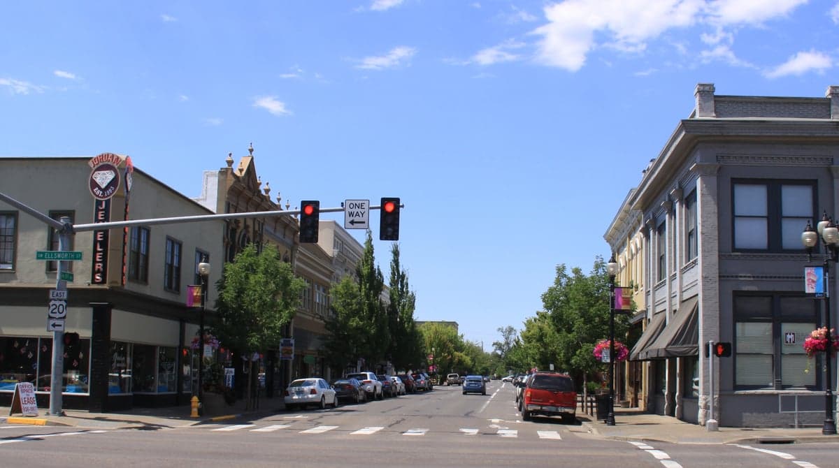
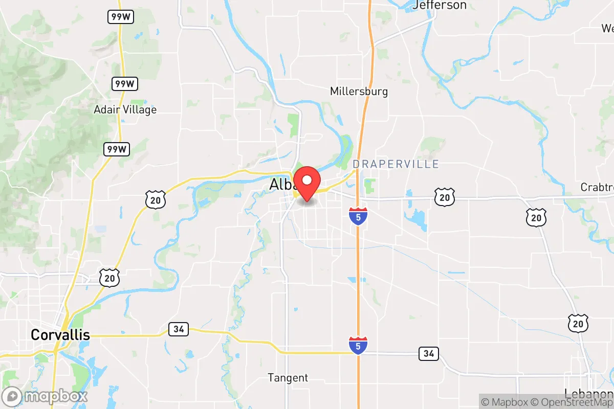
Albany, Oregon, sits at a strategic crossroads in the Willamette Valley, offering a mix of agricultural self-sufficiency and industrial resilience that makes it a serious contender for those prioritizing long-term preparedness. Its position along the I-5 corridor, roughly midway between Portland and Eugene, provides access to critical supply chains while avoiding the direct blast radius and immediate chaos of a major metropolitan collapse. For a conservative-leaning relocator focused on weathering civic unrest, natural disasters, or supply chain disruptions, Albany’s combination of river access, rail infrastructure, and a relatively stable local economy presents a viable base of operations—provided you understand its specific vulnerabilities.
Geographic position and natural advantages for long-term stability
Albany’s geography is its primary asset for a prepper mindset. The city sits at the confluence of the Willamette and Calapooia Rivers, offering abundant freshwater resources—a non-negotiable for any long-term survival scenario. The surrounding Willamette Valley is some of the most fertile agricultural land in the United States, with a growing season that supports year-round food production. This means that even if national supply chains falter, local farms and farmers’ markets can sustain a community. The city’s elevation (around 200 feet) keeps it above most floodplains, though the rivers do pose a moderate flood risk during heavy rains. Albany is also within a two-hour drive of the Cascade Range, providing access to timber, game, and remote retreat options if urban areas become untenable. The region’s mild climate—rarely below freezing or above 90°F—reduces the energy burden for heating and cooling, a critical factor when grid reliability is uncertain. For a relocator, this means lower utility costs and less dependence on external fuel supplies during a crisis.
Risks, exposures, and proximity to fallout-relevant landmarks
No location is without risk, and Albany has several that demand attention. Its proximity to Portland (about 70 miles north) and Eugene (40 miles south) means that in the event of a major civic unrest event—say, a coordinated attack on a federal building or a mass casualty event at a large gathering—Albany could see a surge of refugees fleeing the chaos. The I-5 corridor is a natural evacuation route, and Albany sits directly on it. This makes the city a potential chokepoint for both fleeing populations and supply convoys, which could attract unwanted attention from looters or organized groups. Additionally, the city is within 100 miles of the Oregon Coast, which, while scenic, is also a potential target for tsunami-related events or naval disruptions. More critically, Albany is about 120 miles from the Hanford Nuclear Site in Washington—a decommissioned but still hazardous nuclear waste facility. While a direct fallout plume from Hanford is unlikely to reach Albany under normal wind patterns, a catastrophic failure or terrorist attack on that site could contaminate the Columbia River watershed, which feeds into the Willamette Valley. The city’s industrial base includes a paper mill and a chemical plant (ATI Specialty Materials), which, while economically beneficial, also represent potential local hazards if accidents occur during a crisis. For the survivalist, these are not dealbreakers but factors that require a solid bug-out plan and a well-stocked shelter.
Practical resilience for a relocator: food, water, energy, and defensibility
For the individual or family looking to establish a resilient homestead, Albany offers a mixed bag. Food security is strong: the Willamette Valley produces over 90% of the nation’s hazelnuts, along with berries, vegetables, and grass-fed beef. Local farmers’ markets operate year-round, and the city’s zoning allows for backyard chickens and small livestock in many residential areas. Community gardens are present, though not abundant. Water access is excellent: the Willamette River provides a reliable surface water source, and the city’s municipal supply comes from the Santiam River, which is less prone to contamination than the Willamette. However, a prepper should invest in a high-quality filtration system (e.g., Berkey or Sawyer) and a backup well if possible, as municipal treatment plants could fail during a prolonged grid outage. Energy resilience is moderate: Albany is served by Pacific Power, which relies on a mix of hydro, coal, and natural gas. The region’s hydroelectric dams (e.g., Green Peter Dam on the Santiam) are vulnerable to earthquake damage—a Cascadia Subduction Zone event could knock out power for weeks. Solar is viable, with the valley averaging 150 sunny days per year, but battery storage is essential. Defensibility is a concern: Albany’s layout is typical of a small city—grid streets, open parks, and a downtown core that would be hard to secure. The best defensive posture is to live on the outskirts, near farmland or forest, where you can control access points. The city’s police force is small (about 50 officers), so in a prolonged crisis, you’ll rely on yourself and your neighbors. The local gun culture is present but not extreme; Oregon has relatively permissive firearm laws compared to California, but magazine capacity restrictions and a permit-to-purchase law for handguns are in effect. For a conservative relocator, this means you can own firearms for self-defense, but you should be aware of the legal landscape.
The overall strategic picture for Albany is one of cautious optimism. It’s not a hardened bunker or a remote mountain retreat, but it offers a realistic balance of resources, community, and access to escape routes. The city’s agricultural base and river access make it a viable long-term holdout location, provided you have a plan for the I-5 refugee risk and the Cascadia earthquake threat. For a single individual or family willing to invest in solar, water filtration, and a perimeter security plan, Albany can serve as a stable base from which to ride out the next decade of uncertainty. Just don’t expect it to be a secret—other preppers have already noticed the same advantages. The key is to arrive prepared, build local relationships, and keep a low profile until the storm passes.
* Values derived from national, state, county, city and local statistics and may differ in a specific area. Last updated: 2026-05-01T03:30:14.000Z
Narrative content on this page is AI-generated and may contain mistakes. Verify any details that matter before acting on them.
ReloMaps may earn a commission from affiliate links at no extra cost to you.