
Photo: Wikipedia
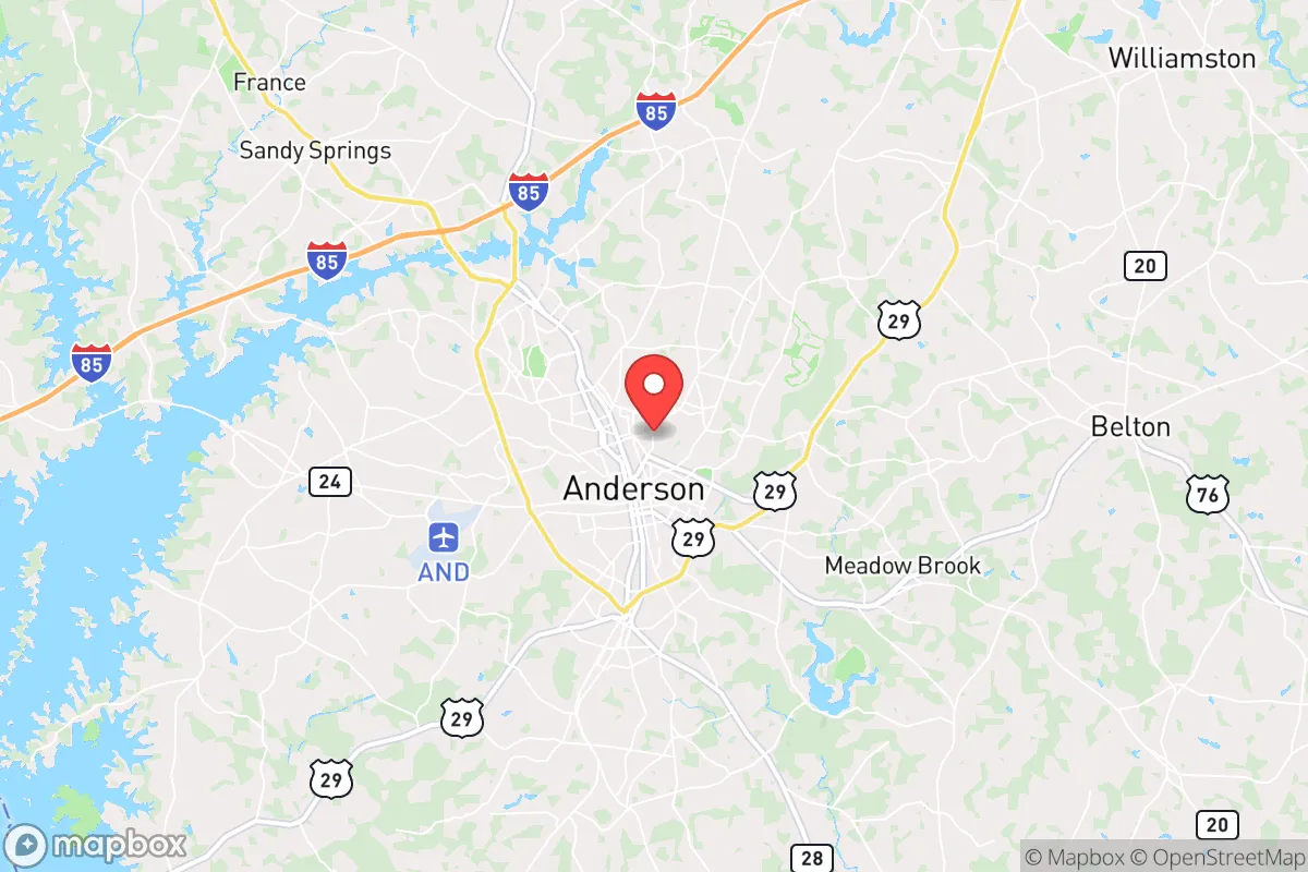
Strategic Assessment of Anderson, SC
Meaningful friction. Expect exposure to either population pressure, blast zones, or natural disaster risk. Consider buying a retreat property.
What does the Strategic Assessment tell us?
Our Strategic Assessment grades tactical survivability of an area. Major population centers, military targets, fallout zones, natural disasters, and border exposure all drive risk — lower exposure means a more defensible position in a crisis.
This is heavily inspired by Joel Skousen's Strategic Relocation book. Highly recommended you checkout the book ($)What does this tell us?
Our Strategic Assessment grades tactical survivability of an area. Major population centers, military targets, fallout zones, natural disasters, and border exposure all drive risk — lower exposure means a more defensible position in a crisis.
This is heavily inspired by Joel Skousen's Strategic Relocation book. Highly recommended you checkout the book ($)Strategic Pillars

Key Distances
Regional Safe Places
Below is our recommended "safe zones" in South Carolina and the surrounding area based on our strategic heuristics. For most people, it's unrealistic to live in a “safe zone” full-time due to work, family or other personal reasons. They tend to be more rural. However, many of these areas are perfect for second homes and retreat properties that double as a vacation home or even a short-term rental.


Important Note: For informational purposes only. This does not mean nothing bad ever happens in the green zones. Please use common sense. This is based on public data and modeled with AI. We tried to take a conservative approach but mistakes happen. We update this regularly as new information becomes available.
Solar Generator Recommendations
Backup power matters more here than in safer locations. We've picked three solar generators across budgets and capacity tiers — start with the budget unit if you only need a few essentials, or step up if you want to run a fridge and HVAC for days at a time.

Jackery Portable Power Station Explorer 300
Budget OptionPower on the Go: Weighing only 11 lbs, it's convenient to set up and store with book-sized foldable solar panels

BLUETTI Portable Power Station AC180
Designed for both indoor and outdoor scenarios, AC180 is highly capable as it has a robost capacity and continuous output power.

EF ECOFLOW DELTA Pro Ultra Power Station
Upgraded PickEcoFlow DELTA Pro Ultra is a whole-home energy system designed to grow with your family. Integrated with the Smart Home Panel 2, it scales to meet your evolving energy needs — keeping your home powered, intelligent, and secure through every stage of life.
We earn a commission, at no additional cost to you.
Strategic Assessment Analysis
Anderson, South Carolina, sits in a strategic sweet spot that resilience-minded relocators should take seriously: far enough from major metropolitan chaos to offer genuine buffer, yet close enough to critical infrastructure and supply lines to avoid the isolation trap that dooms many rural retreats. Located roughly 30 miles from Greenville and 100 miles from Atlanta, Anderson County provides a middle-ground density that supports community cohesion without the anonymity of a big city. The area’s position along the I-85 corridor—a major east-west artery—means you can move people, supplies, or yourself quickly if needed, while the surrounding topography of the Piedmont region offers natural cover and defensible terrain that flat coastal plains simply cannot match.
Geographic position and natural advantages for long-term security
Anderson’s geography is its first and strongest asset for a prepper or survivalist mindset. The area sits in the foothills of the Blue Ridge Mountains, which means rolling hills, mixed hardwood forests, and numerous creeks and rivers that provide both water sources and natural barriers to movement. Lake Hartwell, a 56,000-acre reservoir created by the U.S. Army Corps of Engineers, dominates the southern and eastern edges of the county. This body of water is not just recreational—it’s a reliable freshwater source that can support small-scale agriculture, fishing, and household needs if municipal systems falter. The terrain itself is a mix of open farmland and wooded ridges, offering multiple options for a retreat property with good visibility and limited approach routes. Unlike the dense pine plantations of the coastal plain, the Piedmont’s deciduous forests provide better cover and more diverse wildlife for foraging or hunting. The elevation, ranging from 600 to 1,000 feet above sea level, keeps the area cooler than the Deep South in summer and reduces the risk of flooding from hurricanes—a real concern for anyone looking at Gulf or Atlantic coastal zones. For a relocator prioritizing self-sufficiency, the combination of reliable surface water, moderate climate, and defensible topography makes Anderson County a strong candidate for a long-term base of operations.
Risks, exposures, and proximity to fallout-relevant landmarks
No location is without vulnerabilities, and Anderson has several that a serious prepper must weigh. The most obvious risk is the Oconee Nuclear Station, located just 15 miles northwest of Anderson in Seneca. This three-unit plant, operated by Duke Energy, is a potential target for both accidental release and deliberate attack. While the facility has robust containment structures, the proximity means that a major event—whether from grid failure, sabotage, or a natural disaster—could force a rapid evacuation or shelter-in-place scenario. The prevailing winds in the region generally blow from the west and southwest, which would carry fallout toward the eastern part of the county, including Anderson proper. Anyone settling here should have a radiation detection kit, potassium iodide, and a plan for moving north or east if the worst occurs. Beyond nuclear risk, Anderson sits within a two-hour drive of Greenville-Spartanburg International Airport and within three hours of Hartsfield-Jackson Atlanta, both of which are potential choke points for mass casualty events or civil unrest. The I-85 corridor itself is a double-edged sword: it’s a lifeline for resupply, but it’s also a funnel for refugees fleeing coastal disasters or urban collapse. During a crisis, that highway could become a parking lot or a target for roadblocks. Finally, the area’s reliance on the Duke Energy grid means it’s vulnerable to the same cascading failures that affect the broader Southeast. A coordinated cyber or physical attack on substations could leave Anderson without power for weeks, as the region lacks the distributed microgrid infrastructure seen in parts of Texas or the Pacific Northwest.
Practical resilience for a relocator: food, water, energy, and defensibility
For the individual or family looking to establish a resilient household, Anderson offers a mix of advantages and gaps that require deliberate planning. Water is the strongest suit: Lake Hartwell and the numerous smaller lakes, ponds, and streams mean that a property with a well or direct lake access can secure a year-round supply. The county’s average annual rainfall of 50 inches ensures that rainwater catchment systems are viable, and the clay-heavy soil, while challenging for gardening, holds moisture well. Food production is feasible but not automatic. The growing season runs from April to October, and the local soil, if amended with compost, can support corn, beans, squash, tomatoes, and leafy greens. The area has a strong agricultural heritage, with several farmers’ markets and a network of small farms that could become barter partners in a crisis. However, the county is not a major grain or livestock producer—most meat and staples come from outside the region. A serious prepper should plan for at least a year’s worth of stored food, plus seeds and tools for self-reliant gardening. Energy is a mixed picture. Solar potential is moderate—the region gets about 4.5 peak sun hours per day, which is workable but not ideal. A grid-tied solar system with battery backup is the baseline for anyone serious about resilience, and the county’s building codes are generally lenient enough to allow for off-grid setups. Wood heating is a strong option, given the abundant forests, but be aware that many subdivisions have HOA restrictions that limit timber harvesting or outdoor burning. Defensibility depends on property selection. The ideal retreat is a parcel with a single access road, good sightlines, and natural barriers like creeks or ridges. The rural areas west of Anderson, toward the Georgia line, offer more seclusion and lower population density, while the eastern side near the lake has more vacation homes and transient populations. For a family, the key is to avoid being on a main road or near a public trailhead—both are magnets for desperate people during a breakdown. The local law enforcement presence is adequate but thin in rural zones; the Anderson County Sheriff’s Office has about 120 deputies for a county of 200,000 people, meaning response times in a crisis could be measured in hours, not minutes.
The overall strategic picture for Anderson, South Carolina, is one of cautious optimism for the survivalist-minded relocator. It offers genuine advantages in water availability, defensible terrain, and moderate climate, all within a region that is politically and culturally aligned with conservative values of self-reliance and community. The proximity to a nuclear plant and a major interstate corridor are real liabilities that require active mitigation—not deal-breakers, but factors that demand a solid plan for evacuation or shelter. For a single individual or a family willing to invest in solar, well water, food storage, and a defensible property, Anderson County provides a viable base for weathering the storms—both literal and societal—that the coming years may bring. It is not a bug-out location for the ultra-wealthy, but a working-class stronghold where grit and preparation can still tip the scales in your favor. If you’re looking for a place that balances access with buffer, and where the neighbors are more likely to share a deer than a grievance, Anderson deserves a serious look.
* Values derived from national, state, county, city and local statistics and may differ in a specific area. Last updated: 2026-04-24T02:49:45.000Z
Narrative content on this page is AI-generated and may contain mistakes. Verify any details that matter before acting on them.
ReloMaps may earn a commission from affiliate links at no extra cost to you.