Photo: Wikipedia
Strategic Assessment of Anniston, AL
Workable tactical position. Some exposure to population density or targets, but generally defensible in a crisis.
What does the Strategic Assessment tell us?
Our Strategic Assessment grades tactical survivability of an area. Major population centers, military targets, fallout zones, natural disasters, and border exposure all drive risk — lower exposure means a more defensible position in a crisis.
This is heavily inspired by Joel Skousen's Strategic Relocation book. Highly recommended you checkout the book ($)What does this tell us?
Our Strategic Assessment grades tactical survivability of an area. Major population centers, military targets, fallout zones, natural disasters, and border exposure all drive risk — lower exposure means a more defensible position in a crisis.
This is heavily inspired by Joel Skousen's Strategic Relocation book. Highly recommended you checkout the book ($)Strategic Pillars

Key Distances
Regional Safe Places
Below is our recommended "safe zones" in Alabama and the surrounding area based on our strategic heuristics. For most people, it's unrealistic to live in a “safe zone” full-time due to work, family or other personal reasons. They tend to be more rural. However, many of these areas are perfect for second homes and retreat properties that double as a vacation home or even a short-term rental.
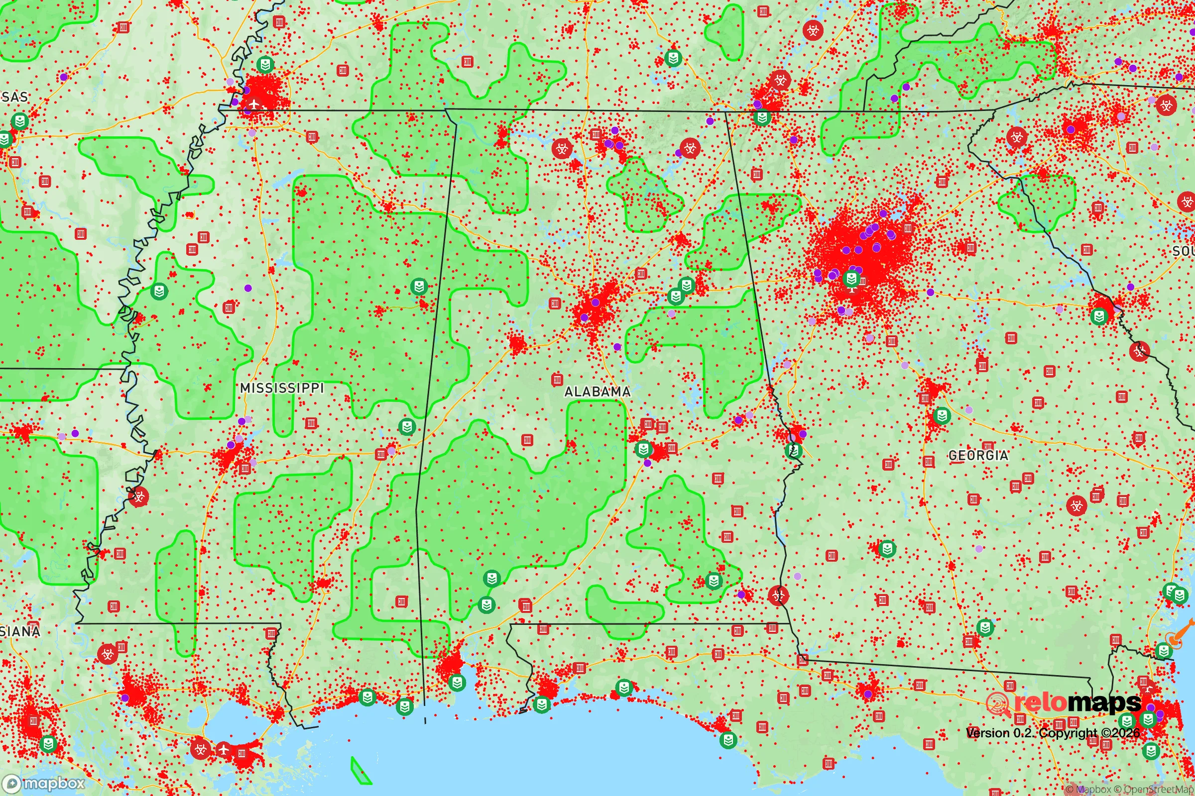
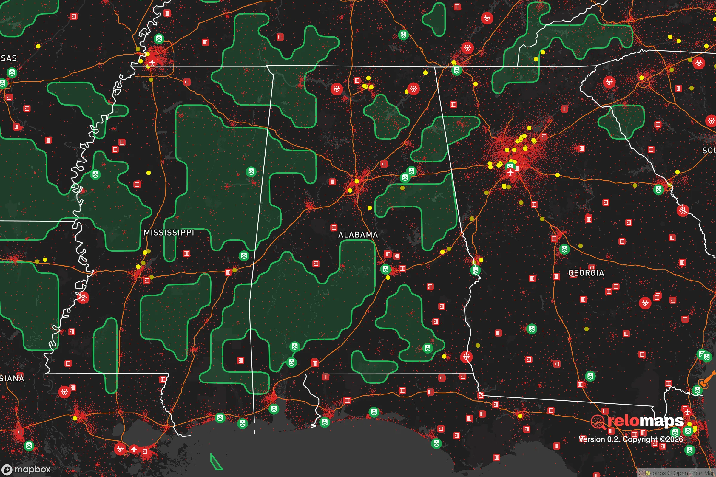
Important Note: For informational purposes only. This does not mean nothing bad ever happens in the green zones. Please use common sense. This is based on public data and modeled with AI. We tried to take a conservative approach but mistakes happen. We update this regularly as new information becomes available.
Solar Generator Recommendations
Backup power matters more here than in safer locations. We've picked three solar generators across budgets and capacity tiers — start with the budget unit if you only need a few essentials, or step up if you want to run a fridge and HVAC for days at a time.

Jackery Portable Power Station Explorer 300
Budget OptionPower on the Go: Weighing only 11 lbs, it's convenient to set up and store with book-sized foldable solar panels

BLUETTI Portable Power Station AC180
Designed for both indoor and outdoor scenarios, AC180 is highly capable as it has a robost capacity and continuous output power.

EF ECOFLOW DELTA Pro Ultra Power Station
Upgraded PickEcoFlow DELTA Pro Ultra is a whole-home energy system designed to grow with your family. Integrated with the Smart Home Panel 2, it scales to meet your evolving energy needs — keeping your home powered, intelligent, and secure through every stage of life.
We earn a commission, at no additional cost to you.
Strategic Assessment Analysis
Anniston, Alabama, offers a compelling mix of strategic depth and practical vulnerability for the conservative prepper or survivalist. Its location in the Appalachian foothills provides natural defensibility and resource access, but its proximity to the Anniston Army Depot and the chemical weapons incinerator introduces a unique set of risks that demand serious consideration. For a relocator weighing long-term resilience against potential man-made disasters, Anniston is a high-reward, high-awareness play—not a simple escape, but a calculated position.
Geographic position and natural advantages for long-term survival
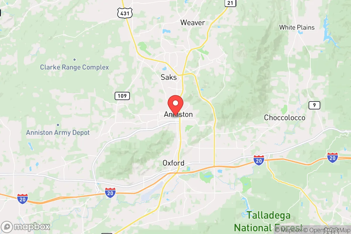
Anniston sits in Calhoun County, roughly 60 miles east of Birmingham and 90 miles west of Atlanta, placing it just outside the immediate blast radius and panic zones of those major metro areas. The city is nestled against the southern end of the Appalachian Mountains, specifically the Talladega National Forest and the Cheaha Wilderness area. This terrain offers significant natural barriers to mass movement during a collapse scenario—dense forests, steep ridges, and limited major highways funnel traffic through a few chokepoints like I-20 and US-431. For a relocator, this means you can monitor and control access to your property far more easily than in flat, open country. The region also boasts abundant surface water—the Coosa River system, including Logan Martin Lake and Weiss Lake, is within a 30-minute drive, and numerous creeks and springs dot the hills. Annual rainfall averages around 50 inches, so rainwater catchment is viable. The growing season is long (roughly 220 days), allowing for serious food production, and the local soil in the valleys is workable for gardens. Timber is plentiful for fuel and construction, and the local wildlife population—deer, turkey, small game—is robust enough to supplement a diet if managed properly. From a pure resource standpoint, Anniston’s geography is a solid B+ for a mid-term survival scenario.
Risks, exposures, and proximity to fallout-relevant landmarks
This is where the analysis gets serious. Anniston’s primary strategic liability is its role as a military and chemical weapons hub. The Anniston Army Depot is a major storage and maintenance facility for the U.S. Army, including large stockpiles of munitions and heavy equipment. During a major conflict or civil unrest, this site becomes a high-value target for sabotage or a focal point for federal security operations. More concerning is the Anniston Chemical Agent Disposal Facility, which has been incinerating the nation’s largest stockpile of VX and sarin nerve agents. While the incineration is reportedly complete as of 2023, the long-term storage and disposal history means the area has a documented legacy of chemical contamination. A catastrophic failure—whether from a terrorist attack, earthquake (rare but possible), or industrial accident—could release agents that would render large portions of the county uninhabitable. Additionally, the Fort McClellan site, a former Army post now partially used for training and by the FBI, has its own Superfund cleanup issues from past chemical and radiological training. For the survivalist, these are not abstract risks. They are concrete, location-specific hazards that could turn a retreat into a no-go zone overnight. The proximity to I-20 also means that any major event in Atlanta or Birmingham will send refugees streaming through Anniston, potentially overwhelming local resources and law enforcement. You are not isolated here—you are on a major evacuation corridor.
Practical resilience for a relocator: food, water, energy, and defensibility
On the ground, Anniston offers a mixed bag for daily preparedness. Water is the strongest asset: the Coosa River and its tributaries provide a reliable source, but you must treat for industrial runoff and agricultural chemicals. A good Berkey or RO system is non-negotiable. Well water is common in rural areas outside city limits, but test for heavy metals given the industrial history. Food production is viable: the local farmers’ market and a few small-scale farms (like Cheaha Farm) show that market gardening works, but the soil in the hills is thin and rocky—raised beds and composting are essential. The growing season is long enough for two crops of warm-season vegetables, and the area supports fruit trees (apples, peaches, figs) if you choose the right microclimate. Energy is a weak point. Anniston is served by Alabama Power, and the grid is aging. Power outages are frequent during summer storms and winter ice events, often lasting 24-48 hours. Solar is viable—the area gets about 210 sunny days per year—but tree cover in the hills can limit panel placement. A generator with a propane or diesel backup is a must for anyone serious about resilience. Defensibility is terrain-dependent. The hills and hollows offer natural chokepoints, but the valley floor (where most homes and businesses are) is open and exposed. Your best bet is a property on a ridge with a single access road, preferably off a county road rather than a state highway. The local population is a mix of retired military, factory workers, and rural families—generally self-reliant and conservative, but not a tight-knit prepper community. You’ll need to build relationships deliberately. The Calhoun County Sheriff’s Office is professional but understaffed; response times in rural areas can exceed 20 minutes. Medical care is adequate for routine issues (Regional Medical Center is the main hospital), but trauma care for a gunshot or major injury will require a helicopter to Birmingham—a significant gap in a SHTF scenario.
The overall strategic picture for Anniston is one of calculated trade-offs. You get genuine natural resources, defensible terrain, and a location that is close enough to civilization for resupply but far enough to avoid the worst of urban collapse—provided you can manage the unique risks from the military and chemical infrastructure. This is not a place for someone seeking total isolation or a bug-out location in the deep wilderness. It is a place for a prepared individual or family who understands that resilience means accepting proximity to danger in exchange for access to resources and community. If you can secure a property with good water, a defensible position, and a plan for evacuation if the chemical depot becomes a liability, Anniston offers a solid foundation for a long-term survival strategy. If you ignore those risks, you’re just camping next to a ticking bomb. Know your ground, know your neighbors, and keep your options open.
* Values derived from national, state, county, city and local statistics and may differ in a specific area. Last updated: 2026-04-19T18:42:14.000Z
Narrative content on this page is AI-generated and may contain mistakes. Verify any details that matter before acting on them.
ReloMaps may earn a commission from affiliate links at no extra cost to you.