
Photo: Wikipedia
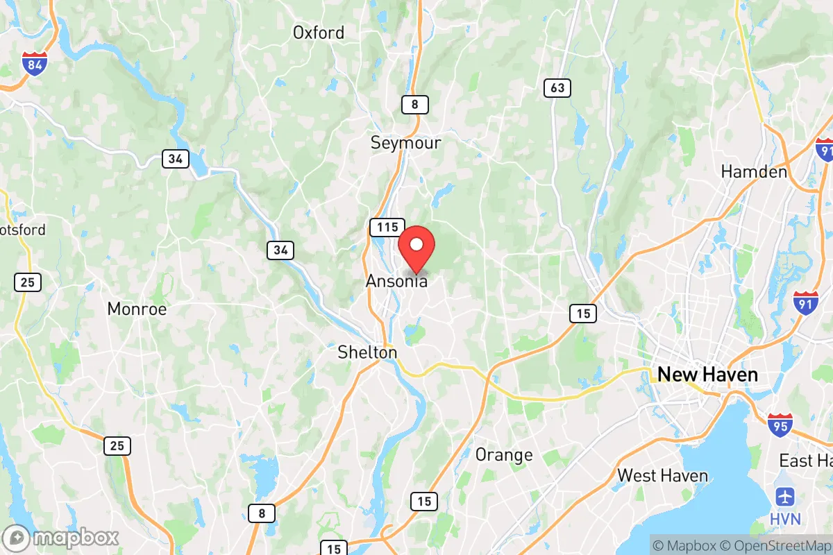
Strategic Assessment of Ansonia, CT
Multiple tactical vulnerabilities. Population density, target proximity, or disaster risk are likely compounding. A retreat property and exit planning is required.
What does the Strategic Assessment tell us?
Our Strategic Assessment grades tactical survivability of an area. Major population centers, military targets, fallout zones, natural disasters, and border exposure all drive risk — lower exposure means a more defensible position in a crisis.
This is heavily inspired by Joel Skousen's Strategic Relocation book. Highly recommended you checkout the book ($)What does this tell us?
Our Strategic Assessment grades tactical survivability of an area. Major population centers, military targets, fallout zones, natural disasters, and border exposure all drive risk — lower exposure means a more defensible position in a crisis.
This is heavily inspired by Joel Skousen's Strategic Relocation book. Highly recommended you checkout the book ($)Strategic Pillars

Key Distances
Regional Safe Places
Below is our recommended "safe zones" in Connecticut and the surrounding area based on our strategic heuristics. For most people, it's unrealistic to live in a “safe zone” full-time due to work, family or other personal reasons. They tend to be more rural. However, many of these areas are perfect for second homes and retreat properties that double as a vacation home or even a short-term rental.


Important Note: For informational purposes only. This does not mean nothing bad ever happens in the green zones. Please use common sense. This is based on public data and modeled with AI. We tried to take a conservative approach but mistakes happen. We update this regularly as new information becomes available.
Solar Generator Recommendations
Backup power matters more here than in safer locations. We've picked three solar generators across budgets and capacity tiers — start with the budget unit if you only need a few essentials, or step up if you want to run a fridge and HVAC for days at a time.

Jackery Portable Power Station Explorer 300
Budget OptionPower on the Go: Weighing only 11 lbs, it's convenient to set up and store with book-sized foldable solar panels

BLUETTI Portable Power Station AC180
Designed for both indoor and outdoor scenarios, AC180 is highly capable as it has a robost capacity and continuous output power.

EF ECOFLOW DELTA Pro Ultra Power Station
Upgraded PickEcoFlow DELTA Pro Ultra is a whole-home energy system designed to grow with your family. Integrated with the Smart Home Panel 2, it scales to meet your evolving energy needs — keeping your home powered, intelligent, and secure through every stage of life.
We earn a commission, at no additional cost to you.
Strategic Assessment Analysis
Ansonia, Connecticut, offers a surprisingly resilient position for those prioritizing strategic relocation in an uncertain future. Nestled in the Naugatuck River Valley, this small city of roughly 18,000 people provides a blend of industrial-era infrastructure and natural chokepoints that can be leveraged for security, while its proximity to larger urban centers like New Haven (about 10 miles south) and Waterbury (about 8 miles north) creates both opportunities and serious liabilities. For the prepper or survivalist with a conservative mindset, Ansonia is a mixed bag—it has genuine defensive advantages and access to resources, but its location in a densely populated corridor and its dependence on fragile supply chains demand careful, sober assessment.
Geographic position and natural defensive advantages in the Naugatuck Valley
Ansonia sits in a narrow valley carved by the Naugatuck River, flanked by steep, wooded hills that rise sharply on both sides. This topography is a double-edged sword: it provides natural barriers that could slow movement and create defensible perimeters, but it also funnels traffic and people into a few key corridors, making the city a potential bottleneck during a crisis. The river itself is a reliable water source, though it requires treatment, and the surrounding hills offer numerous hiking trails and undeveloped land for foraging or retreat. The city’s location along Route 8 and the Metro-North rail line means it’s connected to the broader Northeast corridor, but those same arteries could become escape routes or invasion paths depending on the scenario. For a relocator, the key advantage is the ability to control access points—the valley’s narrow shape means a small group could monitor or block the main roads with relative ease, especially the bridges crossing the river. However, this also means that if civil unrest or a mass casualty event hits the New Haven or Bridgeport metro areas, Ansonia could become a chokepoint for refugees or looters moving north. The surrounding towns of Derby, Seymour, and Shelton are similarly positioned, creating a small cluster of potential safe zones, but none are truly isolated from the region’s population density.
Risks, exposures, and proximity to fallout-relevant landmarks
The most significant risk for Ansonia is its proximity to several high-value targets that could become fallout zones in a major conflict or disaster. The city is roughly 15 miles from the New Haven Harbor, which hosts oil terminals, chemical storage facilities, and the Port of New Haven—a prime target for sabotage or military strike. The nearby Sikorsky Aircraft plant in Stratford (about 12 miles south) is a defense contractor hub, making it a potential target for state actors or domestic terror. Additionally, the Millstone Nuclear Power Station in Waterford is about 30 miles southeast; while not immediately threatening, a meltdown or attack there could send fallout up the Connecticut coast, and the prevailing winds from the southwest would push contamination directly toward the Naugatuck Valley. On a more local level, Ansonia itself has a history of industrial pollution—old brass mills and manufacturing sites have left soil and groundwater contamination, particularly along the river. During a grid-down scenario, these legacy toxins could become a health hazard if water tables shift or flooding occurs. The city’s dense housing stock, with many multi-family homes and narrow streets, also poses a fire risk; a major blaze could spread quickly through the older wooden structures, especially if emergency services are overwhelmed. For the prepper, the takeaway is clear: Ansonia is not a remote bunker location. It’s a valley town within striking distance of multiple high-consequence targets, and any serious crisis in the Northeast corridor will likely ripple through here within hours.
Practical resilience for a relocator: food, water, energy, and defensibility
On the practical side, Ansonia has some genuine strengths for a family or individual looking to hunker down. The Naugatuck River provides a year-round water source, but it’s heavily polluted from industrial runoff and upstream sewage overflows—any use requires robust filtration (e.g., Berkey systems with fluoride and heavy metal filters) or boiling. The city’s water utility draws from the Lake Housatonic watershed, but that system is vulnerable to power outages and contamination. For food, the surrounding valley has limited agricultural land; most produce comes from larger farms in the Litchfield Hills to the west, which are a 20-30 minute drive. However, the area has a strong hunting culture—deer, turkey, and small game are abundant in the nearby woodlands, and fishing in the river is possible (though catch-and-release is advised due to contamination). Energy resilience is a mixed picture: Ansonia’s grid is aging and prone to outages during storms, but the hills offer good locations for solar panels if you own property with southern exposure. Natural gas is piped through the valley, but that infrastructure is vulnerable to earthquakes or sabotage. Defensibility is where Ansonia shines relative to its size. The city’s layout—a compact downtown with residential neighborhoods climbing the hills—means that a prepared group could secure a single street or block with relative ease. The steep terrain limits vehicle access, and the many dead-end roads create natural cul-de-sacs. The Ansonia Police Department is small (about 40 officers), so during a prolonged crisis, self-reliance is mandatory. For a relocator, the best strategy is to buy or rent a home on the hillsides—preferably on the west side of the river, which has fewer through-roads and better views of approaching traffic. The nearby Paugussett State Forest offers a quick retreat into dense woods if needed.
Overall, Ansonia is a viable but not ideal strategic relocation point for the conservative prepper. It’s not a remote redoubt—you’re still within the gravitational pull of the Northeast’s urban chaos, and the valley’s geography makes it a natural funnel for trouble. But for someone who needs to stay within commuting distance of a job or family in Connecticut, it offers a defensible layout, a reliable water source, and enough surrounding wilderness to support a low-profile lifestyle. The key is to treat Ansonia as a base camp, not a fortress: stockpile supplies, build relationships with neighbors (many of whom are working-class and self-reliant), and have a bug-out plan for the Litchfield Hills or the Berkshires if the situation deteriorates. The city’s industrial past gives it a gritty, no-nonsense character that aligns with a survivalist mindset—just don’t mistake its small-town feel for true isolation. In a world of cascading crises, Ansonia is a place to hold the line, not a place to disappear.
* Values derived from national, state, county, city and local statistics and may differ in a specific area. Last updated: 2026-04-30T13:09:23.000Z
Narrative content on this page is AI-generated and may contain mistakes. Verify any details that matter before acting on them.
ReloMaps may earn a commission from affiliate links at no extra cost to you.