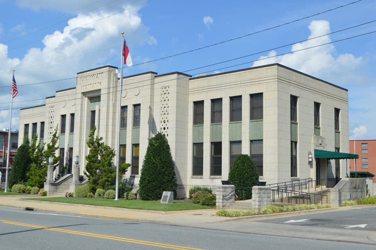
Photo: Wikipedia
Strategic Assessment of Asheboro, NC
Meaningful friction. Expect exposure to either population pressure, blast zones, or natural disaster risk. Consider buying a retreat property.
What does the Strategic Assessment tell us?
Our Strategic Assessment grades tactical survivability of an area. Major population centers, military targets, fallout zones, natural disasters, and border exposure all drive risk — lower exposure means a more defensible position in a crisis.
This is heavily inspired by Joel Skousen's Strategic Relocation book. Highly recommended you checkout the book ($)What does this tell us?
Our Strategic Assessment grades tactical survivability of an area. Major population centers, military targets, fallout zones, natural disasters, and border exposure all drive risk — lower exposure means a more defensible position in a crisis.
This is heavily inspired by Joel Skousen's Strategic Relocation book. Highly recommended you checkout the book ($)Strategic Pillars

Key Distances
Regional Safe Places
Below is our recommended "safe zones" in North Carolina and the surrounding area based on our strategic heuristics. For most people, it's unrealistic to live in a “safe zone” full-time due to work, family or other personal reasons. They tend to be more rural. However, many of these areas are perfect for second homes and retreat properties that double as a vacation home or even a short-term rental.


Important Note: For informational purposes only. This does not mean nothing bad ever happens in the green zones. Please use common sense. This is based on public data and modeled with AI. We tried to take a conservative approach but mistakes happen. We update this regularly as new information becomes available.
Solar Generator Recommendations
Backup power matters more here than in safer locations. We've picked three solar generators across budgets and capacity tiers — start with the budget unit if you only need a few essentials, or step up if you want to run a fridge and HVAC for days at a time.

Jackery Portable Power Station Explorer 300
Budget OptionPower on the Go: Weighing only 11 lbs, it's convenient to set up and store with book-sized foldable solar panels

BLUETTI Portable Power Station AC180
Designed for both indoor and outdoor scenarios, AC180 is highly capable as it has a robost capacity and continuous output power.

EF ECOFLOW DELTA Pro Ultra Power Station
Upgraded PickEcoFlow DELTA Pro Ultra is a whole-home energy system designed to grow with your family. Integrated with the Smart Home Panel 2, it scales to meet your evolving energy needs — keeping your home powered, intelligent, and secure through every stage of life.
We earn a commission, at no additional cost to you.
Strategic Assessment Analysis
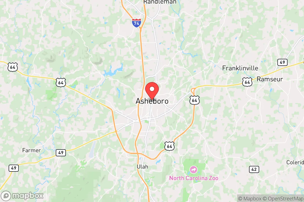
Asheboro, North Carolina, offers a strategic relocation option for those prioritizing resilience, offering a blend of geographic isolation from major metropolitan chaos while maintaining access to critical supply chains. Located in the Piedmont Triad region, roughly 25 miles south of Greensboro and 70 miles west of Raleigh, this city of about 27,000 sits at a crossroads of U.S. Highways 64 and 220, providing a defensible position that is neither too remote nor too exposed. For the conservative-minded prepper or survivalist, Asheboro’s key advantage is its position as a secondary hub—close enough to tap into regional resources during normal times, yet far enough from the likely epicenters of civil unrest, mass casualty events, or disaster fallout that would plague larger urban centers like Charlotte or the Research Triangle.
Geographic position and natural advantages for long-term survival
Asheboro’s location in the Uwharrie Mountains—actually ancient, eroded peaks—offers a natural defensive terrain that flatland cities cannot match. The city sits at an elevation of around 850 feet, with surrounding ridges reaching 1,000 feet, providing vantage points and natural barriers against both human and environmental threats. The Uwharrie National Forest, just 15 miles east, offers over 50,000 acres of public land for hunting, foraging, and emergency retreat, while the nearby Pee Dee River and Lake Tillery provide reliable water sources independent of municipal systems. The region’s temperate climate means no extreme cold snaps that would freeze water supplies, and the growing season runs from April to October, allowing for substantial food production. For the relocator, this means a location that can sustain a family through a grid-down scenario without the brutal winters of the North or the water scarcity of the West. The area’s clay soils are workable for gardening, and the surrounding hardwood forests provide ample firewood and building materials.
Risks, exposures, and proximity to fallout-relevant landmarks
No location is without vulnerabilities, and Asheboro has several that a strategic relocator must weigh. The most immediate concern is the city’s proximity to Interstate 85, a major north-south corridor that connects the Northeast to the Deep South. During a mass evacuation event, I-85 could become a chokepoint for refugees fleeing Charlotte or Greensboro, potentially bringing civil unrest into the area. Additionally, Asheboro is roughly 50 miles from the Piedmont Triad International Airport in Greensboro, a potential target for air-based threats or a staging ground for federal response. The city itself hosts a large furniture manufacturing base and a major distribution center for Amazon, meaning it has a non-trivial economic footprint that could attract attention during a breakdown. More concerning is the presence of the Randleman Dam, about 20 miles northwest, which impounds the Deep River and supplies water to the Triad region. A dam failure—whether from natural disaster or sabotage—could cause catastrophic flooding downstream, though Asheboro sits on higher ground and is not directly in the flood path. The area also lies within the Eastern Seaboard’s hurricane risk zone, though inland location means storm surge is not a factor; the primary risks are wind damage and power outages from storms like Hurricane Florence in 2018, which left parts of Randolph County without power for over a week.
Practical resilience for a relocator: food, water, energy, and defensibility
For the individual or family looking to establish a resilient homestead, Asheboro offers a mix of advantages and challenges. Water availability is strong: the city’s municipal supply comes from the Deep River and Lake Lucas, but private wells are common in the surrounding rural areas, with water tables at depths of 50-150 feet. A hand pump or solar-powered well pump can provide off-grid water security. Food production is viable: the growing season is long enough for two crop cycles, and local farmers’ markets and co-ops exist for seed and livestock acquisition. The Uwharrie National Forest allows deer hunting (with a license), and wild turkey and small game are abundant. For energy, the region has moderate solar potential—about 4.5 peak sun hours per day—and wood heating is practical given the forest cover. Defensibility is a mixed bag: the city itself is a typical small American town with a grid layout, but the surrounding countryside offers numerous rural properties with good sightlines, natural barriers (creeks, ridges), and distance from main roads. The local law enforcement presence is modest—Randolph County Sheriff’s Office has about 100 sworn deputies for a county of 143,000—meaning that in a prolonged crisis, residents would largely rely on themselves and their neighbors. The area has a strong gun culture, with multiple shooting ranges and gun shops, and the local population skews conservative and self-reliant, which can be an asset for forming mutual-aid networks. However, the city’s growing Hispanic population (about 15% of the total) and the presence of a large furniture industry workforce mean that demographic tensions could surface during a breakdown, so careful neighbor selection is advised.
Overall strategic picture for the conservative relocator
Asheboro presents a solid B+ option for the strategic relocator who wants to be prepared for civic unrest, mass casualty events, and natural disasters without going full off-grid in the mountains. Its strengths—reliable water, productive soil, defensible terrain, and a like-minded community—outweigh its weaknesses, which are primarily related to its proximity to major transportation corridors and a moderate risk of hurricane-related disruptions. The city is not a bunker location; it’s a practical, livable base from which to build resilience. For the single individual or family, the key is to secure property outside the city limits, ideally east toward the Uwharrie National Forest or south toward the Pee Dee River, where you can establish a self-sufficient homestead while still having access to Asheboro’s hardware stores, medical clinics, and grocery supply chains during normal times. The area’s low property taxes (Randolph County’s rate is about $0.60 per $100 of assessed value) and lack of state income tax on retirement income make it financially sustainable for long-term holding. In a worst-case scenario, Asheboro’s position as a secondary node—not a primary target—means it would likely be a place of relative stability while the coasts burn. It’s not perfect, but for the prepper who wants to stay within striking distance of civilization while maintaining the ability to bug out to the forest, it’s a strong contender.
* Values derived from national, state, county, city and local statistics and may differ in a specific area. Last updated: 2026-05-03T04:56:10.000Z
Narrative content on this page is AI-generated and may contain mistakes. Verify any details that matter before acting on them.
ReloMaps may earn a commission from affiliate links at no extra cost to you.