
Photo: Wikipedia
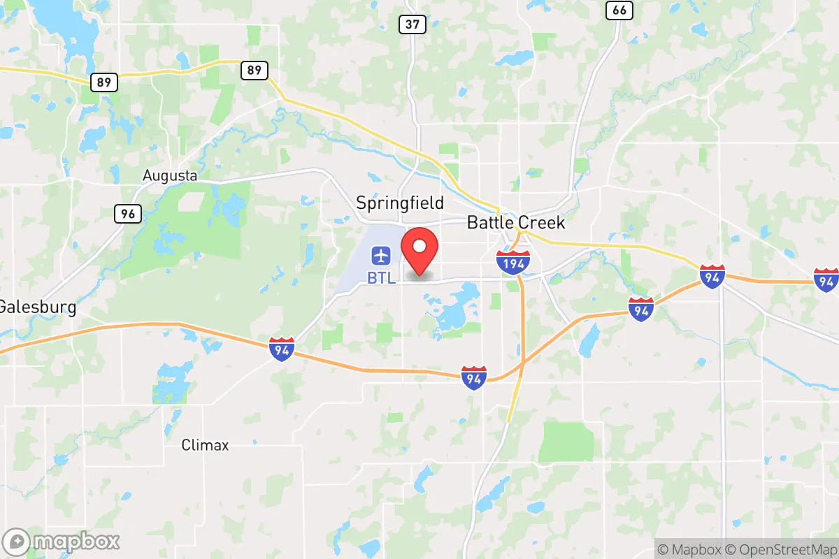
Strategic Assessment of Battle Creek, MI
Meaningful friction. Expect exposure to either population pressure, blast zones, or natural disaster risk. Consider buying a retreat property.
What does the Strategic Assessment tell us?
Our Strategic Assessment grades tactical survivability of an area. Major population centers, military targets, fallout zones, natural disasters, and border exposure all drive risk — lower exposure means a more defensible position in a crisis.
This is heavily inspired by Joel Skousen's Strategic Relocation book. Highly recommended you checkout the book ($)What does this tell us?
Our Strategic Assessment grades tactical survivability of an area. Major population centers, military targets, fallout zones, natural disasters, and border exposure all drive risk — lower exposure means a more defensible position in a crisis.
This is heavily inspired by Joel Skousen's Strategic Relocation book. Highly recommended you checkout the book ($)Strategic Pillars

Key Distances
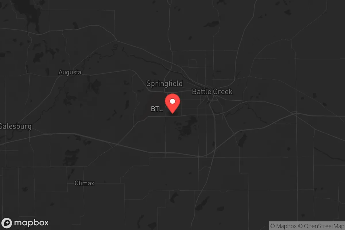
Regional Safe Places
Below is our recommended "safe zones" in Michigan and the surrounding area based on our strategic heuristics. For most people, it's unrealistic to live in a “safe zone” full-time due to work, family or other personal reasons. They tend to be more rural. However, many of these areas are perfect for second homes and retreat properties that double as a vacation home or even a short-term rental.


Important Note: For informational purposes only. This does not mean nothing bad ever happens in the green zones. Please use common sense. This is based on public data and modeled with AI. We tried to take a conservative approach but mistakes happen. We update this regularly as new information becomes available.
Solar Generator Recommendations
Backup power matters more here than in safer locations. We've picked three solar generators across budgets and capacity tiers — start with the budget unit if you only need a few essentials, or step up if you want to run a fridge and HVAC for days at a time.

Jackery Portable Power Station Explorer 300
Budget OptionPower on the Go: Weighing only 11 lbs, it's convenient to set up and store with book-sized foldable solar panels

BLUETTI Portable Power Station AC180
Designed for both indoor and outdoor scenarios, AC180 is highly capable as it has a robost capacity and continuous output power.

EF ECOFLOW DELTA Pro Ultra Power Station
Upgraded PickEcoFlow DELTA Pro Ultra is a whole-home energy system designed to grow with your family. Integrated with the Smart Home Panel 2, it scales to meet your evolving energy needs — keeping your home powered, intelligent, and secure through every stage of life.
We earn a commission, at no additional cost to you.
Strategic Assessment Analysis
Battle Creek, Michigan, often dismissed as just another Rust Belt relic, actually sits on a surprisingly resilient geographic and logistical foundation that deserves a hard look from anyone serious about strategic relocation. The city's position in the southern tier of Michigan's Lower Peninsula, roughly halfway between Lake Michigan and Lake Huron, places it in a sweet spot—close enough to major economic corridors to sustain a livelihood, yet far enough from the densest population centers to offer a meaningful buffer against the cascading failures of a degraded national grid or civil unrest. The area's history as a manufacturing and food-processing hub, anchored by the Kellogg Company and a diversified industrial base, means the local economy isn't a one-trick pony, and the surrounding agricultural land provides a tangible food-security advantage that many relocation targets simply cannot claim.
Geographic position and natural advantages for long-term stability
Battle Creek's location within the Kalamazoo River valley gives it access to a reliable freshwater source, which is non-negotiable for any serious prepper assessment. The river itself is not a massive shipping channel that invites outside attention, but it is a steady, year-round water supply that can support small-scale irrigation and household needs if municipal systems falter. The surrounding Calhoun County is a patchwork of working farms, woodlots, and small towns—places like Marshall, Athens, and Homer—that create a decentralized population pattern. This sprawl is a double-edged sword, but for a relocator, it means you can find a property with acreage, well water, and septic within 15–20 minutes of downtown, giving you both access to city amenities and the ability to go off-grid if needed. The region's temperate climate, with four distinct seasons and no hurricane or wildfire risk, reduces the likelihood of a single catastrophic weather event wiping out your setup. Winter preparedness is mandatory—lake-effect snow can dump two feet in a weekend—but that's a manageable inconvenience compared to the existential threats of coastal flooding or desertification.
Risks, exposures, and proximity to fallout-relevant landmarks
No honest strategic assessment can ignore the liabilities. Battle Creek is home to the Hart-Dole-Inouye Federal Center, a massive former Army facility that now houses multiple federal agencies, including a major VA regional office and the Defense Logistics Agency's distribution hub. In a scenario involving civil unrest or targeted attacks on federal infrastructure, this site is a clear liability. The presence of a large federal workforce and the associated security footprint means the city could see heightened law enforcement activity or, conversely, become a target for organized disruption. Additionally, Battle Creek is roughly 30 miles from the Palmer Woods Munitions Storage Area near the Fort Custer Training Center, a known stockpile of conventional munitions. While not a nuclear site, any large ordnance depot is a concern for secondary explosions or security breaches during a breakdown of order. The city also sits within 100 miles of the Fermi 2 nuclear power plant near Monroe, MI, and the Palisades Nuclear Plant (now decommissioned but still storing spent fuel) near South Haven. A worst-case release from either would put Battle Creek in a downwind danger zone, though the prevailing westerlies offer some mitigation. For a conservative relocator, the proximity to these federal and military assets is a net negative—it increases the probability of the city being a node in a larger crisis, rather than a quiet backwater where you can ride out the storm.
Practical resilience for a relocator: food, water, energy, and defensibility
This is where Battle Creek punches above its weight. The city's identity as the "Cereal City" is not just marketing—the Kellogg Company and Post Consumer Brands both maintain major production facilities here, and the surrounding agricultural region produces corn, soybeans, wheat, and dairy. In a prolonged disruption of supply chains, this local food-processing capacity is a genuine strategic asset. You can buy bulk grains, legumes, and canned goods directly from regional distributors, and the presence of multiple large-scale food warehouses means emergency supplies may be more accessible here than in most places. Water is similarly favorable: the Battle Creek River and the Kalamazoo River both run through the city, and the glacial aquifer underlying much of Calhoun County provides excellent well water at modest depths (typically 50–150 feet). For energy, the area is served by Consumers Energy and DTE Energy, both of which have a mixed grid of coal, natural gas, and renewables. However, the region's relatively low population density compared to Detroit or Grand Rapids means grid failures during winter storms are common but usually repaired within 24–48 hours. For off-grid capability, the area has good solar insolation for Michigan (about 4.0 peak sun hours per day), and wood heating is viable given the extensive hardwood forests in the surrounding countryside. Defensibility is moderate: the terrain is flat to gently rolling, with no natural chokepoints like mountain passes, but the patchwork of small farms and woodlots allows for a low-visibility lifestyle. You can live on a rural road with a single access point, maintain a low profile, and still be 10 minutes from a grocery store. The local gun culture is strong—Michigan is a shall-issue state for concealed carry, and Calhoun County has a robust network of gun shops, ranges, and private landowners who take self-defense seriously. That said, the city itself has pockets of urban decay, particularly on the north and east sides, where property crime and drug activity are elevated. A relocator should avoid those areas and focus on the southern and western townships, where the population is older, more conservative, and more likely to form mutual-aid networks.
The overall strategic picture for Battle Creek is one of cautious optimism for a prepared relocator. It is not a bug-out paradise—there are no mountains to hide in, no remote islands, no fortress-like geography. What it offers is something arguably more valuable in a long-term collapse scenario: a functional, diversified local economy, abundant fresh water, a strong agricultural base, and a population that, while not uniformly conservative, includes a significant number of veterans, farmers, and tradespeople who understand self-reliance. The risks from federal infrastructure and proximity to nuclear plants are real but manageable with situational awareness and a well-chosen property outside the immediate blast or security zones. For a single individual or a family willing to put in the work—dig a well, stock a pantry, learn to hunt and garden, and build relationships with neighbors who share your values—Battle Creek provides a solid foundation. It is a place where you can live a normal life while quietly preparing for the abnormal, without the constant anxiety of being in a major target zone. The key is to treat it as a base of operations, not a final redoubt, and to always have a secondary plan for relocation further north into the Upper Peninsula if the situation deteriorates beyond recovery. In a world where most relocation advice is either naive boosterism or paranoid escapism, Battle Creek offers a rare middle ground: a place that is real, flawed, and worth a serious look.
* Values derived from national, state, county, city and local statistics and may differ in a specific area. Last updated: 2026-05-04T07:51:01.000Z
Narrative content on this page is AI-generated and may contain mistakes. Verify any details that matter before acting on them.
ReloMaps may earn a commission from affiliate links at no extra cost to you.