
Photo: Wikipedia
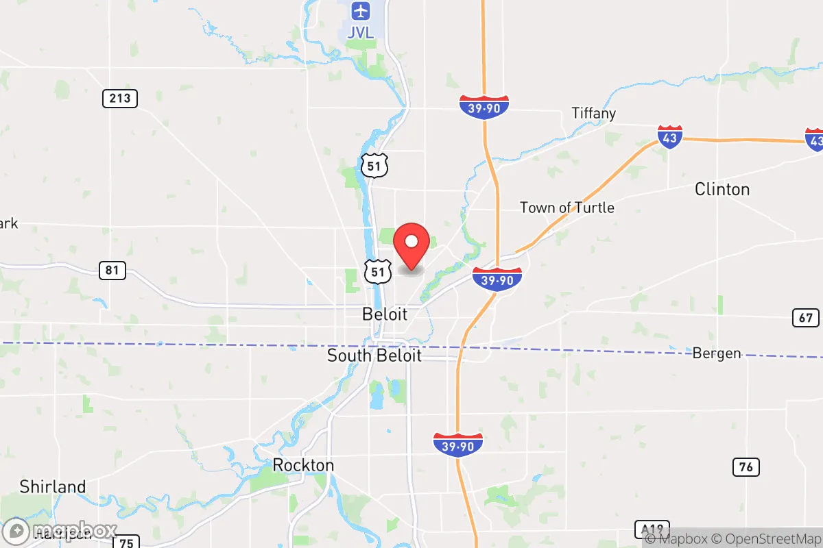
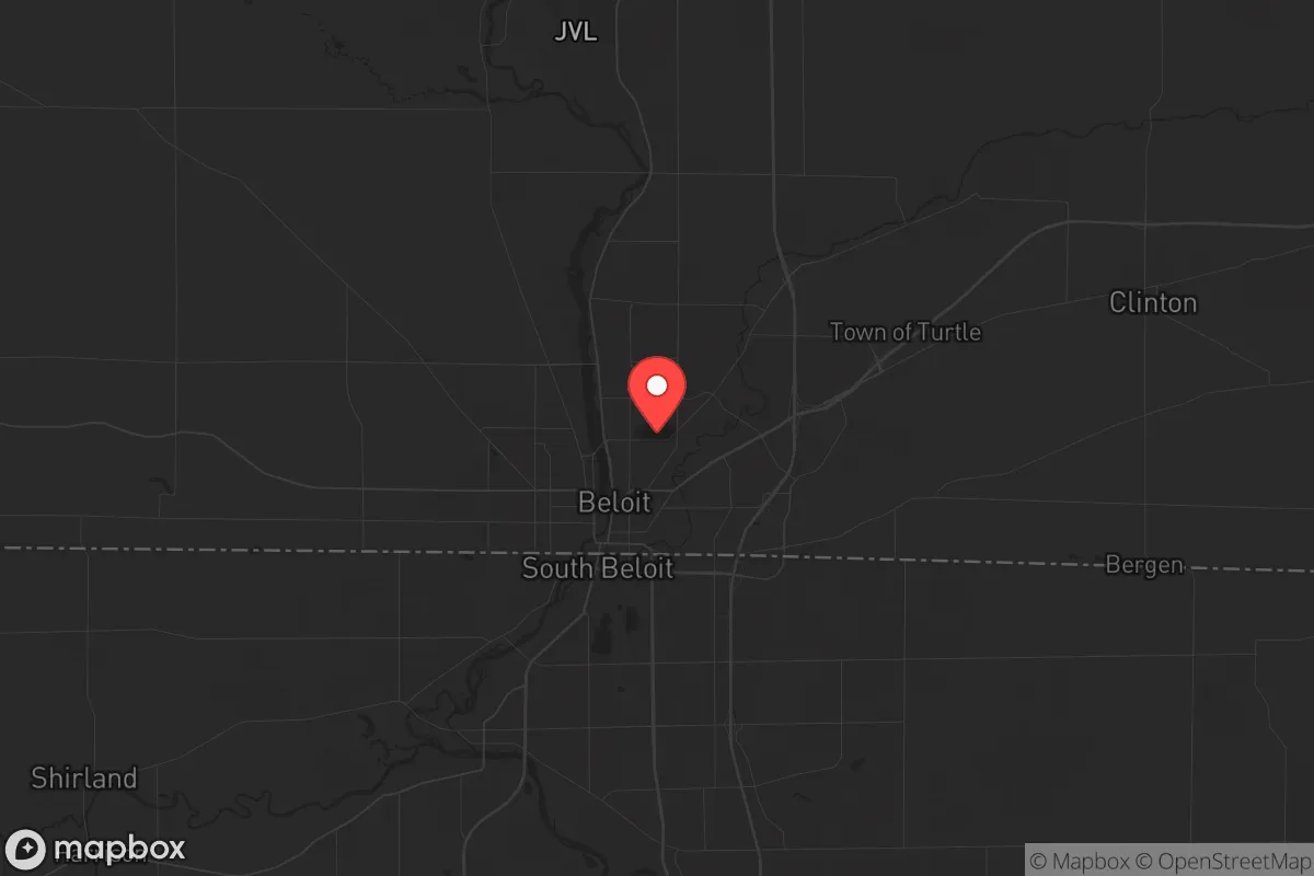
Strategic Assessment of Beloit, WI
Meaningful friction. Expect exposure to either population pressure, blast zones, or natural disaster risk. Consider buying a retreat property.
What does the Strategic Assessment tell us?
Our Strategic Assessment grades tactical survivability of an area. Major population centers, military targets, fallout zones, natural disasters, and border exposure all drive risk — lower exposure means a more defensible position in a crisis.
This is heavily inspired by Joel Skousen's Strategic Relocation book. Highly recommended you checkout the book ($)What does this tell us?
Our Strategic Assessment grades tactical survivability of an area. Major population centers, military targets, fallout zones, natural disasters, and border exposure all drive risk — lower exposure means a more defensible position in a crisis.
This is heavily inspired by Joel Skousen's Strategic Relocation book. Highly recommended you checkout the book ($)Strategic Pillars

Key Distances
Regional Safe Places
Below is our recommended "safe zones" in Wisconsin and the surrounding area based on our strategic heuristics. For most people, it's unrealistic to live in a “safe zone” full-time due to work, family or other personal reasons. They tend to be more rural. However, many of these areas are perfect for second homes and retreat properties that double as a vacation home or even a short-term rental.
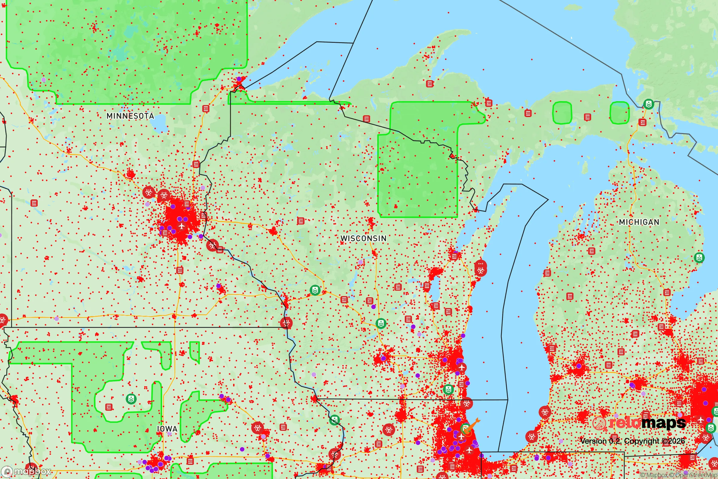
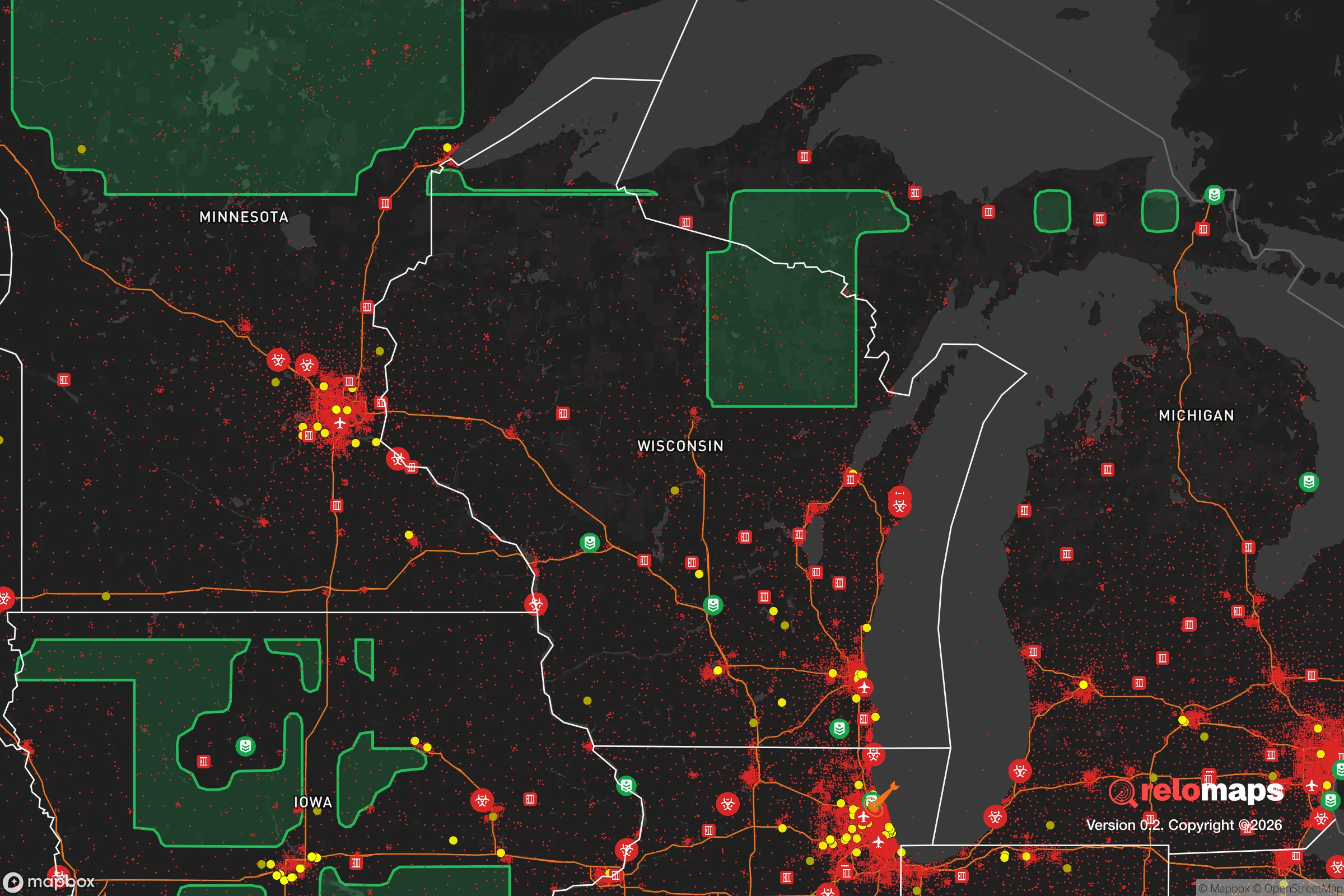
Important Note: For informational purposes only. This does not mean nothing bad ever happens in the green zones. Please use common sense. This is based on public data and modeled with AI. We tried to take a conservative approach but mistakes happen. We update this regularly as new information becomes available.
Solar Generator Recommendations
Backup power matters more here than in safer locations. We've picked three solar generators across budgets and capacity tiers — start with the budget unit if you only need a few essentials, or step up if you want to run a fridge and HVAC for days at a time.

Jackery Portable Power Station Explorer 300
Budget OptionPower on the Go: Weighing only 11 lbs, it's convenient to set up and store with book-sized foldable solar panels

BLUETTI Portable Power Station AC180
Designed for both indoor and outdoor scenarios, AC180 is highly capable as it has a robost capacity and continuous output power.

EF ECOFLOW DELTA Pro Ultra Power Station
Upgraded PickEcoFlow DELTA Pro Ultra is a whole-home energy system designed to grow with your family. Integrated with the Smart Home Panel 2, it scales to meet your evolving energy needs — keeping your home powered, intelligent, and secure through every stage of life.
We earn a commission, at no additional cost to you.
Strategic Assessment Analysis
Beloit, Wisconsin, sits in a precarious but potentially advantageous position for those serious about long-term resilience. Its location on the Illinois border, roughly 70 miles from Chicago and 40 miles from Milwaukee, places it within striking distance of major population centers—a clear liability in a collapse scenario—yet the city itself retains a small-town character and industrial backbone that could prove surprisingly durable. For a relocator with a prepper mindset, Beloit offers a mixed bag: proximity to fallout zones is a real concern, but the area’s access to freshwater, agricultural land, and a working-class ethos provides a foundation for self-reliance that many suburban sprawls lack entirely.
Geographic position and natural advantages for long-term survival
Beloit’s geography is defined by the Rock River, which cuts through the city and provides a reliable surface water source—critical for any grid-down scenario. The surrounding landscape is flat to gently rolling, dominated by fertile glacial till soils that support robust agriculture; Rock County is among Wisconsin’s top producers of corn, soybeans, and dairy. This means local food production is not a theoretical exercise but an existing industry. The city sits at an elevation of roughly 730 feet, with no significant floodplain risk along the river’s higher banks, and the region’s temperate climate allows for a growing season of about 150 days. For a relocator, these natural advantages translate into real options: you can tap the river for irrigation or filtration, source food from nearby farms, and avoid the wildfire and hurricane risks that plague other parts of the country. The area’s position in the upper Midwest also places it outside the most likely nuclear target corridors—no major military bases, ICBM silos, or strategic command centers are within 50 miles—though the proximity to Chicago and Milwaukee introduces a different kind of exposure.
Risks, exposures, and proximity to fallout-relevant landmarks
The single biggest strategic weakness of Beloit is its location on the I-90/39 corridor, a major north-south artery that connects Chicago to Madison and the Twin Cities. In a crisis involving civil unrest or mass evacuation, this highway would become a chokepoint and a vector for displaced populations. Chicago, with its 2.7 million residents and history of civil disorder, lies just 90 minutes south; a mass casualty event or economic collapse there could send waves of refugees northward. Beloit itself has a population of roughly 37,000, but the broader Janesville-Beloit metropolitan area pushes 160,000—enough density to create competition for resources but not so much that the area becomes a primary target. The nearby Rockford, Illinois, area (about 20 miles south) adds another 150,000 people and its own set of urban problems. For fallout from a nuclear exchange, Beloit is far enough from Chicago and Milwaukee to avoid lethal prompt radiation, but prevailing winds from the west could carry fallout from strikes on the Twin Cities or Omaha. The real risk here is not a direct hit but the secondary effects: overwhelmed infrastructure, resource scarcity, and the influx of desperate people from the south. A relocator should plan for the possibility of having to defend a perimeter or relocate further north if the corridor becomes untenable.
Practical resilience for a relocator: food, water, energy, and defensibility
For the individual or family serious about self-sufficiency, Beloit offers several concrete advantages. Water is abundant: the Rock River flows year-round, and the city’s municipal supply draws from deep sandstone aquifers that are less vulnerable to surface contamination. A well on private property is a realistic option in the surrounding rural areas, with typical depths of 100–200 feet. Food production is viable: the growing season is short but productive, and the region’s agricultural infrastructure means seeds, tools, and livestock are readily available from local farm supply stores. The city itself has a working-class industrial base—including a large General Motors plant and several manufacturing facilities—which could be repurposed for fabrication or repair in a prolonged crisis. Energy resilience is mixed: the grid is reliable under normal conditions, but winter ice storms and summer heat waves can cause outages. Solar panels are a reasonable investment here, as the area receives about 4.5 peak sun hours per day, though snow cover in winter requires panel tilting or manual clearing. Natural gas is widely available, and wood-burning stoves are common in rural homes. Defensibility is the weak point: Beloit is flat and open, with no natural chokepoints like mountains or rivers that can be easily fortified. The city’s layout is a typical Midwestern grid, with multiple entry points from all directions. A relocator would be better served by a property on the outskirts—ideally with a long driveway, sightlines, and a buffer of farmland—than by a home within city limits. The local gun culture is strong, with several shooting ranges and gun shops in the area, and Wisconsin is a shall-issue state for concealed carry, which aligns with a preparedness mindset. The nearest major medical facility is Beloit Memorial Hospital, a 100-bed community hospital that could be overwhelmed in a mass casualty event; serious trauma cases would require evacuation to Madison or Milwaukee, which may not be feasible in a grid-down scenario.
The overall strategic picture for Beloit is one of calculated trade-offs. It is not a remote redoubt—you will not find the isolation of the Rocky Mountains or the defensibility of the Appalachian hollows here. What you will find is a functional, working-class community with access to water, food, and industrial resources, positioned far enough from major targets to avoid the worst of a nuclear exchange but close enough to be affected by the aftermath. For a relocator who values community resilience over absolute isolation, Beloit offers a realistic base of operations. The key is to treat it as a staging area: establish a property with a well, a garden, and a wood stove, build relationships with local farmers and tradesmen, and have a plan to move further north or west if the I-90 corridor becomes impassable. The city’s greatest strength is its ordinariness—it is not a likely target, and its people are not predisposed to panic. Its greatest weakness is its location on a highway that connects chaos to the south. If you are willing to accept that risk and prepare accordingly, Beloit can serve as a solid, if unglamorous, anchor for a long-term resilience strategy.
* Values derived from national, state, county, city and local statistics and may differ in a specific area. Last updated: 2026-05-03T20:39:25.000Z
Narrative content on this page is AI-generated and may contain mistakes. Verify any details that matter before acting on them.
ReloMaps may earn a commission from affiliate links at no extra cost to you.