Photo: Wikipedia
Strategic Assessment of Breckenridge, CO
Workable tactical position. Some exposure to population density or targets, but generally defensible in a crisis.
What does the Strategic Assessment tell us?
Our Strategic Assessment grades tactical survivability of an area. Major population centers, military targets, fallout zones, natural disasters, and border exposure all drive risk — lower exposure means a more defensible position in a crisis.
This is heavily inspired by Joel Skousen's Strategic Relocation book. Highly recommended you checkout the book ($)What does this tell us?
Our Strategic Assessment grades tactical survivability of an area. Major population centers, military targets, fallout zones, natural disasters, and border exposure all drive risk — lower exposure means a more defensible position in a crisis.
This is heavily inspired by Joel Skousen's Strategic Relocation book. Highly recommended you checkout the book ($)Strategic Pillars

Key Distances
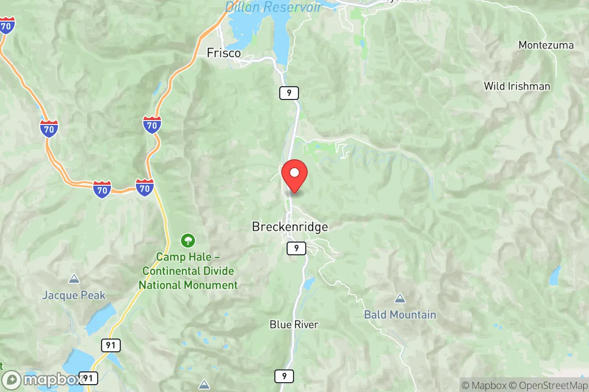
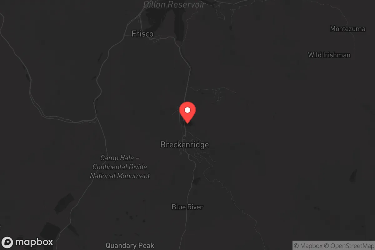
Regional Safe Places
Below is our recommended "safe zones" in Colorado and the surrounding area based on our strategic heuristics. For most people, it's unrealistic to live in a “safe zone” full-time due to work, family or other personal reasons. They tend to be more rural. However, many of these areas are perfect for second homes and retreat properties that double as a vacation home or even a short-term rental.


Important Note: For informational purposes only. This does not mean nothing bad ever happens in the green zones. Please use common sense. This is based on public data and modeled with AI. We tried to take a conservative approach but mistakes happen. We update this regularly as new information becomes available.
Solar Generator Recommendations
Backup power matters more here than in safer locations. We've picked three solar generators across budgets and capacity tiers — start with the budget unit if you only need a few essentials, or step up if you want to run a fridge and HVAC for days at a time.

Jackery Portable Power Station Explorer 300
Budget OptionPower on the Go: Weighing only 11 lbs, it's convenient to set up and store with book-sized foldable solar panels

BLUETTI Portable Power Station AC180
Designed for both indoor and outdoor scenarios, AC180 is highly capable as it has a robost capacity and continuous output power.

EF ECOFLOW DELTA Pro Ultra Power Station
Upgraded PickEcoFlow DELTA Pro Ultra is a whole-home energy system designed to grow with your family. Integrated with the Smart Home Panel 2, it scales to meet your evolving energy needs — keeping your home powered, intelligent, and secure through every stage of life.
We earn a commission, at no additional cost to you.
Strategic Assessment Analysis
Breckenridge, Colorado, sits at a unique strategic crossroads: it’s a high-altitude mountain town with a permanent population of roughly 5,000, yet it’s only 80 miles from the Denver metro area—close enough to access resources, but far enough to avoid the immediate blast radius of a major urban target. Its location in Summit County, nestled in the Tenmile Range, offers natural defensibility through elevation and rugged terrain, but the same geography that makes it a ski resort also creates logistical challenges for long-term self-sufficiency. For a relocator with a survivalist mindset, Breckenridge presents a mixed bag: strong natural barriers and a tight-knit community, but heavy reliance on tourism infrastructure and a single major highway (I-70) that can become a choke point in a crisis.
Geographic position and natural advantages for long-term survival
Breckenridge’s primary strategic asset is its elevation—9,600 feet above sea level—which provides a natural defensive buffer. The surrounding White River National Forest and the Continental Divide create a ring of rugged, sparsely populated terrain that would slow any large-scale movement of people or vehicles. The town sits in a valley, but the steep slopes on all sides mean only a few roads (mainly CO-9 and I-70) provide access, making it easier to monitor and control entry points. The area’s cold, dry climate also reduces the risk of many biological threats; most pathogens struggle to survive at altitude, and the winter freeze acts as a natural sanitation cycle. Water is abundant from the Blue River and numerous alpine lakes, though it requires filtration or boiling due to heavy recreational use and potential contamination from mining runoff—the area has a legacy of hardrock mining that left heavy metals in some drainages. For a prepper, the key advantage is that Breckenridge is far enough from Denver (80 miles) to avoid the immediate fallout from a nuclear or EMP event targeting the Front Range, yet close enough to access medical supplies or fuel caches if the roads are clear. The downside: the town’s economy is almost entirely tourism-driven, meaning most residents work in hospitality and retail, not agriculture or manufacturing. If the ski lifts stop turning, the local food supply dries up fast.
Risks, exposures, and proximity to fallout-relevant landmarks
The biggest strategic vulnerability is Breckenridge’s proximity to I-70, the main east-west artery through the Rockies. In a mass evacuation scenario—say, a Denver-area disaster or a major earthquake along the Wasatch Front—I-70 would become a parking lot, and Breckenridge would be a natural stopping point for refugees. The town’s population swells to over 30,000 on peak ski weekends, meaning the infrastructure (food, water, medical) is already strained during normal times. A crisis would multiply that pressure. Additionally, Breckenridge is within 100 miles of the Rocky Flats National Wildlife Refuge, a former nuclear weapons plant that remains a Superfund site. While the plutonium contamination is mostly contained, a major wildfire or earthquake could resuspend hazardous materials, and prevailing winds from the east could carry fallout into Summit County. The town also sits near the Gore Range, which has known uranium deposits; while not actively mined, the geology means radon levels in basements are a chronic concern. For a prepper, the biggest risk is not a direct strike but a cascading failure: a Denver-area EMP or cyberattack on the grid would knock out power to Breckenridge for weeks, and the town’s reliance on electric snowmelt systems for roads and water pipes would make winter survival extremely difficult. The local hospital (St. Anthony Summit Medical Center) is a Level III trauma center—adequate for routine injuries but overwhelmed in a mass casualty event. The nearest major trauma center is in Frisco (10 miles) or Denver (80 miles), both of which would be gridlocked.
Practical resilience for a relocator: food, water, energy, and defensibility
For a single individual or family looking to hunker down, Breckenridge offers some strong points and some hard limits. Water is the easiest resource to secure: the Blue River runs through town, and there are dozens of small creeks and springs in the surrounding national forest. A good gravity-fed filtration system (like a Berkey or Katadyn) and a few 55-gallon drums would cover a household for months. The town’s municipal water comes from the Blue River and is treated, but in a grid-down scenario, the pumps fail—so a hand pump or rainwater catchment is essential. Food is the weak link. The local grocery stores (City Market, Whole Foods) carry about 3-5 days of supply for the normal population, and in a crisis, those shelves would empty in hours. There are no major farms or ranches within 20 miles; the growing season is only 60-90 days, and the soil is thin and rocky. A serious prepper would need to stockpile at least 6 months of freeze-dried or canned goods, plus a way to hunt elk or mule deer (which are abundant but require a license and a rifle). Energy is a mixed bag. Breckenridge gets over 300 days of sun per year, so solar panels are viable, but the heavy snowpack in winter can bury them for weeks. A small propane generator with a 500-gallon tank is more reliable, but propane deliveries stop in a crisis. Firewood is plentiful from the national forest, but burning it for heat requires a wood stove and a chimney—most modern condos and townhouses lack this. Defensibility is decent but not fortress-level. The town’s layout—a compact core with narrow streets and steep hills—makes it hard for a large group to move through quickly. A well-positioned home on the outskirts (like near the Breckenridge Golf Course or along the Blue River) offers good sightlines and limited access points. However, the town has a strong tourist police presence (Summit County Sheriff’s Office) that would likely enforce order early in a crisis, but that same presence could also mean confiscation of supplies under emergency orders. The local culture is libertarian-leaning but not hardcore prepper; most residents are wealthy second-home owners or service workers, not survivalists. You’d be one of a handful of people with a real plan.
The overall strategic picture for Breckenridge is that it’s a decent fallback position for someone who already has a primary retreat elsewhere—say, a ranch in Wyoming or a cabin in the San Juans. It’s too dependent on tourism and too close to I-70 to be a standalone long-term survival location. But for a single person or a small family who wants a defensible, high-altitude base with good water and decent solar potential, it beats most Front Range suburbs. The key is to treat Breckenridge as a temporary staging point, not a final destination. Stockpile heavily, learn to navigate the backcountry on skis or snowshoes (because I-70 will be impassable in winter), and have a plan to bug out further west—to the Gunnison Valley or the Four Corners—if the Denver metro area collapses. The mountains are a buffer, not a fortress. Breckenridge gives you time, but not safety.
* Values derived from national, state, county, city and local statistics and may differ in a specific area. Last updated: 2026-04-29T00:29:45.000Z
Narrative content on this page is AI-generated and may contain mistakes. Verify any details that matter before acting on them.
ReloMaps may earn a commission from affiliate links at no extra cost to you.