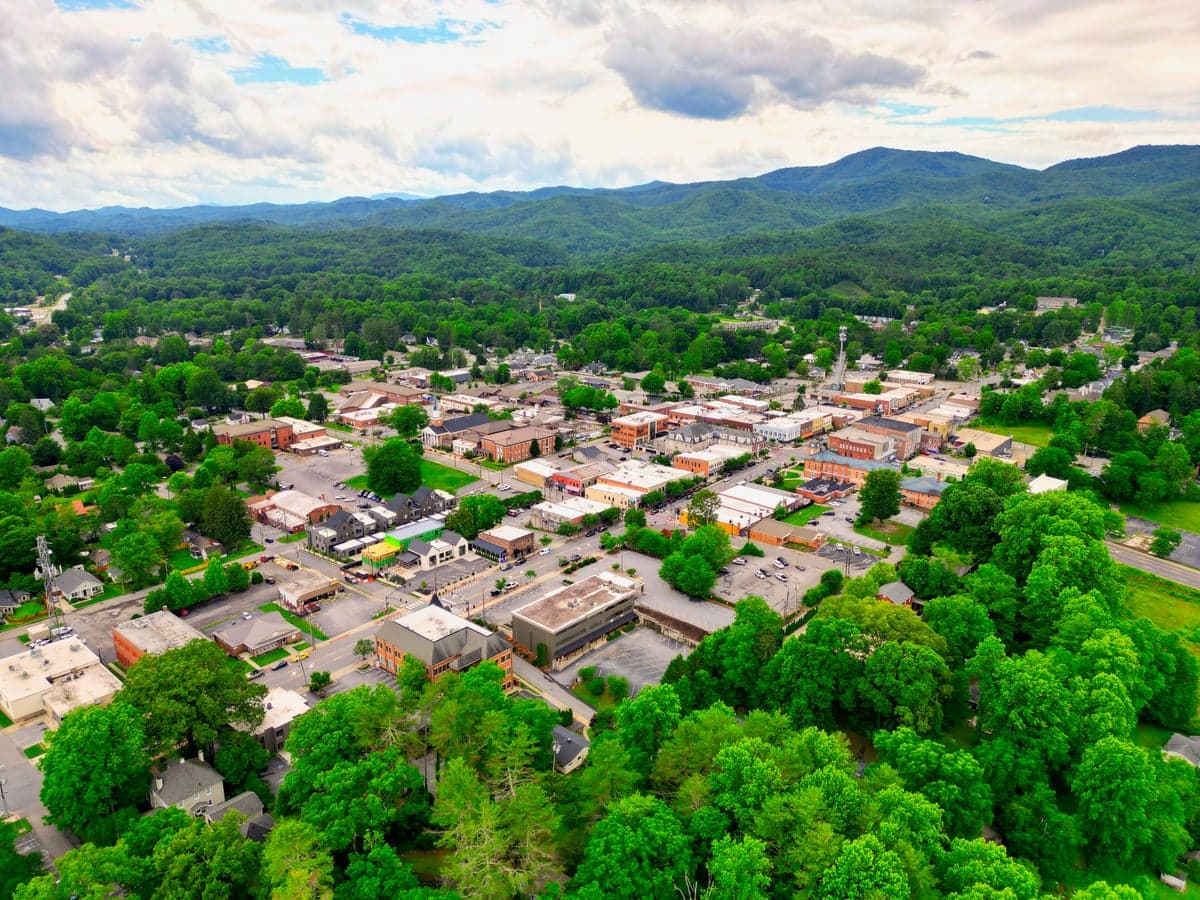
Photo: Wikipedia
Strategic Assessment of Brevard, NC
Workable tactical position. Some exposure to population density or targets, but generally defensible in a crisis.
What does the Strategic Assessment tell us?
Our Strategic Assessment grades tactical survivability of an area. Major population centers, military targets, fallout zones, natural disasters, and border exposure all drive risk — lower exposure means a more defensible position in a crisis.
This is heavily inspired by Joel Skousen's Strategic Relocation book. Highly recommended you checkout the book ($)What does this tell us?
Our Strategic Assessment grades tactical survivability of an area. Major population centers, military targets, fallout zones, natural disasters, and border exposure all drive risk — lower exposure means a more defensible position in a crisis.
This is heavily inspired by Joel Skousen's Strategic Relocation book. Highly recommended you checkout the book ($)Strategic Pillars

Key Distances
Regional Safe Places
Below is our recommended "safe zones" in North Carolina and the surrounding area based on our strategic heuristics. For most people, it's unrealistic to live in a “safe zone” full-time due to work, family or other personal reasons. They tend to be more rural. However, many of these areas are perfect for second homes and retreat properties that double as a vacation home or even a short-term rental.

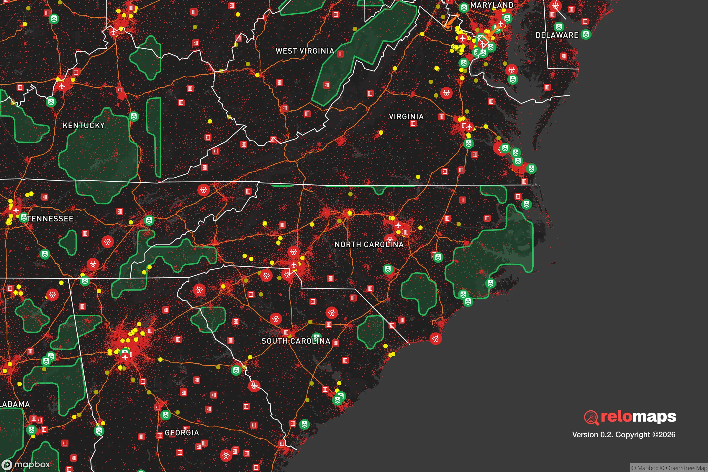


Important Note: For informational purposes only. This does not mean nothing bad ever happens in the green zones. Please use common sense. This is based on public data and modeled with AI. We tried to take a conservative approach but mistakes happen. We update this regularly as new information becomes available.
Solar Generator Recommendations
Backup power matters more here than in safer locations. We've picked three solar generators across budgets and capacity tiers — start with the budget unit if you only need a few essentials, or step up if you want to run a fridge and HVAC for days at a time.

Jackery Portable Power Station Explorer 300
Budget OptionPower on the Go: Weighing only 11 lbs, it's convenient to set up and store with book-sized foldable solar panels

BLUETTI Portable Power Station AC180
Designed for both indoor and outdoor scenarios, AC180 is highly capable as it has a robost capacity and continuous output power.

EF ECOFLOW DELTA Pro Ultra Power Station
Upgraded PickEcoFlow DELTA Pro Ultra is a whole-home energy system designed to grow with your family. Integrated with the Smart Home Panel 2, it scales to meet your evolving energy needs — keeping your home powered, intelligent, and secure through every stage of life.
We earn a commission, at no additional cost to you.
Strategic Assessment Analysis
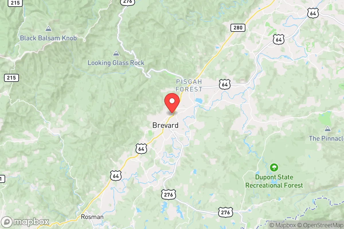
Brevard, North Carolina, offers a compelling mix of geographic isolation and strategic access that makes it a serious candidate for relocation focused on resilience and self-sufficiency. Nestled in the Blue Ridge Mountains at the southwestern edge of Transylvania County, the town sits roughly 35 miles southwest of Asheville and about 45 miles northwest of Greenville, South Carolina, placing it within a reasonable drive of regional medical and supply hubs while remaining distinctly removed from the urban core. The area’s natural topography, temperate climate, and relatively low population density create a baseline of advantages for anyone evaluating long-term preparedness, though proximity to certain infrastructure and regional risks requires a clear-eyed assessment.
Geographic position and natural advantages for self-sufficiency
Brevard’s location in the Pisgah National Forest and near the headwaters of the French Broad River provides a natural buffer against many of the vulnerabilities found in flatter, more densely populated regions. The surrounding mountains, including the Blue Ridge Escarpment to the south and east, create a physical barrier that limits through-traffic and reduces the likelihood of large-scale evacuation or refugee flow during a regional emergency. Elevation in the town itself sits around 2,200 feet, which moderates summer heat and reduces the risk of vector-borne diseases compared to lower-lying areas in the Southeast. The region receives abundant rainfall—averaging roughly 60 inches per year—which supports robust local water tables, springs, and perennial streams. For a relocator focused on water security, this is a significant advantage: most properties with even a modest acreage can develop a reliable off-grid water source via well or surface collection. The surrounding national forest also provides a substantial buffer against suburban sprawl and industrial encroachment, preserving both wildlife corridors and a degree of natural sound and light isolation that is increasingly rare in the eastern United States.
Risks, exposures, and proximity to fallout-relevant landmarks
No resilience assessment is complete without acknowledging the risks that come with mountain living and regional infrastructure. Brevard sits in a seismically quiet zone, but the Appalachian region experiences occasional minor tremors; the more pressing natural threat is flooding in low-lying areas near the French Broad and its tributaries, particularly after heavy rain events. The town itself is not in a designated floodplain, but some outlying properties along creeks and valleys are vulnerable. Wildfire risk is moderate: the surrounding forest is predominantly mixed hardwood, which burns less aggressively than western conifer forests, but dry spells and wind events can elevate danger, especially for homes with heavy tree cover and limited defensible space. From a man-made risk perspective, Brevard’s distance from major metropolitan areas is a double-edged sword. The nearest significant population centers—Asheville and Greenville—are both within a 45- to 60-minute drive, which means that in a widespread crisis, those cities could become sources of outbound traffic and resource competition. More critically, the region lies roughly 150 miles from the Savannah River Site, a major nuclear materials processing facility in South Carolina, and about 200 miles from the Oak Ridge National Laboratory complex in Tennessee. While these distances provide a meaningful buffer against direct fallout in most plausible scenarios, a major release with prevailing winds from the south or southwest could deposit measurable contamination across the western Carolinas. Relocators should evaluate prevailing wind patterns and consider the orientation of their property relative to these facilities. Additionally, the nearby Asheville Regional Airport and the Duke Energy hydroelectric dams along the French Broad represent potential secondary targets or failure points in a conflict scenario, though their strategic value is relatively low compared to infrastructure closer to the East Coast.
Practical resilience for a relocator: food, water, energy, and defensibility
For the individual or family serious about self-sufficiency, Brevard offers a workable but not effortless environment. Water is the strongest asset: the combination of high rainfall, reliable groundwater, and numerous springs means that a well-equipped property can maintain a year-round supply without reliance on municipal systems. Cisterns and rainwater catchment are straightforward additions, and the local geology—primarily granite and gneiss—supports good well yields when drilled to sufficient depth. Food production is viable but requires effort. The growing season runs roughly from mid-April to mid-October, with cool nights limiting some warm-weather crops but favoring apples, berries, greens, and root vegetables. Soil quality varies widely; much of the area is acidic and rocky, so raised beds, composting, and soil amendment are necessary for serious gardening. Local agriculture is present but not dominant—Transylvania County has a handful of small farms and a farmers market, but the area is not a breadbasket. For long-term food security, a relocator should plan to import or store significant supplies, or invest heavily in greenhouse and permaculture infrastructure. Energy resilience is mixed. The region is served by Duke Energy, and grid reliability is generally good, but mountain ice storms can cause multi-day outages, particularly on rural lines. Solar potential is moderate: the area receives about 200 sunny days per year, less than the Southwest but enough for a well-sized off-grid system with battery storage, provided panels are oriented to account for mountain shading. Wood heating is common and practical, with abundant firewood available from national forest permits or private land. Defensibility is a strong point. The mountainous terrain, limited road access, and low population density (roughly 70 people per square mile county-wide) make Brevard a naturally secure location. The primary routes in and out—US 64, US 276, and NC 280—are two-lane roads that can be monitored or controlled with minimal effort. The town itself is small (around 8,000 residents), and the broader county population of roughly 34,000 means that a determined group could establish a meaningful perimeter. However, the same topography that aids defense also complicates evacuation: there are only a few viable exit routes, and a major blockage or disaster could trap residents in the valley.
Overall, Brevard presents a strong strategic option for the relocator who values water security, natural isolation, and a temperate climate, and who is willing to invest in soil improvement, energy storage, and food storage to compensate for the region’s agricultural limitations. The proximity to Asheville and Greenville is a moderate vulnerability, not a fatal one, provided the relocator plans for self-sufficiency rather than relying on those cities for supply. The distance to major nuclear facilities is adequate but not absolute, and should factor into property selection and emergency planning. For the conservative-leaning individual or family seeking a balance of remoteness and access, with a community that leans traditional and self-reliant, Brevard warrants serious consideration—but only with eyes open to the specific work required to make it a true redoubt.

* Values derived from national, state, county, city and local statistics and may differ in a specific area. Last updated: 2026-08-03T15:45:12.000Z
Narrative content on this page is AI-generated and may contain mistakes. Verify any details that matter before acting on them.
ReloMaps may earn a commission from affiliate links at no extra cost to you.

