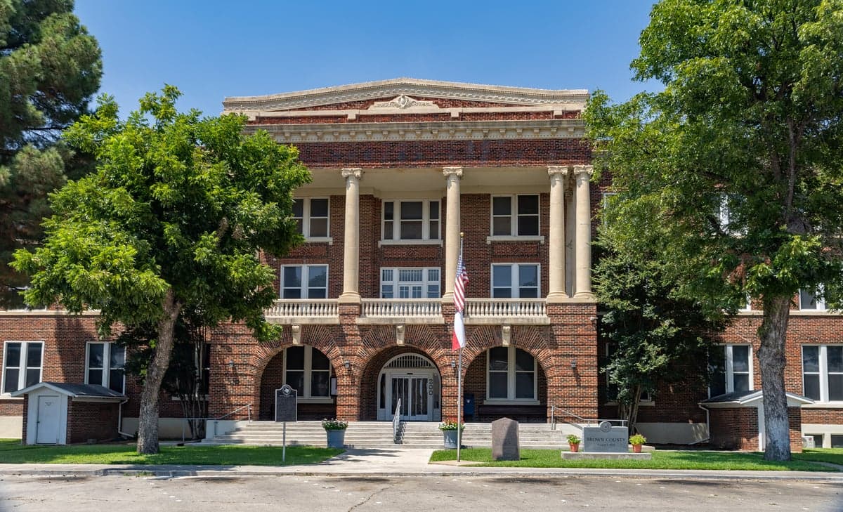
Photo: Wikipedia
Strategic Assessment of Brownwood, TX
Workable tactical position. Some exposure to population density or targets, but generally defensible in a crisis.
What does the Strategic Assessment tell us?
Our Strategic Assessment grades tactical survivability of an area. Major population centers, military targets, fallout zones, natural disasters, and border exposure all drive risk — lower exposure means a more defensible position in a crisis.
This is heavily inspired by Joel Skousen's Strategic Relocation book. Highly recommended you checkout the book ($)What does this tell us?
Our Strategic Assessment grades tactical survivability of an area. Major population centers, military targets, fallout zones, natural disasters, and border exposure all drive risk — lower exposure means a more defensible position in a crisis.
This is heavily inspired by Joel Skousen's Strategic Relocation book. Highly recommended you checkout the book ($)Strategic Pillars

Key Distances
Regional Safe Places
Below is our recommended "safe zones" in Texas and the surrounding area based on our strategic heuristics. For most people, it's unrealistic to live in a “safe zone” full-time due to work, family or other personal reasons. They tend to be more rural. However, many of these areas are perfect for second homes and retreat properties that double as a vacation home or even a short-term rental.


Important Note: For informational purposes only. This does not mean nothing bad ever happens in the green zones. Please use common sense. This is based on public data and modeled with AI. We tried to take a conservative approach but mistakes happen. We update this regularly as new information becomes available.
Solar Generator Recommendations
Backup power matters more here than in safer locations. We've picked three solar generators across budgets and capacity tiers — start with the budget unit if you only need a few essentials, or step up if you want to run a fridge and HVAC for days at a time.

Jackery Portable Power Station Explorer 300
Budget OptionPower on the Go: Weighing only 11 lbs, it's convenient to set up and store with book-sized foldable solar panels

BLUETTI Portable Power Station AC180
Designed for both indoor and outdoor scenarios, AC180 is highly capable as it has a robost capacity and continuous output power.

EF ECOFLOW DELTA Pro Ultra Power Station
Upgraded PickEcoFlow DELTA Pro Ultra is a whole-home energy system designed to grow with your family. Integrated with the Smart Home Panel 2, it scales to meet your evolving energy needs — keeping your home powered, intelligent, and secure through every stage of life.
We earn a commission, at no additional cost to you.
Strategic Assessment Analysis
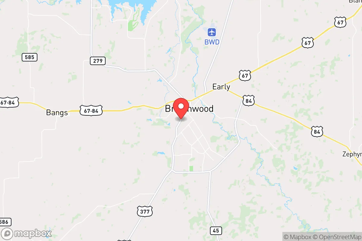
Brownwood, Texas, offers a compelling strategic position for those prioritizing resilience and self-sufficiency, sitting roughly 150 miles west of the Dallas-Fort Worth metroplex and 90 miles south of Abilene. Its location in the Texas Hill Country, away from major population centers and interstate corridors, provides a natural buffer against the cascading effects of urban unrest, grid collapse, or mass casualty events. The city’s population hovers around 19,000, with a county-wide population of roughly 38,000, giving it a small-town feel with enough infrastructure to support a relocation without the vulnerabilities of a dense urban environment.
Geographic position and natural advantages for long-term security
Brownwood sits on the western edge of the Cross Timbers region, a transitional zone between the rolling plains and the Hill Country. This geography offers several defensive advantages: the terrain is hilly and wooded enough to provide cover and natural chokepoints, yet open enough for agriculture and solar exposure. The area is not prone to hurricanes, major flooding, or earthquakes, though occasional tornadoes and severe thunderstorms are a risk. The city is situated near the Colorado River, with Lake Brownwood (about 15 miles northeast) providing a reliable surface water source. The lake holds roughly 7,500 surface acres and is fed by the Pecan Bayou, giving the region a water security advantage over much of West Texas. The surrounding ranchland and mixed hardwood forests offer hunting opportunities (deer, turkey, feral hogs) and timber for fuel or construction. Brownwood’s elevation—around 1,400 feet—keeps summers slightly cooler than the plains, and the growing season is long enough for substantial food production. The area’s low population density means fewer people competing for resources in a crisis, and the local economy is anchored by agriculture, manufacturing, and a regional medical center, which reduces dependence on distant supply chains.
Risks, exposures, and proximity to fallout-relevant landmarks
No location is immune to risk, and Brownwood has its share. The most significant exposure is its proximity to the Brownwood Regional Airport, which hosts a Texas Army National Guard helicopter unit and could become a target in a conflict scenario—though it’s a minor asset compared to Dyess Air Force Base in Abilene (90 miles north) or Fort Cavazos (formerly Fort Hood, 100 miles east). The city lies roughly 120 miles from the nuclear reactors at Comanche Peak (near Glen Rose) and 150 miles from the South Texas Nuclear Generating Station, placing it outside the primary fallout zones for a worst-case event but within a secondary risk radius if prevailing winds shift. The nearby I-20 and I-35 corridors, while not directly through Brownwood, could become evacuation routes or chokepoints during a crisis, potentially drawing transient populations. The area’s reliance on a single major highway (US 67/377) for north-south travel is a vulnerability—if that route is compromised, movement becomes difficult. Wildfire risk is moderate, especially in drought years, and the city’s water treatment plant is a single point of failure for municipal supply. On the positive side, Brownwood is far enough from major military installations, chemical plants, and refineries to avoid the immediate blast or contamination zones of a large-scale attack or industrial accident. The nearest major petrochemical infrastructure is in the Houston area, over 300 miles away, and the nearest major port is Corpus Christi, 300 miles south. This isolation is a double-edged sword: it reduces exposure to targeted strikes but also limits rapid resupply from federal assets.
Practical resilience for a relocator: food, water, energy, and defensibility
For a relocator with a prepper mindset, Brownwood offers a strong baseline for self-sufficiency. The local climate supports year-round gardening, with a frost-free period from March to November, and the soil in the river bottoms is fertile enough for corn, beans, squash, and root vegetables. Rainwater harvesting is viable—annual precipitation averages 28 inches—and the lake provides a backup source if municipal water fails. The area has a robust hunting culture, and wild game is abundant on public and private land. Energy resilience is achievable: the region has good solar insolation (over 5.5 peak sun hours per day), and many rural properties already use propane or diesel generators. The local electric grid is served by the Electric Reliability Council of Texas (ERCOT), which has a history of winter storm failures (e.g., 2021), so off-grid solar with battery storage is a wise investment. Defensibility is aided by the terrain: the hills and tree cover make it easy to secure a homestead with good sightlines, and the low crime rate (violent crime is roughly half the national average) means fewer immediate threats from desperate populations. The city’s police force is small but professional, and the county sheriff’s office has a strong presence in rural areas. For community resilience, Brownwood has a active local chapter of the Texas State Guard and several church-based mutual aid networks, which can be valuable for information sharing and resource pooling. The biggest practical challenge is medical care: Brownwood Regional Medical Center is a 200-bed facility with a Level IV trauma center, adequate for routine emergencies but not for major trauma or prolonged grid-down scenarios. Relocators should plan to stock advanced medical supplies and consider telemedicine options for specialist care.
The overall strategic picture for Brownwood is one of balanced isolation with enough infrastructure to support a comfortable relocation. It’s not a hardened bunker location—it lacks the extreme remoteness of the Montana Rockies or the high desert—but it offers a realistic middle ground for someone who wants to be prepared without living off-grid in a yurt. The city’s conservative political culture (Brown County voted +58 points Republican in 2024) aligns with a self-reliant, community-oriented mindset, and the local economy is stable enough to support remote work or small-scale agriculture. The primary trade-off is distance from major medical and logistical hubs, which is exactly the point for those seeking to avoid the chaos of urban collapse. For a single individual or family looking to build a resilient life in a place that’s not on anyone’s target list, Brownwood deserves serious consideration—just make sure you have a good water filtration system, a reliable vehicle, and a plan for the first 90 days without outside support.
* Values derived from national, state, county, city and local statistics and may differ in a specific area. Last updated: 2026-04-15T06:21:19.000Z
Narrative content on this page is AI-generated and may contain mistakes. Verify any details that matter before acting on them.
ReloMaps may earn a commission from affiliate links at no extra cost to you.