
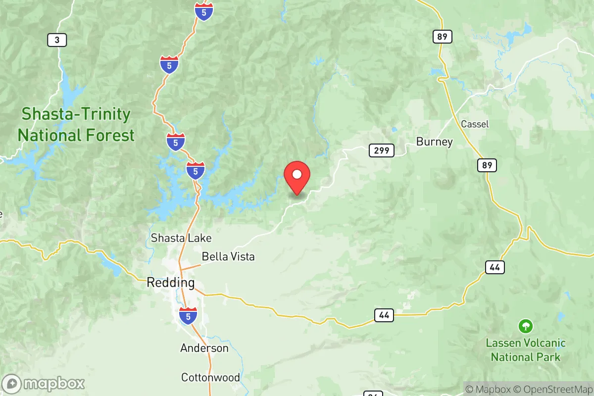
Photo: Wikipedia
Quality of Life in Shasta County
A livable area that tracks near national norms for affordability, walkability, and neighborhood health.
What does Quality of Life tell us?
Quality of Life measures an area by evaluating factors like cost of living, nearby amenities, country club access, airport proximity, socioeconomic signals and neighborhood character. For large states, this is a general average — quality of life can vary dramatically between metro areas, suburbs, and rural communities within the same state.
What does this tell us?
Quality of Life measures an area by evaluating factors like cost of living, nearby amenities, country club access, airport proximity, socioeconomic signals and neighborhood character. For large states, this is a general average — quality of life can vary dramatically between metro areas, suburbs, and rural communities within the same state.
Cost of Living
15% above national average
73%
The Real Cost of Living in Shasta County for 2026
| Tier | Individual | Family (4) |
|---|---|---|
| Survival | $20k | $38k |
| Comfortable | $67k | $99k |
| Luxury | $130k+ | $201k+ |
| Elite (Top 5%) | $155k+ | $240k+ |
Quality-of-Life Analysis
Shasta County offers a broad quality-of-life spectrum, from the urban amenities of Redding to the remote solitude of communities like Old Station and Montgomery Creek. The county draws a mix of outdoor enthusiasts, remote workers seeking affordable land, and families priced out of the California coast, each finding a different lifestyle within its 3,800 square miles. The county's character is defined by this contrast: a regional hub with big-box retail and healthcare, surrounded by national forest, river canyons, and small towns where the nearest grocery store may be 30 minutes away.
Largest town(s) & population centers
Redding is the county's undisputed urban core, home to roughly 93,000 residents and the primary location for employment, shopping, and medical services. Daily life here centers around the Sundial Bridge and the Sacramento River Trail system, with a walkable downtown core that has seen revitalization in recent years. Anderson, about 10 miles south, functions as a more affordable bedroom community with a smaller downtown and direct access to Interstate 5. Both towns offer the county's densest concentration of amenities: chain retailers, multiple grocery stores, hospitals, and the Shasta College campus. Commute times average just under 20 minutes countywide, but within Redding and Anderson, most errands are a 10-15 minute drive. The trade-off is higher traffic and less privacy compared to outlying areas.
Smaller towns & rural pockets
Outside the I-5 corridor, the county's character shifts dramatically. Shasta Lake City (population ~10,000) sits at the edge of the Whiskeytown-Shasta-Trinity National Recreation Area, offering lakefront access and a quieter pace while still being 15 minutes from Redding. Further north, Burney (population ~3,000) is a gateway to the Hat Creek Valley and Lassen Volcanic National Park, with a small but self-sufficient downtown including a grocery store, hardware store, and medical clinic. Fall River Mills and McArthur anchor the eastern part of the county, known for fly-fishing on the Fall River and a ranching economy. On the western edge, Platina and Igo are unincorporated areas with sparse populations, limited cell service, and homes on acreage. The most remote pockets include Old Station near Lassen Park's northern entrance and Montgomery Creek along Highway 299, where residents often rely on propane, well water, and satellite internet.
Cost & lifestyle range
The county's cost of living index of 115 (100 = U.S. average) masks wide internal variation. Redding and Anderson sit at the high end of the county's spectrum, with median home values around $347,200 and median rents of $1,267. A typical three-bedroom home in Redding's desirable Lake Redding or Benton Park neighborhoods can exceed $400,000, while comparable homes in Burney or Fall River Mills often sell for $250,000-$300,000. Rentals in remote areas are scarce; most housing is owner-occupied single-family homes on well and septic. Utility costs are higher in rural pockets due to electric well pumps and propane heating, offsetting lower housing prices. Amenities thin out rapidly: Burney has a grocery store and a hardware store, but residents of Platina or Montgomery Creek drive 30-45 minutes for a full supermarket or pharmacy. Internet access ranges from cable and fiber in Redding to DSL or satellite-only in the eastern and western reaches, a critical factor for remote workers.
The county's strongest draw is for people who want outdoor recreation as a daily part of life—hiking, fishing, boating, and hunting are accessible from nearly every doorstep. Families who prioritize good schools and walkable neighborhoods will find the most options in Redding's established suburbs. Those seeking affordable land, privacy, and a slower pace will find the best value in Burney, Fall River Mills, or the remote unincorporated areas, provided they can tolerate longer drives and self-sufficient living. Retirees on fixed incomes often gravitate to the smaller towns where housing is cheaper and the pace is quieter. The county works best for people who know exactly which trade-offs they are willing to make between convenience and space.

Crime in Shasta County
Higher crime rates than 58% of comparable U.S. locations.
Violent CrimeViolent Crime Analysis
Property CrimeProperty Crime Analysis
Crime Analysis
Shasta County’s overall safety picture is mixed, with a violent crime rate of 434.5 per 100,000 residents and a property crime rate of 1,819.1 per 100,000, both significantly above national averages. The county’s largest city, Redding, drives much of this crime, while smaller communities like Anderson and Shasta Lake also report elevated incidents. However, areas such as Palo Cedro and portions of unincorporated Shasta County near Whiskeytown Lake experience notably lower crime rates, creating a stark urban-rural divide in public safety.
Crime in context
Shasta County’s violent crime rate of 434.5 per 100,000 is roughly 25% higher than the national average of approximately 380 per 100,000 and well above California’s state average of about 442 per 100,000. Property crime at 1,819.1 per 100,000 is nearly double the national rate of roughly 1,954 per 100,000, though slightly below California’s state figure of 2,110 per 100,000. These numbers place Shasta County in the upper tier of California counties for crime, comparable to neighboring Tehama County but worse than more rural Siskiyou County. The county’s proximity to Interstate 5 and its role as a regional hub for the far north state contribute to property crime, particularly vehicle theft and burglary, which are concentrated along the I-5 corridor through Redding and Anderson.
What residents experience
Residents in Redding, the county seat and largest city, face the highest risk, with violent crime rates in some neighborhoods exceeding 600 per 100,000. The city’s downtown and areas near the Sacramento River Trail see frequent reports of theft, drug-related offenses, and assaults. Anderson, a smaller city south of Redding, also reports elevated property crime, driven by its position as a transportation and logistics hub. In contrast, Palo Cedro, an unincorporated community east of Redding, consistently records violent crime rates below 200 per 100,000, making it one of the safest areas in the county. Shasta Lake, a small city north of Redding, falls in between, with moderate property crime but lower violent crime than the county average. The Shasta County District Attorney’s office, under a conservative leadership, has pursued tougher sentencing policies, but critics argue that progressive judicial decisions in the county’s superior courts have sometimes resulted in reduced sentences for repeat offenders, contributing to recidivism. This dynamic is particularly evident in Redding’s municipal court district, where property crime offenders often cycle through the system quickly.
Neighborhood-level variation is pronounced. The safest pockets include the rural outskirts of Cottonwood and the areas around Lake Shasta, where property crime is minimal due to low population density and strong community watch programs. Conversely, the most dangerous blocks are in central Redding near the downtown transit center and along the Market Street corridor, where drug trafficking and gang activity are concentrated. For families and retirees, Palo Cedro and the unincorporated areas near Bella Vista offer the best safety profiles, with crime rates comparable to small towns in the Sierra Nevada foothills. Prospective residents should prioritize neighborhoods with active homeowners’ associations and avoid properties within a half-mile of major highway exits, where transient populations and property crime are highest.
* Values derived from national, state, county, city and local statistics and may differ in a specific area. Last updated: 2026-10-17T13:24:08.000Z
Narrative content on this page is AI-generated and may contain mistakes. Verify any details that matter before acting on them.
ReloMaps may earn a commission from affiliate links at no extra cost to you.

