Photo: Wikipedia
Strategic Assessment of Shasta County
Workable tactical position. Some exposure to population density or targets, but generally defensible in a crisis.
What does the Strategic Assessment tell us?
Our Strategic Assessment grades tactical survivability of an area. Major population centers, military targets, fallout zones, natural disasters, and border exposure all drive risk — lower exposure means a more defensible position in a crisis.
This is heavily inspired by Joel Skousen's Strategic Relocation book. Highly recommended you checkout the book ($)What does this tell us?
Our Strategic Assessment grades tactical survivability of an area. Major population centers, military targets, fallout zones, natural disasters, and border exposure all drive risk — lower exposure means a more defensible position in a crisis.
This is heavily inspired by Joel Skousen's Strategic Relocation book. Highly recommended you checkout the book ($)Strategic Pillars

Key Distances
Strategic Assessment Analysis
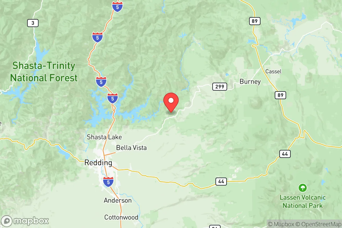
Shasta County offers a compelling mix of geographic isolation and practical self-sufficiency that appeals to relocation-minded individuals and families prioritizing resilience. Anchored by the city of Redding, the county sits at the northern end of California’s Central Valley, roughly 160 miles north of Sacramento and 220 miles south of the Oregon border. Its position along Interstate 5 provides a critical north-south corridor while maintaining a buffer from major metropolitan zones, making it a strategic base for those seeking both access and separation.
Geographic position and natural advantages for long-term stability
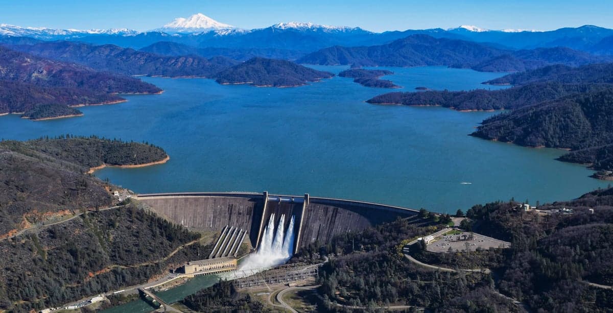
Shasta County’s topography is defined by the southern Cascade Range and the Trinity Alps, with elevations ranging from 500 feet in the Sacramento River canyon to over 9,000 feet at Mount Shasta’s summit. This varied terrain creates multiple microclimates and natural barriers that enhance defensibility. The county spans roughly 3,800 square miles, making it larger than Delaware and Rhode Island combined, yet its population density is low—about 45 people per square mile. The Sacramento River, fed by Shasta Lake (the state’s largest reservoir), runs through the heart of the county, providing a reliable freshwater source that is rare in much of California. The Shasta Dam, completed in 1945, impounds 4.5 million acre-feet of water and generates hydroelectric power, giving the region a built-in energy and water buffer that most of the state lacks. For a relocator, the presence of Shasta Lake and the Sacramento River means water security is not theoretical—it’s engineered into the landscape. The county also sits outside California’s primary seismic hazard zones; while minor quakes occur, the region avoids the high-risk fault lines that run through the Bay Area and Los Angeles. This combination of water abundance, low population density, and moderate seismic risk forms a solid foundation for long-term stability.
Risks, exposures, and proximity to fallout-relevant landmarks
No location is without vulnerabilities, and Shasta County has specific exposures that a strategic relocator must weigh. The most immediate natural risk is wildfire. The 2018 Carr Fire burned over 229,000 acres, destroyed 1,079 homes in and around Redding, and caused eight fatalities. The 2020 Zogg Fire and 2021 Monument Fire further underscored the pattern: dry summers, dense forest, and strong Diablo winds create a high-risk environment from June through October. The county’s wildland-urban interface is extensive, with many rural homes directly adjacent to fire-prone vegetation. Flooding is a secondary concern, particularly along the Sacramento River corridor near Anderson and Cottonwood, where winter rains can cause the river to swell. From a man-made risk perspective, Shasta County is relatively insulated. The nearest major military installation is Beale Air Force Base, roughly 120 miles south near Marysville, which is a strategic target but far enough to avoid direct fallout in most scenarios. The closest major port is the Port of Oakland, over 200 miles away, and the nearest refinery corridor is in the San Francisco Bay Area, roughly 200 miles south. The county does host the Shasta Dam, a critical infrastructure asset that could be a target in a conflict, but its remote location and hardened concrete construction reduce the likelihood of catastrophic failure. The Redding Municipal Airport is a small regional facility with no military significance. For a relocator concerned about fallout from a major conflict, Shasta County’s distance from high-value targets—major ports, refineries, military bases, and population centers—is a net positive. The primary risk remains natural disaster, not man-made catastrophe.
Practical resilience for a relocator: food, water, energy, and defensibility
Shasta County’s practical resilience is where it stands out for self-sufficiency-minded individuals. Water is the strongest asset. The Shasta Dam and Whiskeytown Lake (a 3,200-acre reservoir) provide redundant surface water sources, and the underlying groundwater basin in the Redding area is generally reliable. For a family homesteading on rural land, well drilling is common and depths of 100–300 feet typically yield adequate water. The county’s agricultural output is modest but meaningful: hay, cattle, and some orchards dominate, with the Anderson Valley producing walnuts and almonds. Local food production is supplemented by the Redding Farmers Market and a growing network of small-scale farms. For long-term food security, the county’s growing season runs roughly April through October, with hot summers and mild winters allowing for diverse crops. Energy resilience is strong. The county is served by the Shasta Dam hydroelectric plant (capacity 676 MW) and the Trinity River hydro system, plus several smaller solar installations. Redding’s municipal utility, Redding Electric Utility, offers competitive rates and has invested in grid hardening. For off-grid setups, solar potential is excellent—the area averages 260 sunny days per year. Defensibility is a mixed picture. The county’s mountainous terrain creates natural chokepoints: Interstate 5 through the Shasta Lake canyon is the primary north-south route, and secondary roads like Highway 299 and Highway 89 are narrow and winding. A determined group could control access to many rural valleys with relative ease. However, the county’s sprawl means that defending a single property is more practical than defending a community. The City of Redding itself is a population center of roughly 92,000, which could become a liability in a prolonged crisis due to resource strain. For a relocator, the sweet spot is likely a rural parcel outside Redding but within 30 minutes of its hospitals and supply chains—areas like Palo Cedro, Shingletown, or the French Gulch area offer good water, defensible terrain, and distance from the urban core.
The overall strategic picture for Shasta County is one of high potential with clear trade-offs. Its water abundance, low population density, and distance from major strategic targets make it one of the better-prepared regions in California for a relocator focused on resilience. The wildfire risk is real and requires active mitigation—defensible space, fire-resistant construction, and an evacuation plan are non-negotiable. The county’s political culture leans conservative, with a strong independent streak that aligns with self-sufficiency values. For a family or individual willing to invest in fire preparedness and accept a rural lifestyle, Shasta County offers a rare combination of natural resources and geographic isolation that is hard to find elsewhere in the state. It is not a bug-out location; it is a live-in location that requires ongoing work but rewards with genuine resilience.

* Values derived from national, state, county, city and local statistics and may differ in a specific area. Last updated: 2026-10-17T13:24:08.000Z
Narrative content on this page is AI-generated and may contain mistakes. Verify any details that matter before acting on them.
ReloMaps may earn a commission from affiliate links at no extra cost to you.

